Washford Moor

Downs, Moorland in Devon Mid Devon

England

Washford Moor

Washford Pyne: church and cottage St Peter’s church was completed in 1887; its predecessor was largely destroyed by fire in 1880. The three original bells from the earlier church have survived; there are now six bells. Washford Pyne is no more than a small hamlet. A church stood here in the 13th century. The churchyard stands by the Two Moors Way
Washford Pyne: church and cottage Credit: Martin Bodman

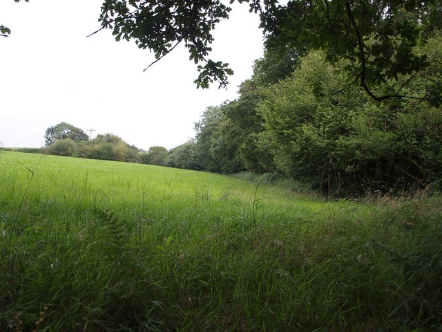
Washford Moor is a picturesque area located in the county of Devon, England. With its expansive downs and moorland, it offers a stunning natural landscape that attracts visitors from near and far.

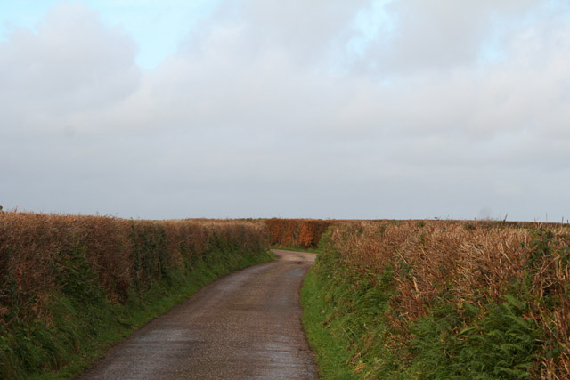
Covering an area of approximately 500 acres, Washford Moor is characterized by rolling hills, heathland, and open grasslands. The moorland is scattered with patches of gorse and heather, creating a vibrant tapestry of colors throughout the year. These wildflowers attract a variety of insects and birds, making it a popular spot for birdwatchers and nature enthusiasts.

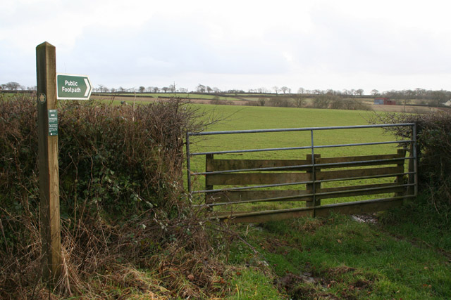
The moor is crisscrossed by a network of footpaths, allowing visitors to explore the area and take in the breathtaking views. One of the highlights of Washford Moor is its ancient stone circles, dating back to the Bronze Age. These mysterious structures add an air of intrigue to the landscape and provide a glimpse into the area's rich history.

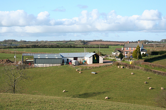
In addition to its natural beauty, Washford Moor is also home to a number of grazing animals, including sheep and ponies. These animals play an important role in maintaining the delicate balance of the ecosystem and add to the charm of the area.

Overall, Washford Moor is a haven for those seeking tranquility and a connection with nature. Its unspoiled beauty and diverse wildlife make it a must-visit destination for anyone exploring the stunning countryside of Devon.

If you have any feedback on the listing, please let us know in the comments section below.

Washford Moor Images

Images are sourced within 2km of 50.886113/-3.6807547 or Grid Reference SS8110. Thanks to Geograph Open Source API. All images are credited.

Washford Pyne: church and cottage St Peter’s church was completed in 1887; its predecessor was largely destroyed by fire in 1880. The three original bells from the earlier church have survived; there are now six bells. Washford Pyne is no more than a small hamlet. A church stood here in the 13th century. The churchyard stands by the Two Moors Way
Washford Pyne: church and cottage
St Peter’s church was completed in 1887; its predecessor was largely destroyed by fire in 1880. The three original bells from the earlier church have survived; there are now six bells. Washford Pyne is no more than a small hamlet. A church stood here in the 13th century. The churchyard stands by the Two Moors Way
Washford Pyne: lane from Black Dog Looking north towards Washford Pyne
Washford Pyne: lane from Black Dog
Looking north towards Washford Pyne
Washford Pyne: footpath sign By the lane from Washford Pyne to Black Dog. The footpath leads to Lower Gatehouse. Looking south east
Washford Pyne: footpath sign
By the lane from Washford Pyne to Black Dog. The footpath leads to Lower Gatehouse. Looking south east
Washford Pyne: Littleborough Cross By Brin Villa Farm. Across the way, behind the camera, is Littleborough Chapel, built in 1907, and surviving with its own graveyard but not marked as a chapel on the Ordnance Survey Pathfinder map of 1976. Looking south west
Washford Pyne: Littleborough Cross
By Brin Villa Farm. Across the way, behind the camera, is Littleborough Chapel, built in 1907, and surviving with its own graveyard but not marked as a chapel on the Ordnance Survey Pathfinder map of 1976. Looking south west
Washford Pyne: Littleborough Cross Signpost, shed and post box by a crossroads: looking north. Behind the post box is Littleborough Chapel, built in 1907, and surviving with its own graveyard but not marked as a chapel on the Ordnance Survey Pathfinder map of 1976
Washford Pyne: Littleborough Cross
Signpost, shed and post box by a crossroads: looking north. Behind the post box is Littleborough Chapel, built in 1907, and surviving with its own graveyard but not marked as a chapel on the Ordnance Survey Pathfinder map of 1976
Puddington: the village The central building was once the garage for the village school bus. It was originally a separate property, but by the time this photo was taken it had been bought by the owners of the adjacent cottage (Hill Crest) and incorporated into that property (information from John Annan, who reported that by 2017 the red doors had been replaced).
Puddington: the village
The central building was once the garage for the village school bus. It was originally a separate property, but by the time this photo was taken it had been bought by the owners of the adjacent cottage (Hill Crest) and incorporated into that property (information from John Annan, who reported that by 2017 the red doors had been replaced).
Puddington: the village Looking west: the road ahead runs to Littleborough Cross and Black Dog
Puddington: the village
Looking west: the road ahead runs to Littleborough Cross and Black Dog
Puddington: Outbuilding at Pulsfordware The farm stands on a road about half a mile north of Puddington. Looking west-south-west
Puddington: Outbuilding at Pulsfordware
The farm stands on a road about half a mile north of Puddington. Looking west-south-west
Puddington: near Twenty Acres Track and public footpath: the latter runs on to Woodscombe, on the way to Nomansland. Looking north-north-west
Puddington: near Twenty Acres
Track and public footpath: the latter runs on to Woodscombe, on the way to Nomansland. Looking north-north-west
Puddington: towards Henceford Cross Looking north west on a lane that links Puddington and Witheridge
Puddington: towards Henceford Cross
Looking north west on a lane that links Puddington and Witheridge
Thelbridge: Henceford Cross The road ahead leads to Witheridge. Turn left for Washford Pyne; right for Nomansland and the main road to Tiverton
Thelbridge: Henceford Cross
The road ahead leads to Witheridge. Turn left for Washford Pyne; right for Nomansland and the main road to Tiverton
Thelbridge: on Henceford Moor The wood ahead is known as Upcott Moor Plantation. The lane leads to Nomansland. Looking north east
Thelbridge: on Henceford Moor
The wood ahead is known as Upcott Moor Plantation. The lane leads to Nomansland. Looking north east
Thelbridge: north from Mill Barton The conifer to the left of the wood – and beyond the square – is a disguised communications mast. Antennae appear at the top of the tree. Looking west-south-west
Thelbridge: north from Mill Barton
The conifer to the left of the wood – and beyond the square – is a disguised communications mast. Antennae appear at the top of the tree. Looking west-south-west
Thelbridge: barns These buildings stand above the valley of the river Dalch. Looking east-north-east
Thelbridge: barns
These buildings stand above the valley of the river Dalch. Looking east-north-east
Washford Pyne: towards Sentrys Looking north from a bridleway which runs west to Hele Lane
Washford Pyne: towards Sentrys
Looking north from a bridleway which runs west to Hele Lane
Washford Wood Looking out across a corner of a neighbouring field from the wood, near the Two Moors Way.
Washford Wood
Looking out across a corner of a neighbouring field from the wood, near the Two Moors Way.
Field Boundary near Black Dog
Converted Chapel on the outskirts of Puddington
Show me another place!

Washford Moor is located at Grid Ref: SS8110 (Lat: 50.886113, Lng: -3.6807547)

Administrative County: Devon

District: Mid Devon

Police Authority: Devon and Cornwall

What 3 Words

///renewals.jiggle.firewall. Near Witheridge, Devon

Nearby Locations

Washford Moor

Related Wikis

Washford Pyne

Washford Pyne is a village and civil parish in Devon, England. It is 7 miles NE of Morchard Road railway station and 8 N by W of Crediton.The local church...

Puddington, Devon

Puddington is a small village in Mid Devon within the Witheridge hundred. It is approximately nine miles from the town of Tiverton and 8 Miles from Crediton...

Black Dog, Devon

Black Dog is a village in Mid Devon, ten miles west of Tiverton and six miles north of Crediton. The village is on one of the highest ridges of land between...

Woolfardisworthy, Mid Devon

Woolfardisworthy (pronounced "Woolsery") is a village and civil parish in Mid Devon. It is situated about 5 miles (9 km) north of Crediton. According to...

Nearby Amenities

Located within 500m of 50.886113,-3.6807547
Generator Method: wind_turbine
Generator Output Electricity: yes
Generator Type: horizontal_axis
Location: ground
Power: generator
Wall: solar
Lat/Long: 50.8858898/-3.6745647
The data included in this document is from www.openstreetmap.org. The data is made available under ODbL.

Have you been to Washford Moor?

Leave your review of Washford Moor below (or comments, questions and feedback).