Waun Fforest

Downs, Moorland in Brecknockshire

Wales

Waun Fforest

Afon Llechach at Tomen Llechach The 'slabby river' runs through a small gorge section just to the south of the Roman camp at Arhosfa'r Garreg-lwyd.
Afon Llechach at Tomen Llechach Credit: Alan Bowring

Waun Fforest is a scenic area located in the county of Brecknockshire, Wales. It is characterized by its rolling downs and expansive moorland, making it a popular destination for nature enthusiasts and hikers alike.

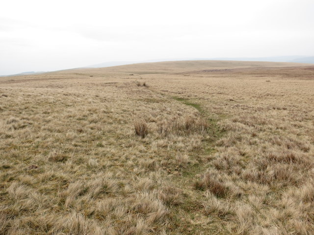
The downs of Waun Fforest offer breathtaking views of the surrounding countryside, with its gently sloping hills covered in lush green grass. These downs are home to a variety of flora and fauna, including wildflowers, grazing sheep, and birds such as skylarks and buzzards. The area is also dotted with numerous ancient burial mounds, adding a touch of historical significance to the landscape.

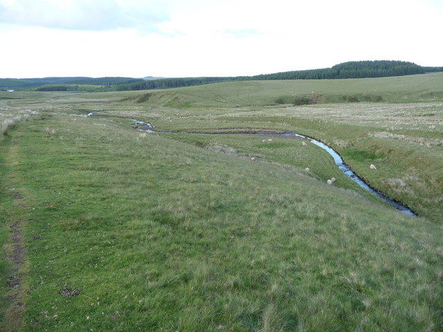
The moorland of Waun Fforest is a vast expanse of open countryside, characterized by its wet and boggy terrain. This unique ecosystem is home to a wide range of plant species, including heather, mosses, and cotton grass. The moorland is also home to several rare bird species, such as the curlew and red grouse.

Visitors to Waun Fforest can explore the area through a network of walking trails that offer stunning panoramic views of the surrounding countryside. These trails cater to all levels of fitness, ranging from gentle strolls to more challenging hikes. Additionally, the area is a popular destination for birdwatchers, who can observe a diverse range of bird species in their natural habitat.

Overall, Waun Fforest is a picturesque location that offers visitors the opportunity to immerse themselves in the beauty of Wales' natural landscape. Whether it's walking, birdwatching, or simply enjoying the tranquility of the moorland, this area has something to offer everyone.

If you have any feedback on the listing, please let us know in the comments section below.

Waun Fforest Images

Images are sourced within 2km of 51.911007/-3.7227567 or Grid Reference SN8125. Thanks to Geograph Open Source API. All images are credited.

Afon Llechach at Tomen Llechach The 'slabby river' runs through a small gorge section just to the south of the Roman camp at Arhosfa'r Garreg-lwyd.
Afon Llechach at Tomen Llechach
The 'slabby river' runs through a small gorge section just to the south of the Roman camp at Arhosfa'r Garreg-lwyd.
Upland road on the way to Talsarn A Roman camp occupies the high ground to the left of the road ahead. They knew where to site their camps for maximum defence and impact. Sheep graze the open moorland.
Upland road on the way to Talsarn
A Roman camp occupies the high ground to the left of the road ahead. They knew where to site their camps for maximum defence and impact. Sheep graze the open moorland.
Two riders on Mynydd y Llan on a June evening And their dog. They rode up from Pont 'ar Wysg, where I saw their horsebox and 4x4. Not a bad way to spend a summer evening. They had just cantered up to my right and slowed to a walk as they passed, when the female appeared to take a mobile phone call. That dog must be fit.
Two riders on Mynydd y Llan on a June evening
And their dog. They rode up from Pont 'ar Wysg, where I saw their horsebox and 4x4. Not a bad way to spend a summer evening. They had just cantered up to my right and slowed to a walk as they passed, when the female appeared to take a mobile phone call. That dog must be fit.
Path down the valley of the Nant Cwmothlwn A valley that doesn't see many human footfalls.
Path down the valley of the Nant Cwmothlwn
A valley that doesn't see many human footfalls.
Upland scenery below the source of the River Usk I first followed the source of the Usk down this hillside as a teenager and it's nice to come back.
Upland scenery below the source of the River Usk
I first followed the source of the Usk down this hillside as a teenager and it's nice to come back.
The River Usk near Pont 'ar Wysg The young river meanders through glacial debris below the Carmarthen Fans as it makes its way down towards the Usk Reservoir and then the Usk Valley.
The River Usk near Pont 'ar Wysg
The young river meanders through glacial debris below the Carmarthen Fans as it makes its way down towards the Usk Reservoir and then the Usk Valley.
View above the Nant Melyn below the Carmarthen Fans As I gain height up the valley the view widens out.
View above the Nant Melyn below the Carmarthen Fans
As I gain height up the valley the view widens out.
View up to Fan Foel from the Nant Melyn valley The lonely little sheep gives scale.
View up to Fan Foel from the Nant Melyn valley
The lonely little sheep gives scale.
View down the Nant Melyn valley Distant squalls are coming in from the west over the Carmarthenshire countryside.
View down the Nant Melyn valley
Distant squalls are coming in from the west over the Carmarthenshire countryside.
View to Carmarthen Fan View across moorland drained by the upper reaches of the River Usk to the Carmarthen Fan range of the Brecon Beacons.
View to Carmarthen Fan
View across moorland drained by the upper reaches of the River Usk to the Carmarthen Fan range of the Brecon Beacons.
Time for a break on Waun Lwyd
Nant y Creigiau between Bryn Mawr and Foel Seen from 10km away to the southwest Nant y Creigiau has cut a cleft between Bryn Mawr and Foel.
Nant y Creigiau between Bryn Mawr and Foel
Seen from 10km away to the southwest Nant y Creigiau has cut a cleft between Bryn Mawr and Foel.
Mountain Road near Bylchau Blaenclydach The hill is Arhosfa'r Garreg-lwyd.
Mountain Road near Bylchau Blaenclydach
The hill is Arhosfa'r Garreg-lwyd.
Sheep Crossing Mountain Road near Bylchau Blaenclydach
Moorland, Bryn Mawr This is the view looking east from the hides at the Red Kite Feeding Centre at Llanddeusant.
Moorland, Bryn Mawr
This is the view looking east from the hides at the Red Kite Feeding Centre at Llanddeusant.
View S across moors towards Fan Foel & Fan Brycheiniog
Nant y Creigiau Cwm bach cul a elwir Nant y Creigiau o Fryn Mawr. Enw'r bryn ar yr ochr arall o'r ffrwd  yw y Foel.

A small steep sided valley called Nant y Creigiau (trans. stream or valley of rocks) from Bryn Mawr (trans. big hill). The hill on the other side of the stream is called y Foel (bare hill).
Nant y Creigiau
Cwm bach cul a elwir Nant y Creigiau o Fryn Mawr. Enw'r bryn ar yr ochr arall o'r ffrwd yw y Foel. A small steep sided valley called Nant y Creigiau (trans. stream or valley of rocks) from Bryn Mawr (trans. big hill). The hill on the other side of the stream is called y Foel (bare hill).
Bryn Elen Llwybr yn arwain at Fryn Elen a rhyd Afon Llechach. 

A path leading in the direction of Bryn Elen and Afon Llechach ford
Bryn Elen
Llwybr yn arwain at Fryn Elen a rhyd Afon Llechach. A path leading in the direction of Bryn Elen and Afon Llechach ford
Show me another place!

Waun Fforest is located at Grid Ref: SN8125 (Lat: 51.911007, Lng: -3.7227567)

Unitary Authority: Powys

Police Authority: Dyfed Powys

What 3 Words

///sprinkle.velocity.delusions. Near Llanddeusant, Carmarthenshire

Nearby Locations

Waun Fforest

Related Wikis

Picws Du

Picws Du is the second highest peak of the Carmarthen Fans (or, in Welsh Bannau Sir Gâr) in the Carmarthenshire section of the Black Mountain in the west...

Fan Brycheiniog

Fan Brycheiniog is the highest peak at a height of 802.5 metres (2,633 ft) (above sea level) in the Black Mountain (Y Mynydd Du) region of the Brecon Beacons...

Black Mountain (range)

The Black Mountain (Welsh: Y Mynydd Du) is a mountain range in South, Mid and West Wales, straddling the administrative boundary between Carmarthenshire...
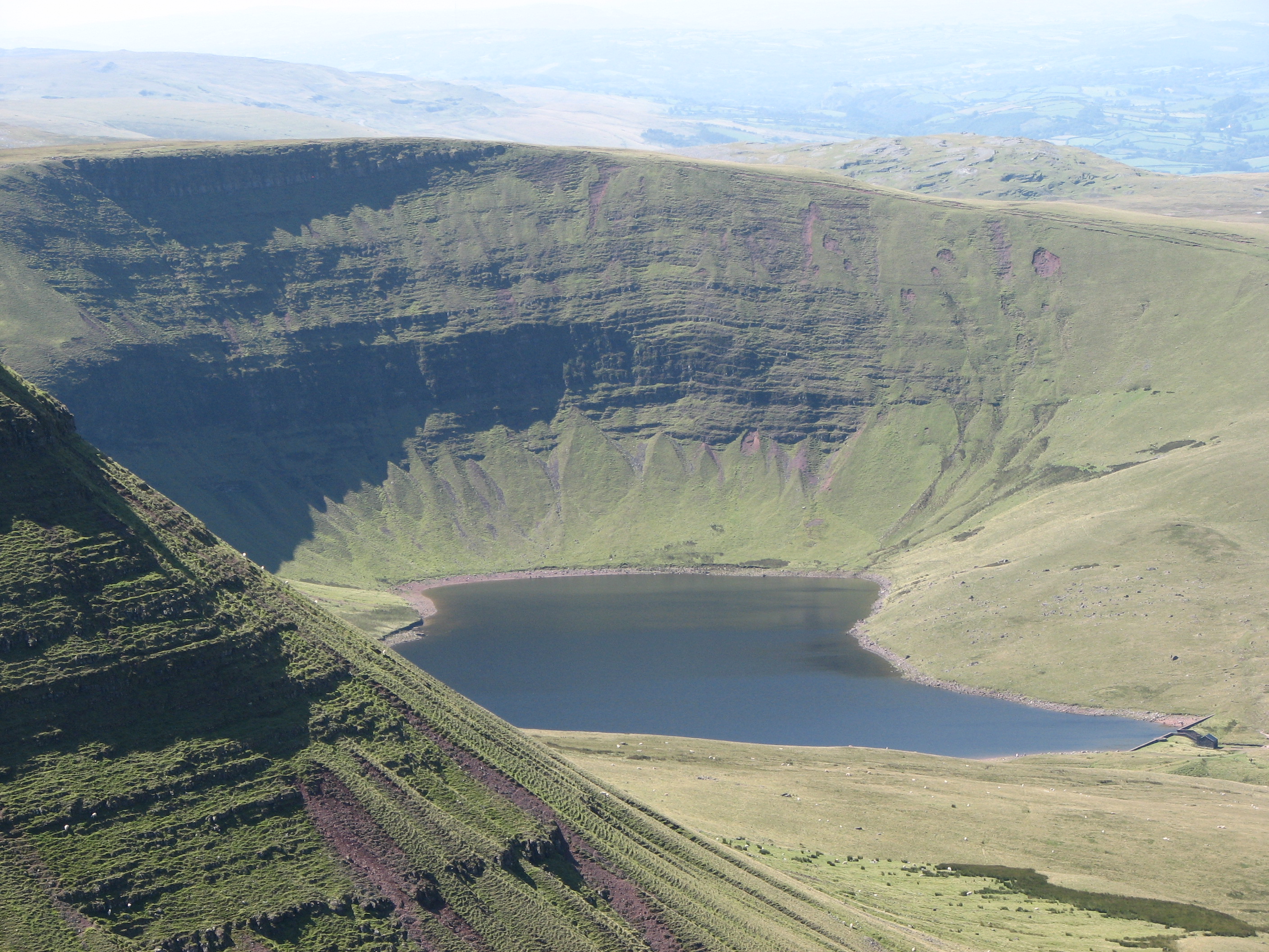
Llyn y Fan Fach

Llyn y Fan Fach (Welsh meaning "little lake (near) the peak") is a lake of approximately 10 hectares (25 acres) on the northern margin of the Black Mountain...

Have you been to Waun Fforest?

Leave your review of Waun Fforest below (or comments, questions and feedback).