Hawkridge Common

Downs, Moorland in Somerset Somerset West and Taunton

England

Hawkridge Common

Landacre Bridge on the River Barle The River Barle on Exmoor from Pinkery Pond to Exebridge where it meets the River Exe.
Landacre Bridge on the River Barle Credit: Roger A Smith

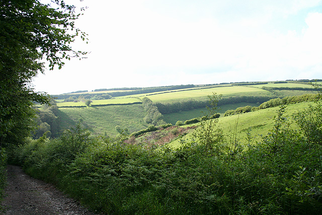
Hawkridge Common is a stunning natural area located in Somerset, England. Situated on the beautiful landscape of the Brendon Hills, this common encompasses both downs and moorland, offering visitors a diverse and picturesque environment to explore.

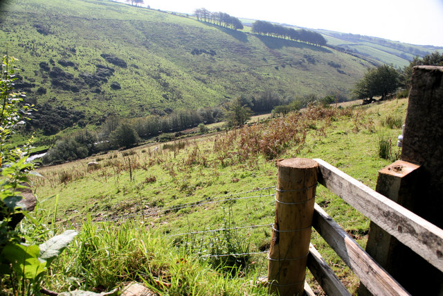
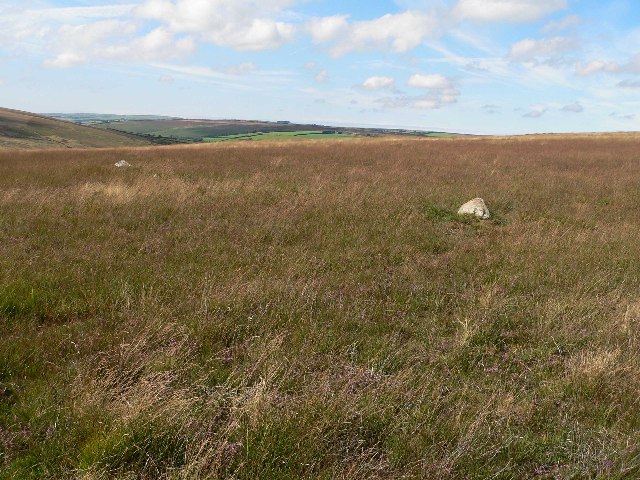
The common covers an expansive area of approximately 500 hectares, making it a significant site for nature enthusiasts and those seeking tranquility amidst nature. Its location on the Brendon Hills provides breathtaking views of the surrounding countryside, with rolling hills and valleys stretching as far as the eye can see.

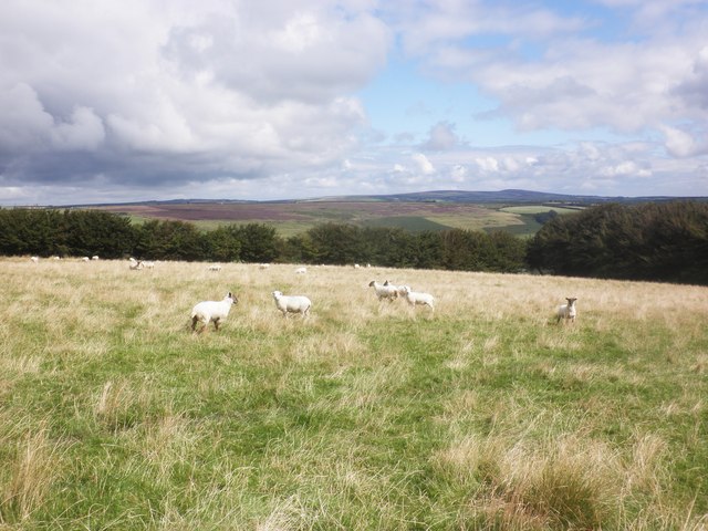
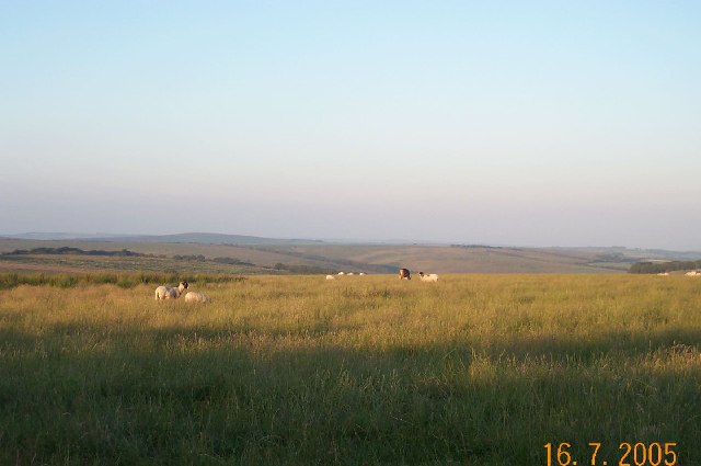
The vegetation on Hawkridge Common is characterized by a mix of grassy downs and heather moorland, creating a unique and vibrant landscape. This variety of habitats supports a rich array of plant and animal species. Visitors can expect to see a range of wildflowers, including yellow rattle and harebell, as well as various species of grasses.

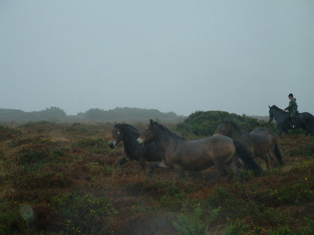
The common is also home to a diverse bird population, attracting birdwatchers from near and far. Common sightings include skylarks, stonechats, and meadow pipits. Additionally, the area is known for its resident populations of red deer and Exmoor ponies, which can often be spotted grazing in the open spaces.

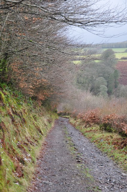
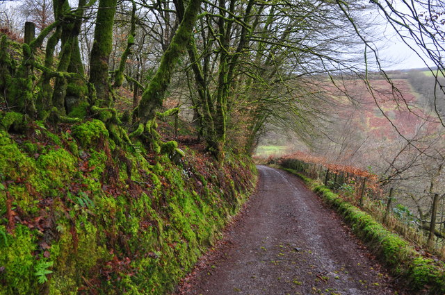
Hawkridge Common offers several walking trails, allowing visitors to explore the area at their own pace. These trails provide access to the different habitats and viewpoints, allowing visitors to appreciate the natural beauty and tranquility of the common.

Overall, Hawkridge Common is a captivating destination for nature lovers and those seeking a peaceful retreat amidst the stunning Somerset countryside.

If you have any feedback on the listing, please let us know in the comments section below.

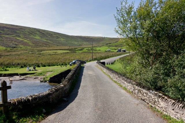
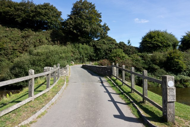
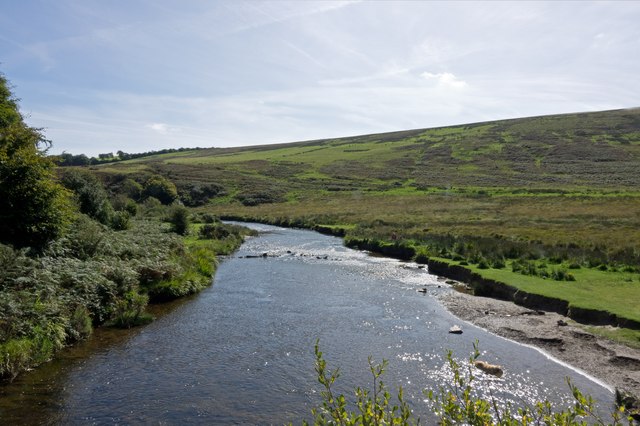
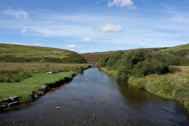
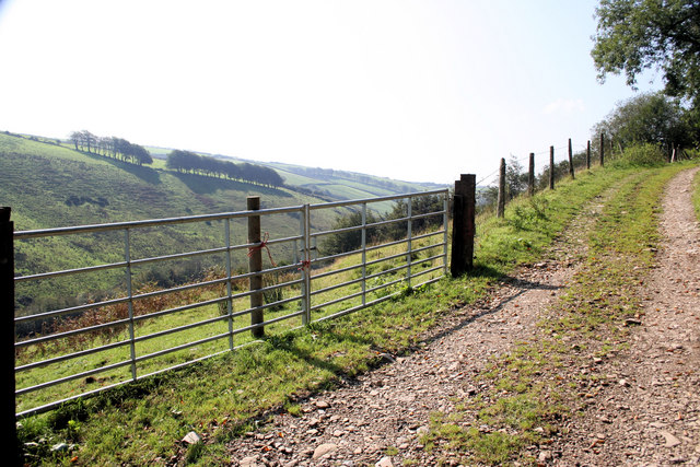
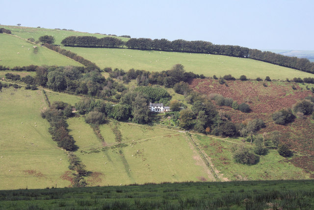
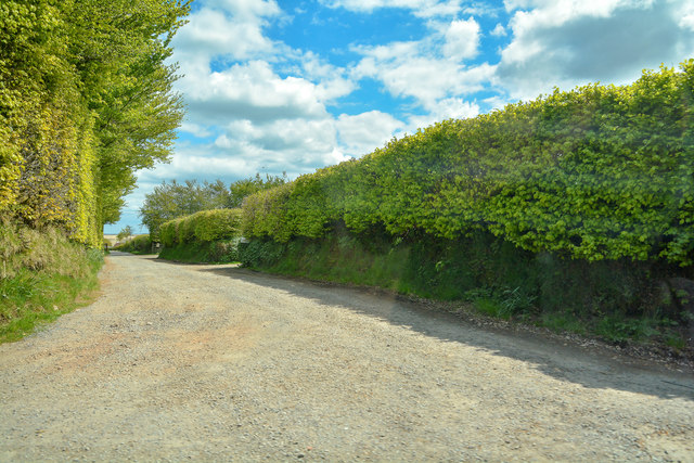
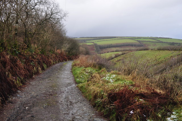
Hawkridge Common Images

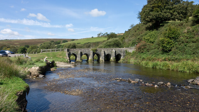
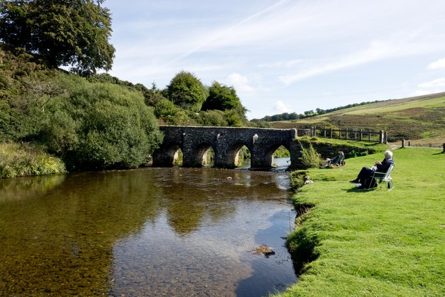
Images are sourced within 2km of 51.097331/-3.6927174 or Grid Reference SS8134. Thanks to Geograph Open Source API. All images are credited.

Landacre Bridge on the River Barle The River Barle on Exmoor from Pinkery Pond to Exebridge where it meets the River Exe.
Landacre Bridge on the River Barle
The River Barle on Exmoor from Pinkery Pond to Exebridge where it meets the River Exe.
Landacre Bridge on the River Barle The River Barle on Exmoor from Pinkery Pond to Exebridge where it meets the River Exe.
Landacre Bridge on the River Barle
The River Barle on Exmoor from Pinkery Pond to Exebridge where it meets the River Exe.
Looking downstream from Landacre Bridge on the River Barle The River Barle on Exmoor from Pinkery Pond to Exebridge where it meets the River Exe.
Looking downstream from Landacre Bridge on the River Barle
The River Barle on Exmoor from Pinkery Pond to Exebridge where it meets the River Exe.
Looking upstream from Landacre Bridge on the River Barle The River Barle on Exmoor from Pinkery Pond to Exebridge where it meets the River Exe.
Looking upstream from Landacre Bridge on the River Barle
The River Barle on Exmoor from Pinkery Pond to Exebridge where it meets the River Exe.
Landacre Bridge on the River Barle viewed from downstream The River Barle on Exmoor from Pinkery Pond to Exebridge where it meets the River Exe.
Landacre Bridge on the River Barle viewed from downstream
The River Barle on Exmoor from Pinkery Pond to Exebridge where it meets the River Exe.
Landacre Bridge on the River Barle viewed from upstream The River Barle on Exmoor from Pinkery Pond to Exebridge where it meets the River Exe.
Landacre Bridge on the River Barle viewed from upstream
The River Barle on Exmoor from Pinkery Pond to Exebridge where it meets the River Exe.
Exmoor: bridleway to Horsen Looking north west on a track some way above Sherdon Bridge
Exmoor: bridleway to Horsen
Looking north west on a track some way above Sherdon Bridge
Looking down on Sherdon Water Taken from the very edge of the open access land by the side of the track leading to Lower Sherdon
Looking down on Sherdon Water
Taken from the very edge of the open access land by the side of the track leading to Lower Sherdon
Track to Lower Sherdon Taken from the edge of the Open Access land. The track leads on to Lower Sherdon with Sherdon Water in the valley on the left.
Track to Lower Sherdon
Taken from the edge of the Open Access land. The track leads on to Lower Sherdon with Sherdon Water in the valley on the left.
Lower Sherdon Viewed from the road on the other side of the Sherdon Water valley.
Lower Sherdon
Viewed from the road on the other side of the Sherdon Water valley.
West Somerset : Farm Track A track to Litton.
West Somerset : Farm Track
A track to Litton.
West Somerset : Farm Track A small track and a public right of way.
West Somerset : Farm Track
A small track and a public right of way.
West Somerset : Farm Track Looking along a small track as it heads down the hillside.
West Somerset : Farm Track
Looking along a small track as it heads down the hillside.
West Somerset : Farm Track A small track heading down the hill and towards Sherdon Farm.
West Somerset : Farm Track
A small track heading down the hill and towards Sherdon Farm.
Grazing sheep, above Lower Sherdon
Exmoor Pony Round-up Hawkridge Common near Withypool, during the round-up of one of Britain's oldest breeds of horse
Exmoor Pony Round-up
Hawkridge Common near Withypool, during the round-up of one of Britain's oldest breeds of horse
On the road to Withypool The moorland view between North Molton and Withypool. There's a deer grazing with the sheep in the photo.
On the road to Withypool
The moorland view between North Molton and Withypool. There's a deer grazing with the sheep in the photo.
Stone Circle on Withypool Hill Apparently Bronze Age, with 37 stones.
Stone Circle on Withypool Hill
Apparently Bronze Age, with 37 stones.
Show me another place!

Hawkridge Common is located at Grid Ref: SS8134 (Lat: 51.097331, Lng: -3.6927174)

Administrative County: Somerset

District: Somerset West and Taunton

Police Authority: Avon and Somerset

What 3 Words

///permanent.plausible.dialects. Near Dulverton, Somerset

Related Wikis

Landacre Bridge

Landacre Bridge carries Landacre Lane across the River Barle near Withypool on Exmoor in the English county of Somerset. It has been designated as a scheduled...

Withypool Stone Circle

Withypool Stone Circle, also known as Withypool Hill Stone Circle, is a stone circle located on the Exmoor moorland, near the village of Withypool in the...
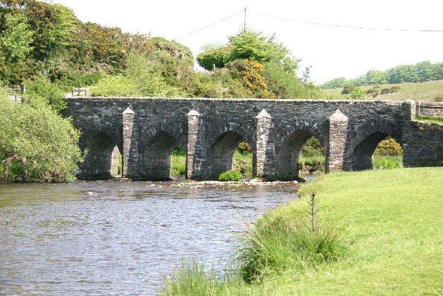
Withypool Bridge

The Withypool Bridge is an arch bridge that carries a small road over the River Barle at Withypool in Somerset, England. It is a Grade II* listed building...

Withypool

Withypool (formerly Widepolle, Widipol, Withypoole) is a small village and former civil parish, now in the parish of Withypool and Hawkridge, in the Somerset...

Nearby Amenities

Located within 500m of 51.097331,-3.6927174
Barrier: cattle_grid
Lat/Long: 51.0972192/-3.6985525
The data included in this document is from www.openstreetmap.org. The data is made available under ODbL.

Have you been to Hawkridge Common?

Leave your review of Hawkridge Common below (or comments, questions and feedback).