Ffridd Celynnog

Downs, Moorland in Merionethshire

Wales

Ffridd Celynnog

The A494 north at Rhydymain village sign
The A494 north at Rhydymain village sign Credit: Roy Hughes

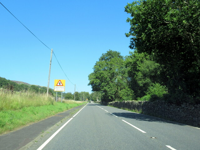
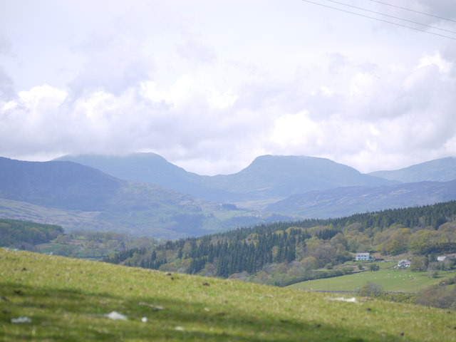
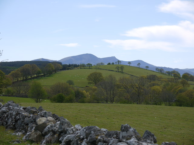
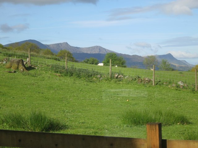
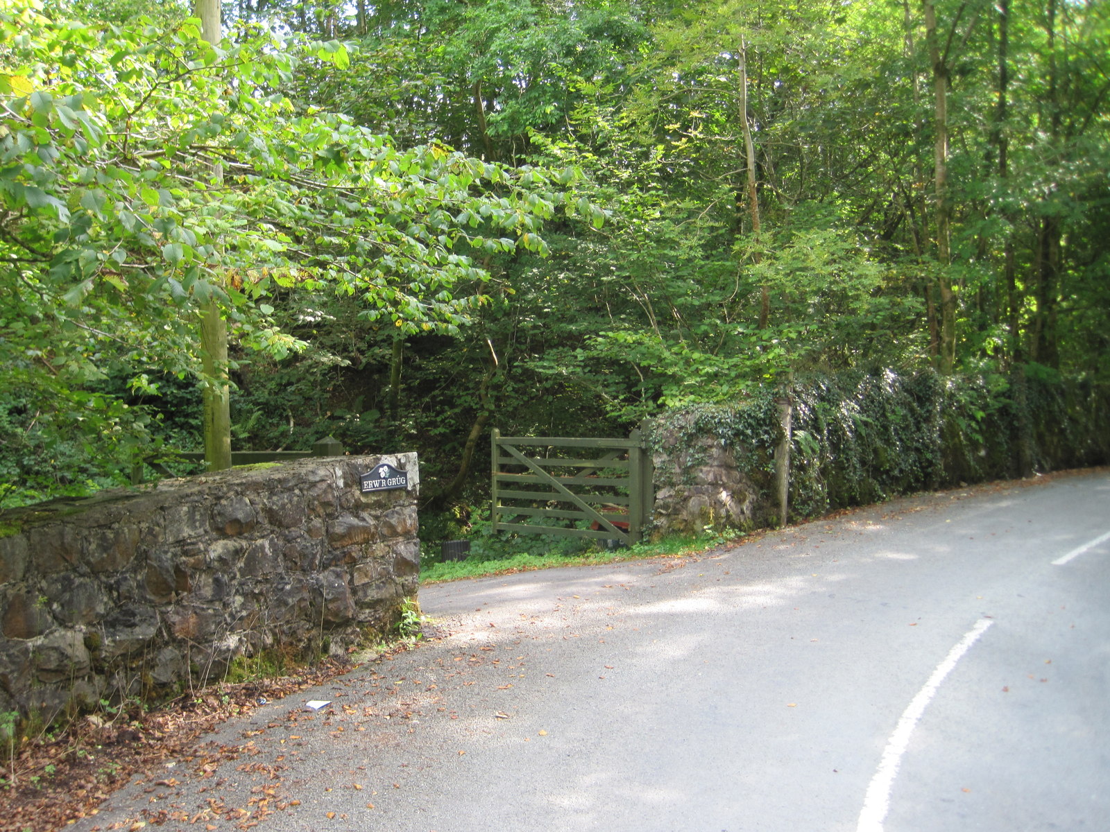
Ffridd Celynnog is an area located in Merionethshire, Wales, known for its picturesque landscape of downs and moorland. Situated in the heart of Snowdonia National Park, this region offers breathtaking views and a unique experience of the Welsh countryside.

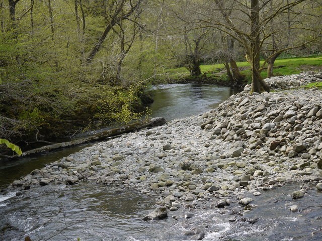
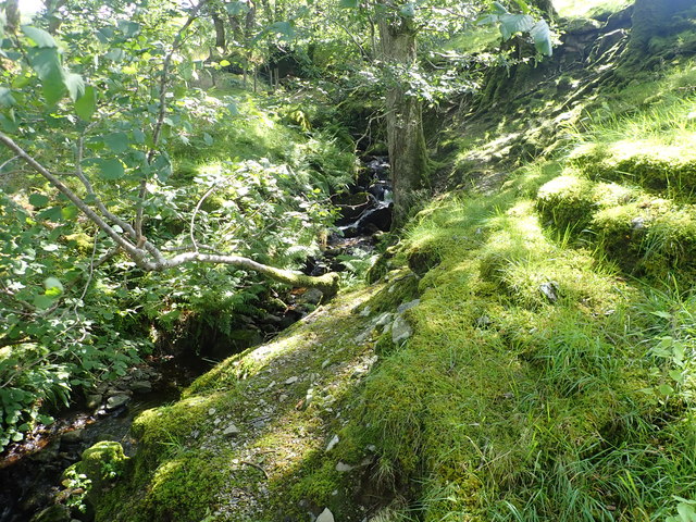
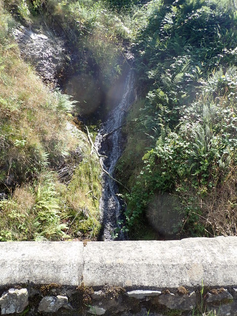
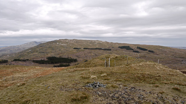
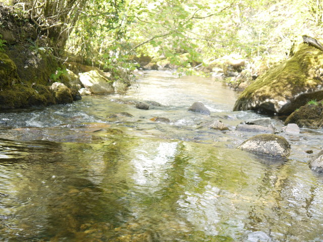
Covering an area of approximately 10 square kilometers, Ffridd Celynnog is characterized by rolling hills, open grasslands, and heather-covered moors. The terrain is diverse, with steep slopes and rocky outcrops interspersed with tranquil valleys and meandering streams. The area is rich in wildlife and provides a habitat for a variety of plant and animal species, including red grouse, mountain hares, and various species of wildflowers.

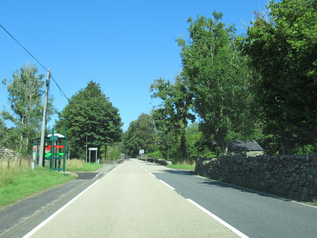
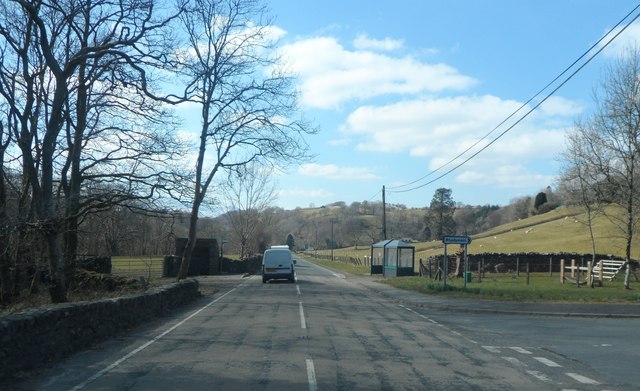
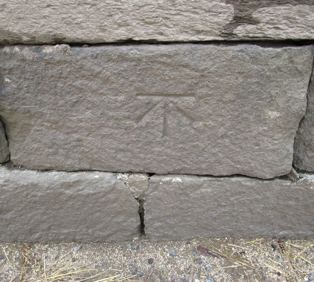
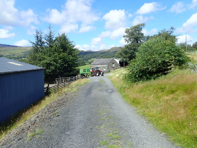
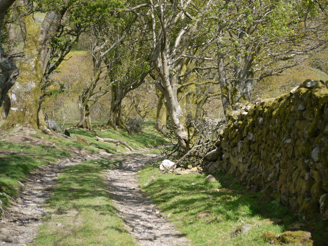
The Ffridd Celynnog landscape has been shaped by centuries of farming practices, with evidence of ancient stone walls and enclosures still visible today. The area has a long history of traditional farming, and some of the fields are still used for grazing livestock. The combination of the natural beauty and the cultural heritage of the area makes Ffridd Celynnog a popular destination for outdoor enthusiasts and nature lovers.

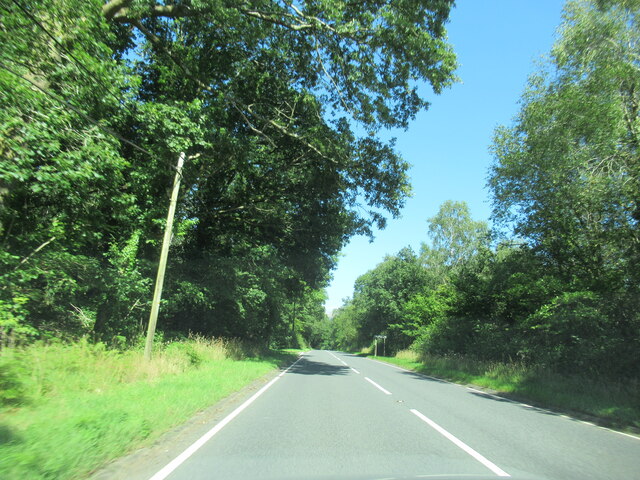
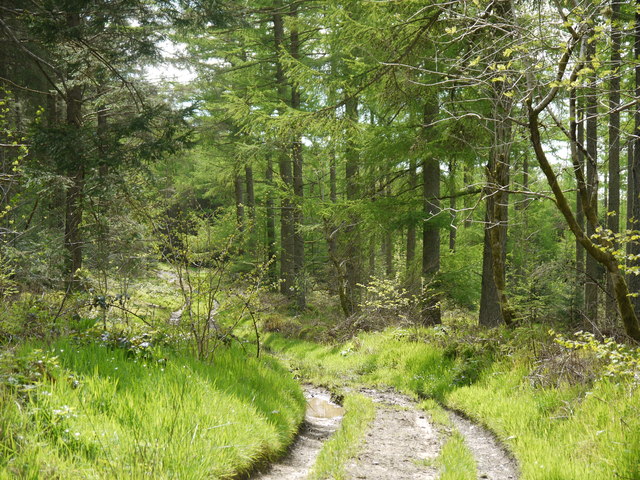
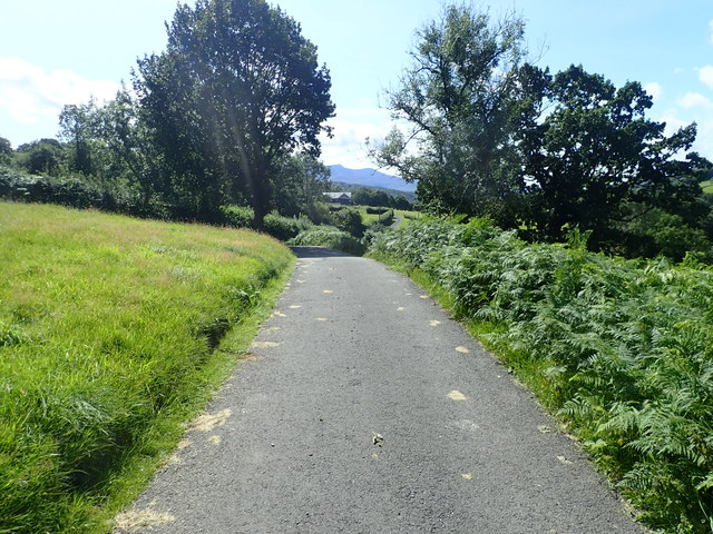
The region offers numerous walking trails and hiking routes, allowing visitors to explore its vast expanse and discover hidden gems along the way. Whether it's a leisurely stroll through the rolling hills or a challenging hike to the summit of nearby mountains, Ffridd Celynnog offers something for everyone.

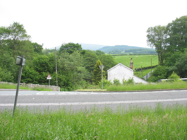
Overall, Ffridd Celynnog in Merionethshire is a captivating destination, offering a unique blend of natural beauty, wildlife, and cultural heritage. Its downs and moorland provide a stunning backdrop for outdoor activities and a chance to immerse oneself in the peacefulness and serenity of the Welsh countryside.

If you have any feedback on the listing, please let us know in the comments section below.

Ffridd Celynnog Images

Images are sourced within 2km of 52.763985/-3.7715355 or Grid Reference SH8019. Thanks to Geograph Open Source API. All images are credited.

The A494 north at Rhydymain village sign
The A494 north at Rhydymain
The A494 north approaching junction for Llanfachreth
View north-west towards Rhobell Fawr
Cader Idris in background
Forest Path
Forest Path
Bend in Afon Wnion
Bend in Afon Wnion
The Rhydymain junction on the A494
Coed-y-rhos-lwyd Taken from the farmhouse garden
Coed-y-rhos-lwyd
Taken from the farmhouse garden
Approaching Rhydymain junction on A494
Ordnance Survey Cut Mark This OS cut mark can be found on the SE parapet of the bridge. It marks a point 127.252m above mean sea level.
Ordnance Survey Cut Mark
This OS cut mark can be found on the SE parapet of the bridge. It marks a point 127.252m above mean sea level.
Cross Britain Way & Taith Mari Jones Following a minor road eastwards from Bryn-Coed-Ifor.  The Cross Britain Way is a long distance path between Barmouth and Boston, Lincs <span class="nowrap"><a title="http://www.macmillanway.org/index_files/cross_britain_way.htm" rel="nofollow ugc noopener" href="http://www.macmillanway.org/index_files/cross_britain_way.htm">Link</a><img style="margin-left:2px;" alt="External link" title="External link - shift click to open in new window" src="https://s1.geograph.org.uk/img/external.png" width="10" height="10"/></span> while Taith Mari Jones is a 28 mile route from Llanfihangel y Pennant to Bala. <span class="nowrap"><a title="https://martyswalks.blogspot.com/2018/06/mary-jones-walk.html" rel="nofollow ugc noopener" href="https://martyswalks.blogspot.com/2018/06/mary-jones-walk.html">Link</a><img style="margin-left:2px;" alt="External link" title="External link - shift click to open in new window" src="https://s1.geograph.org.uk/img/external.png" width="10" height="10"/></span>
Cross Britain Way & Taith Mari Jones
Following a minor road eastwards from Bryn-Coed-Ifor. The Cross Britain Way is a long distance path between Barmouth and Boston, Lincs LinkExternal link while Taith Mari Jones is a 28 mile route from Llanfihangel y Pennant to Bala. LinkExternal link
Nant Terfyn One of many streams from the Aran Mountains on its way to join the river Wnion
Nant Terfyn
One of many streams from the Aran Mountains on its way to join the river Wnion
Nant Coed A mountain stream descending from the Aran mountains to the river Wnion
Nant Coed
A mountain stream descending from the Aran mountains to the river Wnion
Llety Wyn Small mountain farm on the northern slopes of the Arans
Llety Wyn
Small mountain farm on the northern slopes of the Arans
Summit area of north top of Pen y Brynnfforchog Pen y Brynnfforchog on its north top are 2000 foot mountain tops lying south-west of the higher Glasgwm which is the mountain seen in the distance. OS mapping shows an extensive area of coniferous plantation to the west of the hills but as can be seen from the image, that has been largely clear-felled with just 'decorative' clumps of trees left standing.
Summit area of north top of Pen y Brynnfforchog
Pen y Brynnfforchog on its north top are 2000 foot mountain tops lying south-west of the higher Glasgwm which is the mountain seen in the distance. OS mapping shows an extensive area of coniferous plantation to the west of the hills but as can be seen from the image, that has been largely clear-felled with just 'decorative' clumps of trees left standing.
View down Afon Celygog Lovely view down the stream on its way to join Afon Wnion
View down Afon Celygog
Lovely view down the stream on its way to join Afon Wnion
Footpath
Footpath
Show me another place!

Ffridd Celynnog is located at Grid Ref: SH8019 (Lat: 52.763985, Lng: -3.7715355)

Unitary Authority: Gwynedd

Police Authority: North Wales

What 3 Words

///hatter.anguished.rentals. Near Dolgellau, Gwynedd

Nearby Locations

Ffridd Celynnog

Related Wikis

Wnion Halt railway station

Wnion Halt (Pron: Oon-y'n) in Gwynedd, Wales, was on the Ruabon to Barmouth line. The station was situated in a narrow part of the Wnion Valley next to...

Brithdir and Llanfachreth

Brithdir and Llanfachreth is a community in the county of Gwynedd, Wales, near Dolgellau, and is 93.1 miles (149.8 km) from Cardiff and 178.4 miles (287...

Pen y Brynfforchog

Pen y Brynfforchog is subsidiary summit of Glasgwm in North Wales forming part of the Aran range in southern Snowdonia.It is separated from Glasgwm by...

Drws-y-Nant

Drws-y-Nant is a village in Gwynedd, Wales. It was formerly served by the Drws-y-Nant railway station but this closed in 1965.

Drws-y-Nant railway station

Drws-y-Nant railway station (Pron: Droos-a-Nant) in Gwynedd, Wales, was formerly a station on the Ruabon to Barmouth line. The station had two platforms...

Bont Newydd railway station

Bont Newydd railway station (sometimes shown as Bontnewydd) in Gwynedd, Wales, was a station on the now-closed Ruabon to Barmouth line. Originally a single...

Allt y Benglog National Nature Reserve

Allt y Benglog is a small national nature reserve near Dolgellau in Wales.Its position on the lower slopes of Rhobell Fawr, one of north Wales’ extinct...

Craig Cywarch

Craig Cywarch is an extensive crag looming above Cwm Cywarch. The nearest village is Dinas Mawddwy on the A470. Climbing routes on the various buttresses...

Have you been to Ffridd Celynnog?

Leave your review of Ffridd Celynnog below (or comments, questions and feedback).