Rhos Nant-gau

Downs, Moorland in Cardiganshire

Wales

Rhos Nant-gau

Stile marking stream fording point This flashy stile in otherwise pathless terrain marks a point where it is safe to ford the Nant Milwyn even at high water.  The whole square is open moorland, with the shallow valley of Nant Milwyn separating the high points of Domen Milwyn <a href="https://www.geograph.org.uk/gridref/SN8071">SN8071</a> and Banc Hir.
Stile marking stream fording point Credit: Rudi Winter

The requested URL returned error: 429 Too Many Requests

If you have any feedback on the listing, please let us know in the comments section below.

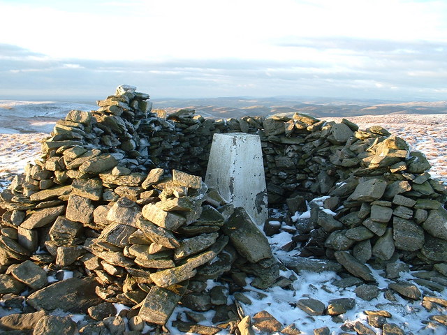
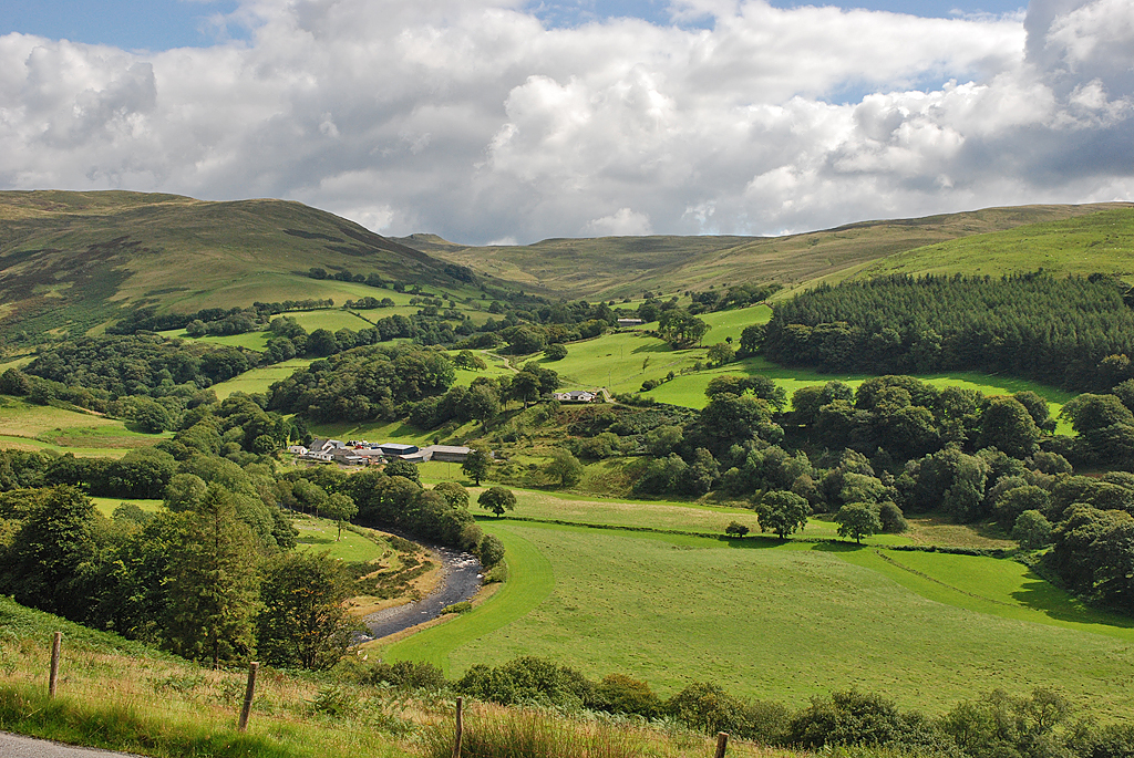
Rhos Nant-gau Images

Images are sourced within 2km of 52.332097/-3.7874802 or Grid Reference SN7871. Thanks to Geograph Open Source API. All images are credited.

Stile marking stream fording point This flashy stile in otherwise pathless terrain marks a point where it is safe to ford the Nant Milwyn even at high water.  The whole square is open moorland, with the shallow valley of Nant Milwyn separating the high points of Domen Milwyn <a href="https://www.geograph.org.uk/gridref/SN8071">SN8071</a> and Banc Hir.
Stile marking stream fording point
This flashy stile in otherwise pathless terrain marks a point where it is safe to ford the Nant Milwyn even at high water. The whole square is open moorland, with the shallow valley of Nant Milwyn separating the high points of Domen Milwyn SN8071 and Banc Hir.
Bridge on the Hafod Estate, near Pont-rhyd-y-groes The Hafod Estate is made up of the former grounds of a historic house. It is now the site of many walks amongst the trees. Many features of the old walks have been restored.
Bridge on the Hafod Estate, near Pont-rhyd-y-groes
The Hafod Estate is made up of the former grounds of a historic house. It is now the site of many walks amongst the trees. Many features of the old walks have been restored.
Grotto on the Hafod estate
Pont Dologau The gorge of the river Ystwyth just west of Cwmystwyth village.  Pont Dologau refers to four bridges crossing the gorge and a small tributary just upstream from the little waterfall in the picture.
Pont Dologau
The gorge of the river Ystwyth just west of Cwmystwyth village. Pont Dologau refers to four bridges crossing the gorge and a small tributary just upstream from the little waterfall in the picture.
Forest near Pont Dologau The Ystwyth gorge is framed by forest.  There are lots of bluebells in it, too!
Forest near Pont Dologau
The Ystwyth gorge is framed by forest. There are lots of bluebells in it, too!
Carved-out rocks in the river Ystwyth These rocks in the river bed of the Ystwyth have been carved out by the water.  Photo taken from the bridge just south of the village of Cwmystwyth during a period of fairly low water level.  The square contains farmland, some forest and, in the southern half, some open moorland.
Carved-out rocks in the river Ystwyth
These rocks in the river bed of the Ystwyth have been carved out by the water. Photo taken from the bridge just south of the village of Cwmystwyth during a period of fairly low water level. The square contains farmland, some forest and, in the southern half, some open moorland.
Trawsallt cairn This is Trawsallt cairn, looking towards the South West (sunset behind). Trawsallt is the first peak you come to as you walk up onto the high plateau from Pontrhydygroes.
Trawsallt cairn
This is Trawsallt cairn, looking towards the South West (sunset behind). Trawsallt is the first peak you come to as you walk up onto the high plateau from Pontrhydygroes.
Bryn Dafydd Cold and desolate, in a howling January east wind, this was not a place to hang around. The controversial Cefn Croes wind farm can be seen behind (to the north).
Bryn Dafydd
Cold and desolate, in a howling January east wind, this was not a place to hang around. The controversial Cefn Croes wind farm can be seen behind (to the north).
Ruined house at foot of Bryn Dafydd This house ruin at the western foot of Bryn Dafydd looked most peculiar, with its modernish oil tank outside! On closer inspection I found that the oil tank was being used by the farmer for storage, so presumably was not there when the house was last occupied.
Ruined house at foot of Bryn Dafydd
This house ruin at the western foot of Bryn Dafydd looked most peculiar, with its modernish oil tank outside! On closer inspection I found that the oil tank was being used by the farmer for storage, so presumably was not there when the house was last occupied.
Ford to Bwlchgwallter This track is the only access to the house at Bwlchgwallter.
Ford to Bwlchgwallter
This track is the only access to the house at Bwlchgwallter.
Trawsallt approach from the north Typical rough moorland terrain, on the approach towards the cairn of Trawsallt from the north. The forest roads of the Hafod Estate can be used to reach this point.
Trawsallt approach from the north
Typical rough moorland terrain, on the approach towards the cairn of Trawsallt from the north. The forest roads of the Hafod Estate can be used to reach this point.
Moorland north west of Llan Ddu Fawr Rough moorland separates the cairns of Trawsallt and Llan Ddu Fawr; the latter cairn can be seen on the horizon.
Moorland north west of Llan Ddu Fawr
Rough moorland separates the cairns of Trawsallt and Llan Ddu Fawr; the latter cairn can be seen on the horizon.
Moorland north east of Llan Ddu Fawr The rough moorland between Carnyrhyrddod and Llan Ddu Fawr, whose summit and cairn lies ahead.
Moorland north east of Llan Ddu Fawr
The rough moorland between Carnyrhyrddod and Llan Ddu Fawr, whose summit and cairn lies ahead.
Nant Milwyn The Nant Milwyn in its wooded valley, just above Tynewydd Farm.
Nant Milwyn
The Nant Milwyn in its wooded valley, just above Tynewydd Farm.
Sheepfold on Esgair Milwyn A rather elaborate sheepfold with several interlinked enclosures, situated on Esgair Milwyn above Tynewdd Farm.
Sheepfold on Esgair Milwyn
A rather elaborate sheepfold with several interlinked enclosures, situated on Esgair Milwyn above Tynewdd Farm.
Electric fence stake This mystery instrument was found at the entrance to a sheepfold (<a href="https://www.geograph.org.uk/photo/510646">SN7973 : Sheepfold on Esgair Milwyn</a>).  It is a broken electric fence stake, normally used to put up temporary fencing for grazing animals.  After the insulator bit at the top has broken off, it is now used as general re-inforcement of a permanent non-electrical fence.  Thanks to Colin Grice <a title="https://www.geograph.org.uk/profile/685" href="https://www.geograph.org.uk/profile/685">Link</a> for identifying it.
Electric fence stake
This mystery instrument was found at the entrance to a sheepfold (SN7973 : Sheepfold on Esgair Milwyn). It is a broken electric fence stake, normally used to put up temporary fencing for grazing animals. After the insulator bit at the top has broken off, it is now used as general re-inforcement of a permanent non-electrical fence. Thanks to Colin Grice Link for identifying it.
View of Cwmystwyth from Esgair Milwyn The village is located in the upper Ystwyth valley.
View of Cwmystwyth from Esgair Milwyn
The village is located in the upper Ystwyth valley.
Esgair Milwyn While the lower slopes of Esgair Milwyn are regularly grazed, the higher ground above is much rougher.  This remnant of a cairn marks approximately the transition between the two areas.  Higher up, the land is becoming more boggy - it's the NW end of a massive sphagnum-filled bathtub that stretches from Cwmystwyth to Rhaeadr.
Esgair Milwyn
While the lower slopes of Esgair Milwyn are regularly grazed, the higher ground above is much rougher. This remnant of a cairn marks approximately the transition between the two areas. Higher up, the land is becoming more boggy - it's the NW end of a massive sphagnum-filled bathtub that stretches from Cwmystwyth to Rhaeadr.
Show me another place!

Rhos Nant-gau is located at Grid Ref: SN7871 (Lat: 52.332097, Lng: -3.7874802)

Unitary Authority: Ceredigion

Police Authority: Dyfed Powys

What 3 Words

///nagging.talkative.hopping. Near Cwmystwyth, Ceredigion

Nearby Locations

Rhos Nant-gau

Related Wikis

Llan Ddu Fawr

Llan Ddu Fawr or Waun Claerddu is a hill located in Ceredigion, Wales, at 594 metres (1,949 ft) above sea level. It is located about 10 miles south of...

Cwmystwyth

Cwmystwyth (also Cwm Ystwyth, Welsh pronunciation: [kʊmˈəstʊɨθ]; English: "valley of the River Ystwyth") is a village in Ceredigion, Wales near Devil's...

Eglwys Newydd Church

Eglwys Newydd Church (also known as St Michael's Church, Hafod) is an early 19th-century church which replaced a previous chapel of ease. The chapel of...

Banc Tynddol sun-disc

The Banc Tynddol sun-disc (Welsh: Disc Haul Banc Tynddol) is a small, decorated, gold ornament discovered at Cwmystwyth, Ceredigion, Wales. It most likely...

Have you been to Rhos Nant-gau?

Leave your review of Rhos Nant-gau below (or comments, questions and feedback).