Moorhouse Moors

Downs, Moorland in Devon North Devon

England

Moorhouse Moors

Cemetery on outskirts of Bishops Nympton
Cemetery on outskirts of Bishops Nympton Credit: Ivan Taylor

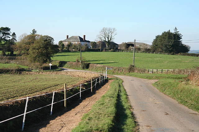
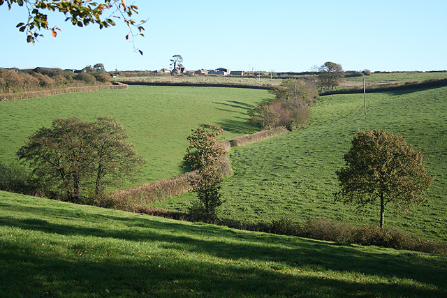
Moorhouse Moors is a picturesque area located in Devon, England, known for its stunning downs and vast moorland landscapes. Situated in the southwestern part of the county, Moorhouse Moors offers visitors a unique experience of the region's natural beauty and rich biodiversity.

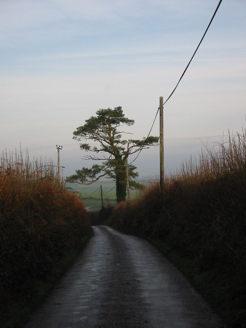
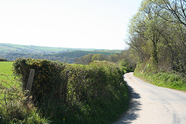
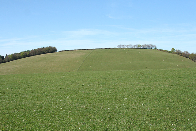
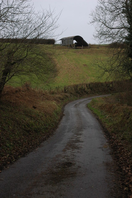
The moors of Moorhouse Moors stretch across rolling hills and valleys, covered in a patchwork of heather, gorse, and grasses. These vibrant colors create a breathtaking sight, especially when contrasted against the clear blue skies above. The area is home to various species of wildlife, including birds like skylarks and curlews, as well as small mammals like rabbits and voles.

The moorland of Moorhouse Moors provides an ideal habitat for many plant species, with vibrant displays of purple heather dominating the landscape during the summer months. Walking through the moorland, visitors can enjoy the tranquility and solitude that this untouched wilderness offers. There are several footpaths and trails that wind through the area, allowing hikers to explore and immerse themselves in the natural surroundings.

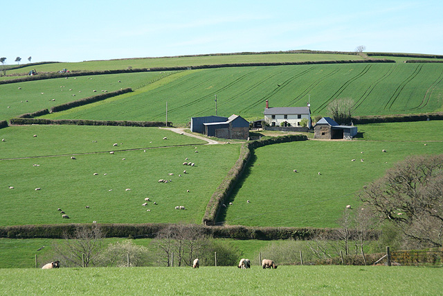
The downs of Moorhouse Moors are another highlight of the area. These rolling hills offer sweeping views of the surrounding countryside, with picturesque villages and farmland scattered in the distance. The downs are perfect for leisurely walks, picnics, or simply taking in the stunning vistas.

Moorhouse Moors is a haven for nature enthusiasts, photographers, and those seeking a peaceful escape from the bustling city life. It is a place where one can reconnect with nature, embrace the simplicity of the countryside, and marvel at the untouched beauty of Devon's moorland and downs.

If you have any feedback on the listing, please let us know in the comments section below.

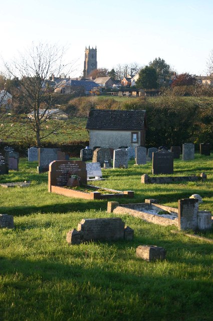
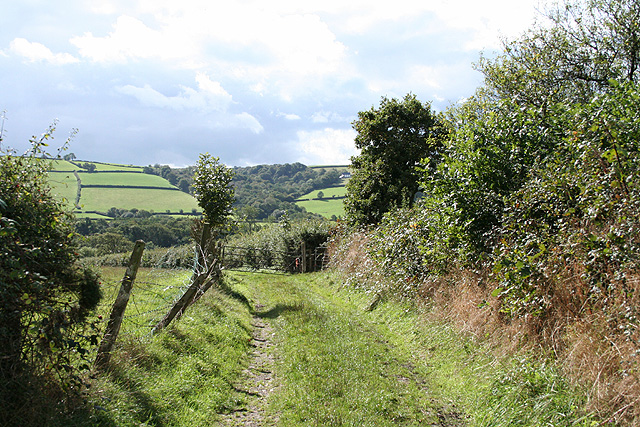
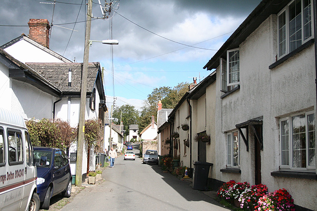
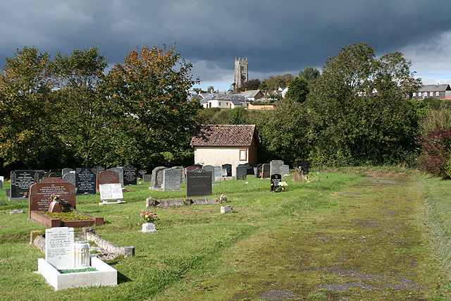
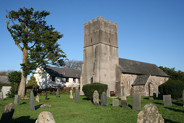
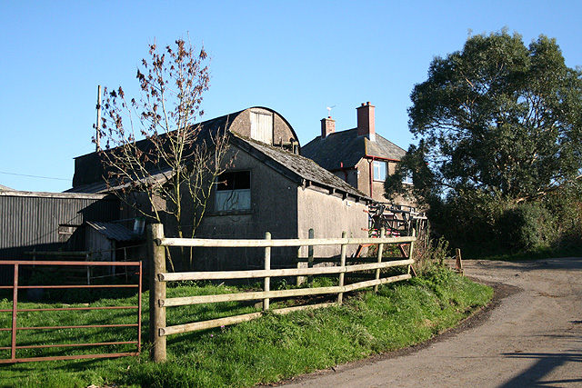
Moorhouse Moors Images

Images are sourced within 2km of 50.992177/-3.7850165 or Grid Reference SS7422. Thanks to Geograph Open Source API. All images are credited.

Cemetery on outskirts of Bishops Nympton
Bishop’s Nympton: footpath to Avercombe Mill Looking south. Here the path adjoins the village’s cemetery
Bishop’s Nympton: footpath to Avercombe Mill
Looking south. Here the path adjoins the village’s cemetery
Bishop’s Nympton: village street Looking north near the churchyard entrance. Behind the camera on the east side of the street are a post office and an inn, the Old Snare and Gin Trap
Bishop’s Nympton: village street
Looking north near the churchyard entrance. Behind the camera on the east side of the street are a post office and an inn, the Old Snare and Gin Trap
Bishop’s Nympton: cemetery Looking north west towards the village on the hill, dominated by the tower of St Mary’s Church
Bishop’s Nympton: cemetery
Looking north west towards the village on the hill, dominated by the tower of St Mary’s Church
Mariansleigh: approaching Hilltown The right turn heads for Bishop’s Nympton; the next junction, on the left, is for Upcott. Ahead is Hilltown farm and the road to Mariansleigh village
Mariansleigh: approaching Hilltown
The right turn heads for Bishop’s Nympton; the next junction, on the left, is for Upcott. Ahead is Hilltown farm and the road to Mariansleigh village
Mariansleigh: St Mary’s church The village name suggests the original dedication was to St Marina and this may have been lost at the Reformation. Looking north east
Mariansleigh: St Mary’s church
The village name suggests the original dedication was to St Marina and this may have been lost at the Reformation. Looking north east
Mariansleigh: towards Upcott Looking south east across a valley south of Mariansleigh village. Upcott is on the skyline
Mariansleigh: towards Upcott
Looking south east across a valley south of Mariansleigh village. Upcott is on the skyline
Mariansleigh: Lower Upcott Looking east-south-east
Mariansleigh: Lower Upcott
Looking east-south-east
Scots Pine mark tree at Uppacott This tree is a landmark visible from miles around. Scots Pine trees were planted to mark farmsteads and drovers routes in the past.
Scots Pine mark tree at Uppacott
This tree is a landmark visible from miles around. Scots Pine trees were planted to mark farmsteads and drovers routes in the past.
Beacon at Silcombe Cross
Mariansleigh: lane to Alswear Looking west-north-west
Mariansleigh: lane to Alswear
Looking west-north-west
Bishop’s Nympton: St Mary’s church A four-stage west tower with set-back buttresses. The church was constructed in the 15th century and early 16th; the interior was 'modernised' in the 19th century. Looking north east
Bishop’s Nympton: St Mary’s church
A four-stage west tower with set-back buttresses. The church was constructed in the 15th century and early 16th; the interior was 'modernised' in the 19th century. Looking north east
Bishop’s Nympton: towards Barton A small farm west of the village
Bishop’s Nympton: towards Barton
A small farm west of the village
Bishop’s Nympton: near Westwood A poultry farm
Bishop’s Nympton: near Westwood
A poultry farm
Bishop’s Nympton: Crosse A Devon longhouse by the back lane from Bishop’s Nympton to South Molton. Looking north east
Bishop’s Nympton: Crosse
A Devon longhouse by the back lane from Bishop’s Nympton to South Molton. Looking north east
Bishop’s Nympton: towards Blastridge Hill View from Radley Cross looking north. The hill is beyond the square
Bishop’s Nympton: towards Blastridge Hill
View from Radley Cross looking north. The hill is beyond the square
Barn near Mariansleigh Barn in a field above Middle Wood to the west of Mariansleigh.
Barn near Mariansleigh
Barn in a field above Middle Wood to the west of Mariansleigh.
Slough House This no through road heading south-east has come to an end with Slough House on the left. The cattle grid prevents livestock getting on the road.
Slough House
This no through road heading south-east has come to an end with Slough House on the left. The cattle grid prevents livestock getting on the road.
Show me another place!

Moorhouse Moors is located at Grid Ref: SS7422 (Lat: 50.992177, Lng: -3.7850165)

Administrative County: Devon

District: North Devon

Police Authority: Devon and Cornwall

What 3 Words

///words.otherwise.dressing. Near South Molton, Devon

Related Wikis

Mariansleigh

Mariansleigh is a village and civil parish in Devon, England. In 2021 the parish had a population of 170. == External links == GENUKI Mariansleigh Page

Bishop's Nympton

Bishop's Nympton is a village and civil parish in the North Devon district of Devon, England, about three miles east of South Molton. According to the...

Alswear

Alswear is a village in Devon, England, approximately 25 miles (40 km) northwest of Exeter. == References == == External links == Media related to Alswear...

Queen's Nympton

Queen's Nympton or Queensnympton is a small civil parish in the North Devon district of Devon, England. According to the 2001 census it had a population...

Romansleigh

Romansleigh is a village and civil parish in the North Devon district of Devon, England. It is surrounded clockwise from the north by the parishes of Mariansleigh...

Meshaw

Meshaw is a village and civil parish in the North Devon district of Devon, England. Its nearest town is South Molton, which lies approximately 5.9 miles...

Ash Mill

Ash Mill is a village in Devon, England.Ashmill was the site of Ashwater station on the former L.S.W.R. North Cornwall line which closed in the 1960s....

South Molton Community College

South Molton Community College (known to students and teachers as SMCC) is a coeducational foundation secondary school located in South Molton in the English...

Nearby Amenities

Located within 500m of 50.992177,-3.7850165
Ford: yes
Lat/Long: 50.9962598/-3.7872122
Power: pole
Source: bing
Lat/Long: 50.996021/-3.7876828
Power: pole
Source: bing
Lat/Long: 50.9954218/-3.7832893
Power: pole
Source: bing
Lat/Long: 50.9956108/-3.7827167
Power: pole
Source: bing
Lat/Long: 50.9957324/-3.7863699
Power: pole
Source: bing
Lat/Long: 50.9954606/-3.7851226
Power: pole
Source: bing
Transformer: distribution
Lat/Long: 50.9952006/-3.7839505
Power: pole
Source: bing
Lat/Long: 50.9949947/-3.7829742
Power: pole
Source: bing
Lat/Long: 50.9947853/-3.7819898
Power: pole
Source: bing
Lat/Long: 50.9948613/-3.7807184
Power: pole
Source: bing
Lat/Long: 50.9949389/-3.7795302
The data included in this document is from www.openstreetmap.org. The data is made available under ODbL.

Have you been to Moorhouse Moors?

Leave your review of Moorhouse Moors below (or comments, questions and feedback).