Chagford Common

Downs, Moorland in Devon West Devon

England

Chagford Common

Bush Down - Bennett's Cross A wayside cross on the B3212 Moretonhampstead - Two Bridges road, believed to be carved from a prehistoric menhir. It is ca 1.7 metres tall and is a well known Dartmoor landmark. Birch Tor is on the skyline.
<span class="nowrap"><a title="www.dartmoor.gov.uk" rel="nofollow ugc noopener" href="http://www.dartmoor.gov.uk">Link</a><img style="margin-left:2px;" alt="External link" title="External link - shift click to open in new window" src="https://s1.geograph.org.uk/img/external.png" width="10" height="10"/></span>
Bush Down - Bennett's Cross Credit: Colin Smith

Chagford Common is a vast expanse of moorland located in the county of Devon, South West England. Situated near the town of Chagford, the common covers an area of approximately 2,000 acres and is nestled within the Dartmoor National Park.

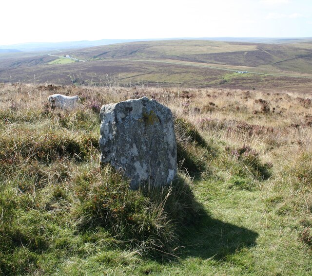
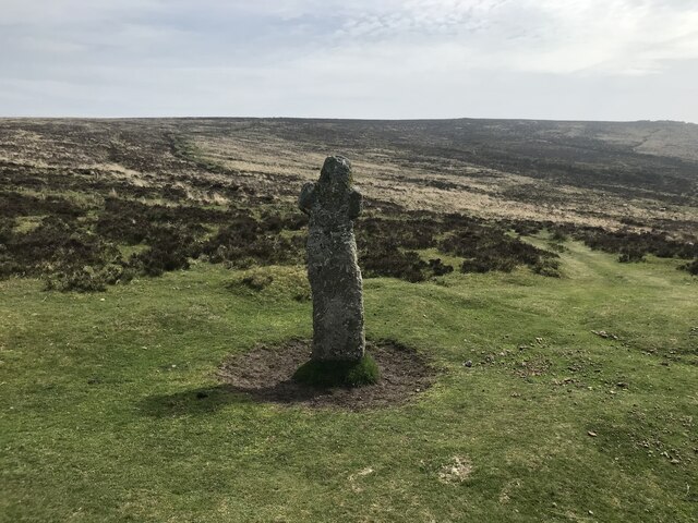
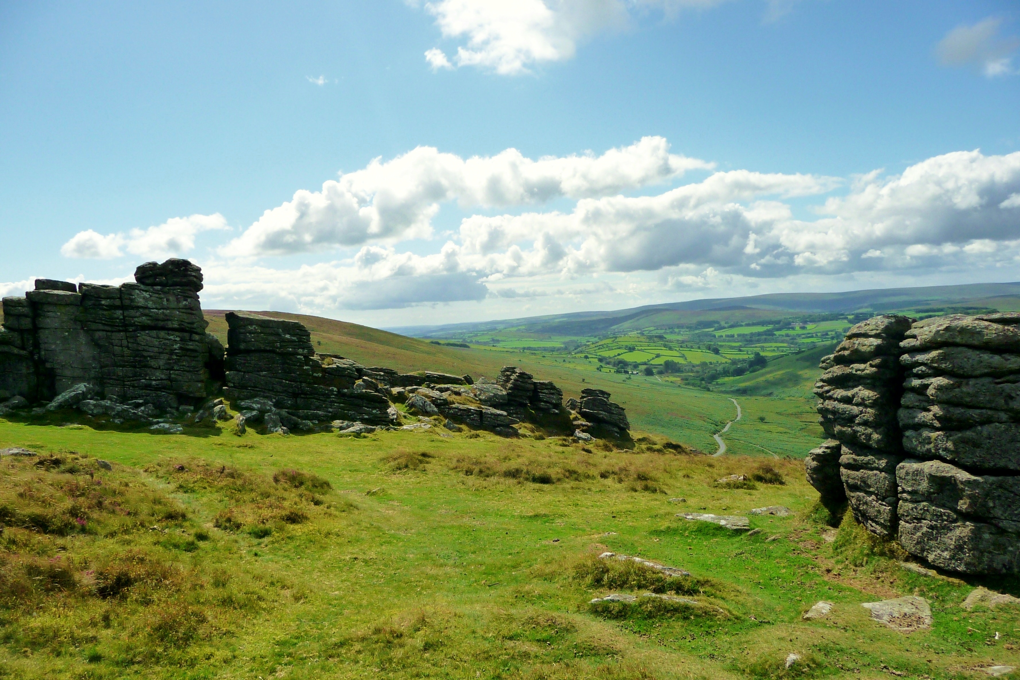
Characterized by its rolling hills, granite tors, and open grasslands, Chagford Common offers visitors a quintessential moorland experience. The landscape is dominated by heather, gorse, and bracken, creating a rich tapestry of colors throughout the year. The common is home to a diverse range of wildlife, including Dartmoor ponies, sheep, and various bird species, such as skylarks and curlews.

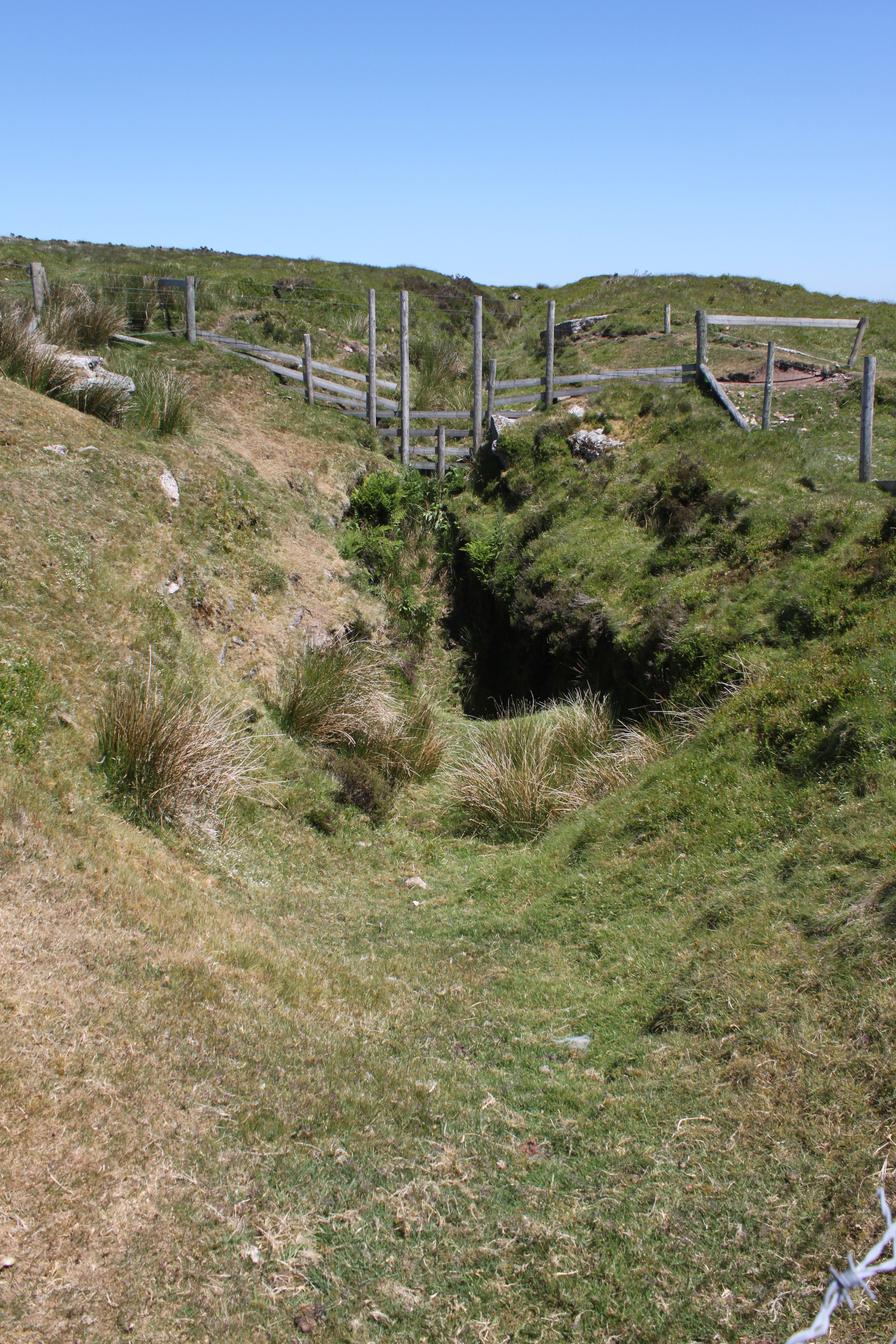
The common is crisscrossed by a network of public footpaths and bridleways, making it a popular destination for walkers, hikers, and horse riders. These paths allow visitors to explore the stunning scenery and take in panoramic views of the surrounding countryside. Chagford Common is also intersected by several rivers and streams, providing opportunities for fishing and picnicking along their banks.

The common has a rich historical and cultural significance. It has been utilized for centuries for grazing livestock and harvesting peat for fuel. The remnants of prehistoric settlements, including stone circles and hut circles, can still be found scattered across the common, offering insights into its ancient past.

Chagford Common is not only a haven for nature enthusiasts but also a place of tranquility and beauty, providing a glimpse into the rugged charm of Dartmoor's moorland landscape.

If you have any feedback on the listing, please let us know in the comments section below.

Chagford Common Images

Images are sourced within 2km of 50.633404/-3.8748439 or Grid Reference SX6783. Thanks to Geograph Open Source API. All images are credited.

Bush Down - Bennett's Cross A wayside cross on the B3212 Moretonhampstead - Two Bridges road, believed to be carved from a prehistoric menhir. It is ca 1.7 metres tall and is a well known Dartmoor landmark. Birch Tor is on the skyline.
<span class="nowrap"><a title="www.dartmoor.gov.uk" rel="nofollow ugc noopener" href="http://www.dartmoor.gov.uk">Link</a><img style="margin-left:2px;" alt="External link" title="External link - shift click to open in new window" src="https://s1.geograph.org.uk/img/external.png" width="10" height="10"/></span>
Bush Down - Bennett's Cross
A wayside cross on the B3212 Moretonhampstead - Two Bridges road, believed to be carved from a prehistoric menhir. It is ca 1.7 metres tall and is a well known Dartmoor landmark. Birch Tor is on the skyline. LinkExternal link
Bush Down - Bennett's Cross A roadside cross, believed to have been carved from a prehistoric menhir. It is ca 1.7 metres high.
<span class="nowrap"><a title="www.dartmoor.gov.uk" rel="nofollow ugc noopener" href="http://www.dartmoor.gov.uk">Link</a><img style="margin-left:2px;" alt="External link" title="External link - shift click to open in new window" src="https://s1.geograph.org.uk/img/external.png" width="10" height="10"/></span>
Bush Down - Bennett's Cross
A roadside cross, believed to have been carved from a prehistoric menhir. It is ca 1.7 metres high. LinkExternal link
Old Boundary Marker north of Birch Tor, North Bovey parish Estate Boundary Marker 10 metres northwest of the tumulus on Birch Tor. North Bovey parish. Inscribed W B to mark the boundary of the Headland Warren, and dating from 1780. Grade II Listed details <span class="nowrap"><a title="https://historicengland.org.uk/listing/the-list/list-entry/1021341" rel="nofollow ugc noopener" href="https://historicengland.org.uk/listing/the-list/list-entry/1021341">Link</a><img style="margin-left:2px;" alt="External link" title="External link - shift click to open in new window" src="https://s1.geograph.org.uk/img/external.png" width="10" height="10"/></span>.

Milestone Society National ID: DV_CCFB04em
Old Boundary Marker north of Birch Tor, North Bovey parish
Estate Boundary Marker 10 metres northwest of the tumulus on Birch Tor. North Bovey parish. Inscribed W B to mark the boundary of the Headland Warren, and dating from 1780. Grade II Listed details LinkExternal link. Milestone Society National ID: DV_CCFB04em
Prehistoric Round House forming part of a settlement known as Lowton Brook East Scale 2m <span class="nowrap"><a title="https://historicengland.org.uk/listing/the-list/list-entry/1017990?section=official-list-entry" rel="nofollow ugc noopener" href="https://historicengland.org.uk/listing/the-list/list-entry/1017990?section=official-list-entry">Link</a><img style="margin-left:2px;" alt="External link" title="External link - shift click to open in new window" src="https://s1.geograph.org.uk/img/external.png" width="10" height="10"/></span>
Prehistoric Round House forming part of a settlement known as Lowton Brook East
Scale 2m LinkExternal link
Longhouse at Assycombe Farm Scale 2m <span class="nowrap"><a title="https://www.heritagegateway.org.uk/Gateway/Results_Single.aspx?uid=MDV6703&resourceID=104" rel="nofollow ugc noopener" href="https://www.heritagegateway.org.uk/Gateway/Results_Single.aspx?uid=MDV6703&resourceID=104">Link</a><img style="margin-left:2px;" alt="External link" title="External link - shift click to open in new window" src="https://s1.geograph.org.uk/img/external.png" width="10" height="10"/></span>
Longhouse at Assycombe Farm
Scale 2m LinkExternal link
Bennett's Cross
Bennett's Cross
Picnic area at Fernworthy Reservoir
Fernworthy Reservoir dam
Moss covered trees
Moss covered trees
Sandeman bridge
Sandeman bridge
Chagford Common
Chagford Common
Chagford Common
Chagford Common
Dartmoor near East Bovey Head
Dartmoor near Challacombe Cross
Footpath through the Trees The gravel track that forms part of the complete circuit of Fernworthy Reservoir in Dartmoor in Devon.
Footpath through the Trees
The gravel track that forms part of the complete circuit of Fernworthy Reservoir in Dartmoor in Devon.
The B3212 near Water Hill The B3212 near Water Hill on Dartmoor.
The B3212 near Water Hill
The B3212 near Water Hill on Dartmoor.
The B3212 crossing Dartmoor
Moorland road above Green Combe Moorland road above Green Combe near Lettaford.
Moorland road above Green Combe
Moorland road above Green Combe near Lettaford.
Show me another place!

Chagford Common is located at Grid Ref: SX6783 (Lat: 50.633404, Lng: -3.8748439)

Administrative County: Devon

District: West Devon

Police Authority: Devon and Cornwall

What 3 Words

///predict.crispier.wiggles. Near Chagford, Devon

Related Wikis

Warren House Inn

The Warren House Inn is a remote and isolated public house in the heart of Dartmoor, Devon, England. It is the highest pub in southern England at 1,425...

Birch Tor and Vitifer mine

Birch Tor and Vitifer mine was a tin mine on Dartmoor, Devon, England. Located in the valley of the Redwater Brook, to the east of the B3212 Moretonhampstead...

Frenchbeer

Frenchbeer is a settlement in Devon, England. It is in Dartmoor national park. Fernworthy reservoir is to the south and so is the South Teign river. Chagford...

Hookney Tor

Hookney Tor is a tor, situated on Dartmoor in Devon, England. It lies on the Two Moors Way and remains of Headland Warren farm and Vitifer Mine are also...

Have you been to Chagford Common?

Leave your review of Chagford Common below (or comments, questions and feedback).