Treeland Downs

Downs, Moorland in Devon South Hams

England

Treeland Downs

Old Milestone in Aish village, South Brent Carved stone post by the UC road, in parish of South Brent (South Hams District), Aish, centre of village, by "Long Barn", opposite "Treeby", 15m South of telephone/post box, on grass verge by gate to Long Barn, on South West side of road. Small granite tombstone, erected by the parish in the 19th century.

Inscription reads:-
8
MILES
FROM
TOTNES

Milestone Society National ID: DV_TNAI08
Old Milestone in Aish village, South Brent Credit: Max Piper

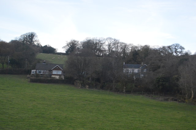
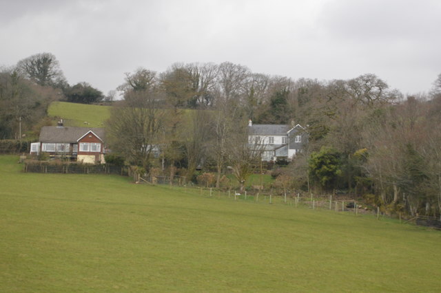
Treeland Downs is a picturesque area located in Devon, England. Situated within the expansive Downs and Moorland region, this breathtaking landscape offers visitors a unique and immersive experience in the heart of nature.

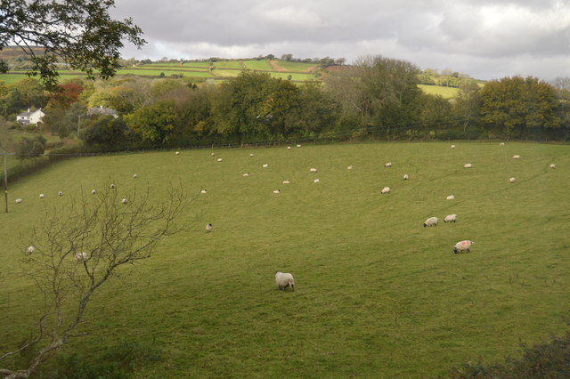
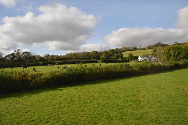
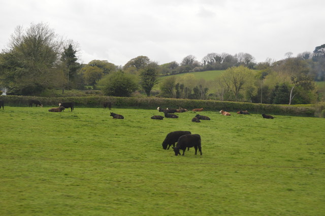
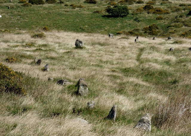
The Downs are characterized by gently rolling hills covered in lush green grass and dotted with vibrant wildflowers, creating a stunning tapestry of colors. The area also boasts an abundance of wildlife, with various species of birds, butterflies, and small mammals calling it home. Nature enthusiasts will find themselves captivated by the tranquility and beauty that surrounds them.

Treeland Downs offers a range of outdoor activities for visitors to enjoy. Hiking and walking trails wind through the hills, providing opportunities for exploration and discovery. The panoramic views from the hilltops are truly awe-inspiring, allowing visitors to soak in the natural splendor of the area.

In addition to hiking, Treeland Downs is also a popular spot for picnicking and nature photography. The open meadows and clear skies offer the perfect backdrop for capturing stunning images of the landscape and its inhabitants.

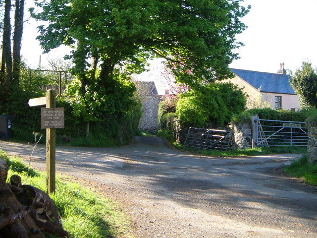
The area is easily accessible by car or public transport, with ample parking available for visitors. Local amenities, such as cafes and shops, can be found nearby, ensuring that visitors have everything they need for a day of adventure in Treeland Downs.

Whether you are seeking a peaceful escape from the hustle and bustle of daily life or a chance to reconnect with nature, Treeland Downs in Devon is a must-visit destination. Its natural beauty and tranquil atmosphere make it a truly unforgettable experience.

If you have any feedback on the listing, please let us know in the comments section below.

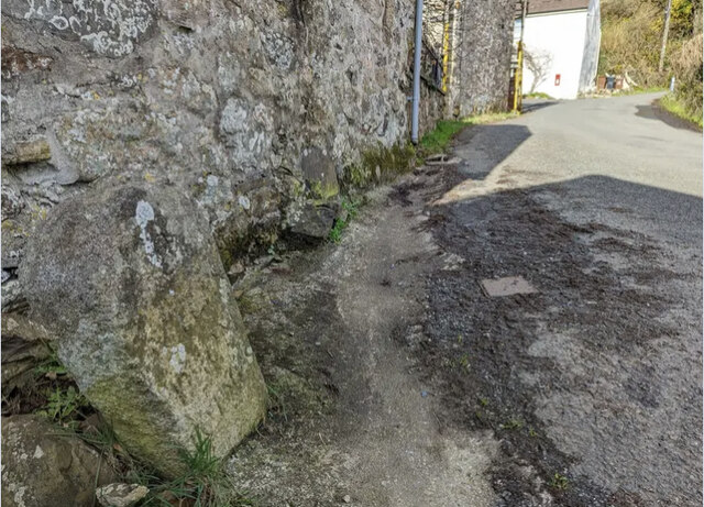
Treeland Downs Images

Images are sourced within 2km of 50.435839/-3.8684902 or Grid Reference SX6761. Thanks to Geograph Open Source API. All images are credited.

Old Milestone in Aish village, South Brent Carved stone post by the UC road, in parish of South Brent (South Hams District), Aish, centre of village, by "Long Barn", opposite "Treeby", 15m South of telephone/post box, on grass verge by gate to Long Barn, on South West side of road. Small granite tombstone, erected by the parish in the 19th century.

Inscription reads:-
8
MILES
FROM
TOTNES

Milestone Society National ID: DV_TNAI08
Old Milestone in Aish village, South Brent
Carved stone post by the UC road, in parish of South Brent (South Hams District), Aish, centre of village, by "Long Barn", opposite "Treeby", 15m South of telephone/post box, on grass verge by gate to Long Barn, on South West side of road. Small granite tombstone, erected by the parish in the 19th century. Inscription reads:- 8 MILES FROM TOTNES Milestone Society National ID: DV_TNAI08
Sheep grazing
Sheep grazing
Farmland near South Brent
Wall by the ford at Shipley Bridge There isn't much water about today and the ford isn't over the road. The fields here are the last before 
the unfenced moorland begins.
Wall by the ford at Shipley Bridge
There isn't much water about today and the ford isn't over the road. The fields here are the last before the unfenced moorland begins.
Marshy patch at Shipley Bridge Right on the edge of Dartmoor proper here. Facing this way it's green fields and woods but just behind me are the gorse and bracken covered slopes of the unfenced moorland.
Marshy patch at Shipley Bridge
Right on the edge of Dartmoor proper here. Facing this way it's green fields and woods but just behind me are the gorse and bracken covered slopes of the unfenced moorland.
Cattle
Cattle
Houses on Ash Lane
Houses on Ash Lane
Houses on Aish Lane
Houses on Aish Lane
River Avon, Shipley Bridge
Old Milestone in Aish village, South Brent Carved stone post by the UC road, in parish of South Brent (South Hams District), Aish, centre of village, by "Long Barn", opposite "Treeby", 15m South of telephone/post box, on grass verge by gate to Long Barn, on South West side of road. Small granite tombstone, erected by the parish in the 19th century. 

Inscription reads:-
8
MILES
FROM
TOTNES   

Milestone Society National ID: DV_TNAI08
Old Milestone in Aish village, South Brent
Carved stone post by the UC road, in parish of South Brent (South Hams District), Aish, centre of village, by "Long Barn", opposite "Treeby", 15m South of telephone/post box, on grass verge by gate to Long Barn, on South West side of road. Small granite tombstone, erected by the parish in the 19th century. Inscription reads:- 8 MILES FROM TOTNES Milestone Society National ID: DV_TNAI08
River Avon Looking upstream, below Black Brake.
River Avon
Looking upstream, below Black Brake.
Brent Fore Hill prehistoric stone row A double prehistoric stone row measuring 120m long, including at least 32 small and medium-sized stones. The row is orientated north east to south west and there is a kerbed cairn at the upper north eastern end. <span class="nowrap"><a title="https://stonerows.wordpress.com/gazetteer/region/dartmoor/brent-fore-hill/" rel="nofollow ugc noopener" href="https://stonerows.wordpress.com/gazetteer/region/dartmoor/brent-fore-hill/">Link</a><img style="margin-left:2px;" alt="External link" title="External link - shift click to open in new window" src="https://s1.geograph.org.uk/img/external.png" width="10" height="10"/></span>
Brent Fore Hill prehistoric stone row
A double prehistoric stone row measuring 120m long, including at least 32 small and medium-sized stones. The row is orientated north east to south west and there is a kerbed cairn at the upper north eastern end. LinkExternal link
Corringdon Ball, North prehistoric stone row A single prehistoric stone row measuring 132m long, including at least 21 small and medium-sized stones. The row is orientated north east to south west and there is a kerbed cairn at the lower north eastern end. The large stone in the middle distance forms part of the kerbed cairn at the end of this row. The stones to the right form part of Corringdon Ball, South stone row and its terminal cairn. <span class="nowrap"><a title="https://stonerows.wordpress.com/gazetteer/region/dartmoor/corringdon-ball-north/" rel="nofollow ugc noopener" href="https://stonerows.wordpress.com/gazetteer/region/dartmoor/corringdon-ball-north/">Link</a><img style="margin-left:2px;" alt="External link" title="External link - shift click to open in new window" src="https://s1.geograph.org.uk/img/external.png" width="10" height="10"/></span>
Corringdon Ball, North prehistoric stone row
A single prehistoric stone row measuring 132m long, including at least 21 small and medium-sized stones. The row is orientated north east to south west and there is a kerbed cairn at the lower north eastern end. The large stone in the middle distance forms part of the kerbed cairn at the end of this row. The stones to the right form part of Corringdon Ball, South stone row and its terminal cairn. LinkExternal link
Corringdon Ball, South prehistoric stone row A multiple prehistoric stone row measuring 178m long, including at least 247 mainly small-sized together with some medium-sized stones arranged in at least 7 separate lines. The row is orientated north east to south west and there is a kerbed cairn at the lower north eastern end. This row is of a rare multiple row type, consisting as it does of parallel lines of stones rather than the usual fan-shaped arrangement. <span class="nowrap"><a title="https://stonerows.wordpress.com/gazetteer/region/dartmoor/corringdon-ball-south/" rel="nofollow ugc noopener" href="https://stonerows.wordpress.com/gazetteer/region/dartmoor/corringdon-ball-south/">Link</a><img style="margin-left:2px;" alt="External link" title="External link - shift click to open in new window" src="https://s1.geograph.org.uk/img/external.png" width="10" height="10"/></span>
Corringdon Ball, South prehistoric stone row
A multiple prehistoric stone row measuring 178m long, including at least 247 mainly small-sized together with some medium-sized stones arranged in at least 7 separate lines. The row is orientated north east to south west and there is a kerbed cairn at the lower north eastern end. This row is of a rare multiple row type, consisting as it does of parallel lines of stones rather than the usual fan-shaped arrangement. LinkExternal link
Glasscombe Ball prehistoric stone row A combination single and double prehistoric stone row measuring 84.5m long, including 24 recumbent stones of different sizes.  The row is orientated north east to south west and is in the vicinity of six stone rows and  several cairns. <span class="nowrap"><a title="https://stonerows.wordpress.com/gazetteer/region/dartmoor/glasscombe-ball-north/" rel="nofollow ugc noopener" href="https://stonerows.wordpress.com/gazetteer/region/dartmoor/glasscombe-ball-north/">Link</a><img style="margin-left:2px;" alt="External link" title="External link - shift click to open in new window" src="https://s1.geograph.org.uk/img/external.png" width="10" height="10"/></span>
Glasscombe Ball prehistoric stone row
A combination single and double prehistoric stone row measuring 84.5m long, including 24 recumbent stones of different sizes. The row is orientated north east to south west and is in the vicinity of six stone rows and several cairns. LinkExternal link
Glasscombe Corner prehistoric stone row A combination single and double prehistoric stone row measuring 173m long, including at least 82 small and medium-sized stones. The row is orientated north east to south west and there is a kerbed cairn at the lower north eastern end. <span class="nowrap"><a title="https://stonerows.wordpress.com/gazetteer/region/dartmoor/glasscombe-corner/" rel="nofollow ugc noopener" href="https://stonerows.wordpress.com/gazetteer/region/dartmoor/glasscombe-corner/">Link</a><img style="margin-left:2px;" alt="External link" title="External link - shift click to open in new window" src="https://s1.geograph.org.uk/img/external.png" width="10" height="10"/></span>
Glasscombe Corner prehistoric stone row
A combination single and double prehistoric stone row measuring 173m long, including at least 82 small and medium-sized stones. The row is orientated north east to south west and there is a kerbed cairn at the lower north eastern end. LinkExternal link
Corringdon Ball prehistoric enclosed settlements Prehistoric agglomerated enclosures that were probably built and lived in during the Middle Bronze Age (1400 - 1000 BC). <span class="nowrap"><a title="https://historicengland.org.uk/listing/the-list/list-entry/1010208" rel="nofollow ugc noopener" href="https://historicengland.org.uk/listing/the-list/list-entry/1010208">Link</a><img style="margin-left:2px;" alt="External link" title="External link - shift click to open in new window" src="https://s1.geograph.org.uk/img/external.png" width="10" height="10"/></span>
Corringdon Ball prehistoric enclosed settlements
Prehistoric agglomerated enclosures that were probably built and lived in during the Middle Bronze Age (1400 - 1000 BC). LinkExternal link
Corringdon Ball chambered cairn The mutilated remains of the chamber at the southern end of the mound (Scale 1m). <span class="nowrap"><a title="https://www.megalithic.co.uk/article.php?sid=4619" rel="nofollow ugc noopener" href="https://www.megalithic.co.uk/article.php?sid=4619">Link</a><img style="margin-left:2px;" alt="External link" title="External link - shift click to open in new window" src="https://s1.geograph.org.uk/img/external.png" width="10" height="10"/></span>
Corringdon Ball chambered cairn
The mutilated remains of the chamber at the southern end of the mound (Scale 1m). LinkExternal link
Show me another place!

Treeland Downs is located at Grid Ref: SX6761 (Lat: 50.435839, Lng: -3.8684902)

Administrative County: Devon

District: South Hams

Police Authority: Devon and Cornwall

What 3 Words

///fended.shopping.footballers. Near South Brent, Devon

Related Wikis

Badworthy

Badworthy is a village in Devon, England.

Aish, South Brent

Aish is a relatively small hamlet in the English county of Devon. It is near the large village of South Brent. This Aish is not to be confused with the...

Lutton, South Brent

Lutton is a small farming hamlet on the outskirts of South Brent, Devon, England. It is a hillside community on the side of Brent Hill. It is only a small...

South Brent

South Brent is a large village on the southern edge of Dartmoor, England, in the valley of the River Avon. The parish includes the small hamlets of Aish...

Nearby Amenities

Located within 500m of 50.435839,-3.8684902
Corringdon Ball
Natural: peak
Source: NPE
Lat/Long: 50.4335729/-3.8718974
The data included in this document is from www.openstreetmap.org. The data is made available under ODbL.

Have you been to Treeland Downs?

Leave your review of Treeland Downs below (or comments, questions and feedback).