Dail an Tullaich
Downs, Moorland in Inverness-shire
Scotland
Dail an Tullaich
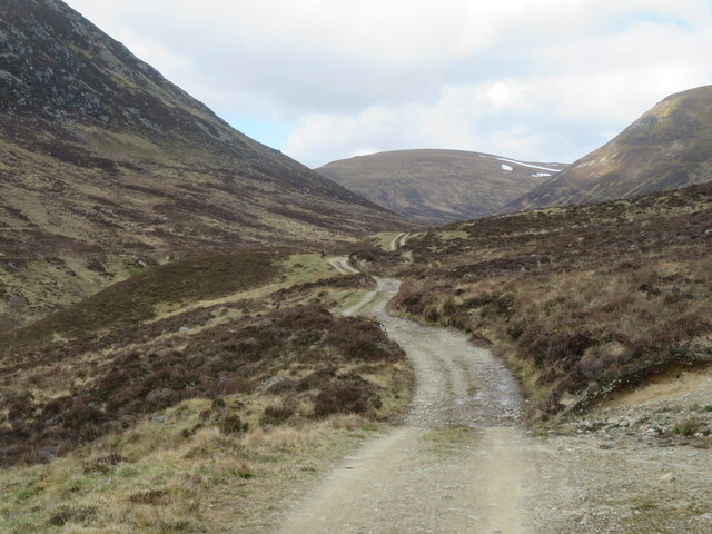
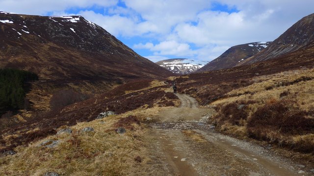
![View from the first steep section of track above Glenbanchor After an easy approach across sheep nibbled pastures, the track into the side valley of the Allt-Fionndrigh ascends a short steep [to those in their 8th decade] hill before levelling out. The view is back into Glen Banchor where a plantation of conifers has suffered damage during winter gales.](https://s2.geograph.org.uk/geophotos/07/17/13/7171350_caa00b5e.jpg)
The requested URL returned error: 429 Too Many Requests
If you have any feedback on the listing, please let us know in the comments section below.
Dail an Tullaich Images
Images are sourced within 2km of 57.0596/-4.1902653 or Grid Reference NN6798. Thanks to Geograph Open Source API. All images are credited.


Dail an Tullaich is located at Grid Ref: NN6798 (Lat: 57.0596, Lng: -4.1902653)
Unitary Authority: Highland
Police Authority: Highlands and Islands
What 3 Words
///cities.braved.workflow. Near Newtonmore, Highland
Nearby Locations
Related Wikis

Creag Dhubh (Newtonmore)
Creag Dhubh (756 m) is a mountain in the Grampian Mountains of Scotland. It is located in the Strathspey area of the central Highlands, above the village...

Battle of Invernahavon
The Battle of Invernahavon was a Scottish clan battle between the Clan Cameron and the confederation of Clan Chattan that consisted of the Clan Mackintosh...

River Truim
The River Truim (Abhainn Truim in Gaelic) is a right bank tributary of the River Spey in the Scottish Highlands. Its headwaters meet to the north of the...
River Calder, Highland
The River Calder (Scottish Gaelic: Caladar) is a left bank tributary of the River Spey in the Scottish Highlands. Its headwaters are the t-Allt Ballach...
Have you been to Dail an Tullaich?
Leave your review of Dail an Tullaich below (or comments, questions and feedback).