Stoodleigh Down

Downs, Moorland in Devon North Devon

England

Stoodleigh Down

Orswell Wood Stream coming down from Orswell Wood.
Orswell Wood Credit: Martyn Davies

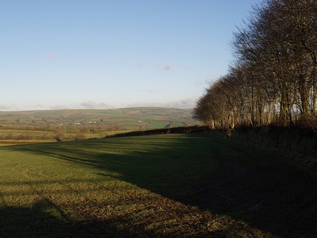
Stoodleigh Down is a picturesque area located in Devon, England. It is renowned for its stunning natural beauty and diverse landscape. Stretching across acres of land, Stoodleigh Down is a combination of downs and moorland, offering visitors a unique and captivating experience.

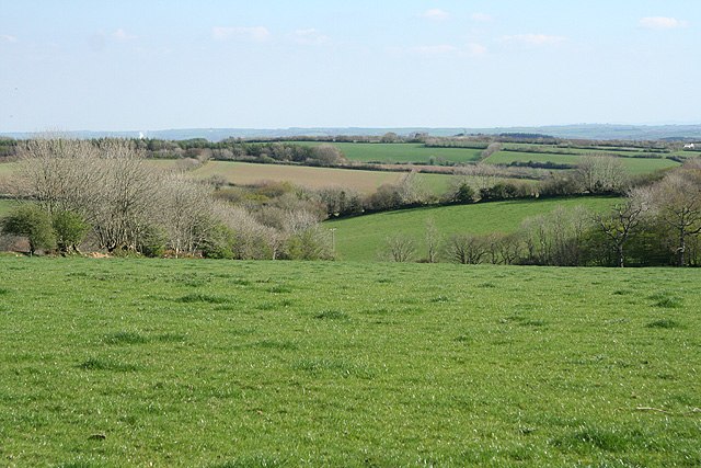
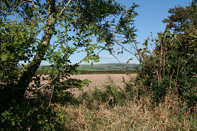
The downs in Stoodleigh Down are characterized by their rolling hills and grassy expanses. They provide breathtaking views of the surrounding countryside, making it a popular spot for hiking enthusiasts and nature lovers. The well-maintained trails offer a variety of routes, allowing visitors to explore the downs at their own pace.

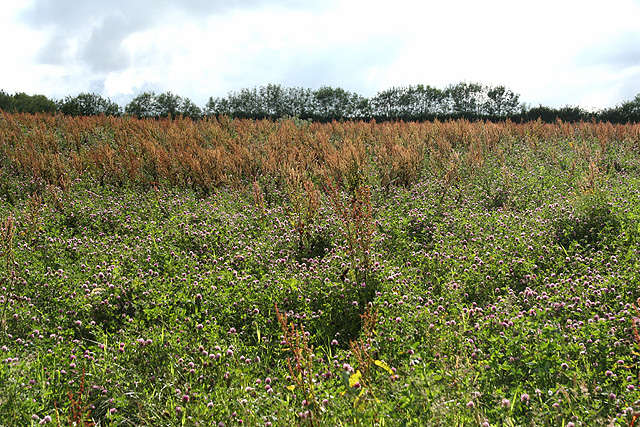
In addition to the downs, Stoodleigh Down is also home to vast moorland areas. The moors are characterized by their open, rugged terrain, covered with heather and gorse. They are a haven for wildlife, with a variety of bird species, deer, and smaller mammals making their home in this untamed landscape.

Stoodleigh Down is not only a place of natural beauty but also steeped in history. The area is dotted with ancient archaeological sites, including burial mounds and standing stones. These remnants of the past add an additional layer of intrigue to the already captivating landscape.

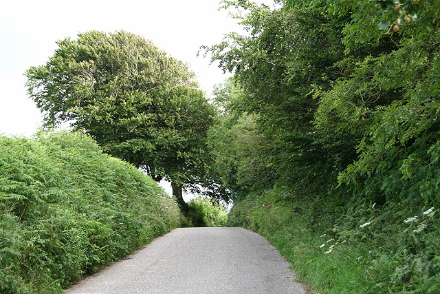
Visitors to Stoodleigh Down can expect a peaceful and tranquil environment, away from the hustle and bustle of city life. It is a place to reconnect with nature, soak in the breathtaking views, and immerse oneself in the rich history of the area. Whether it's a leisurely stroll through the downs or an adventurous hike across the moorland, Stoodleigh Down offers something for everyone.

If you have any feedback on the listing, please let us know in the comments section below.

Stoodleigh Down Images

Images are sourced within 2km of 51.091127/-3.9162623 or Grid Reference SS6534. Thanks to Geograph Open Source API. All images are credited.

Orswell Wood Stream coming down from Orswell Wood.
Orswell Wood
Stream coming down from Orswell Wood.
Swimbridge: near Stone Cross Looking south east. The plume of smoke on the left indicates the site of the chipboard factory near South Molton
Swimbridge: near Stone Cross
Looking south east. The plume of smoke on the left indicates the site of the chipboard factory near South Molton
West Buckland: Whitsford Entrance to the farm, looking south. A barn here at one time had machinery powered by a waterwheel
West Buckland: Whitsford
Entrance to the farm, looking south. A barn here at one time had machinery powered by a waterwheel
West Buckland: South Stoodleigh The entrance gateposts seem slightly elaborate for the location but once served West Buckland School. Looking south-south-east
West Buckland: South Stoodleigh
The entrance gateposts seem slightly elaborate for the location but once served West Buckland School. Looking south-south-east
West Buckland: Stoodleigh Barton Plantation Looking south
West Buckland: Stoodleigh Barton Plantation
Looking south
Stoke Rivers: on Mockham Down Looking south-south-west with Dartmoor on the horizon, left
Stoke Rivers: on Mockham Down
Looking south-south-west with Dartmoor on the horizon, left
West Buckland: near Upcott Farm
West Buckland: towards Catriage Hill Near the summit and the parish boundary with East Buckland
West Buckland: towards Catriage Hill
Near the summit and the parish boundary with East Buckland
Charles: farmland near Thornpark Cross Looking south-south-east
Charles: farmland near Thornpark Cross
Looking south-south-east
Charles: towards Brayford Looking east with Whitefield Down on the horizon, left
Charles: towards Brayford
Looking east with Whitefield Down on the horizon, left
Charles: over a hedge Looking east-north-east on the lane by the entrance to Slade Farm
Charles: over a hedge
Looking east-north-east on the lane by the entrance to Slade Farm
Stoke Rivers: towards Kimbland Farm The farm is partly hidden by trees, left; Thornpark Cottages to the right, with Exmoor on the skyline
Stoke Rivers: towards Kimbland Farm
The farm is partly hidden by trees, left; Thornpark Cottages to the right, with Exmoor on the skyline
Stoke Rivers: above Tossell's Barton Looking south-south-east
Stoke Rivers: above Tossell's Barton
Looking south-south-east
Stoke Rivers: towards Barnacott Barnacott Farm stands by the group of trees, centre, on the skyline
Stoke Rivers: towards Barnacott
Barnacott Farm stands by the group of trees, centre, on the skyline
Stoke Rivers: Orswell Cottages By the entrance to Orswell, looking east
Stoke Rivers: Orswell Cottages
By the entrance to Orswell, looking east
Track to Tossell's Barton The farm road curves away from the lane from Wistford Cross to Kimbland Cross.
Track to Tossell's Barton
The farm road curves away from the lane from Wistford Cross to Kimbland Cross.
Gate, sheep and field A hedged bank runs away from the lane between Wistford Cross to Kimbland Cross.
Gate, sheep and field
A hedged bank runs away from the lane between Wistford Cross to Kimbland Cross.
Trees and shadows near Kimbland Cross Trees along a field boundary cast shadows across the field by the lane from Wistford Cross to Kimbland Cross.
Trees and shadows near Kimbland Cross
Trees along a field boundary cast shadows across the field by the lane from Wistford Cross to Kimbland Cross.
Show me another place!

Stoodleigh Down is located at Grid Ref: SS6534 (Lat: 51.091127, Lng: -3.9162623)

Administrative County: Devon

District: North Devon

Police Authority: Devon and Cornwall

What 3 Words

///release.woes.stability. Near Barnstaple, Devon

Nearby Locations

Stoodleigh Down

Related Wikis

Mockham Down

Mockham Down is the site of an Iron Age hill fort close to Brayfordhill in Devon, England. It takes the form of a multi-ditch and rampart enclosure close...

Benton, Devon

Benton is a village in Devon, England, within the civil parish of Bratton Fleming.

Accott

Accott is an historic estate, now a small settlement, in the parish of Bishop's Tawton in the county of Devon, England == History == The place-name Accott...

Charles, Devon

Charles is a village and former civil parish, now in the parish of Brayford, in the North Devon district of Devon, England. Its nearest town is South Molton...

Have you been to Stoodleigh Down?

Leave your review of Stoodleigh Down below (or comments, questions and feedback).