Gidleigh Common
Downs, Moorland in Devon West Devon
England
Gidleigh Common

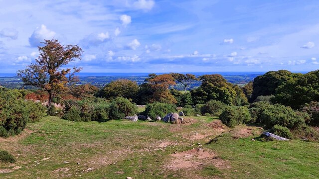
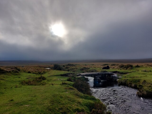
Gidleigh Common is a picturesque area located in the county of Devon, England. Situated within the Dartmoor National Park, it is known for its stunning natural beauty and diverse ecosystem. The common is characterized by its rolling hills, lush green meadows, and expansive moorland, providing visitors with breathtaking views and a sense of tranquility.
Covering an area of approximately 1,500 acres, Gidleigh Common is home to a wide range of flora and fauna, making it a popular spot for nature enthusiasts and wildlife lovers. The heather-covered moorland provides a habitat for various bird species, including the rare cuckoo and the majestic peregrine falcon. Additionally, the common is also home to several species of deer, such as red deer and roe deer.
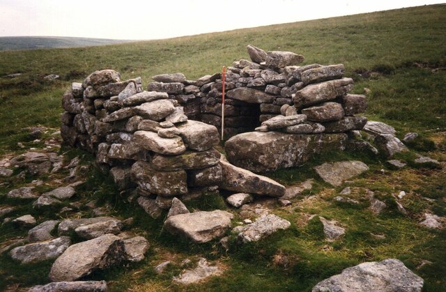
The landscape of Gidleigh Common is dotted with ancient archaeological remains, including stone circles and hut circles, which offer insight into the area's rich history. These remnants give visitors a glimpse into the lives of the early inhabitants of Dartmoor.
The common is crisscrossed by numerous footpaths and trails, allowing visitors to explore and immerse themselves in the natural surroundings. Hiking and walking are popular activities, providing opportunities to discover hidden gems such as babbling brooks, cascading waterfalls, and charming woodland areas.
Gidleigh Common is a haven for those seeking an escape from the hustle and bustle of everyday life. With its stunning landscapes, diverse wildlife, and historical significance, it offers a unique and unforgettable experience for nature lovers and history enthusiasts alike.
If you have any feedback on the listing, please let us know in the comments section below.
Gidleigh Common Images
Images are sourced within 2km of 50.675238/-3.9073091 or Grid Reference SX6587. Thanks to Geograph Open Source API. All images are credited.


Gidleigh Common is located at Grid Ref: SX6587 (Lat: 50.675238, Lng: -3.9073091)
Administrative County: Devon
District: West Devon
Police Authority: Devon and Cornwall
What 3 Words
///blackbird.newsstand.folders. Near Chagford, Devon
Nearby Locations
Related Wikis

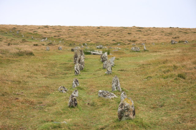
Scorhill
Scorhill (pronounced Scorill) Stone Circle is now the commonly known name for Gidleigh Stone Circle or Steep Hill Stone Circle, one of Devon's biggest...

Gidleigh Castle
Gidleigh Castle was the manor house of the manor of Gidleigh on the north-eastern edge of Dartmoor, about two miles (3.2 km) north-west of the town of...
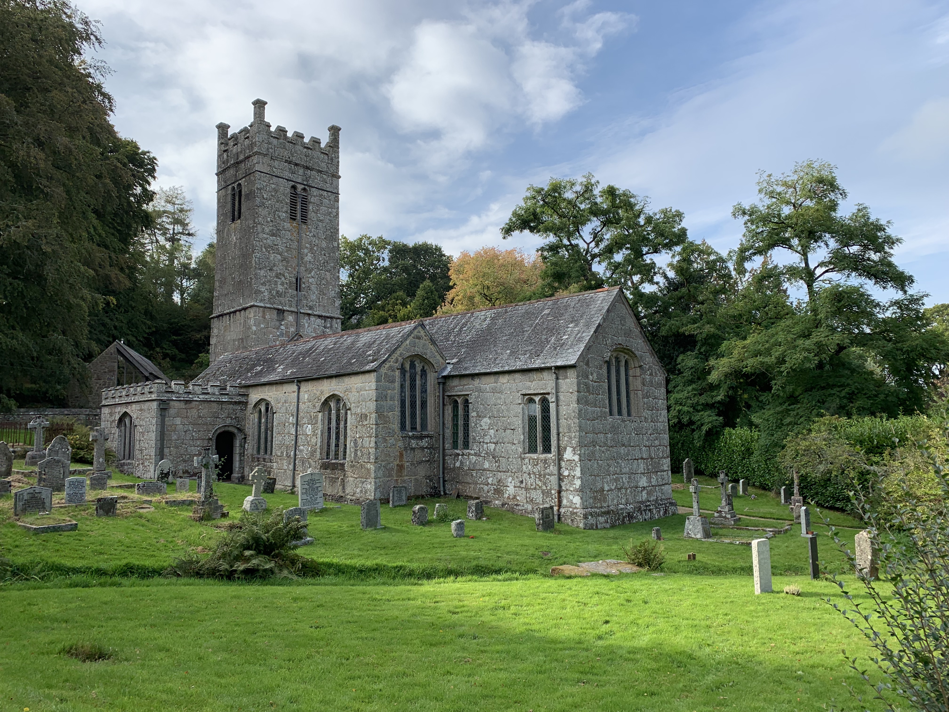
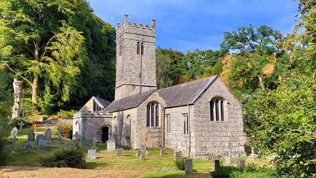
Holy Trinity Church, Gidleigh
Holy Trinity Church, Gidleigh dates from the late 15th-century, and is a Grade I listed parish church in the Church of England Diocese of Exeter in Gidleigh...

Gidleigh
Gidleigh is a village and civil parish in the West Devon district of Devon, England. Located within Dartmoor National Park, the parish is surrounded clockwise...
Shovel Down
Shovel Down is an area of Dartmoor in Devon that is covered in megaliths including the remains of several stone rows, the Fourfold Stone Circle, and several...

Gidleigh Park
Gidleigh Park is a hotel and restaurant located in Gidleigh, near Chagford, Devon, England. Chris Eden joined as Executive Head Chef in September 2019...

Central Devon (UK Parliament constituency)
Central Devon is a constituency represented in the House of Commons of the UK Parliament since 2010 by Mel Stride, a Conservative. == History == The constituency...

Frenchbeer
Frenchbeer is a settlement in Devon, England. It is in Dartmoor national park. Fernworthy reservoir is to the south and so is the South Teign river. Chagford...
Nearby Amenities
Located within 500m of 50.675238,-3.9073091Have you been to Gidleigh Common?
Leave your review of Gidleigh Common below (or comments, questions and feedback).