Brown Heath

Downs, Moorland in Devon South Hams

England

Brown Heath

Old Wayside Cross on Western White Barrow, South Brent parish Petre's Cross, old head and shaft, Starkey No.02 by the moorland track, in parish of South Brent (South Hams District), on the summit cairn, Western White Barrow, on a pile of stones beside an abandoned shelter.

Scheduled Monument.
List Entry Number: 1002661 <span class="nowrap"><a title="https://historicengland.org.uk/listing/the-list/list-entry/1002661" rel="nofollow ugc noopener" href="https://historicengland.org.uk/listing/the-list/list-entry/1002661">Link</a><img style="margin-left:2px;" alt="External link" title="External link - shift click to open in new window" src="https://s1.geograph.org.uk/img/external.png" width="10" height="10"/></span>

Surveyed

Milestone Society National ID: DVSH_SBR03
Old Wayside Cross on Western White Barrow, South Brent parish Credit: Alan Rosevear

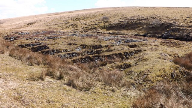
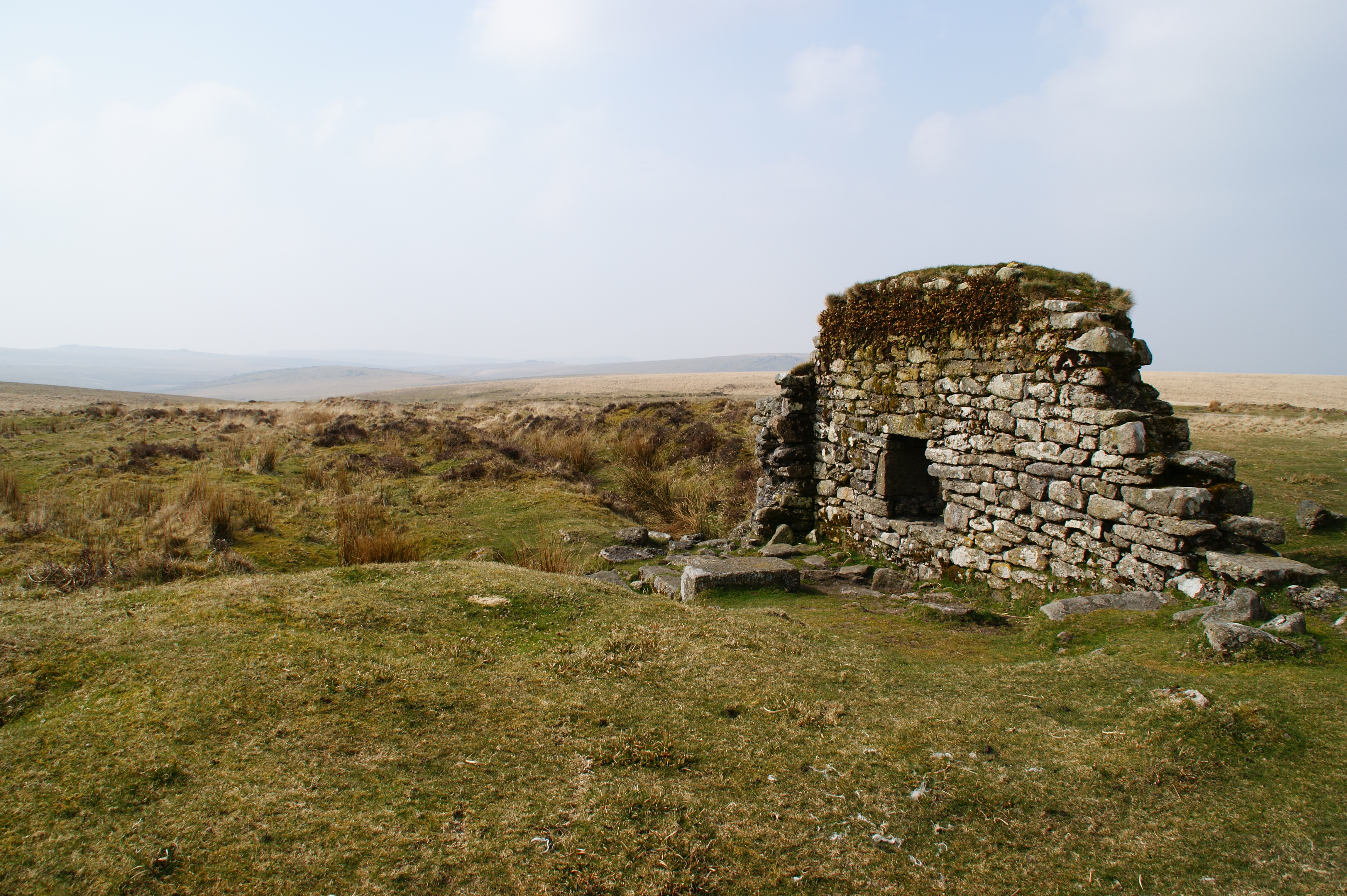
Brown Heath is a picturesque area located in Devon, England, known for its stunning natural beauty and diverse landscape. Situated in the southern part of the county, Brown Heath is characterized by its rolling hills, open meadows, and vast stretches of moorland.

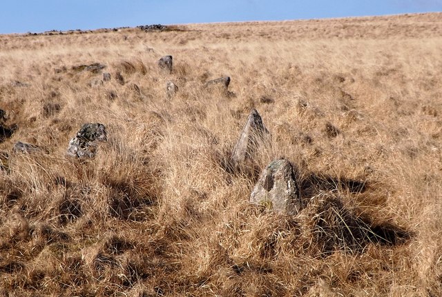
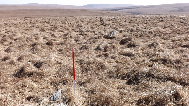
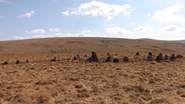
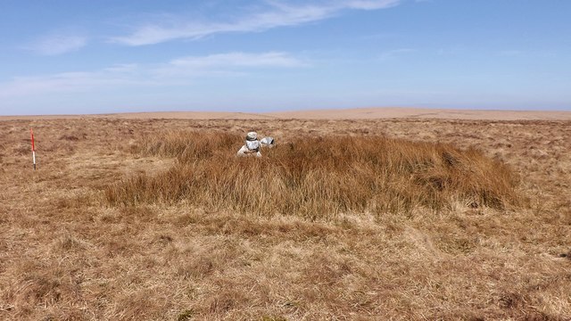
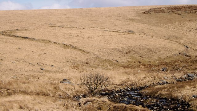
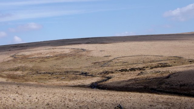
The area is predominantly rural, with scattered farmhouses and cottages dotting the landscape. The countryside is rich in biodiversity, home to an array of wildlife, including rabbits, foxes, and various bird species. The moorland, in particular, is renowned for its heather-covered expanses, creating a vibrant purple hue during the blooming season.

The climate in Brown Heath is typically mild, with warm summers and cool winters. The area often experiences a fair amount of rainfall, contributing to the lush greenery that blankets the countryside. The local community is small but close-knit, with a strong emphasis on preserving the natural environment and promoting sustainable practices.

Visitors to Brown Heath can enjoy a range of outdoor activities, such as hiking, cycling, and birdwatching. The area is crisscrossed with numerous footpaths and trails, offering breathtaking views of the surrounding countryside. Additionally, there are several nature reserves and protected areas within close proximity, providing opportunities to explore and learn about the local flora and fauna.

Overall, Brown Heath in Devon is a tranquil and idyllic destination, perfect for those seeking a peaceful retreat amidst the beauty of nature.

If you have any feedback on the listing, please let us know in the comments section below.

Brown Heath Images

Images are sourced within 2km of 50.477476/-3.9163478 or Grid Reference SX6465. Thanks to Geograph Open Source API. All images are credited.

Old Wayside Cross on Western White Barrow, South Brent parish Petre's Cross, old head and shaft, Starkey No.02 by the moorland track, in parish of South Brent (South Hams District), on the summit cairn, Western White Barrow, on a pile of stones beside an abandoned shelter.

Scheduled Monument.
List Entry Number: 1002661 <span class="nowrap"><a title="https://historicengland.org.uk/listing/the-list/list-entry/1002661" rel="nofollow ugc noopener" href="https://historicengland.org.uk/listing/the-list/list-entry/1002661">Link</a><img style="margin-left:2px;" alt="External link" title="External link - shift click to open in new window" src="https://s1.geograph.org.uk/img/external.png" width="10" height="10"/></span>

Surveyed

Milestone Society National ID: DVSH_SBR03
Old Wayside Cross on Western White Barrow, South Brent parish
Petre's Cross, old head and shaft, Starkey No.02 by the moorland track, in parish of South Brent (South Hams District), on the summit cairn, Western White Barrow, on a pile of stones beside an abandoned shelter. Scheduled Monument. List Entry Number: 1002661 LinkExternal link Surveyed Milestone Society National ID: DVSH_SBR03
Old Waymarker Stone near Western White Barrow, South Brent parish Western White Barrow marker stone, standing stone by the moorland path, in parish of South Brent (South Hams District), just below the summit cairn, Western White Barrow, on open moor.

Surveyed

Milestone Society National ID: DVSH_SBR04
Old Waymarker Stone near Western White Barrow, South Brent parish
Western White Barrow marker stone, standing stone by the moorland path, in parish of South Brent (South Hams District), just below the summit cairn, Western White Barrow, on open moor. Surveyed Milestone Society National ID: DVSH_SBR04
Hook Lake prehistoric stone row A single prehistoric stone row measuring 227m long, including at least 92 mainly medium-sized stones and a few small stones. The row is orientated north to south and leads downslope (south) from a cairn. The southern length of the row is partly incorporated into a prehistoric enclosure wall and at one-point a round house has been built up against one of the row stones. <span class="nowrap"><a title="https://stonerows.wordpress.com/gazetteer/region/dartmoor/hook-lake/" rel="nofollow ugc noopener" href="https://stonerows.wordpress.com/gazetteer/region/dartmoor/hook-lake/">Link</a><img style="margin-left:2px;" alt="External link" title="External link - shift click to open in new window" src="https://s1.geograph.org.uk/img/external.png" width="10" height="10"/></span>
Hook Lake prehistoric stone row
A single prehistoric stone row measuring 227m long, including at least 92 mainly medium-sized stones and a few small stones. The row is orientated north to south and leads downslope (south) from a cairn. The southern length of the row is partly incorporated into a prehistoric enclosure wall and at one-point a round house has been built up against one of the row stones. LinkExternal link
Upper Erme prehistoric stone row The longest prehistoric stone row in the world is of the single type and measures 3,386m long, including around 922 mainly medium and small-sized stones together with some large orthostats. The row, which is sinuous in character is orientated north to south.  There are cairns at the both ends, the one at the south is kerbed and the upper one at the north is surprisingly small and nondescript. <span class="nowrap"><a title="https://stonerows.wordpress.com/gazetteer/region/dartmoor/upper-erme/" rel="nofollow ugc noopener" href="https://stonerows.wordpress.com/gazetteer/region/dartmoor/upper-erme/">Link</a><img style="margin-left:2px;" alt="External link" title="External link - shift click to open in new window" src="https://s1.geograph.org.uk/img/external.png" width="10" height="10"/></span>
Upper Erme prehistoric stone row
The longest prehistoric stone row in the world is of the single type and measures 3,386m long, including around 922 mainly medium and small-sized stones together with some large orthostats. The row, which is sinuous in character is orientated north to south. There are cairns at the both ends, the one at the south is kerbed and the upper one at the north is surprisingly small and nondescript. LinkExternal link
Upper Erme prehistoric stone row The longest prehistoric stone row in the world is of the single type and  measures 3,386m long, including around 922 mainly medium and small-sized stones together with some large orthostats. Sinuous alignment ascending the hill at Dry Lake Ford. <span class="nowrap"><a title="https://stonerows.wordpress.com/gazetteer/region/dartmoor/upper-erme/" rel="nofollow ugc noopener" href="https://stonerows.wordpress.com/gazetteer/region/dartmoor/upper-erme/">Link</a><img style="margin-left:2px;" alt="External link" title="External link - shift click to open in new window" src="https://s1.geograph.org.uk/img/external.png" width="10" height="10"/></span>
Upper Erme prehistoric stone row
The longest prehistoric stone row in the world is of the single type and measures 3,386m long, including around 922 mainly medium and small-sized stones together with some large orthostats. Sinuous alignment ascending the hill at Dry Lake Ford. LinkExternal link
Upper Erme prehistoric stone row The longest prehistoric stone row in the world is of the single type and  measures 3,386m long, including around 922 mainly medium and small-sized stones together with some large orthostats. The stone row passes Erme Pound which is a prehistoric enclosed settlement which was re-used in the historic period. <span class="nowrap"><a title="https://stonerows.wordpress.com/gazetteer/region/dartmoor/upper-erme/" rel="nofollow ugc noopener" href="https://stonerows.wordpress.com/gazetteer/region/dartmoor/upper-erme/">Link</a><img style="margin-left:2px;" alt="External link" title="External link - shift click to open in new window" src="https://s1.geograph.org.uk/img/external.png" width="10" height="10"/></span>
Upper Erme prehistoric stone row
The longest prehistoric stone row in the world is of the single type and measures 3,386m long, including around 922 mainly medium and small-sized stones together with some large orthostats. The stone row passes Erme Pound which is a prehistoric enclosed settlement which was re-used in the historic period. LinkExternal link
Upper Erme prehistoric stone row The longest prehistoric stone row in the world is of the single type and measures 3,386m long, including around 922 mainly medium and small-sized stones together with some large orthostats. Row passing a large cairn. <span class="nowrap"><a title="https://stonerows.wordpress.com/gazetteer/region/dartmoor/upper-erme/" rel="nofollow ugc noopener" href="https://stonerows.wordpress.com/gazetteer/region/dartmoor/upper-erme/">Link</a><img style="margin-left:2px;" alt="External link" title="External link - shift click to open in new window" src="https://s1.geograph.org.uk/img/external.png" width="10" height="10"/></span>
Upper Erme prehistoric stone row
The longest prehistoric stone row in the world is of the single type and measures 3,386m long, including around 922 mainly medium and small-sized stones together with some large orthostats. Row passing a large cairn. LinkExternal link
Upper Erme prehistoric stone row The longest prehistoric stone row in the world is of the single type and measures 3,386m long, including around 922 mainly medium and small-sized stones together with some large orthostats. Stone row leading from the kerbed cairn (Scale 1m). <span class="nowrap"><a title="https://stonerows.wordpress.com/gazetteer/region/dartmoor/upper-erme/" rel="nofollow ugc noopener" href="https://stonerows.wordpress.com/gazetteer/region/dartmoor/upper-erme/">Link</a><img style="margin-left:2px;" alt="External link" title="External link - shift click to open in new window" src="https://s1.geograph.org.uk/img/external.png" width="10" height="10"/></span>
Upper Erme prehistoric stone row
The longest prehistoric stone row in the world is of the single type and measures 3,386m long, including around 922 mainly medium and small-sized stones together with some large orthostats. Stone row leading from the kerbed cairn (Scale 1m). LinkExternal link
Upper Erme prehistoric stone row and kerbed cairn The longest prehistoric stone row in the world is of the single type and measures 3,386m long, including around 922 mainly medium and small-sized stones together with some large orthostats. The stone row leads from a well preserved kerbed cairn.
<span class="nowrap"><a title="https://stonerows.wordpress.com/gazetteer/region/dartmoor/upper-erme/" rel="nofollow ugc noopener" href="https://stonerows.wordpress.com/gazetteer/region/dartmoor/upper-erme/">Link</a><img style="margin-left:2px;" alt="External link" title="External link - shift click to open in new window" src="https://s1.geograph.org.uk/img/external.png" width="10" height="10"/></span>
Upper Erme prehistoric stone row and kerbed cairn
The longest prehistoric stone row in the world is of the single type and measures 3,386m long, including around 922 mainly medium and small-sized stones together with some large orthostats. The stone row leads from a well preserved kerbed cairn. LinkExternal link
Cairn at the upper end of the Upper Erme stone row The cairn at the upper end of the longest stone row in the world is remarkably unimpressive (Scale 1m). <span class="nowrap"><a title="https://stonerows.wordpress.com/gazetteer/region/dartmoor/upper-erme/" rel="nofollow ugc noopener" href="https://stonerows.wordpress.com/gazetteer/region/dartmoor/upper-erme/">Link</a><img style="margin-left:2px;" alt="External link" title="External link - shift click to open in new window" src="https://s1.geograph.org.uk/img/external.png" width="10" height="10"/></span>
Cairn at the upper end of the Upper Erme stone row
The cairn at the upper end of the longest stone row in the world is remarkably unimpressive (Scale 1m). LinkExternal link
Blatchford Bottom 1 prehistoric settlement Prehistoric settlement including at least eight houses and several fields.
Blatchford Bottom 1 prehistoric settlement
Prehistoric settlement including at least eight houses and several fields.
Pair of prehistoric enclosed settlements at Hook Lake Two Bronze Age enclosures, several houses, cairns and a stone row at Hook Lake. <span class="nowrap"><a title="https://www.megalithic.co.uk/article.php?sid=14936" rel="nofollow ugc noopener" href="https://www.megalithic.co.uk/article.php?sid=14936">Link</a><img style="margin-left:2px;" alt="External link" title="External link - shift click to open in new window" src="https://s1.geograph.org.uk/img/external.png" width="10" height="10"/></span>
Pair of prehistoric enclosed settlements at Hook Lake
Two Bronze Age enclosures, several houses, cairns and a stone row at Hook Lake. LinkExternal link
Alluvial tin streamwork in the Erme Valley A series of waste dumps revetted by drystone walling known as stiling. The dumps were produced during systematic working of the tin deposits. <span class="nowrap"><a title="https://earlytin.wordpress.com/thesis-1986/chapter-five-fieldwork-interpretation/extraction-alluvial-streamworks/" rel="nofollow ugc noopener" href="https://earlytin.wordpress.com/thesis-1986/chapter-five-fieldwork-interpretation/extraction-alluvial-streamworks/">Link</a><img style="margin-left:2px;" alt="External link" title="External link - shift click to open in new window" src="https://s1.geograph.org.uk/img/external.png" width="10" height="10"/></span>
Alluvial tin streamwork in the Erme Valley
A series of waste dumps revetted by drystone walling known as stiling. The dumps were produced during systematic working of the tin deposits. LinkExternal link
Hook Lake tin mill Building which housed stamping machinery used to crush tin ore. <span class="nowrap"><a title="https://earlytin.wordpress.com/thesis-1986/chapter-three-mining-technology/processing-stamping/" rel="nofollow ugc noopener" href="https://earlytin.wordpress.com/thesis-1986/chapter-three-mining-technology/processing-stamping/">Link</a><img style="margin-left:2px;" alt="External link" title="External link - shift click to open in new window" src="https://s1.geograph.org.uk/img/external.png" width="10" height="10"/></span>
Hook Lake tin mill
Building which housed stamping machinery used to crush tin ore. LinkExternal link
Moorland above Avon valley With a distant glimpse of the Avon Dam reservoir.
Moorland above Avon valley
With a distant glimpse of the Avon Dam reservoir.
Clapper bridge over the Avon Another view of the clapper bridge shown at <a title="https://www.geograph.org.uk/search.php?i=126658397" href="https://www.geograph.org.uk/search.php?i=126658397">Link</a> . <span class="nowrap"><a title="https://web.archive.org/web/20170225131017/http://www.heritagegateway.org.uk/Gateway/Results_Single.aspx?uid=441447&resourceID=2" rel="nofollow ugc noopener" href="https://web.archive.org/web/20170225131017/http://www.heritagegateway.org.uk/Gateway/Results_Single.aspx?uid=441447&resourceID=2">Archive Link</a><img style="margin-left:2px;" alt="External link" title="External link - shift click to open in new window" src="https://s1.geograph.org.uk/img/external.png" width="10" height="10"/></span>
Clapper bridge over the Avon
Another view of the clapper bridge shown at Link . Archive LinkExternal link
Clapper bridge over the Avon Another view of the bridge <a title="https://www.geograph.org.uk/search.php?i=126658397" href="https://www.geograph.org.uk/search.php?i=126658397">Link</a> that carries the Two Moors Way across the river, this time from the west side. <span class="nowrap"><a title="https://web.archive.org/web/20170225131017/http://www.heritagegateway.org.uk/Gateway/Results_Single.aspx?uid=441447&resourceID=2" rel="nofollow ugc noopener" href="https://web.archive.org/web/20170225131017/http://www.heritagegateway.org.uk/Gateway/Results_Single.aspx?uid=441447&resourceID=2">Archive Link</a><img style="margin-left:2px;" alt="External link" title="External link - shift click to open in new window" src="https://s1.geograph.org.uk/img/external.png" width="10" height="10"/></span>
Clapper bridge over the Avon
Another view of the bridge Link that carries the Two Moors Way across the river, this time from the west side. Archive LinkExternal link
Clapper bridge over the Avon A view of the bridge shown at <a title="https://www.geograph.org.uk/search.php?i=126658397" href="https://www.geograph.org.uk/search.php?i=126658397">Link</a> from upstream. <span class="nowrap"><a title="https://web.archive.org/web/20170225131017/http://www.heritagegateway.org.uk/Gateway/Results_Single.aspx?uid=441447&resourceID=2" rel="nofollow ugc noopener" href="https://web.archive.org/web/20170225131017/http://www.heritagegateway.org.uk/Gateway/Results_Single.aspx?uid=441447&resourceID=2">Archive Link</a><img style="margin-left:2px;" alt="External link" title="External link - shift click to open in new window" src="https://s1.geograph.org.uk/img/external.png" width="10" height="10"/></span>
Clapper bridge over the Avon
A view of the bridge shown at Link from upstream. Archive LinkExternal link
Show me another place!

Brown Heath is located at Grid Ref: SX6465 (Lat: 50.477476, Lng: -3.9163478)

Administrative County: Devon

District: South Hams

Police Authority: Devon and Cornwall

What 3 Words

///flattens.amount.houseboat. Near South Brent, Devon

Nearby Locations

Brown Heath Stony Bottom

Related Wikis

Duck's Pool, Dartmoor

Duck's Pool is a small depression set in a remote location in the southern half of Dartmoor, Devon, England at grid reference SX624678. It lies between...

Ryder's Hill

At 515 m, Ryder's Hill is the highest point on the southern part of Dartmoor, Devon, England. On its summit there are two standing stones and a low cairn...

Eylesbarrow mine

Eylesbarrow mine was a tin mine on Dartmoor, Devon, England that was active during the first half of the 19th century. In its early years it was one of...

Stalldown Barrow

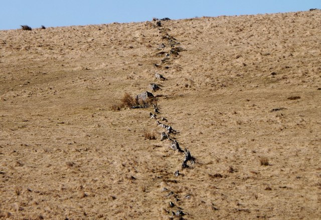
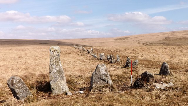
Stalldown Barrow, sometimes called Staldon, is a megalithic site in Devon, about 5 km from Harford. It consists of a long stone row. It is fairly close...

Nearby Amenities

Located within 500m of 50.477476,-3.9163478
Brown Heath
Place: locality
Source: NPE
Lat/Long: 50.478239/-3.9143248
The data included in this document is from www.openstreetmap.org. The data is made available under ODbL.

Have you been to Brown Heath?

Leave your review of Brown Heath below (or comments, questions and feedback).