Falcadon Moor
Downs, Moorland in Devon West Devon
England
Falcadon Moor

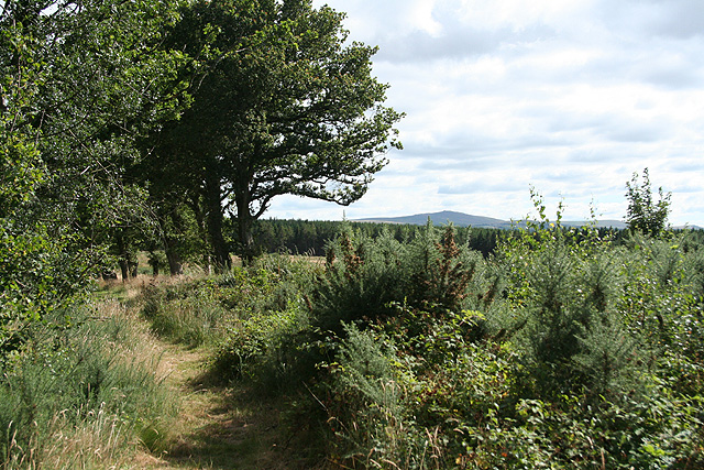
Falcadon Moor, located in Devon, England, is a captivating area encompassing both downs and moorland landscapes. Situated amidst the picturesque surroundings, this moorland spans over a vast expanse of approximately 500 acres. The moor is renowned for its stunning natural beauty, attracting tourists, nature enthusiasts, and hikers alike.
The terrain of Falcadon Moor is characterized by undulating hills, rocky outcrops, and areas of heather and gorse. The moorland is predominantly covered in grasses, providing a home to a plethora of wildlife species. Visitors can often spot rabbits, foxes, and a range of bird species, including kestrels and skylarks, thriving in their natural habitat.
The moorland is also home to a rich variety of plant life, with notable species such as bell heather, ling, and bristle bent grass adorning the landscape. These vibrant colors, combined with the panoramic views of the surrounding countryside, make Falcadon Moor a truly enchanting place to explore.
Visitors to the moor can enjoy several walking trails that crisscross the area, offering opportunities to immerse oneself in the tranquility of nature. The trails vary in difficulty, catering to both seasoned hikers and leisurely strollers. The expansive moorland provides ample space for picnics, family outings, and even birdwatching.
Falcadon Moor is a cherished natural gem in Devon, offering a serene escape from the hustle and bustle of everyday life. With its diverse range of flora and fauna, stunning vistas, and peaceful atmosphere, it is no wonder that this moorland is a favorite destination for locals and tourists seeking solace in nature.
If you have any feedback on the listing, please let us know in the comments section below.
Falcadon Moor Images
Images are sourced within 2km of 50.775537/-3.9323231 or Grid Reference SX6399. Thanks to Geograph Open Source API. All images are credited.


Falcadon Moor is located at Grid Ref: SX6399 (Lat: 50.775537, Lng: -3.9323231)
Administrative County: Devon
District: West Devon
Police Authority: Devon and Cornwall
What 3 Words
///prep.dorms.windy. Near North Tawton, Devon
Nearby Locations
Related Wikis
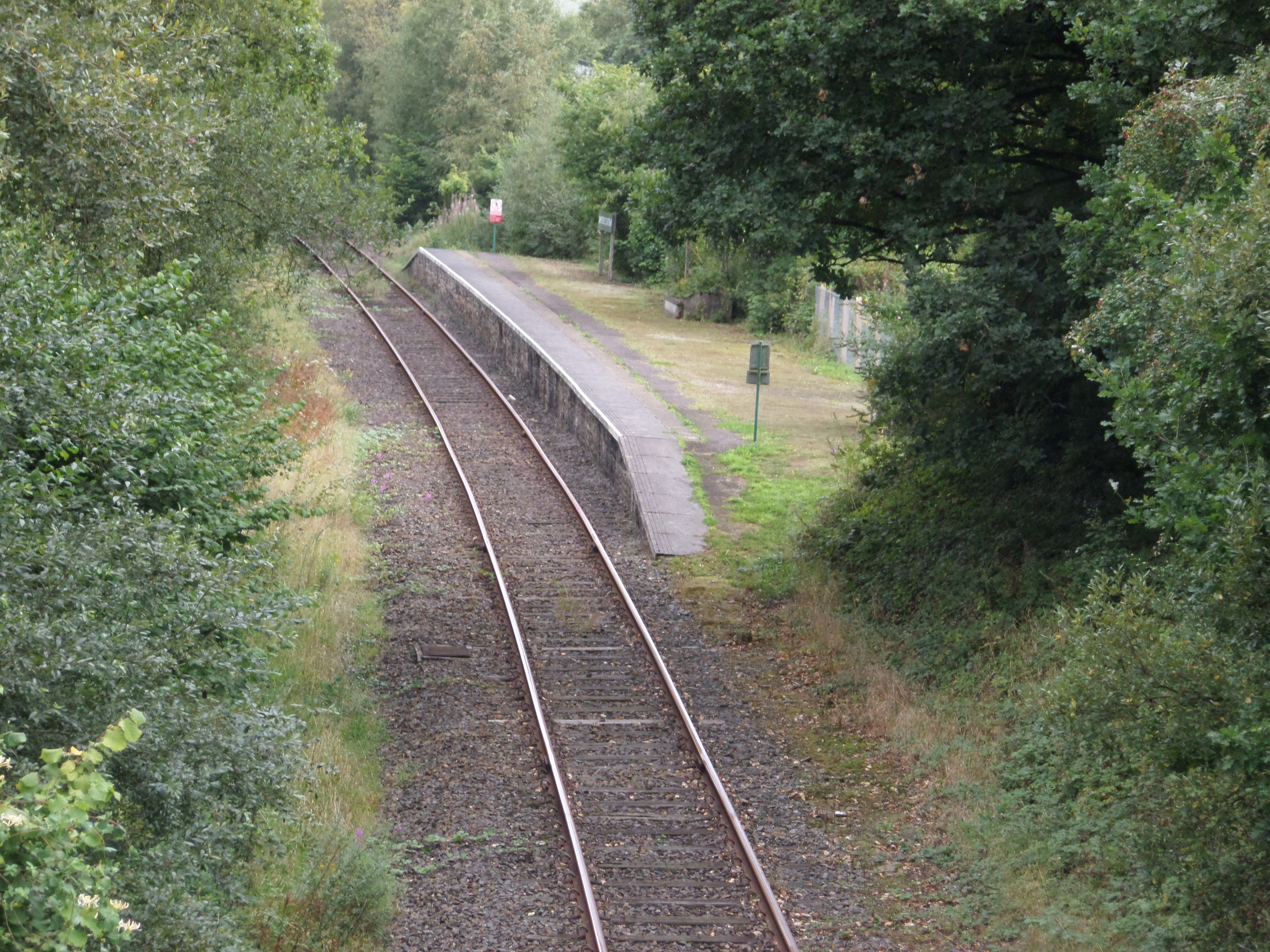
Sampford Courtenay railway station
Sampford Courtenay railway station is a disused railway station at Belstone Corner, which used to serve the nearby (1.6 miles) village of Sampford Courtenay...

Battle of Sampford Courtenay
The Battle of Sampford Courtenay was one of the chief military engagements in the Western Rebellion of 1549. == Preparations == By mid August 1549, Humphrey...

Sampford Courtenay
Sampford Courtenay is a village and civil parish in West Devon in England, most famous for being the place where the Western Rebellion, otherwise known...

Belstone Corner
Belstone Corner is a hamlet in West Devon in the English county of Devon, part of the civil parish of Sampford Courtenay. The Sampford Courtenay railway...
Nearby Amenities
Located within 500m of 50.775537,-3.9323231Have you been to Falcadon Moor?
Leave your review of Falcadon Moor below (or comments, questions and feedback).