Penmon Park

Downs, Moorland in Anglesey

Wales

Penmon Park

Eglwys Sant Cawrdaf  St Cawrdaf Church
Eglwys Sant Cawrdaf St Cawrdaf Church Credit: Ceri Thomas

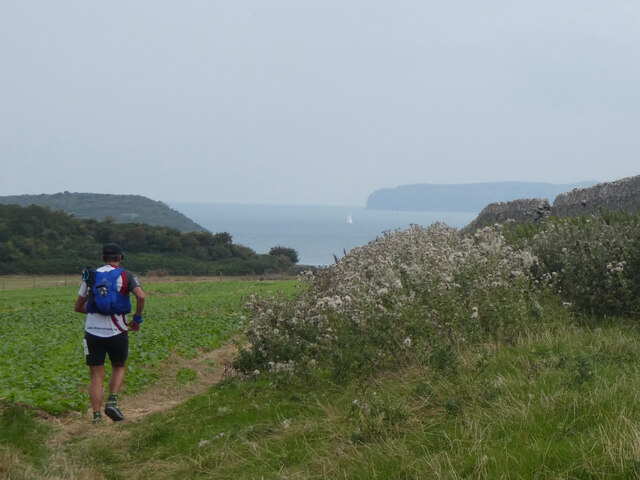
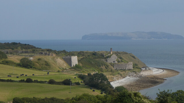
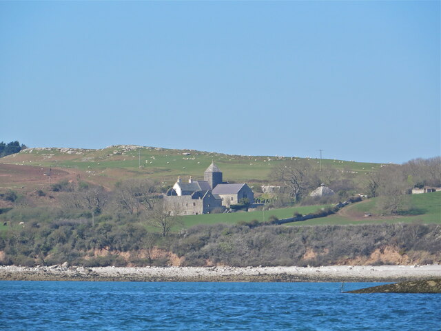
Penmon Park is a picturesque natural reserve located in the northeastern part of Anglesey, Wales. Spanning over 25 hectares, it offers a diverse landscape of downs and moorland, making it a popular destination for nature enthusiasts and outdoor adventurers.

The park is characterized by its rolling hills and open grasslands, providing a tranquil setting for visitors to explore and enjoy. The downs, with their gentle slopes and panoramic views, are ideal for leisurely walks and picnics. They also offer a habitat for a variety of plant species, including heather, gorse, and wildflowers, creating a vibrant and colorful display during the summer months.

The moorland areas of Penmon Park provide a contrasting landscape, with their rugged terrain and rocky outcrops. These sections are home to a range of wildlife, such as rabbits, foxes, and various bird species, making it a haven for birdwatchers and wildlife enthusiasts. The park's location near the coast also attracts seabirds, including gulls and cormorants.

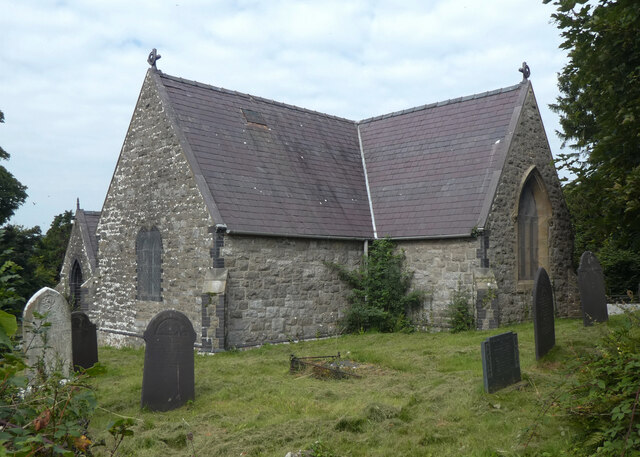
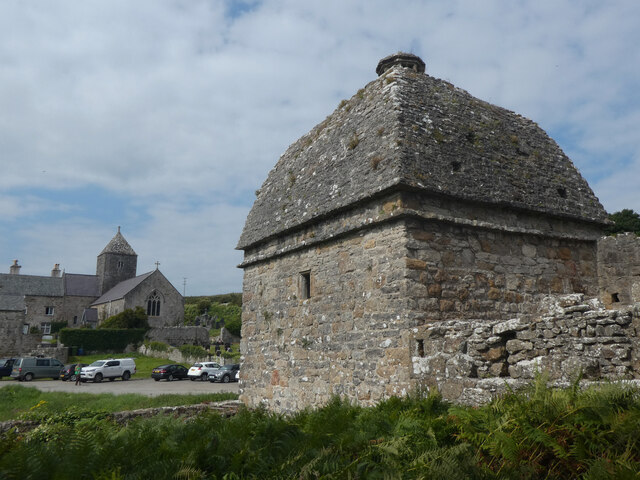
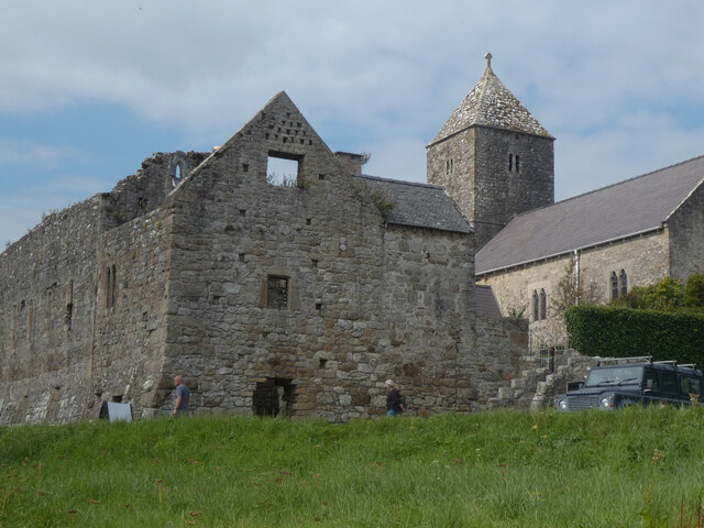
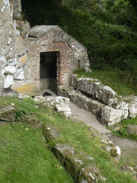
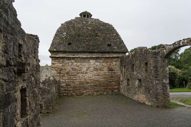
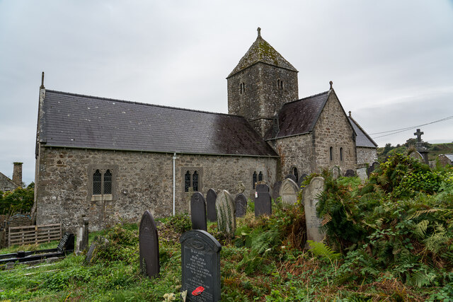
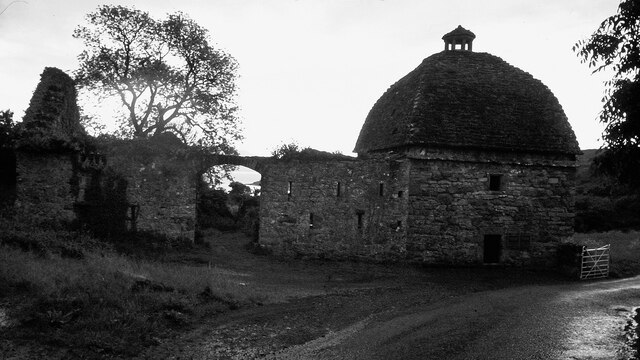
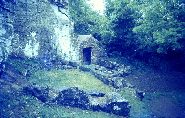
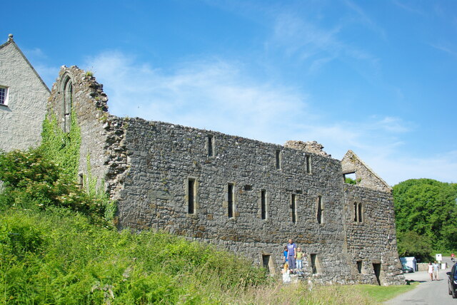
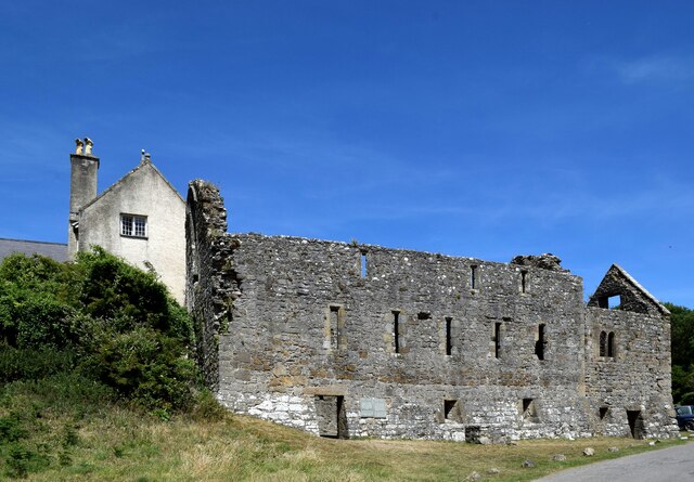
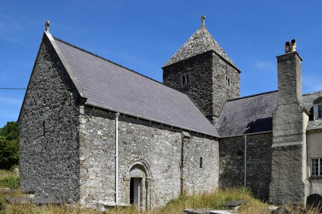
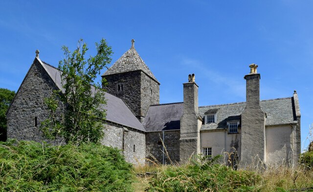
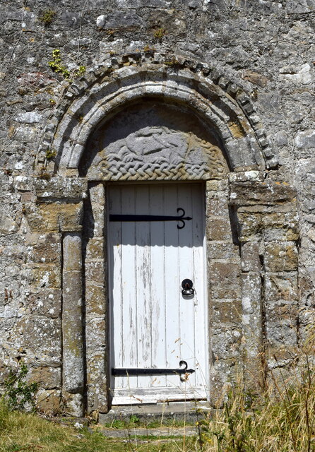
Penmon Park offers several walking trails and paths, allowing visitors to explore its natural beauty at their own pace. The park is also home to Penmon Priory, a historic religious site dating back to the 6th century, which adds cultural and historical significance to the area.

Overall, Penmon Park provides a serene and picturesque escape, offering a combination of downs and moorland that appeals to nature lovers, hikers, and those seeking a peaceful retreat in the heart of Anglesey.

If you have any feedback on the listing, please let us know in the comments section below.

Penmon Park Images

Images are sourced within 2km of 53.29875/-4.0605331 or Grid Reference SH6279. Thanks to Geograph Open Source API. All images are credited.

Eglwys Sant Cawrdaf  St Cawrdaf Church
Eglwys Sant Cawrdaf St Cawrdaf Church
Arwydd draenogiad / Hedgehog sign
Pentref Penmon / Penmon village
Colomendy Penmon ac Eglwys Sant Seiriol / Penmon Dovecote and St Seiriol's Church
Osgoi'r ysgall / Dodging the thistles
Priordy Penmon ac Eglwys Sant Seiriol / Penmon Priory and St Seiriol's Church
Ffynnon Sant Seiriol / St Seiriol's Well
Chwarel Flagstaff / Flagstaff Quarry
Priordy Penmon o'r môr Penmon Priory from the sea.
Priordy Penmon o'r môr
Penmon Priory from the sea.
Penmon Dovecote, Anglesey Built in the 1600's for the priory also on the site. There are over 900 nesting holes inside, Must have been messy :)
Penmon Dovecote, Anglesey
Built in the 1600's for the priory also on the site. There are over 900 nesting holes inside, Must have been messy :)
St Seiriol's church, Penmon Priory
Penmon Dovecote in 1980
St Seiriol's Well <span class="nowrap"><a title="https://www.megalithic.co.uk/article.php?sid=8077" rel="nofollow ugc noopener" href="https://www.megalithic.co.uk/article.php?sid=8077">Link</a><img style="margin-left:2px;" alt="External link" title="External link - shift click to open in new window" src="https://s1.geograph.org.uk/img/external.png" width="10" height="10"/></span>
St Seiriol's Well
Penmon Priory Refectory & Warming House Remains
Penmon Priory
Refectory & Warming House Remains
Ruins of the refectory, Penmon Priory Probably dating from the 13th Century, the building once housed the monks' dormitory above the refectory.   Grade-I listed by Cadw (26764 <span class="nowrap"><a title="https://cadwpublic-api.azurewebsites.net/reports/listedbuilding/FullReport?lang=&id=26764" rel="nofollow ugc noopener" href="https://cadwpublic-api.azurewebsites.net/reports/listedbuilding/FullReport?lang=&id=26764">Link</a><img style="margin-left:2px;" alt="External link" title="External link - shift click to open in new window" src="https://s1.geograph.org.uk/img/external.png" width="10" height="10"/></span> ).
Ruins of the refectory, Penmon Priory
Probably dating from the 13th Century, the building once housed the monks' dormitory above the refectory. Grade-I listed by Cadw (26764 LinkExternal link ).
St Seiriol's Church (Penmon Priory) A church was probably established on the site in the 6th Century.  The nave and tower pictured date from the mid-12th Century and are grade-I listed by Cadw (5525 <span class="nowrap"><a title="https://cadwpublic-api.azurewebsites.net/reports/listedbuilding/FullReport?lang=&id=5525" rel="nofollow ugc noopener" href="https://cadwpublic-api.azurewebsites.net/reports/listedbuilding/FullReport?lang=&id=5525">Link</a><img style="margin-left:2px;" alt="External link" title="External link - shift click to open in new window" src="https://s1.geograph.org.uk/img/external.png" width="10" height="10"/></span> ).  Note the tympanum above the south doorway.
St Seiriol's Church (Penmon Priory)
A church was probably established on the site in the 6th Century. The nave and tower pictured date from the mid-12th Century and are grade-I listed by Cadw (5525 LinkExternal link ). Note the tympanum above the south doorway.
St Seiriol's Church and Priory House, Penmon Priory House (listed at grade-II* by Cadw 5454 <span class="nowrap"><a title="https://cadwpublic-api.azurewebsites.net/reports/listedbuilding/FullReport?lang=&id=5454" rel="nofollow ugc noopener" href="https://cadwpublic-api.azurewebsites.net/reports/listedbuilding/FullReport?lang=&id=5454">Link</a><img style="margin-left:2px;" alt="External link" title="External link - shift click to open in new window" src="https://s1.geograph.org.uk/img/external.png" width="10" height="10"/></span> ), with its gigantic buttress chimneys, is built onto the south transept of the church.
St Seiriol's Church and Priory House, Penmon
Priory House (listed at grade-II* by Cadw 5454 LinkExternal link ), with its gigantic buttress chimneys, is built onto the south transept of the church.
South door of the nave, St Seiriol's Church, Penmon Note the crouching dragon in the tympanum.
South door of the nave, St Seiriol's Church, Penmon
Note the crouching dragon in the tympanum.
Show me another place!

Penmon Park is located at Grid Ref: SH6279 (Lat: 53.29875, Lng: -4.0605331)

Unitary Authority: Isle of Anglesey

Police Authority: North Wales

What 3 Words

///amending.slowly.heartache. Near Llangoed, Isle of Anglesey

Related Wikis

Penmon

Penmon is a promontory, village and ecclesiastical parish on the eastern tip of the Isle of Anglesey in Wales, about 3 miles (4.8 km) east of the town...

Caim, Anglesey

Caim is a hamlet in the community of Llangoed, Anglesey, Wales, which is 144.3 miles (232.2 km) from Cardiff and 225.8 miles (363.4 km) from London. Cafnan...

Cornelyn

Cornelyn is an area in the community of Llangoed, Anglesey, Wales, which is 131.2 miles (211.2 km) from Cardiff and 207.4 miles (333.8 km) from London...

Castell Aberlleiniog

Castell Aberlleiniog (Castle of the Mouth of the Lleiniog) is a motte and bailey fortress near the Welsh village of Llangoed on the Isle of Anglesey, built...

Nearby Amenities

Located within 500m of 53.29875,-4.0605331
Parking
Lat/Long: 53.2974906/-4.0575421
Bench
Backrest: yes
Lat/Long: 53.2947773/-4.0624127
Information: trail_marker
Tourism: information
Lat/Long: 53.2949783/-4.0612354
Information: guidepost
Tourism: information
Lat/Long: 53.2948959/-4.0635332
Note: solar panels
Survey Date: 2022-06-15
Lat/Long: 53.2954742/-4.0640523
Ford: yes
Lat/Long: 53.2969337/-4.0601147
The data included in this document is from www.openstreetmap.org. The data is made available under ODbL.

Have you been to Penmon Park?

Leave your review of Penmon Park below (or comments, questions and feedback).