Broad Down

Downs, Moorland in Devon West Devon

England

Broad Down

Beehive hut in Great Stannon Newtake Scale 1m <span class="nowrap"><a title="https://historicengland.org.uk/listing/the-list/list-entry/1019266?section=official-list-entry" rel="nofollow ugc noopener" href="https://historicengland.org.uk/listing/the-list/list-entry/1019266?section=official-list-entry">Link</a><img style="margin-left:2px;" alt="External link" title="External link - shift click to open in new window" src="https://s1.geograph.org.uk/img/external.png" width="10" height="10"/></span>
Beehive hut in Great Stannon Newtake Credit: Sandy Gerrard

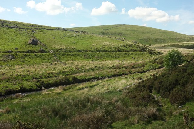
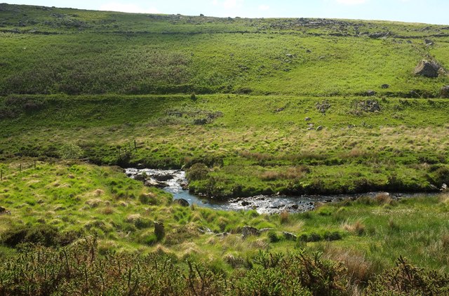
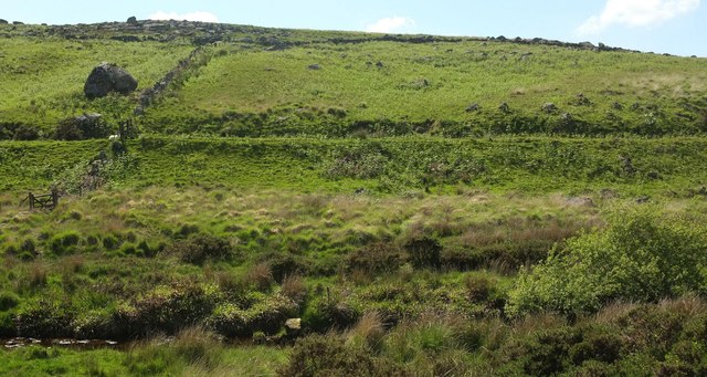
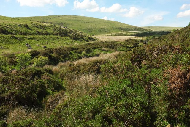
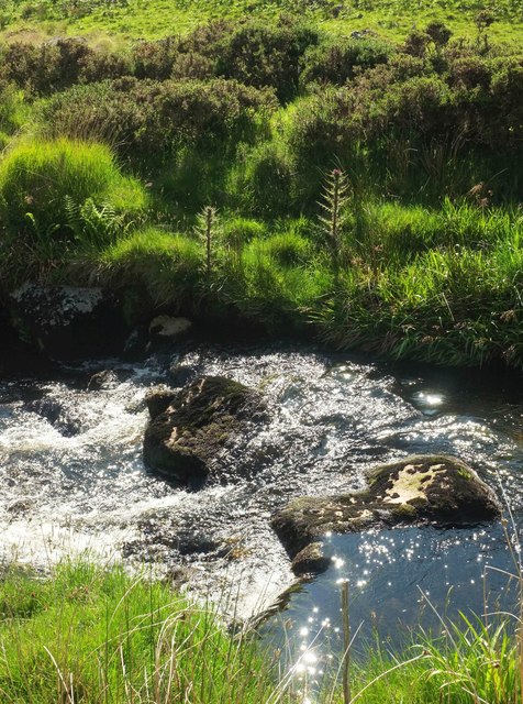
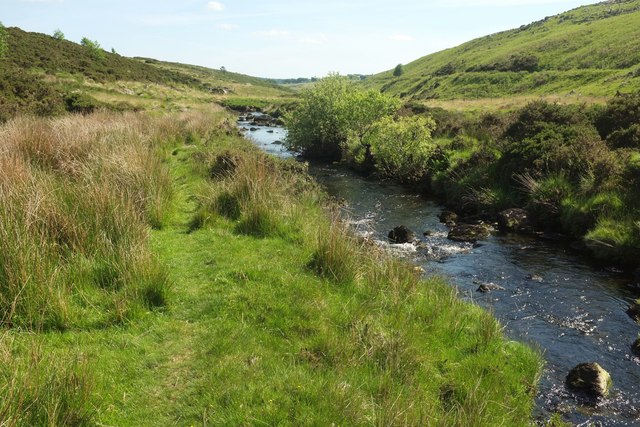
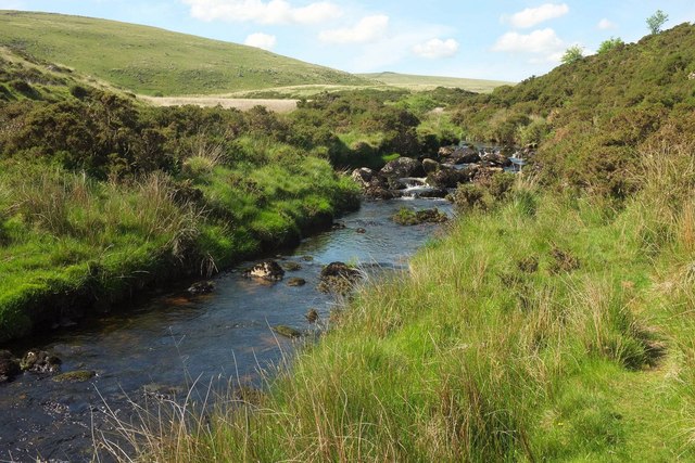
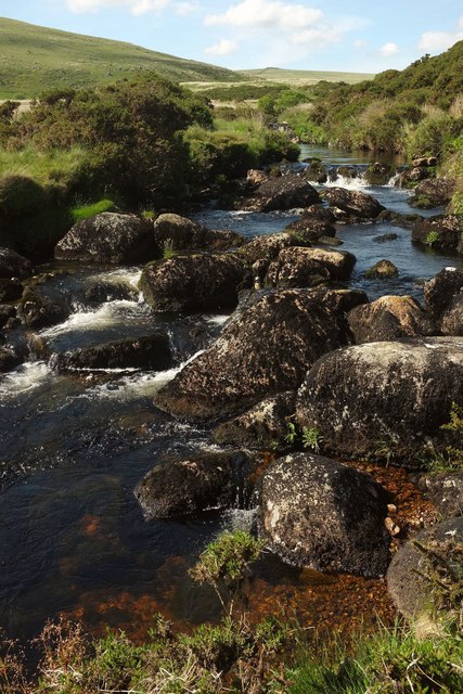
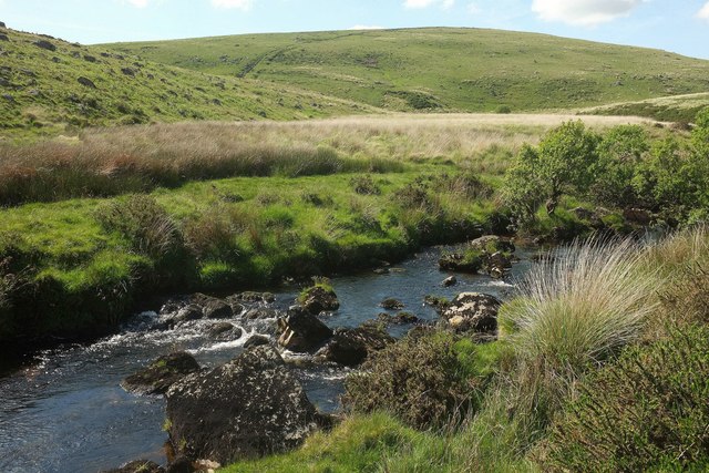
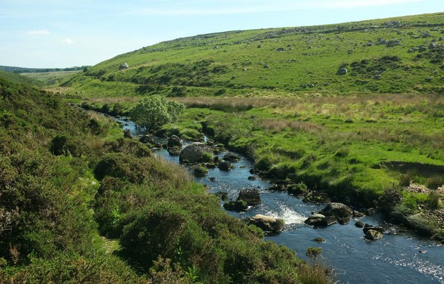
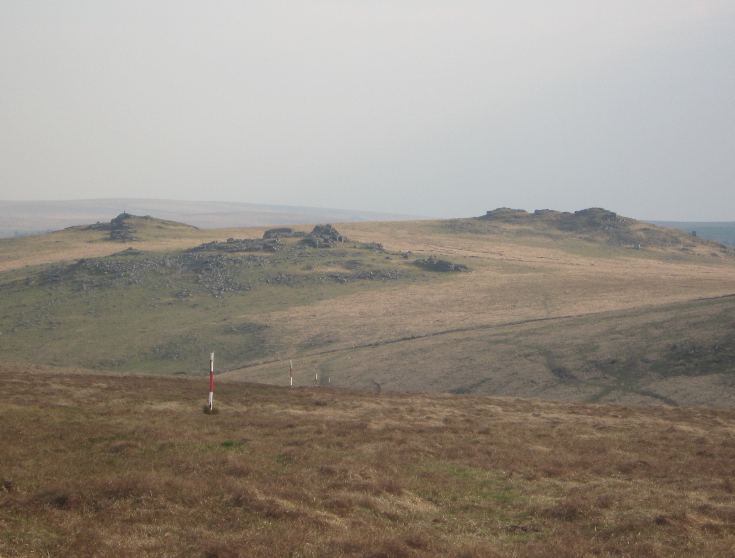
Broad Down is a picturesque area located in the county of Devon, England. It is a part of the larger Dartmoor National Park and is known for its stunning natural beauty and diverse ecosystems. The area is characterized by its expansive moorland, rolling hills, and panoramic views of the surrounding countryside.

Covering an area of approximately 4 square miles, Broad Down is home to a wide range of flora and fauna. The moorland is covered in heather, gorse, and grasses, providing a unique habitat for various species of birds, insects, and small mammals. Visitors to the area can enjoy walking along the numerous footpaths that crisscross the landscape, taking in the tranquil atmosphere and breathtaking vistas.

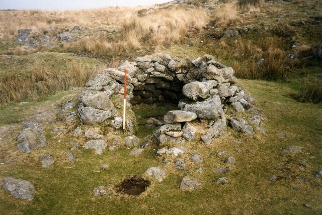
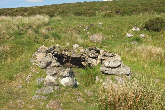
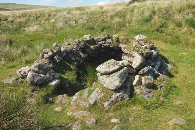
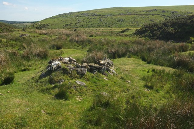
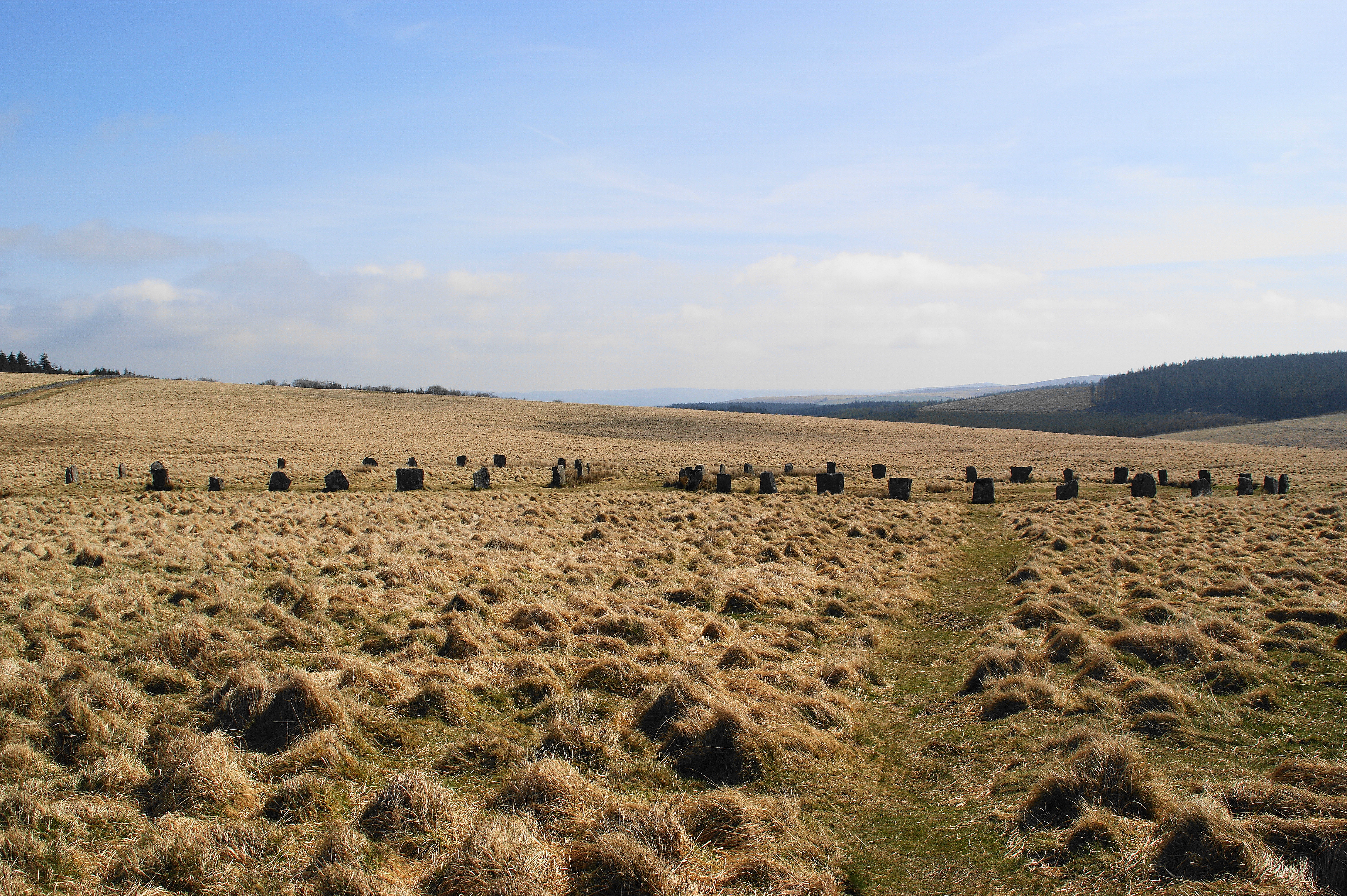
Broad Down is also steeped in history, with evidence of human habitation dating back thousands of years. Ancient stone circles, burial sites, and remnants of prehistoric settlements can be found scattered throughout the area, providing a glimpse into the region's rich past.

The natural beauty and cultural significance of Broad Down make it a popular destination for outdoor enthusiasts and history buffs alike. Whether it's hiking, birdwatching, or simply enjoying the peace and quiet of the countryside, Broad Down offers a truly immersive experience in the heart of Devon's stunning landscape.

If you have any feedback on the listing, please let us know in the comments section below.

Broad Down Images

Images are sourced within 2km of 50.607918/-3.9465332 or Grid Reference SX6280. Thanks to Geograph Open Source API. All images are credited.

Beehive hut in Great Stannon Newtake Scale 1m <span class="nowrap"><a title="https://historicengland.org.uk/listing/the-list/list-entry/1019266?section=official-list-entry" rel="nofollow ugc noopener" href="https://historicengland.org.uk/listing/the-list/list-entry/1019266?section=official-list-entry">Link</a><img style="margin-left:2px;" alt="External link" title="External link - shift click to open in new window" src="https://s1.geograph.org.uk/img/external.png" width="10" height="10"/></span>
Beehive hut in Great Stannon Newtake
Scale 1m LinkExternal link
Broadun Bronze Age Settlement View from Chittaford Down <span class="nowrap"><a title="https://historicengland.org.uk/listing/the-list/list-entry/1021333?section=official-list-entry" rel="nofollow ugc noopener" href="https://historicengland.org.uk/listing/the-list/list-entry/1021333?section=official-list-entry">Link</a><img style="margin-left:2px;" alt="External link" title="External link - shift click to open in new window" src="https://s1.geograph.org.uk/img/external.png" width="10" height="10"/></span>
Broadun Bronze Age Settlement
View from Chittaford Down LinkExternal link
Vitifer Leat The path of the disused Vitifer Mine leat crossing the edge of Winney's Down. Looking upstream towards the East Dart Waterfall above which the leat took its water.
Vitifer Leat
The path of the disused Vitifer Mine leat crossing the edge of Winney's Down. Looking upstream towards the East Dart Waterfall above which the leat took its water.
Vitifer Leat A clapper bridge over the disused Vitifer Mine Leat which took water from the East Dart River.
Vitifer Leat
A clapper bridge over the disused Vitifer Mine Leat which took water from the East Dart River.
Beehive hut by Lade Hill Brook Sadly depleted compared with the images at <a href="https://www.geograph.org.uk/photo/1989015">SX6381 : Beehive hut</a> and <a href="https://www.geograph.org.uk/photo/15204">SX6381 : Beehive hut</a>; see also <a href="https://www.geograph.org.uk/photo/3782935">SX6381 : Tinners Beehive Hut</a> and <a href="https://www.geograph.org.uk/photo/1390857">SX6381 : Beehive hut</a>. The ancient monument is described at <span class="nowrap"><a title="https://www.historicengland.org.uk/listing/the-list/list-entry/1019266" rel="nofollow ugc noopener" href="https://www.historicengland.org.uk/listing/the-list/list-entry/1019266">Link</a><img style="margin-left:2px;" alt="External link" title="External link - shift click to open in new window" src="https://s1.geograph.org.uk/img/external.png" width="10" height="10"/></span> . "The tinners' building in Great Stannon Newtake ... survives very well and contains both environmental and structural information. This building is amongst the most visually impressive of the beehive huts on the Moor ... The hut is built within a disused streamwork tye and it is presumed that it was constructed by tinners, perhaps for storage purposes and as a shelter."
Beehive hut by Lade Hill Brook
Sadly depleted compared with the images at SX6381 : Beehive hut and SX6381 : Beehive hut; see also SX6381 : Tinners Beehive Hut and SX6381 : Beehive hut. The ancient monument is described at LinkExternal link . "The tinners' building in Great Stannon Newtake ... survives very well and contains both environmental and structural information. This building is amongst the most visually impressive of the beehive huts on the Moor ... The hut is built within a disused streamwork tye and it is presumed that it was constructed by tinners, perhaps for storage purposes and as a shelter."
Beehive hut by Lade Hill Brook Another view of <a href="https://www.geograph.org.uk/photo/5413619">SX6381 : Beehive hut by Lade Hill Brook</a> from a slightly different angle. <a title="https://www.geograph.org.uk/search.php?i=72347803" href="https://www.geograph.org.uk/search.php?i=72347803">Link</a> The ancient monument is described at <span class="nowrap"><a title="https://www.historicengland.org.uk/listing/the-list/list-entry/1019266" rel="nofollow ugc noopener" href="https://www.historicengland.org.uk/listing/the-list/list-entry/1019266">Link</a><img style="margin-left:2px;" alt="External link" title="External link - shift click to open in new window" src="https://s1.geograph.org.uk/img/external.png" width="10" height="10"/></span>
Beehive hut by Lade Hill Brook
Another view of SX6381 : Beehive hut by Lade Hill Brook from a slightly different angle. Link The ancient monument is described at LinkExternal link
Beehive hut by Lade Hill Brook A rear view of <a href="https://www.geograph.org.uk/photo/5413619">SX6381 : Beehive hut by Lade Hill Brook</a> / <a href="https://www.geograph.org.uk/photo/5413622">SX6381 : Beehive hut by Lade Hill Brook</a>, looking down the valley to the junction with the East Dart.
Beehive hut by Lade Hill Brook
A rear view of SX6381 : Beehive hut by Lade Hill Brook / SX6381 : Beehive hut by Lade Hill Brook, looking down the valley to the junction with the East Dart.
East Dart valley west of Stannon Tor On the right the valley bends sharply westwards (heading upstream) at the junction with the Lade Hill Brook. <a href="https://www.geograph.org.uk/photo/5413761">SX6381 : East Dart River</a> looks across the valley to the left from this point. On the left across the valley is the prominent line of the Powder Mills Leat.
East Dart valley west of Stannon Tor
On the right the valley bends sharply westwards (heading upstream) at the junction with the Lade Hill Brook. SX6381 : East Dart River looks across the valley to the left from this point. On the left across the valley is the prominent line of the Powder Mills Leat.
East Dart River From the same position as <a href="https://www.geograph.org.uk/photo/5413689">SX6381 : East Dart valley west of Stannon Tor</a>, with a double bend in the river and the outline of a small enclosure beyond. Across the valley is the prominent line of the Powder Mills Leat.
East Dart River
From the same position as SX6381 : East Dart valley west of Stannon Tor, with a double bend in the river and the outline of a small enclosure beyond. Across the valley is the prominent line of the Powder Mills Leat.
East Dart valley west of Stannon Tor Taken a little further north than <a href="https://www.geograph.org.uk/photo/5413761">SX6381 : East Dart River</a>, again across the river. Across the valley is the prominent line of the Powder Mills Leat.
East Dart valley west of Stannon Tor
Taken a little further north than SX6381 : East Dart River, again across the river. Across the valley is the prominent line of the Powder Mills Leat.
East Dart valley west of Stannon Tor A similar view to <a href="https://www.geograph.org.uk/photo/5413689">SX6381 : East Dart valley west of Stannon Tor</a>, taken a little further north, the valley turning west at the junction with the Lade Hill Brook. On the left across the valley is the prominent line of the Powder Mills Leat. <a href="https://www.geograph.org.uk/photo/5413770">SX6381 : East Dart valley west of Stannon Tor</a> looks left from here.
East Dart valley west of Stannon Tor
A similar view to SX6381 : East Dart valley west of Stannon Tor, taken a little further north, the valley turning west at the junction with the Lade Hill Brook. On the left across the valley is the prominent line of the Powder Mills Leat. SX6381 : East Dart valley west of Stannon Tor looks left from here.
East Dart River Rocks in the narrow river, and a pair of marsh thistles on the other bank
East Dart River
Rocks in the narrow river, and a pair of marsh thistles on the other bank
East Dart River Looking downstream from where <a href="https://www.geograph.org.uk/photo/5413948">SX6381 : East Dart River</a> was taken.
East Dart River
Looking downstream from where SX6381 : East Dart River was taken.
East Dart River Looking upstream from where <a href="https://www.geograph.org.uk/photo/5413949">SX6381 : East Dart River</a> looks downstream.
East Dart River
Looking upstream from where SX6381 : East Dart River looks downstream.
Rocks on East Dart River Some providing a seat for a short rest. The rocks can be seen in <a href="https://www.geograph.org.uk/photo/5416378">SX6381 : East Dart River</a>.
Rocks on East Dart River
Some providing a seat for a short rest. The rocks can be seen in SX6381 : East Dart River.
East Dart River A little upstream from <a href="https://www.geograph.org.uk/photo/5416650">SX6381 : Rocks on East Dart River</a>, with the southeast slopes of Winney's Down ahead across the river beyond its upstream bend westwards.
East Dart River
A little upstream from SX6381 : Rocks on East Dart River, with the southeast slopes of Winney's Down ahead across the river beyond its upstream bend westwards.
East Dart River With large boulders in the river, and the small group of trees seen from downstream in <a href="https://www.geograph.org.uk/photo/5417397">SX6381 : East Dart River</a>.
East Dart River
With large boulders in the river, and the small group of trees seen from downstream in SX6381 : East Dart River.
East Dart River Looking right from the same position as <a href="https://www.geograph.org.uk/photo/5417412">SX6381 : East Dart River</a>, with a washout on the far bank.
East Dart River
Looking right from the same position as SX6381 : East Dart River, with a washout on the far bank.
Show me another place!

Broad Down is located at Grid Ref: SX6280 (Lat: 50.607918, Lng: -3.9465332)

Administrative County: Devon

District: West Devon

Police Authority: Devon and Cornwall

What 3 Words

///restores.investor.zones. Near Princetown, Devon

Nearby Locations

Broad Down Broad Down

Related Wikis

Dartmoor Forest

Dartmoor Forest is a civil parish in Devon, England. It was formed in 1987 by the splitting of the former parish of Lydford. It covers about 56,000 acres...

Postbridge

Postbridge is a hamlet in the heart of Dartmoor in the English county of Devon. It lies on the B3212, roughly midway between Princetown and Moretonhampstead...

Grey Wethers

Grey Wethers consists of a pair of prehistoric stone circles, situated on grassy plateau to the north of Postbridge, Dartmoor, in the United Kingdom....

Devonport Leat

The Devonport Leat is a leat in Devon constructed in the 1790s to carry fresh drinking water from the high ground of Dartmoor to the expanding dockyards...

Roman Catholic Diocese of Plymouth

The Diocese of Plymouth(Latin: Dioecesis Plymuthensis) is a Latin Church diocese of the Catholic Church in England. The episcopal see is in the city of...

Wistman's Wood

Wistman's Wood is one of three remote high-altitude oakwoods on Dartmoor in Devon, England. == Geography == The wood lies at an altitude of 380–410 metres...

Beardown Tors

Beardown Tors is the 14th highest summit of Dartmoor with a height of 513 metres (1,683 ft). == References == OS OL20 Map Beardown Tors-Mountains Britain

Bellever

Bellever is a hamlet in Dartmoor, Devon, England. It is located on the river East Dart about 2 kilometres (1 mi) south of Postbridge. The first mention...

Nearby Amenities

Located within 500m of 50.607918,-3.9465332
Ford: yes
Lat/Long: 50.6045774/-3.9429683
The data included in this document is from www.openstreetmap.org. The data is made available under ODbL.

Have you been to Broad Down?

Leave your review of Broad Down below (or comments, questions and feedback).