Penrhyn Park

Downs, Moorland in Caernarfonshire

Wales

Penrhyn Park

Penrhyn Castle, western aspect A National Trust property on the edge of the Snowdonia National Park.
Penrhyn Castle, western aspect Credit: Trevor Littlewood

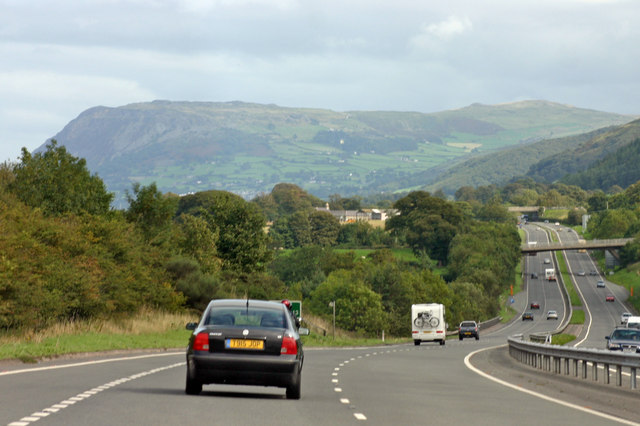
Penrhyn Park is a picturesque area located in Caernarfonshire, North Wales. Situated on the outskirts of the town of Caernarfon, it encompasses a diverse landscape of downs and moorland, offering visitors a unique natural experience.

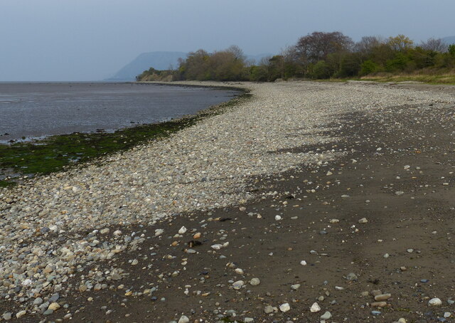
The park is renowned for its stunning views and unspoiled beauty, with rolling hills and expansive fields stretching as far as the eye can see. The downs provide a gentle and undulating terrain, perfect for leisurely walks and picnics, while the moorland offers a more rugged and wild landscape, attracting hikers and nature enthusiasts.

The park is home to a rich variety of plant and animal species, making it a haven for wildlife enthusiasts. Rare birds, such as the red kite and peregrine falcon, can be spotted soaring overhead, while the moorland is home to a range of wildflowers and heather that create a vibrant and colorful backdrop.

Visitors to Penrhyn Park can explore the numerous walking trails that crisscross the area, taking in the breathtaking scenery and immersing themselves in the tranquility of nature. The park also offers opportunities for outdoor activities, such as horse riding and cycling, allowing visitors to fully engage with the natural surroundings.

In addition to its natural beauty, Penrhyn Park also boasts historical significance. The park is home to several ancient burial mounds, providing a glimpse into the area's rich past and offering a connection to its ancient inhabitants.

Overall, Penrhyn Park in Caernarfonshire is a hidden gem, offering a harmonious blend of stunning landscapes, diverse wildlife, and cultural heritage. It is a must-visit destination for those seeking a peaceful retreat in the heart of nature.

If you have any feedback on the listing, please let us know in the comments section below.

Penrhyn Park Images

Images are sourced within 2km of 53.225437/-4.0948381 or Grid Reference SH6071. Thanks to Geograph Open Source API. All images are credited.

Penrhyn Castle, western aspect A National Trust property on the edge of the Snowdonia National Park.
Penrhyn Castle, western aspect
A National Trust property on the edge of the Snowdonia National Park.
An Avongard Tell-Tale gauge on Penrhyn Bridge at Porth Penrhyn, Bangor <span class="nowrap"><a title="https://www.avongard.com/product/standard-tell-tale/" rel="nofollow ugc noopener" href="https://www.avongard.com/product/standard-tell-tale/">Link</a><img style="margin-left:2px;" alt="External link" title="External link - shift click to open in new window" src="https://s1.geograph.org.uk/img/external.png" width="10" height="10"/></span>
An Avongard Tell-Tale gauge on Penrhyn Bridge at Porth Penrhyn, Bangor
A55 North Wales Expressway junction 11
Tiroedd Castell y Penrhyn / The grounds of Penrhyn Castle
Drychiad cefn Castell y Penrhyn / Rear elevation of Penrhyn Castle
Gwartheg yng Nghastell y Penrhyn / Cattle at Penrhyn Castle
Ffenestri bwa / Arched windows
Llusern / Lantern
Llusern / Lantern
Road towards Tan-y-lôn
Road towards Tal-y-bont
Llandegai Road at Tal-y-bont
Lon-Ddwr at Talybont
Railway towards Llanfairfechan
Pentre-isaf near Tal-y-bont
Lane at Aber-Ogwen
Lane at Aber-Ogwen
Stream at Aber-Ogwen
Shoreline at the Traeth Lafan Nature Reserve
Rocky shoreline at the Traeth Lafan Nature Reserve
Show me another place!

Penrhyn Park is located at Grid Ref: SH6071 (Lat: 53.225437, Lng: -4.0948381)

Unitary Authority: Gwynedd

Police Authority: North Wales

What 3 Words

///sweetened.yacht.dugouts. Near Bangor, Gwynedd

Nearby Locations

Penrhyn Park

Related Wikis

Penrhyn Castle

Penrhyn Castle (Welsh: Castell Penrhyn) is a country house in Llandygai, Bangor, Gwynedd, North Wales, constructed in the style of a Norman castle. The...

Talybont, Bangor

Talybont (otherwise Tal-y-bont), is a small village to the southeast of the city of Bangor in Gwynedd, north Wales, in the community of Llanllechid, and...

Nant Ffrancon Formation

The Nant Ffrancon Fermation is a geologic formation in Wales. It preserves fossils dating back to the Ordovician period. == See also == List of fossiliferous...

Spinnies, Aberogwen

Spinnies Aberogwen is a nature reserve located near Bangor, in Gwynedd, Wales. The reserve is owned and managed by North Wales Wildlife Trust. == References ==

Nearby Amenities

Located within 500m of 53.225437,-4.0948381
Shelter
Lat/Long: 53.2254615/-4.0983562
Chapel
Historic: ruins
Lat/Long: 53.2271612/-4.0972932
Adventure Playground
Access: customers
Leisure: playground
Lat/Long: 53.2275448/-4.0960453
Bog Garden
Leisure: garden
Lat/Long: 53.2255609/-4.0984332
Dell
Natural: wood
Lat/Long: 53.2252251/-4.0974963
Pheasant`s Chase
Natural: wood
Lat/Long: 53.2261793/-4.097266
Entrance: yes
Lat/Long: 53.2247289/-4.0916722
Entrance: yes
Lat/Long: 53.2247837/-4.0915955
Barrier: yes
Lat/Long: 53.2264148/-4.0981497
Cafe
Penrhyn Castle Coffee Shop
Lat/Long: 53.2263613/-4.0946111
Toilets
Changing Table: yes
Fee: no
Wheelchair: no
Lat/Long: 53.2257926/-4.0941849
Railway: buffer_stop
Lat/Long: 53.22612/-4.0944181
Railway: buffer_stop
Lat/Long: 53.2264152/-4.0944065
Penrhyn Castle Railway Museum
Fee: no
Museum: railway
Operator: National Trust
Tourism: museum
Wikidata: Q7164580
Wikipedia: en:Penrhyn Castle Railway Museum
Lat/Long: 53.2260815/-4.0945684
Toilets
Access: customers
Female: yes
Male: no
Operator: National Trust
Toilets Disposal: flush
Unisex: no
Lat/Long: 53.225984/-4.0948482
Toilets
Access: customers
Female: no
Male: yes
Operator: National Trust
Toilets Disposal: flush
Lat/Long: 53.2261458/-4.0950355
Waste Basket
Waste: trash
Lat/Long: 53.2248441/-4.0915514
Board Type: notice
Information: board
Operator: National Trust
Operator Wikidata: Q333515
Tourism: information
Lat/Long: 53.2248993/-4.0924555
Bench
Backrest: yes
Lat/Long: 53.2252747/-4.0924454
Check Date: 2022-11-19
Natural: tree_stump
Lat/Long: 53.2254742/-4.0925192
Bench
Backrest: yes
Lat/Long: 53.2262156/-4.0929846
Bench
Backrest: yes
Lat/Long: 53.2270694/-4.0935036
Bench
Backrest: yes
Lat/Long: 53.2256545/-4.0973536
Bench
Backrest: yes
Lat/Long: 53.2242088/-4.0963212
Fountain
Drinking Water: no
Fountain: nozzle
Lit: no
Lat/Long: 53.2259009/-4.0976239
Fountain
Drinking Water: no
Fountain: nozzle
Lit: no
Lat/Long: 53.2259134/-4.0976457
Fountain
Drinking Water: no
Fountain: nozzle
Lit: no
Lat/Long: 53.2262389/-4.0981151
Fountain
Drinking Water: no
Fountain: nozzle
Lit: no
Lat/Long: 53.2262514/-4.098135
Fountain
Drinking Water: no
Fountain: nozzle
Lit: no
Lat/Long: 53.2260525/-4.0979269
Artwork Type: statue
Tourism: artwork
Lat/Long: 53.2269162/-4.0941626
Covered: no
Leisure: picnic_table
Lat/Long: 53.2270679/-4.0952645
Covered: no
Leisure: picnic_table
Lat/Long: 53.2269575/-4.0952303
Covered: no
Leisure: picnic_table
Lat/Long: 53.2269442/-4.0953744
Covered: no
Leisure: picnic_table
Lat/Long: 53.2268884/-4.0954656
Covered: no
Leisure: picnic_table
Lat/Long: 53.2268647/-4.0955595
Direction: backward
Traffic Sign: no_entry
Lat/Long: 53.2278085/-4.0949541
Bench
Backrest: yes
Lat/Long: 53.2278699/-4.0973944
Bench
Backrest: yes
Lat/Long: 53.2258726/-4.0974804
Bench
Backrest: yes
Indoor: yes
Lat/Long: 53.2261208/-4.0977835
Shelter
Lat/Long: 53.2221236/-4.0946467
The data included in this document is from www.openstreetmap.org. The data is made available under ODbL.

Have you been to Penrhyn Park?

Leave your review of Penrhyn Park below (or comments, questions and feedback).