Gwernymynydd

Settlement in Flintshire

Wales

Gwernymynydd

Sign for Loggerheads Country Park At last!  Found where Loggerheads actually is!  If I hear that anyone is at loggerheads with anybody else, I now know where they are!
Sign for Loggerheads Country Park Credit: Bob Walters

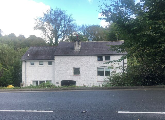
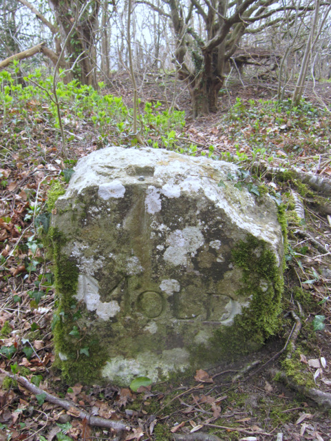
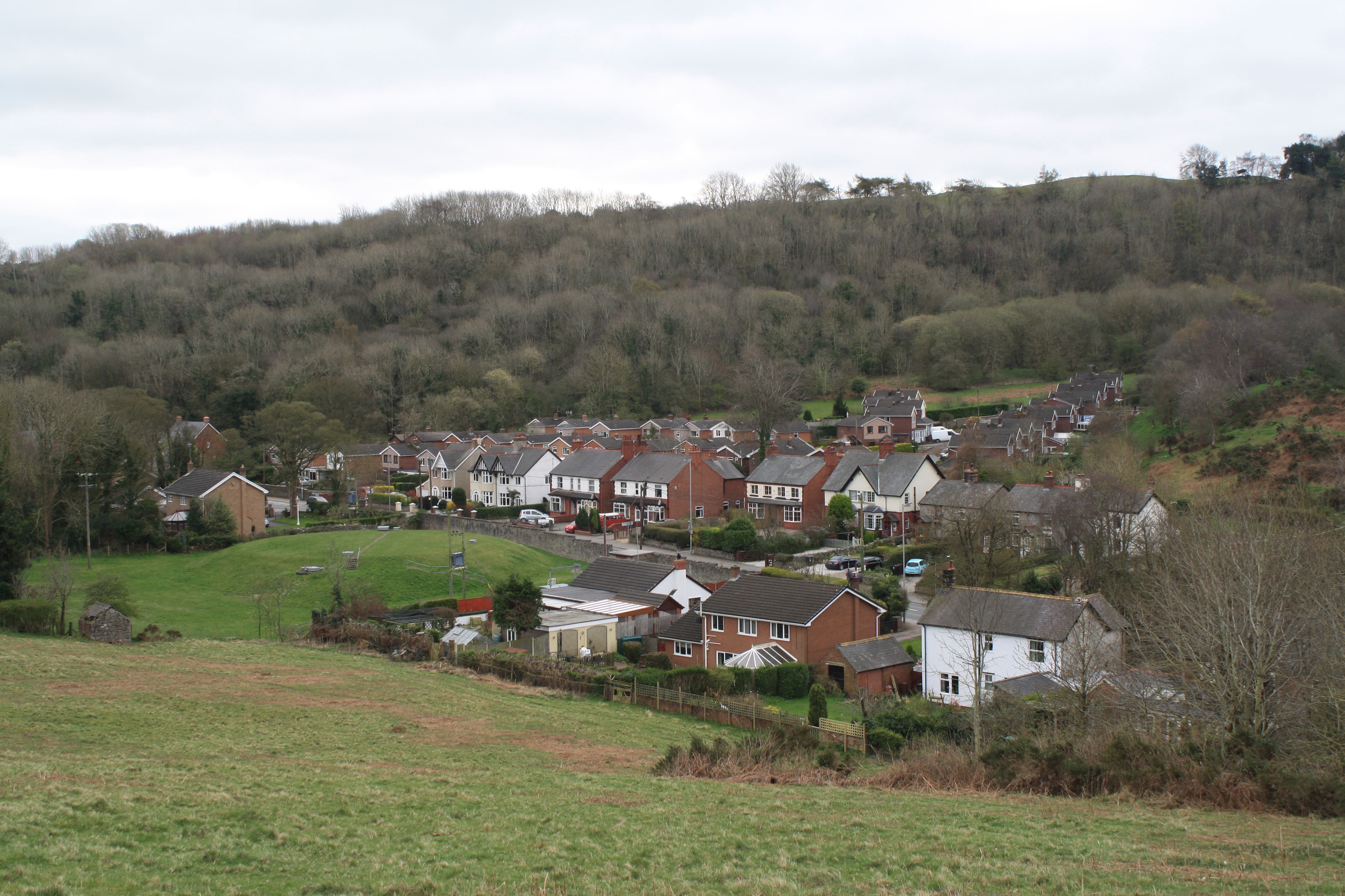
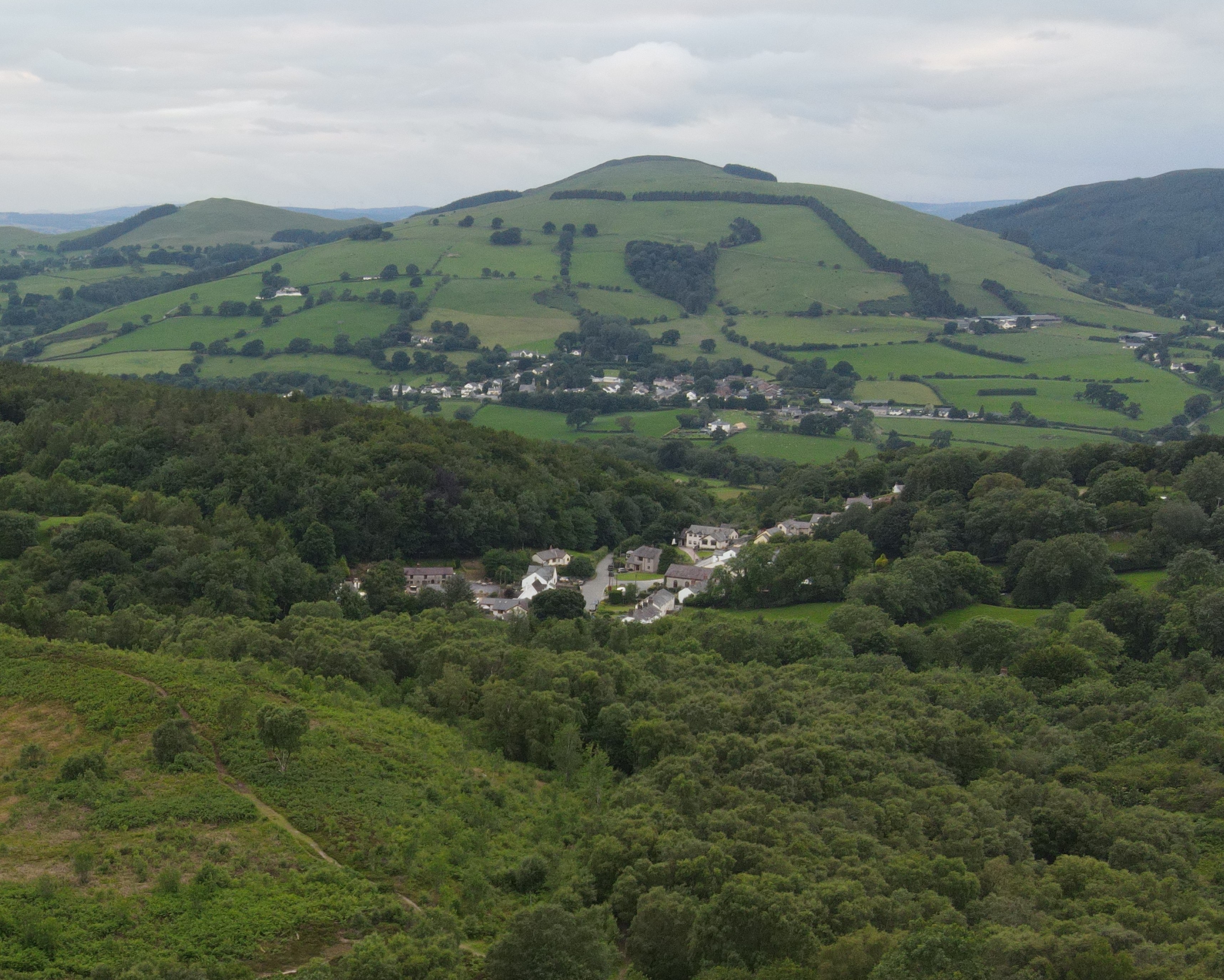
Gwernymynydd is a small village located in Flintshire, Wales. Situated in the northeastern part of the country, it lies approximately 11 miles southwest of the city of Chester and 6 miles north of the market town of Mold. The village is nestled in the scenic countryside, surrounded by rolling hills and picturesque landscapes.

Gwernymynydd has a rich history, with evidence of human settlement dating back to the Bronze Age. The village was primarily an agricultural community, with farming being the main occupation for many of its residents. Today, while agriculture still plays a role in the local economy, the village has become more diverse, with residents employed in various industries in nearby towns and cities.

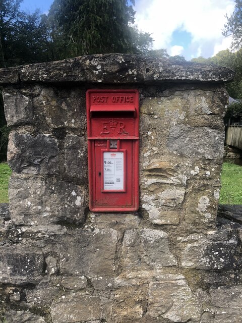
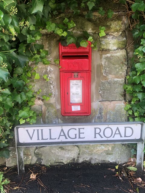
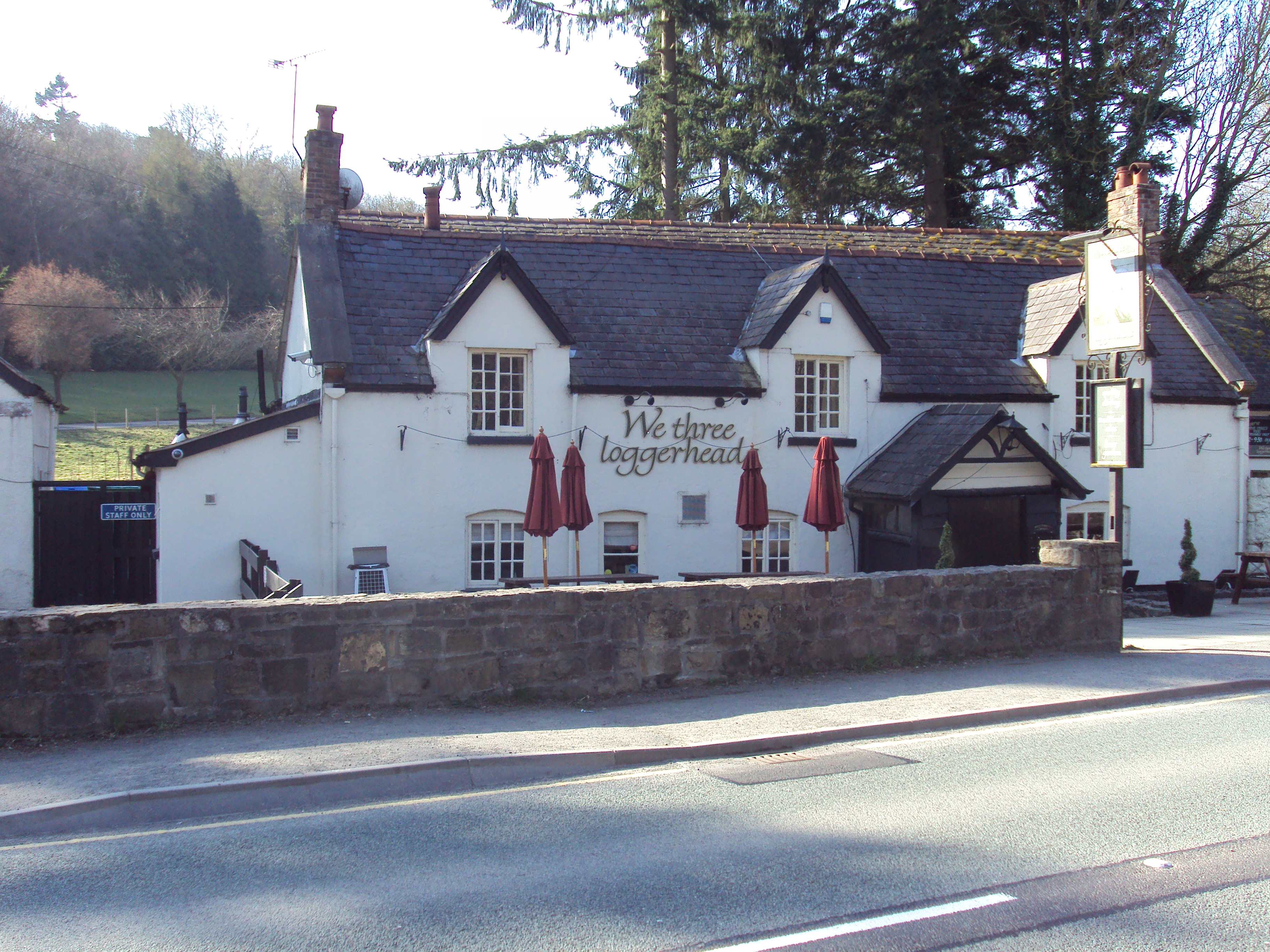
The village is home to a close-knit community, with a population of around 1,500 people. It boasts a range of amenities, including a primary school, a community center, a post office, and a village pub. The local pub, The Bee Inn, is a popular meeting place for residents and visitors alike, offering a friendly atmosphere and traditional Welsh hospitality.

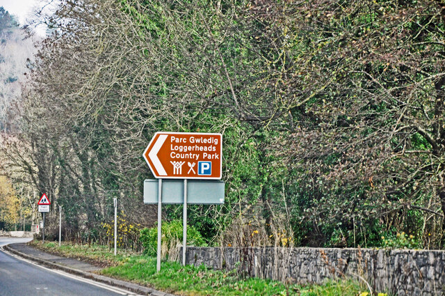
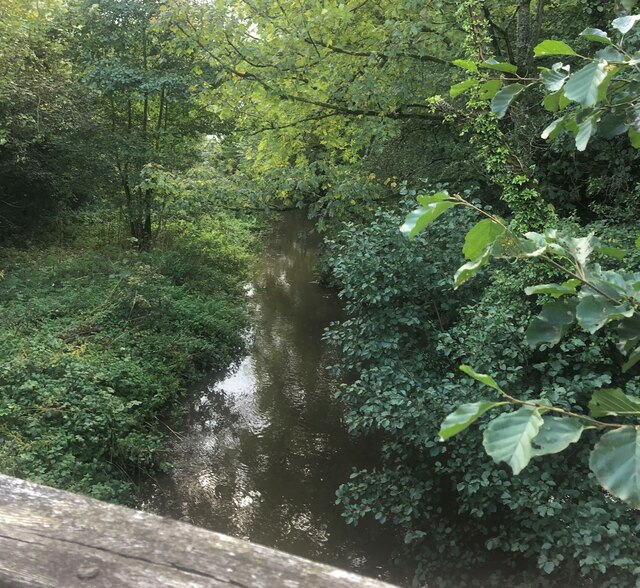
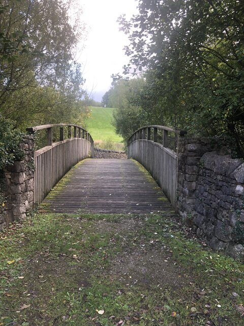
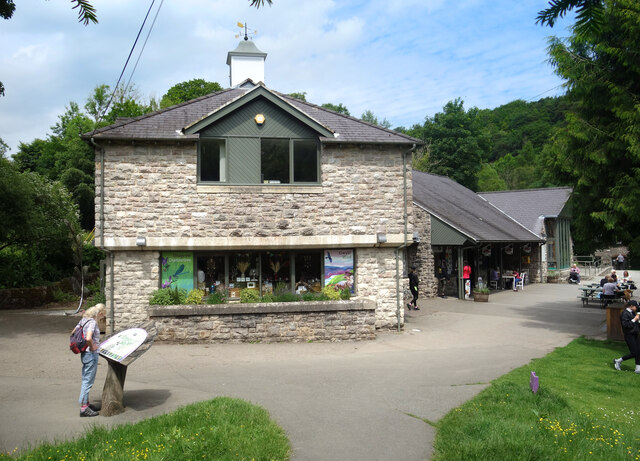
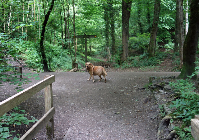
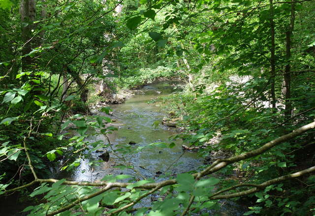
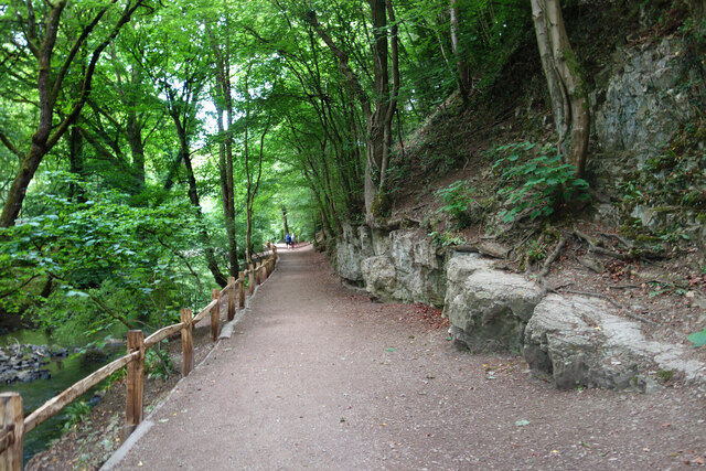
Gwernymynydd is surrounded by natural beauty, making it an ideal location for outdoor enthusiasts. The nearby Moel Famau mountain offers stunning panoramic views of the surrounding countryside, and the Loggerheads Country Park, just a short drive away, provides opportunities for walking, picnicking, and exploring nature.

Overall, Gwernymynydd is a charming village that offers a peaceful and picturesque lifestyle for its residents, while also providing easy access to the amenities and attractions of nearby towns and cities.

If you have any feedback on the listing, please let us know in the comments section below.

Gwernymynydd Images

Images are sourced within 2km of 53.152847/-3.176611 or Grid Reference SJ2162. Thanks to Geograph Open Source API. All images are credited.

Sign for Loggerheads Country Park At last!  Found where Loggerheads actually is!  If I hear that anyone is at loggerheads with anybody else, I now know where they are!
Sign for Loggerheads Country Park
At last! Found where Loggerheads actually is! If I hear that anyone is at loggerheads with anybody else, I now know where they are!
Wall-mounted postbox at Loggerheads Inset into a wall opposite the We Three Loggerheads public house
Wall-mounted postbox at Loggerheads
Inset into a wall opposite the We Three Loggerheads public house
The River Alyn at Loggerheads
Wooden footbridge over the River Alyn at Loggerheads
Llanferres Mill Former corn mill on the A494
Llanferres Mill
Former corn mill on the A494
Shop at the Country Park Part of the visitor centre buildings at Loggerheads Country Park.
Shop at the Country Park
Part of the visitor centre buildings at Loggerheads Country Park.
Dog on the Trail Waiting for his people to catch up and decide which way they are going.
Loggerheads Country Park.
Dog on the Trail
Waiting for his people to catch up and decide which way they are going. Loggerheads Country Park.
River Alyn in Loggerheads Park The river flows past limestone cliffs in a beautiful woodland setting.
River Alyn in Loggerheads Park
The river flows past limestone cliffs in a beautiful woodland setting.
Riverside Path, Loggerheads Park Sandwiched between the River Alyn on one side and steep limestone crags on the other.
Riverside Path, Loggerheads Park
Sandwiched between the River Alyn on one side and steep limestone crags on the other.
Old road before the roundabout on Gwernymynydd Road This section of the old road has been closed off at both ends so is not really a lay-by
Old road before the roundabout on Gwernymynydd Road
This section of the old road has been closed off at both ends so is not really a lay-by
Milestone on the A494 on the east side of Gwernymynydd Part of the inscription can just be made out on the bottom right, but most is buried.
Milestone on the A494 on the east side of Gwernymynydd
Part of the inscription can just be made out on the bottom right, but most is buried.
Wall-mounted postbox at Gwernymynydd
Fron Hall Lodge
Fron Hall Lodge
Oddity at Gwernymynydd A pump or tap?
Oddity at Gwernymynydd
A pump or tap?
Post-mounted postbox at Gwernymynydd Near Eagles & Crawford depot
Post-mounted postbox at Gwernymynydd
Near Eagles & Crawford depot
Small housing development On the site of the old Rainbow Inn
Small housing development
On the site of the old Rainbow Inn
Wall-mounted postbox at Cadole
'Mold' boundary stone and a rivet bench mark This old boundary stone has the name 'MOLD' on the dressed face, but the back of the stone is just rough cut. A rivet bench mark has been cut into the top edge of the stone and this is recorded on the 1878 O.S. map levelled at 804.8 feet. This stone is very close to the popular viewing area high above Loggerheads, but is about three metres off the track - see <a href="https://www.geograph.org.uk/photo/2331859">SJ1962 : Track to Loggerheads viewing point</a>. Another similar boundary stone, without a bench mark, is adjacent to the track, and is more obvious, about 50 metres east of this one.

Milestone Society National ID: FLT_MOLD03pb
'Mold' boundary stone and a rivet bench mark
This old boundary stone has the name 'MOLD' on the dressed face, but the back of the stone is just rough cut. A rivet bench mark has been cut into the top edge of the stone and this is recorded on the 1878 O.S. map levelled at 804.8 feet. This stone is very close to the popular viewing area high above Loggerheads, but is about three metres off the track - see SJ1962 : Track to Loggerheads viewing point. Another similar boundary stone, without a bench mark, is adjacent to the track, and is more obvious, about 50 metres east of this one. Milestone Society National ID: FLT_MOLD03pb
Show me another place!

Gwernymynydd is located at Grid Ref: SJ2162 (Lat: 53.152847, Lng: -3.176611)

Unitary Authority: Flintshire

Police Authority: North Wales

What 3 Words

///blacked.about.dugouts. Near Mold, Flintshire

Nearby Locations

Gwernymynydd Gwernymynydd

Related Wikis

Gwernymynydd

Gwernymynydd (Welsh for 'Alder trees on the mountain') is a village outside the market town of Mold in Flintshire, Wales. It forms part of the Gwernymynydd...

Cadole

Cadole is a village in Flintshire, Wales. It lies west of Gwernymynydd and Mold (Yr Wyddgrug), south of Gwernaffield and to the east of the Clwydian Range...

Loggerheads Country Park

Loggerheads Country Park is a country park in the village of Loggerheads, Denbighshire, Wales. The park has a wooded river valley that follows the course...

Loggerheads, Denbighshire

Loggerheads is a village in Denbighshire, Wales on the River Alyn, a tributary of the River Dee. It is the location of Loggerheads Country Park which follows...

Maeshafn

Maeshafn is a small village in Denbighshire, Wales, near the border with Flintshire. Maeshafn lies several miles to the southwest of Mold. Overlooked...

Gwernaffield

Gwernaffield (Welsh: Y Waun), also known as Gwernaffield-y-Waun, is a village and electoral ward in Flintshire, Wales. It lies about three miles west of...

Gwernaffield with Pantymwyn

Gwernaffield with Pantymwyn is a community in Flintshire, Wales with a population of 1942 as of the 2011 UK census. It includes the villages of Gwernaffield...

Alun School

Alun School is a secondary school located in the community of Mold, Flintshire, Wales. It was formed in 1970 as a result of the merger of the Alun Grammar...

Nearby Amenities

Located within 500m of 53.152847,-3.176611
Crossing
Crossing Island: yes
Kerb: flush
Tactile Paving: yes
Lat/Long: 53.1549166/-3.1712126
The Rainbow Inn
Beer Garden: yes
Disused Amenity: pub
Food: yes
Real Ale: yes
Lat/Long: 53.1528133/-3.1785565
Ref: 51
Lat/Long: 53.1542188/-3.1823903
Bus Stop
Bus: yes
Naptan AtcoCode: 5120AWF80471
Naptan NaptanCode: fliawga
Public Transport: platform
Shelter: yes
Timetable: yes
Lat/Long: 53.152957/-3.1765742
Bus Stop
Bus: yes
Naptan AtcoCode: 5120WDB46557
Naptan NaptanCode: flijgmp
Public Transport: platform
Shelter: no
Timetable: yes
Lat/Long: 53.1528777/-3.1762178
Parking
Parking: street_side
Lat/Long: 53.1544293/-3.1718902
Bus Stop
Bus: yes
Naptan AtcoCode: 5120WDB47542
Naptan NaptanCode: flimtpm
Public Transport: platform
Shelter: no
Lat/Long: 53.1546198/-3.1719108
Direction: SE
Generator Method: photovoltaic
Generator Output Electricity: yes
Generator Solar Modules: 14
Generator Source: solar
Generator Type: solar_photovoltaic_panel
Location: roof
Power: generator
Lat/Long: 53.1538972/-3.1711168
Direction: SE
Generator Method: photovoltaic
Generator Output Electricity: yes
Generator Solar Modules: 5
Generator Source: solar
Generator Type: solar_photovoltaic_panel
Location: roof
Power: generator
Lat/Long: 53.1538373/-3.1712664
Direction: SE
Generator Method: photovoltaic
Generator Output Electricity: yes
Generator Solar Modules: 10
Generator Source: solar
Generator Type: solar_photovoltaic_panel
Location: roof
Power: generator
Lat/Long: 53.1537943/-3.1713368
Direction: 140
Generator Method: photovoltaic
Generator Output Electricity: yes
Generator Solar Modules: 15
Generator Source: solar
Generator Type: solar_photovoltaic_panel
Location: roof
Power: generator
Lat/Long: 53.15346/-3.1723988
Direction: SSE
Generator Method: photovoltaic
Generator Output Electricity: yes
Generator Solar Modules: 7
Generator Source: solar
Generator Type: solar_photovoltaic_panel
Location: roof
Power: generator
Lat/Long: 53.1531936/-3.17764
Barrier: stile
Foot: yes
Material: wood
Stile: stepover
Lat/Long: 53.1506935/-3.1784834
Direction: SSW
Generator Method: photovoltaic
Generator Output Electricity: yes
Generator Solar Modules: 16
Generator Source: solar
Generator Type: solar_photovoltaic_panel
Location: roof
Power: generator
Lat/Long: 53.154177/-3.1810087
Direction: SSE
Generator Method: photovoltaic
Generator Output Electricity: yes
Generator Solar Modules: 3
Generator Source: solar
Generator Type: solar_photovoltaic_panel
Location: roof
Power: generator
Lat/Long: 53.1532131/-3.1775701
Historic: memorial
Lat/Long: 53.1546846/-3.1713799
The data included in this document is from www.openstreetmap.org. The data is made available under ODbL.

Have you been to Gwernymynydd?

Leave your review of Gwernymynydd below (or comments, questions and feedback).