Headon Down

Downs, Moorland in Devon South Hams

England

Headon Down
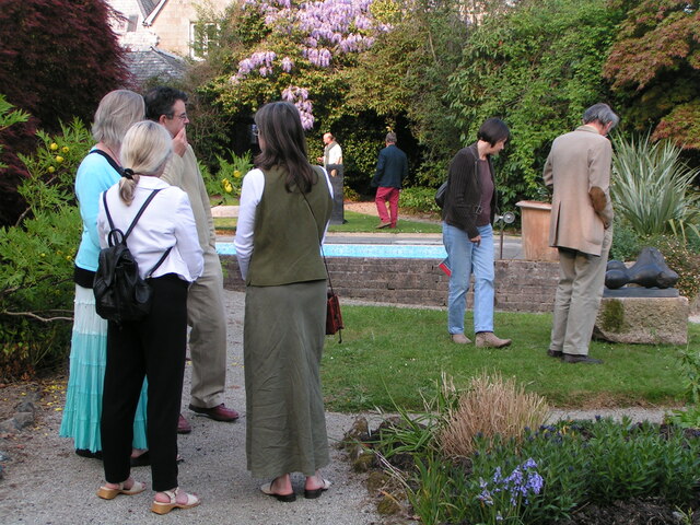
Looking at art works at Delamore House
Looking at art works at Delamore House Credit: Rob Purvis

The requested URL returned error: 429 Too Many Requests

If you have any feedback on the listing, please let us know in the comments section below.

Headon Down Images

Images are sourced within 2km of 50.423662/-3.9888332 or Grid Reference SX5860. Thanks to Geograph Open Source API. All images are credited.

Looking at art works at Delamore House
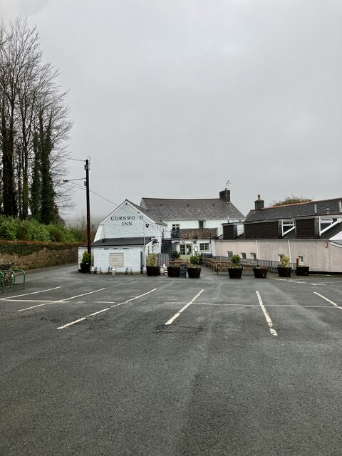
Cornwood Inn Looking across the parking area, to the rear entrance/ beer garden of this now community run inn.
Cornwood Inn
Looking across the parking area, to the rear entrance/ beer garden of this now community run inn.
Lane at West Rook Looking towards Cornwood on a miserable day. The lane serves a couple of farmsteads and a boarding kennels business at West Rook.
Lane at West Rook
Looking towards Cornwood on a miserable day. The lane serves a couple of farmsteads and a boarding kennels business at West Rook.
Access road to china clay works at Lee Moor
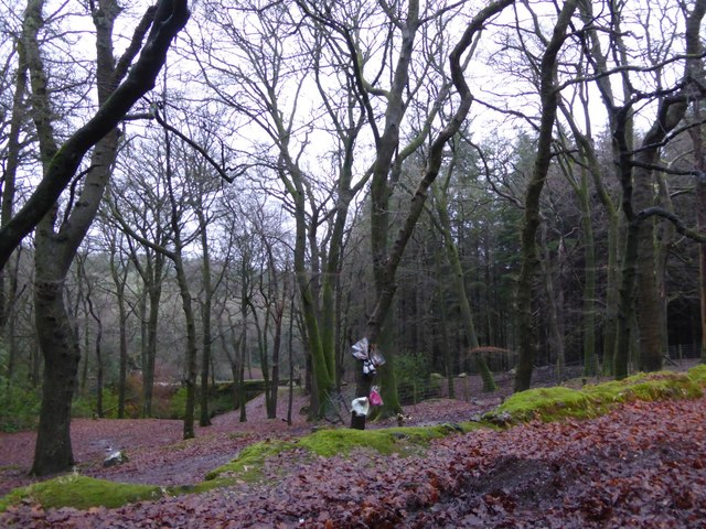
Newpark Wood One tree has flowers as a memorial to some event that happened near here
Newpark Wood
One tree has flowers as a memorial to some event that happened near here
Access into Newpark Wood
Old Wayside Cross north of Tinpark Farm, Cornwood parish Ridding Down (Cholwich Town Farm) Cross, old head and shaft, by the UC road, in parish of Cornwood (South Hams District), Tinpark Farm stables, Ridding Down (opposite entrance to Cholwich Town Farm), in a paddock, to North of farm, 5m from roadside.

Grade II listed.
List Entry Number: 1325395 <span class="nowrap"><a title="https://historicengland.org.uk/listing/the-list/list-entry/1325395" rel="nofollow ugc noopener" href="https://historicengland.org.uk/listing/the-list/list-entry/1325395">Link</a><img style="margin-left:2px;" alt="External link" title="External link - shift click to open in new window" src="https://s1.geograph.org.uk/img/external.png" width="10" height="10"/></span>

Scheduled Monument. 
List Entry Number: 1008931 <span class="nowrap"><a title="https://historicengland.org.uk/listing/the-list/list-entry/1008931" rel="nofollow ugc noopener" href="https://historicengland.org.uk/listing/the-list/list-entry/1008931">Link</a><img style="margin-left:2px;" alt="External link" title="External link - shift click to open in new window" src="https://s1.geograph.org.uk/img/external.png" width="10" height="10"/></span> 

Surveyed

Milestone Society National ID: DVSH_COR01
Old Wayside Cross north of Tinpark Farm, Cornwood parish
Ridding Down (Cholwich Town Farm) Cross, old head and shaft, by the UC road, in parish of Cornwood (South Hams District), Tinpark Farm stables, Ridding Down (opposite entrance to Cholwich Town Farm), in a paddock, to North of farm, 5m from roadside. Grade II listed. List Entry Number: 1325395 LinkExternal link Scheduled Monument. List Entry Number: 1008931 LinkExternal link Surveyed Milestone Society National ID: DVSH_COR01
Bridge over the Piall River Partially hidden by the invasive Rhododendrons. The Bridleway passes this way up towards the open moor.
Bridge over the Piall River
Partially hidden by the invasive Rhododendrons. The Bridleway passes this way up towards the open moor.
Bridleway passing through Quick Wood Having recently been clear felled, not much of a wood now!
Bridleway passing through Quick Wood
Having recently been clear felled, not much of a wood now!
Track to Parkland A small community living in this fairly isolated position.
Track to Parkland
A small community living in this fairly isolated position.
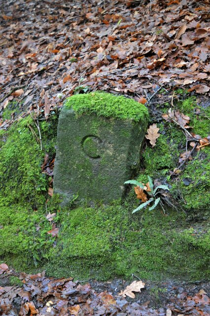
Old Boundary Marker near Piall Bridge County Bridge Marker set in a bank on the west side of the road 80 metres northwest of Piall Bridge, Piall River, northwest of Cornwood. Cornwood parish. Inscribed C. The stone marks the extent of roadway adjoining the bridge that the County was obliged to maintain.

Milestone Society National ID: DV_IBSP02Abr
Old Boundary Marker near Piall Bridge
County Bridge Marker set in a bank on the west side of the road 80 metres northwest of Piall Bridge, Piall River, northwest of Cornwood. Cornwood parish. Inscribed C. The stone marks the extent of roadway adjoining the bridge that the County was obliged to maintain. Milestone Society National ID: DV_IBSP02Abr
Old Boundary Marker near Piall Bridge County Bridge Marker at the base of a stone wall on the east side of the road 80 metres southeast of Piall Bridge, Piall River, northwest of Cornwood. Cornwood parish. Inscribed C. The stone marks the extent of roadway adjoining the bridge that the County was obliged to maintain.

Milestone Society National ID: DV_IBSP02Bbr
Old Boundary Marker near Piall Bridge
County Bridge Marker at the base of a stone wall on the east side of the road 80 metres southeast of Piall Bridge, Piall River, northwest of Cornwood. Cornwood parish. Inscribed C. The stone marks the extent of roadway adjoining the bridge that the County was obliged to maintain. Milestone Society National ID: DV_IBSP02Bbr
Lee Moor - Dartmoor Lee Moor village from the cemetery. This "industrial" village is quite atypical for Devon. On the right horizon you can see one of the landscaped spoil heaps with Cholwich town works on the left.
Lee Moor - Dartmoor
Lee Moor village from the cemetery. This "industrial" village is quite atypical for Devon. On the right horizon you can see one of the landscaped spoil heaps with Cholwich town works on the left.
Cromlech - Delamore This "Cromlech" was constructed to commemorate the Millennium. It stands in the Grounds of Delamore House. Although not open to the public they hold an annual sculpture Exhibition every summer. Picture taken May 2004.
Cromlech - Delamore
This "Cromlech" was constructed to commemorate the Millennium. It stands in the Grounds of Delamore House. Although not open to the public they hold an annual sculpture Exhibition every summer. Picture taken May 2004.
Sheraleers Wood A permissive path through this very mixed woodland northwest of Cornwood.
Sheraleers Wood
A permissive path through this very mixed woodland northwest of Cornwood.
Tuckers Head Cross Or Tucker's Hill Head Cross on the 6" map. The post is on a bank with haws behind. No finger for Pitman's Lane, which heads off left towards Lutton.
Tuckers Head Cross
Or Tucker's Hill Head Cross on the 6" map. The post is on a bank with haws behind. No finger for Pitman's Lane, which heads off left towards Lutton.
Cornwood Houses in Fore Street, with the modern (1902) village cross, a memorial to the local squire <span class="nowrap"><a title="http://www.dartmoor-crosses.org.uk/cornwood.htm" rel="nofollow ugc noopener" href="http://www.dartmoor-crosses.org.uk/cornwood.htm">Link</a><img style="margin-left:2px;" alt="External link" title="External link - shift click to open in new window" src="https://s1.geograph.org.uk/img/external.png" width="10" height="10"/></span> . Behind it is the Jubilee drinking fountain.
Cornwood
Houses in Fore Street, with the modern (1902) village cross, a memorial to the local squire LinkExternal link . Behind it is the Jubilee drinking fountain.
Headon Gate Sparkwell Footpath 18 passes through this gate on its way onto Dartmoor near Headon China Clay Works. To the right, a driveway to a ghostly house in the mist.
Headon Gate
Sparkwell Footpath 18 passes through this gate on its way onto Dartmoor near Headon China Clay Works. To the right, a driveway to a ghostly house in the mist.
Show me another place!

Headon Down is located at Grid Ref: SX5860 (Lat: 50.423662, Lng: -3.9888332)

Administrative County: Devon

District: South Hams

Police Authority: Devon and Cornwall

What 3 Words

///blog.compiled.corporate. Near Ivybridge, Devon

Nearby Locations

Headon Down Broomage Wood

Related Wikis

Yondertown

Yondertown is a mining hamlet located in an Area of Great Landscape Value on the edge of Dartmoor National Park in the English county of Devon. The community...

Cornwood

Cornwood is a village and civil parish in the South Hams in Devon, England. The parish has a population of 988. The village is part of the electoral ward...

Dartmoor Zoological Park

Dartmoor Zoological Park (originally Dartmoor Wildlife Park) is a 30-acre (12 ha) zoo just north of the village of Sparkwell, on the south-west edge of...

Drakelands Mine

Drakelands Mine, also known as Hemerdon Mine or Hemerdon Ball Mine, is a tungsten and tin mine. It is located 11 km (7 miles) northeast of Plymouth, near...

Have you been to Headon Down?

Leave your review of Headon Down below (or comments, questions and feedback).