Stoke Down

Downs, Moorland in Devon South Hams

England

Stoke Down

Caravan park and Stoke Beach
Caravan park and Stoke Beach Credit: David Smith

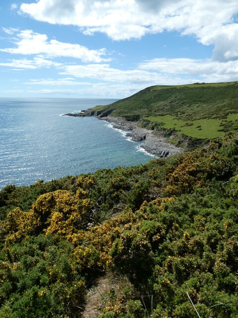
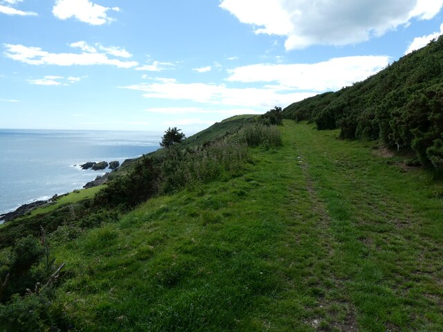
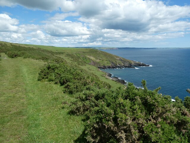
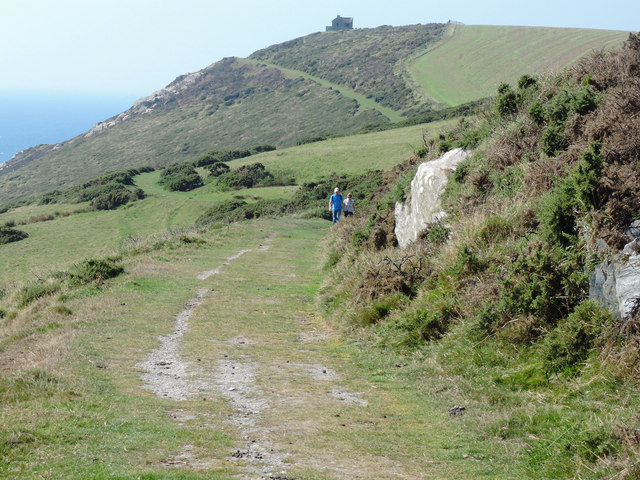
Stoke Down is a charming area located in the county of Devon, England. It is a region known for its stunning Downs and Moorland landscapes, offering visitors a picturesque and diverse natural environment to explore.

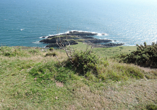
Situated in the southwestern part of Devon, Stoke Down is nestled within the Dartmoor National Park, a renowned area of outstanding natural beauty. The landscape is characterized by rolling hills, vast open spaces, and an abundance of flora and fauna. The area is dotted with ancient woodlands, rivers, and streams, making it a haven for nature lovers and outdoor enthusiasts.

Stoke Down offers a range of activities for visitors to enjoy. Hiking and walking trails crisscross the area, allowing visitors to immerse themselves in the breathtaking scenery. The Downs provide excellent opportunities for birdwatching, with a variety of species calling the area home. Additionally, the Moorland is popular among cyclists and horse riders, who can explore the vast network of trails and paths.

The area also boasts a rich history and heritage. Visitors can uncover prehistoric remains, such as stone circles and burial mounds, which provide a glimpse into the region's ancient past. Stoke Down is also home to several quaint villages and hamlets, where visitors can experience traditional Devonshire culture and hospitality.

In summary, Stoke Down, Devon, is a captivating region that showcases the natural beauty of the Downs and Moorland landscapes. With its diverse flora and fauna, numerous outdoor activities, and rich history, Stoke Down offers an unforgettable experience for anyone seeking to explore the beauty of the English countryside.

If you have any feedback on the listing, please let us know in the comments section below.

Stoke Down Images

Images are sourced within 2km of 50.295975/-4.0209073 or Grid Reference SX5645. Thanks to Geograph Open Source API. All images are credited.

Caravan park and Stoke Beach
The bay of Stoke Beach and cliffs beyond
Church Cove, Stoke
Church Cove, Stoke
View west from Stoke Down The land on the north is Netton Down, and the coves and bays have a range of names, despite being very small
View west from Stoke Down
The land on the north is Netton Down, and the coves and bays have a range of names, despite being very small
The Carriage Drive on Netton Down Part of Lord Revelstoke's private carriage drive <span class="nowrap"><a title="https://www.southdevonaonb.org.uk/wp-content/uploads/2020/06/Noss-Mayo-Revelstoke-Drive-walk-guide.pdf" rel="nofollow ugc noopener" href="https://www.southdevonaonb.org.uk/wp-content/uploads/2020/06/Noss-Mayo-Revelstoke-Drive-walk-guide.pdf">Link</a><img style="margin-left:2px;" alt="External link" title="External link - shift click to open in new window" src="https://s1.geograph.org.uk/img/external.png" width="10" height="10"/></span>
The Carriage Drive on Netton Down
Part of Lord Revelstoke's private carriage drive LinkExternal link
Stoke Point from Netton Down
Netton Down
Netton Down
Netton Island
Netton Island
Towards Rowden Court and Rowden Farm Seen from the National Trust's small Stoke Point car park, by the lane from Netton Farm to Stoke Cross, seen in the foreground
Towards Rowden Court and Rowden Farm
Seen from the National Trust's small Stoke Point car park, by the lane from Netton Farm to Stoke Cross, seen in the foreground
On Revelstoke Drive On Netton Down, looking towards Snellings Down. The late nineteenth-century carriageway created by Lord Revelstoke, now serves as the South West Coast Path for a fair distance between Stoke and the ferry crossing to Wembury
On Revelstoke Drive
On Netton Down, looking towards Snellings Down. The late nineteenth-century carriageway created by Lord Revelstoke, now serves as the South West Coast Path for a fair distance between Stoke and the ferry crossing to Wembury
Stoke Point Seen from the South West Coast Path on Netton Down
Stoke Point
Seen from the South West Coast Path on Netton Down
Stoke Point from Snellings Down Seen from the South West Coast Path. The gorse in the foreground has been subject to swayling. The Devon coastline in the distance is largely lost in the September haze, but on a clear day can be seen running out to Bolt Tail
Stoke Point from Snellings Down
Seen from the South West Coast Path. The gorse in the foreground has been subject to swayling. The Devon coastline in the distance is largely lost in the September haze, but on a clear day can be seen running out to Bolt Tail
Netton Island seen from Snellings Down View from the South West Coast Path
Netton Island seen from Snellings Down
View from the South West Coast Path
On Snellings Down The South West Coast Path looking west towards Gunrow's Down, with the old coastguard lookout forming a landmark on the skyline. The coast path here, formerly Lord Revelstoke's Drive, follows the contours to some extent before ascending Gunrow's Down
On Snellings Down
The South West Coast Path looking west towards Gunrow's Down, with the old coastguard lookout forming a landmark on the skyline. The coast path here, formerly Lord Revelstoke's Drive, follows the contours to some extent before ascending Gunrow's Down
Rocks by Pilot Cove Seen from the South West Coast Path on Snellings Down
Rocks by Pilot Cove
Seen from the South West Coast Path on Snellings Down
Gunrow signal station The disused Gunrow signal station on Gunrow's Down beside the South West Coast Path.
Gunrow signal station
The disused Gunrow signal station on Gunrow's Down beside the South West Coast Path.
Coast path on Snellings Down The South West Coast Path on Snellings Down above Netton Island.
Coast path on Snellings Down
The South West Coast Path on Snellings Down above Netton Island.
Coast path on Netton Down The South West Coast Path following Revelstoke Drive on Netton Down.
Coast path on Netton Down
The South West Coast Path following Revelstoke Drive on Netton Down.
Show me another place!

Stoke Down is located at Grid Ref: SX5645 (Lat: 50.295975, Lng: -4.0209073)

Administrative County: Devon

District: South Hams

Police Authority: Devon and Cornwall

What 3 Words

///painters.articulated.bookshelf. Near Newton Ferrers, Devon

Nearby Locations

Rugger Cove Stoke Down

Related Wikis

Revelstoke, Devon

Revelstoke is a former civil parish, now in the parish of Newton and Noss, in the South Hams district, in the county of Devon, England. It has a church...

Church of St Peter the Poor Fisherman, Revelstoke

The Church of St Peter the Poor Fisherman in the village of Noss Mayo, in Devon, England, was built in 1226. It is located in the former civil parish of...

Hillsea Point Rock

Hillsea Point Rock is an area of the English Channel located 0.5 nm south-east of Hillsea Point, Devon. It consists of seven or eight pinnacles ranging...

St Peter's Church, Noss Mayo

St Peter's Church is a Church of England parish church in Noss Mayo, Devon, England. It was constructed in 1880–82 and designed by the London architect...

Nearby Amenities

Located within 500m of 50.295975,-4.0209073
Created By: almien_coastlines
Source: PGS
Lat/Long: 50.294774/-4.023471
Source: PGS
Lat/Long: 50.2945863/-4.022251
Source: PGS
Lat/Long: 50.2945438/-4.020781
Source: PGS
Lat/Long: 50.2945595/-4.0203226
Source: PGS
Lat/Long: 50.2947697/-4.0194078
Source: PGS
Lat/Long: 50.2951666/-4.0190133
Source: PGS
Lat/Long: 50.29562/-4.0185656
Source: PGS
Lat/Long: 50.2957007/-4.0185112
Source: PGS
Lat/Long: 50.2959242/-4.0183233
Source: PGS
Lat/Long: 50.2963921/-4.0178902
Stoke Point
Place: locality
Lat/Long: 50.2946725/-4.0212328
Bench
Backrest: no
Lat/Long: 50.2962331/-4.0210406
Barrier: kissing_gate
Lat/Long: 50.2967613/-4.0193572
The data included in this document is from www.openstreetmap.org. The data is made available under ODbL.

Have you been to Stoke Down?

Leave your review of Stoke Down below (or comments, questions and feedback).