Gwennap

Settlement in Cornwall

England

Gwennap

Pasture, Gwennap A footpath descends to the gate on its way across fields to the east of South Tresamble.
Pasture, Gwennap Credit: Andrew Smith

Gwennap is a small civil parish located in the county of Cornwall, England. Situated approximately four miles southwest of Redruth, it covers an area of about 5.7 square miles. Gwennap is known for its charming countryside, historic mining heritage, and the iconic Gwennap Pit.

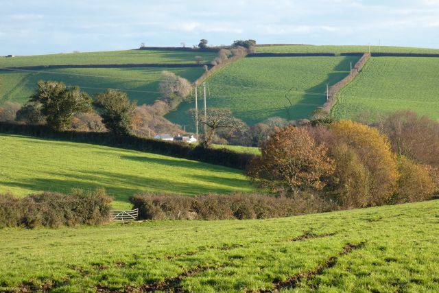
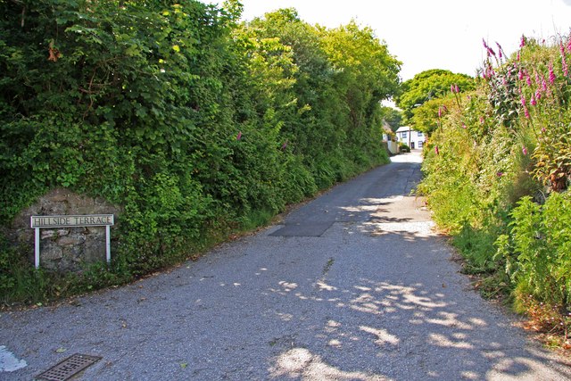
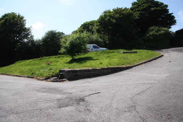
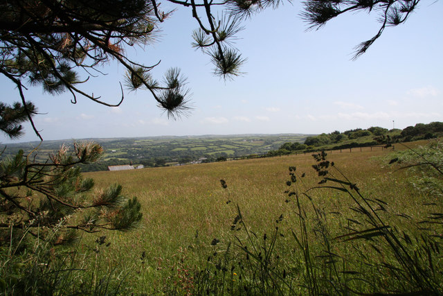
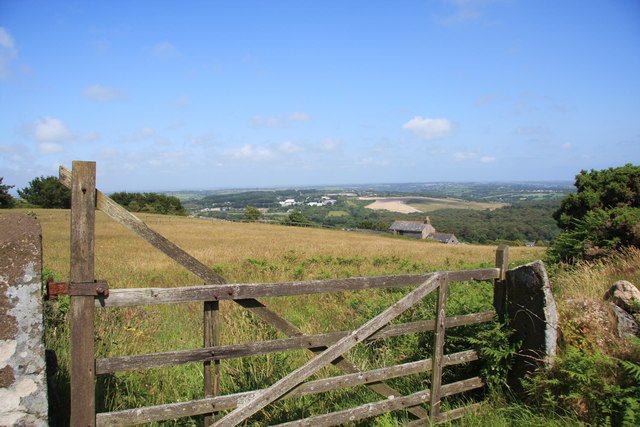
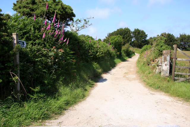
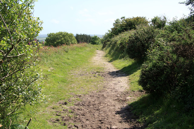
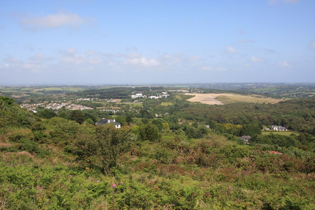
The landscape of Gwennap is characterized by rolling hills and picturesque views, which make it a popular destination for outdoor enthusiasts and nature lovers. The area is dotted with quaint villages and hamlets, offering a peaceful and idyllic atmosphere.

One of the prominent attractions in Gwennap is the Gwennap Pit, a historic open-air amphitheater that was formed by the collapse of an underground mine. This natural amphitheater has a unique horseshoe shape and was used as a preaching pit by the 18th-century Methodist preacher, John Wesley. Today, it serves as a site for religious gatherings and occasional concerts, attracting visitors from far and wide.

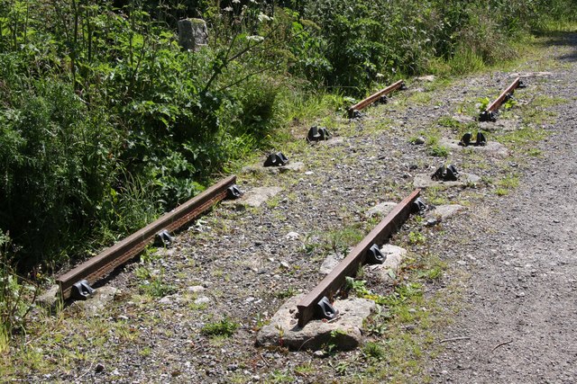
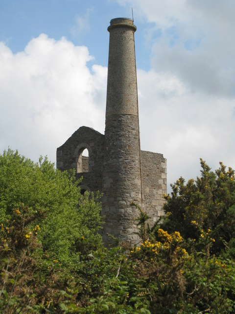
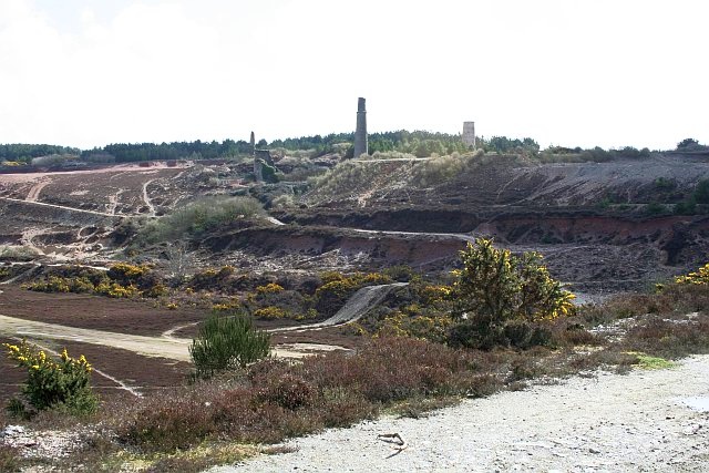
Gwennap also has a rich mining heritage, with evidence of copper and tin mining activities dating back centuries. Many remnants of mining structures, such as engine houses and chimneys, can be found throughout the area, offering a glimpse into its industrial past.

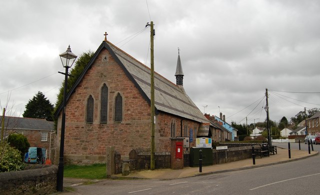
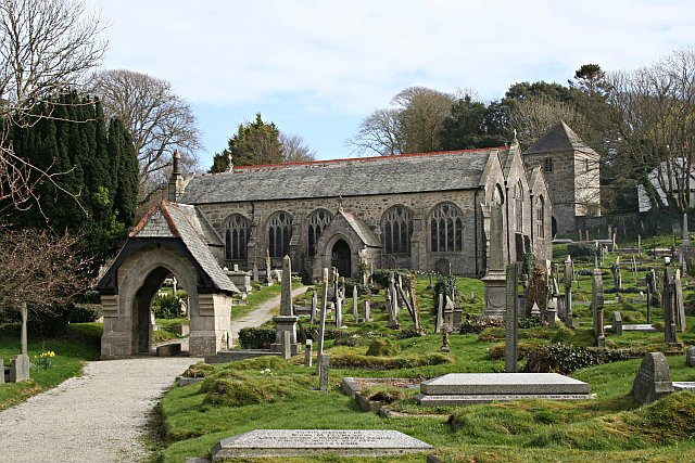
The parish of Gwennap is home to a close-knit community, with a range of amenities including local shops, schools, and churches. It provides a peaceful and tranquil living environment, away from the hustle and bustle of larger towns and cities.

Overall, Gwennap offers a captivating blend of natural beauty, historical significance, and a strong sense of community, making it a delightful place to visit or call home.

If you have any feedback on the listing, please let us know in the comments section below.

Gwennap Images

Images are sourced within 2km of 50.217025/-5.171464 or Grid Reference SW7340. Thanks to Geograph Open Source API. All images are credited.

Pasture, Gwennap A footpath descends to the gate on its way across fields to the east of South Tresamble.
Pasture, Gwennap
A footpath descends to the gate on its way across fields to the east of South Tresamble.
Farmland, Gwennap Maize stubble and oaks beside the footpath north of Devis.
Farmland, Gwennap
Maize stubble and oaks beside the footpath north of Devis.
Pasture, Gwennap A footpath to the north of Trebost passes through the gate.
Pasture, Gwennap
A footpath to the north of Trebost passes through the gate.
Pasture, Lanner A view over Lower Tretharrup from the footpath to its west.
Pasture, Lanner
A view over Lower Tretharrup from the footpath to its west.
Former Primitive Methodist Chapel
Turn for The Coppice off the A393
From atop Carn Marth looking down into Lanner The view from Carn Marth down into Lanner & the junior school (roughly in centre of the picture)
From atop Carn Marth looking down into Lanner
The view from Carn Marth down into Lanner & the junior school (roughly in centre of the picture)
St Piran's Church, Carharrack
St Weneppa's church, Gwennap The detached tower of St Weneppa's church.
St Weneppa's church, Gwennap
The detached tower of St Weneppa's church.
Hillside Terrace, from the junction with Pennance Road
Burncoose Nurseries stock beds and tunnels A major supplier of plants direct to gardeners via Mail Order.
See <span class="nowrap"><a title="http://www.burncoose.co.uk/site/index.cfm" rel="nofollow ugc noopener" href="http://www.burncoose.co.uk/site/index.cfm">Link</a><img style="margin-left:2px;" alt="External link" title="External link - shift click to open in new window" src="https://s1.geograph.org.uk/img/external.png" width="10" height="10"/></span>
Burncoose Nurseries stock beds and tunnels
A major supplier of plants direct to gardeners via Mail Order. See LinkExternal link
Old Railway Track Sections of the track of the Redruth and Chacewater Railway.  The track was not laid on wooden sleepers, but rather on granite "chairs" set in the ground.  In this shot there are actually two generations of track.  Nearer the camera the track is the original style, from when the wagons were horse-drawn.  Further from the camera the track is of a heavier cross section, installed when steam locomotives replaced horses.
Old Railway Track
Sections of the track of the Redruth and Chacewater Railway. The track was not laid on wooden sleepers, but rather on granite "chairs" set in the ground. In this shot there are actually two generations of track. Nearer the camera the track is the original style, from when the wagons were horse-drawn. Further from the camera the track is of a heavier cross section, installed when steam locomotives replaced horses.
The Shute The Shute, on the eponymous Shute Hill, flows non-stop regardless of the level of rainfall.  Reputedly it has never been known to dry up.  The water is believed to originate from ground water under the mass of Carn Marth, to the west, and is potable.  People still come to fill containers from it.  In days gone by villagers from Carharrack would come here not just to collect water but also to do the weekly wash.  Old photographs show the shute looking just the same as it does now.
The Shute
The Shute, on the eponymous Shute Hill, flows non-stop regardless of the level of rainfall. Reputedly it has never been known to dry up. The water is believed to originate from ground water under the mass of Carn Marth, to the west, and is potable. People still come to fill containers from it. In days gone by villagers from Carharrack would come here not just to collect water but also to do the weekly wash. Old photographs show the shute looking just the same as it does now.
Farmland on the lower slopes of Carn Marth Looking broadly towards Lanner, though Lanner itself is hidden in the valley.
Farmland on the lower slopes of Carn Marth
Looking broadly towards Lanner, though Lanner itself is hidden in the valley.
Farmland on the lower slopes of Carn Marth Looking broadly north east, towards United Downs and the site of the former refuse tip.  The white sheds in the distance, near the skyline, are on the United Downs industrial estate.  The light coloured field is the site of the former tip, now being grassed over.  The house slightly right of middle was once a barn.
Farmland on the lower slopes of Carn Marth
Looking broadly north east, towards United Downs and the site of the former refuse tip. The white sheds in the distance, near the skyline, are on the United Downs industrial estate. The light coloured field is the site of the former tip, now being grassed over. The house slightly right of middle was once a barn.
Bridleway near Carharrack
Bridleway on Carn Marth
Scrub on the slopes of Carn Marth Looking towards United Downs Industrial Estate (white sheds)  and the former refuse tip (light coloured field).  Carharrack village nestles in the middle left.
Scrub on the slopes of Carn Marth
Looking towards United Downs Industrial Estate (white sheds) and the former refuse tip (light coloured field). Carharrack village nestles in the middle left.
Show me another place!

Gwennap is located at Grid Ref: SW7340 (Lat: 50.217025, Lng: -5.171464)

Unitary Authority: Cornwall

Police Authority: Devon and Cornwall

What 3 Words

///seducing.geese.offshore. Near St Day, Cornwall

Related Wikis

Gwennap

Gwennap (Standard Written Form: Lannwenep (village), Pluw Wenep (parish)) is a village and civil parish in Cornwall, England, United Kingdom. It is about...

Comford

Comford is a small settlement in Cornwall, England, United Kingdom. It is approximately 3 miles (5 km) southeast of Redruth on the A393 road and very close...

Redruth Rural District

Redruth Rural District was a local government division of Cornwall in England, UK, between 1894 and 1934. Established under the Local Government Act 1894...

Burncoose

Burncoose is a hamlet near Gwennap in west Cornwall, England; Burncoose lies on the A393 road, 4 miles (6.4 km) south-east of Redruth. It was first recorded...

Trevarth

Trevarth (Cornish: Trevargh) is a hamlet in the parish of Lanner, Cornwall, England, United Kingdom. The name Trevarth comes from the Cornish language...

United Downs

United Downs is a hamlet in the parish of Gwennap, Cornwall, England, UK.The hamlet is the site of the United Downs Deep Geothermal Power project, using...
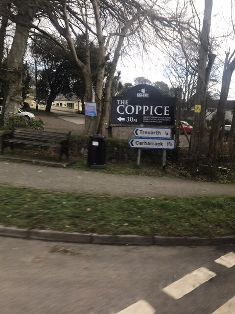
Carharrack

Carharrack (Cornish: Karardhek) is a civil parish and village in west Cornwall, England, United Kingdom. It is situated two miles (3 km) east of Redruth...

Consolidated Mines

Consolidated Mines, also known as Great Consolidated mine, but most commonly called Consols or Great Consols was a metalliferous mine about a mile ESE...

Nearby Amenities

Located within 500m of 50.217025,-5.171464
Gwennap
Is In: Cornwall, England, UK
Is In Country: England
Is In Country Code: GB
Is In County: Cornwall
Name Kw: Lannwenep
Place: village
Source: npe
Lat/Long: 50.2180351/-5.171
Comford
Is In: Cornwall, England, UK
Is In Country: England
Is In Country Code: GB
Is In County: Cornwall
Place: village
Source: NPE
Wikidata: Q5151661
Lat/Long: 50.2151962/-5.1772144
Bus Stop
Gwennap Church
Naptan AtcoCode: 0800COD41023
Naptan Bearing: S
Naptan CommonName: Gwennap Church
Naptan NaptanCode: corapgpj
Naptan Street: Unclassified
Naptan Verified: no
Source: naptan_import
Lat/Long: 50.2180373/-5.172454
Bus Stop
Fox and Hounds
Naptan AtcoCode: 0800FWX38694
Naptan Bearing: NE
Naptan CommonName: Fox and Hounds
Naptan NaptanCode: corapgdw
Naptan Street: A393
Naptan Verified: no
Source: naptan_import
Lat/Long: 50.2154394/-5.1773148
Bus Stop
Fox and Hounds
Naptan AtcoCode: 0800FWZ38518
Naptan Bearing: NE
Naptan CommonName: Fox and Hounds
Naptan NaptanCode: corapgja
Naptan Street: A393
Naptan Verified: no
Source: naptan_import
Lat/Long: 50.2154803/-5.1771352
Pub
Fox and Hounds
Addr City: Redruth
Addr Country: GB
Addr Hamlet: Lanner
Addr Housename: The Fox And Hounds Inn
Addr Place: Comford
Addr Postcode: TR16 6AX
Cuisine: local
Fhrs Id: 1021082
Internet Access: wlan
Operator: St. Austell Brewery
Phone: +44 1209 820251
Source Addr: FHRS Open Data
Website: https://www.staustellbrewery.co.uk/pub/lanner/fox--hounds
Wikidata: Q26433667
Lat/Long: 50.2154699/-5.1769414
Generator Method: photovoltaic
Generator Output Electricity: yes
Generator Source: solar
Generator Type: solar_photovoltaic_panel
Power: generator
Lat/Long: 50.217631/-5.1716742
Generator Method: photovoltaic
Generator Output Electricity: small_installation
Generator Source: solar
Generator Type: solar_photovoltaic_panel
Location: roof
Power: generator
Source: bing
Lat/Long: 50.2174033/-5.1731819
Generator Method: photovoltaic
Generator Output Electricity: small_installation
Generator Source: solar
Generator Type: solar_photovoltaic_panel
Location: roof
Power: generator
Source: bing
Lat/Long: 50.2175045/-5.1730987
Power: pole
Lat/Long: 50.2131664/-5.1734555
Power: pole
Lat/Long: 50.2139088/-5.1719762
Power: pole
Lat/Long: 50.2146271/-5.1705882
Power: pole
Lat/Long: 50.2152278/-5.1693919
Power: pole
Lat/Long: 50.2156981/-5.1684853
Power: pole
Lat/Long: 50.2167142/-5.1664455
Power: pole
Lat/Long: 50.2170737/-5.1657361
Power: pole
Lat/Long: 50.2175878/-5.1647115
Public Bookcase
Gwennap Book Exchange
Booth: K6
Disused Amenity: telephone
Man Made: telephone_box
Public Bookcase Type: phone_box
Wikimedia Commons: File:Gwennap - Post Box and Telephone Box.jpg
Lat/Long: 50.217363/-5.1717361
Post Box
Brand: Royal Mail
Brand Wikidata: Q638098
Collection Times: Mo-Fr 16:30; Sa 11:15; Su off
Drive Through: no
Operator: Royal Mail
Operator Wikidata: Q638098
Post Box Design: 2010_pattern
Post Box Mounting: pier
Post Box Type: lamp
Ref: TR16 44
Royal Cypher: EIIR
Royal Cypher Wikidata: Q33102113
Source: survey;streetlevel imagery;aerial imagery
Lat/Long: 50.217336/-5.171709
The data included in this document is from www.openstreetmap.org. The data is made available under ODbL.

Have you been to Gwennap?

Leave your review of Gwennap below (or comments, questions and feedback).