Beara Down
Downs, Moorland in Devon West Devon
England
Beara Down

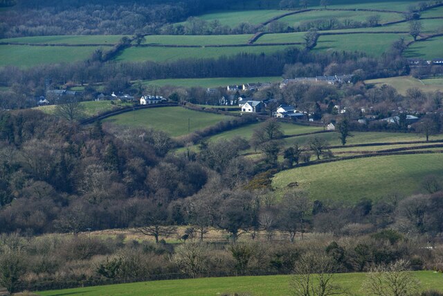
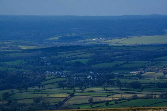
Beara Down is a picturesque area located in Devon, England. It is characterized by its rolling hills, vast moorlands, and stunning landscapes that attract nature enthusiasts and hikers alike. Situated within the Dartmoor National Park, Beara Down offers visitors a unique opportunity to explore the beauty of the region.
Covering an area of approximately 8 square miles, Beara Down is known for its diverse wildlife and rich biodiversity. It is home to a wide array of flora and fauna, including heather, gorse, and a variety of bird species such as skylarks and stonechats. The area also boasts a number of ancient archaeological sites, including Bronze Age burial mounds and stone circles, which add to its historical significance.
The landscape of Beara Down is dominated by rolling hills and open moorland, providing stunning panoramic views of the surrounding countryside. It is a popular destination for hikers and walkers, with a network of well-maintained footpaths and trails that allow visitors to explore the area at their own pace. The challenging terrain also attracts mountain bikers and horse riders, who can enjoy the thrill of navigating through the rugged landscapes.
In addition to its natural beauty, Beara Down offers a tranquil and peaceful atmosphere, making it an ideal spot for those seeking an escape from the hustle and bustle of city life. The area is dotted with quaint villages and charming country pubs, where visitors can relax and enjoy traditional Devonshire hospitality.
Overall, Beara Down, Devon, is a stunning and diverse area that offers a unique blend of natural beauty, historical significance, and outdoor activities. It is a must-visit destination for nature lovers and adventurers looking to experience the best that Devon has to offer.
If you have any feedback on the listing, please let us know in the comments section below.
Beara Down Images
Images are sourced within 2km of 50.669061/-4.1100841 or Grid Reference SX5087. Thanks to Geograph Open Source API. All images are credited.


Beara Down is located at Grid Ref: SX5087 (Lat: 50.669061, Lng: -4.1100841)
Administrative County: Devon
District: West Devon
Police Authority: Devon and Cornwall
What 3 Words
///corrosive.eased.move. Near Okehampton, Devon
Nearby Locations
Related Wikis

Bridestowe railway station
Bridestowe railway station served the 2 miles or so distant village of Bridestowe in West Devon, England, located outside Okehampton on the edge of Dartmoor...

Burley Wood
Burley Wood is the site of an Iron Age hill fort north of Lydford in Devon, England. The fort occupies much of a hilltop some 220 metres above sea level...

Great Bidlake Manor
Great Bidlake Manor is a Grade II* listed manor house in the parish of Bridestowe on the north western edge of Dartmoor in the county of Devon, England...
Bridestowe
Bridestowe () is a civil parish and village in the district of West Devon, Devon, England. The parish is surrounded clockwise from the north by the parishes...
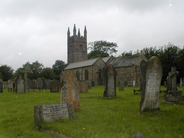
St Bridget's Church, Bridestowe
St Bridget's Church in Bridestowe, Devon, is a parish church in the Church of England and one of the central buildings in the rural area on the northwestern...

Lydford
Lydford, sometimes spelled Lidford, is a village, once an important town, in Devon, seven miles (11 km) north of Tavistock on the western fringe of Dartmoor...

Lydford Castle
Lydford Castle is a medieval castle in the town of Lydford, Devon, England. The first castle in Lydford, sometimes termed the Norman fort, was a small...

Combebow
Combebow is a small settlement in Devon, England. It is situated by the River Lew. == External links == Media related to Combebow at Wikimedia Commons...
Nearby Amenities
Located within 500m of 50.669061,-4.1100841Have you been to Beara Down?
Leave your review of Beara Down below (or comments, questions and feedback).