Bovisand Park

Downs, Moorland in Devon South Hams

England

Bovisand Park

Beacon near the South West Coast Path between Bovisand and Heybrook Bay The Plymouth Breakwater can just be made out in the background to the left.
Beacon near the South West Coast Path between Bovisand and Heybrook Bay Credit: Ruth Sharville

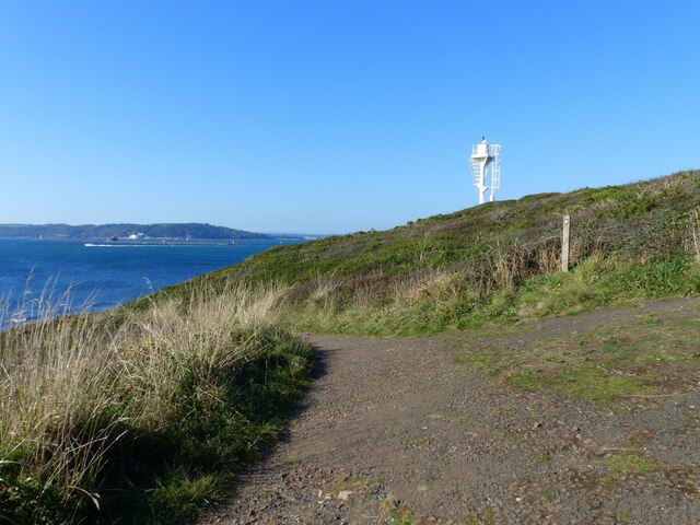
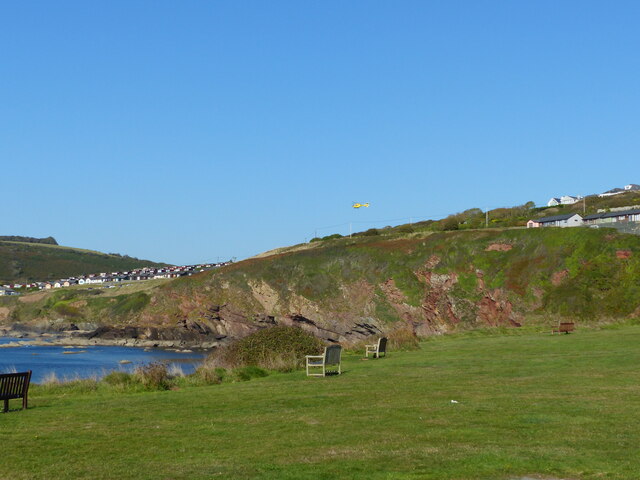
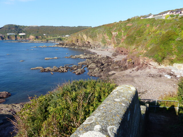
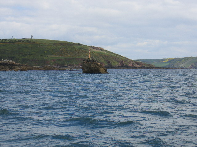
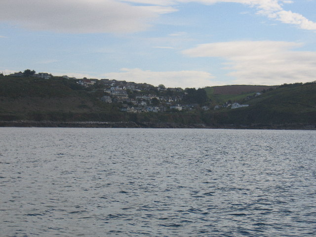
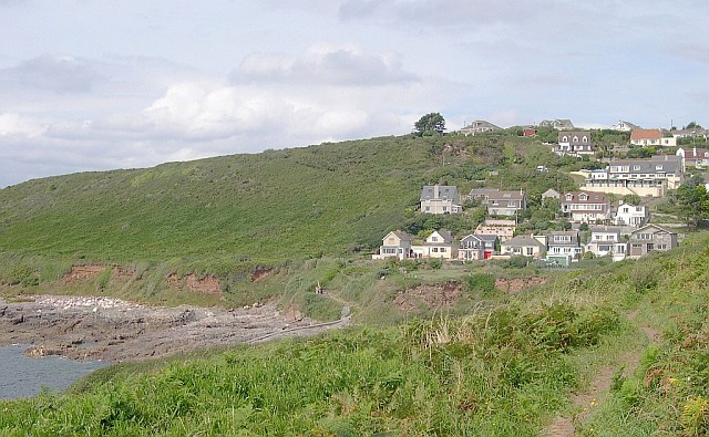
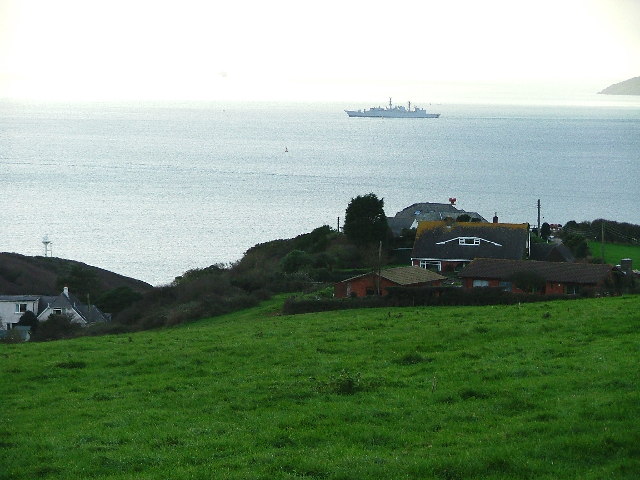
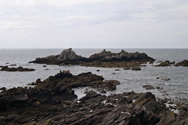
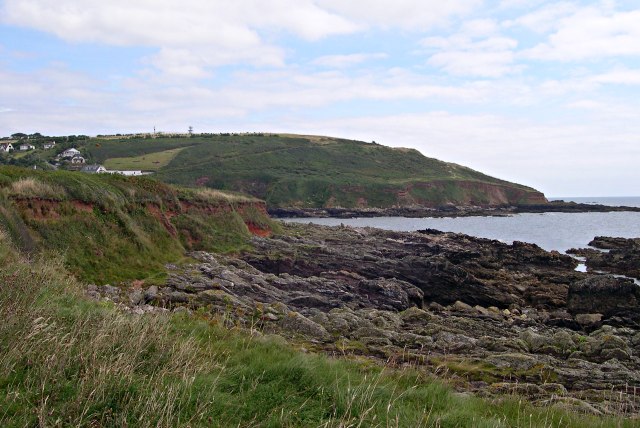
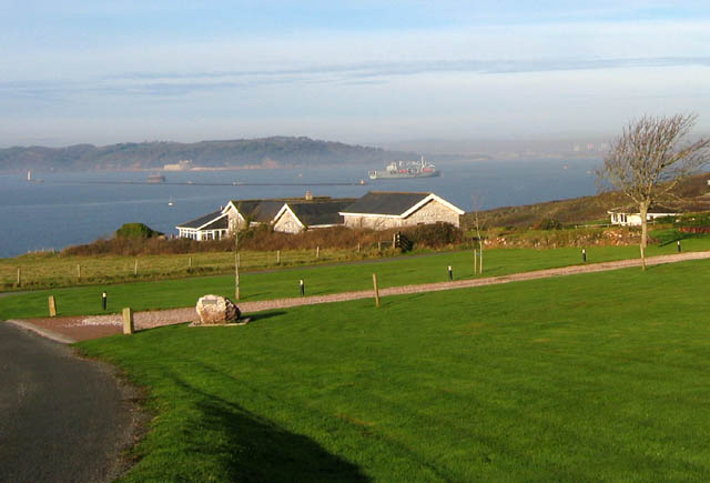
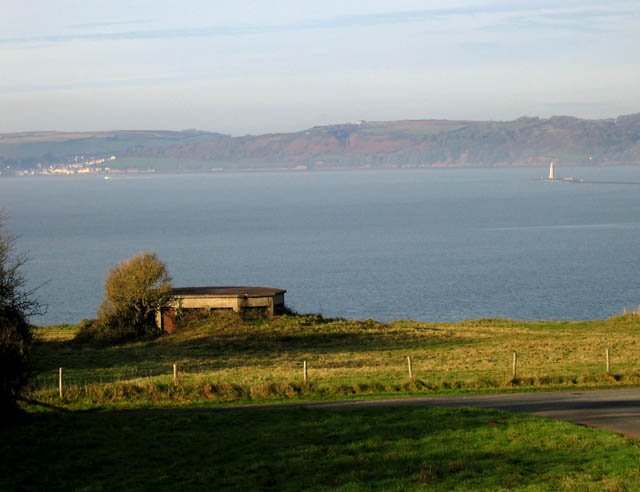
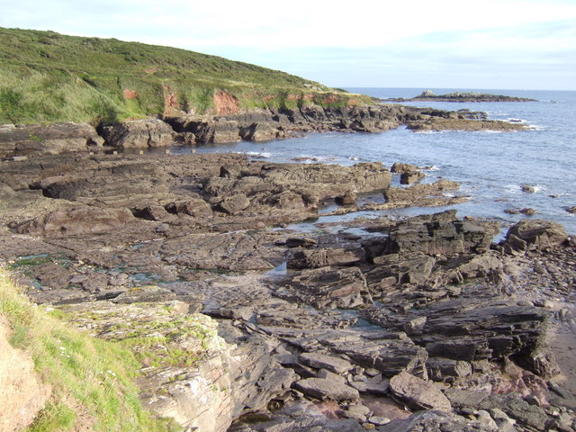
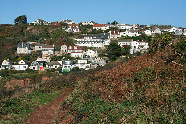
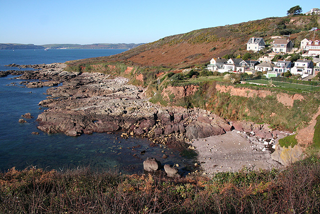
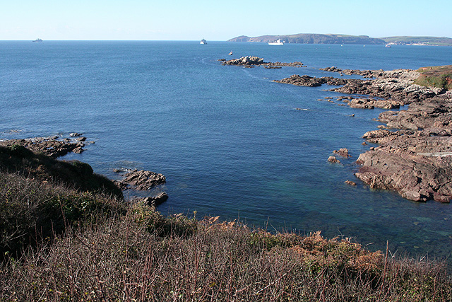
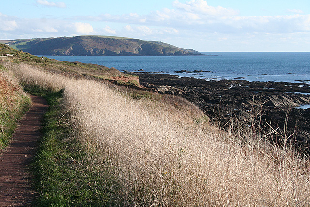
Bovisand Park is a stunning coastal area located in Devon, England. Situated on the South Devon coastline, it is renowned for its breathtaking views, beautiful beaches, and diverse natural landscapes. The park encompasses both downs and moorland, providing a diverse range of habitats for various flora and fauna.

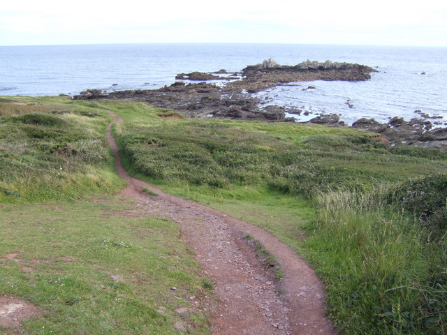
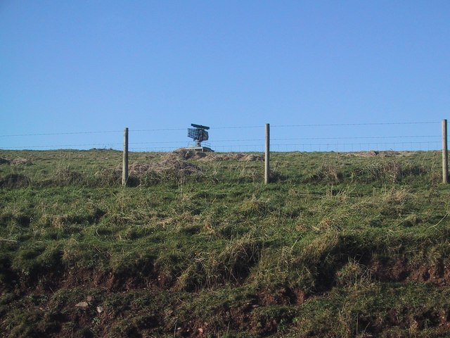
The downs in Bovisand Park offer picturesque grassy slopes that gently roll down towards the coastline. These downs, characterized by their rich greenery and panoramic views, are ideal for leisurely walks, picnics, and enjoying the serenity of nature. Visitors can take in the sweeping vistas of the English Channel and the surrounding countryside from these elevated vantage points.

In contrast, the moorland section of Bovisand Park offers a different experience. The rugged terrain, interspersed with heather, gorse, and bracken, creates a wild and untamed atmosphere. This part of the park is perfect for those seeking a more adventurous outing, with opportunities for hiking and exploring.

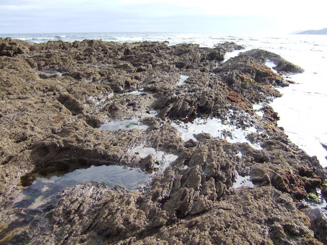
The park's highlight is undoubtedly its stunning sandy beach. The soft golden sand stretches for miles, offering ample space for sunbathing, sandcastle building, and beach games. The clear, azure waters of the English Channel are inviting for swimming, paddleboarding, and other water activities.

Bovisand Park is a popular destination for locals and tourists alike, with its natural beauty and tranquil ambiance. Whether visitors are seeking relaxation, outdoor adventures, or simply enjoying the scenic surroundings, Bovisand Park provides an idyllic setting for all.

If you have any feedback on the listing, please let us know in the comments section below.

Bovisand Park Images

Images are sourced within 2km of 50.328704/-4.1165058 or Grid Reference SX4949. Thanks to Geograph Open Source API. All images are credited.

Beacon near the South West Coast Path between Bovisand and Heybrook Bay The Plymouth Breakwater can just be made out in the background to the left.
Beacon near the South West Coast Path between Bovisand and Heybrook Bay
The Plymouth Breakwater can just be made out in the background to the left.
Grassy area - and occasional car park - Bovisand Bay You can just make out the yellow helicopter in the centre of the photo.  It belongs to the Electricity board - see <a href="https://www.geograph.org.uk/photo/7118177">SX4950 : Zoom shot of Electricity Board helicopter over chalets at Bovisand</a>.
Grassy area - and occasional car park - Bovisand Bay
You can just make out the yellow helicopter in the centre of the photo. It belongs to the Electricity board - see SX4950 : Zoom shot of Electricity Board helicopter over chalets at Bovisand.
Crownhill  Bay, Bovisand - south end, from the access steps
Crownhill Bay, Bovisand - south end, from the access steps
Shag Stone This rock, near the Eastern entrance to Plymouth Sound, is one of several along the coastline with the same name. The rock is a popular spot with the local Cormorant population.
Shag Stone
This rock, near the Eastern entrance to Plymouth Sound, is one of several along the coastline with the same name. The rock is a popular spot with the local Cormorant population.
Heybrook Bay The settlement at Heybrook Bay, adjacent to Wembury Point
Heybrook Bay
The settlement at Heybrook Bay, adjacent to Wembury Point
Heybrook Bay This is not a tourist spot.  There is no beach, just rocks and a warning sign in the village advises you not to eat any shellfish you might find.
Heybrook Bay
This is not a tourist spot. There is no beach, just rocks and a warning sign in the village advises you not to eat any shellfish you might find.
Manor Bourne, Andurn Brake Looking down on  Manor Bourne and over Andurn Brake from the arable fields that descend from Down Thomas to the coast. This image showing a Royal Navy frigate shortly after its sailing out from Plymouth Sound.
Manor Bourne, Andurn Brake
Looking down on Manor Bourne and over Andurn Brake from the arable fields that descend from Down Thomas to the coast. This image showing a Royal Navy frigate shortly after its sailing out from Plymouth Sound.
Renney Rocks This is a rocky promontory on the western side of Heybrook Bay seen at mid-tide.  At low tide a wide area of rocks are exposed, at high tide just a few limestone crags.
Renney Rocks
This is a rocky promontory on the western side of Heybrook Bay seen at mid-tide. At low tide a wide area of rocks are exposed, at high tide just a few limestone crags.
Across Heybrook Bay The wave-cut platform in the foreground is a raised beach which stands roughly at the current high tide mark. Behind it the low cliffs are made of glacial "head", an unconsolidated deposit formed in periglacial times.
Across Heybrook Bay
The wave-cut platform in the foreground is a raised beach which stands roughly at the current high tide mark. Behind it the low cliffs are made of glacial "head", an unconsolidated deposit formed in periglacial times.
Renney Road looking towards Plymouth Breakwater This is the site of Fort Renney which was a Gunnery Battery protecting Plymouth Sound.
Renney Road looking towards Plymouth Breakwater
This is the site of Fort Renney which was a Gunnery Battery protecting Plymouth Sound.
Old Fort Renney looking towards Cawsand The building in the foreground is part of the old gunnery battery which overlooks Heybrook Bay.
Old Fort Renney looking towards Cawsand
The building in the foreground is part of the old gunnery battery which overlooks Heybrook Bay.
Andurn Point At a fairly low tide the rocks stretch out like a fist into the approaches to Plymouth Sound. Rame Head is just visible in the west.
Andurn Point
At a fairly low tide the rocks stretch out like a fist into the approaches to Plymouth Sound. Rame Head is just visible in the west.
View south across Westlake Bay Renney Rocks are sticking out beyond the point at the southern end of this small bay.
View south across Westlake Bay
Renney Rocks are sticking out beyond the point at the southern end of this small bay.
Renney Rocks Viewed from the South West Coastal Path LDF. This is at low tide, the rocks becoming an island at mean high tide.
Renney Rocks
Viewed from the South West Coastal Path LDF. This is at low tide, the rocks becoming an island at mean high tide.
Wembury: approaching Heybrook Bay On the South West Coast Path. The large building, centre, with the terrace, dark roof and car park up on the left, is the Eddystone Inn, with two restaurants and a bar providing good views out to sea
Wembury: approaching Heybrook Bay
On the South West Coast Path. The large building, centre, with the terrace, dark roof and car park up on the left, is the Eddystone Inn, with two restaurants and a bar providing good views out to sea
Wembury: coast at Heybrook Bay Looking towards Cawsand Bay with the neighbouring Cornish villages of Cawsand and Kingsand across the water, in the distance
Wembury: coast at Heybrook Bay
Looking towards Cawsand Bay with the neighbouring Cornish villages of Cawsand and Kingsand across the water, in the distance
Wembury: towards Rame Head A coastal view with three Royal Navy vessels visible: the amphibious assault ship HMS Albion in the Channel, left, and two Royal Fleet Auxiliary Bay Class landing vessels closer inshore. Rame Head is in Cornwall and is crowned with a small chapel. In the distance, on the right, are the neighbouring villages of Cawsand and Kingsand
Wembury: towards Rame Head
A coastal view with three Royal Navy vessels visible: the amphibious assault ship HMS Albion in the Channel, left, and two Royal Fleet Auxiliary Bay Class landing vessels closer inshore. Rame Head is in Cornwall and is crowned with a small chapel. In the distance, on the right, are the neighbouring villages of Cawsand and Kingsand
Wembury: towards Wembury Bay On the South West Coast Path looking towards the land mass on the far side of the mouth of the river Yealm including Mouthstone Point, Noss Mayo
Wembury: towards Wembury Bay
On the South West Coast Path looking towards the land mass on the far side of the mouth of the river Yealm including Mouthstone Point, Noss Mayo
Show me another place!

Bovisand Park is located at Grid Ref: SX4949 (Lat: 50.328704, Lng: -4.1165058)

Administrative County: Devon

District: South Hams

Police Authority: Devon and Cornwall

What 3 Words

///goofy.going.senders. Near Wembury, Devon

Related Wikis

Watch House Battery

Watch House Battery is a former 19th-century gun battery, built as one of a number of batteries to defend the Eastern approaches to Plymouth Sound, for...

Lentney Battery

Lentney Battery is a former 20th-century gun battery, built in 1905 as one of three 6-inch gun batteries to defend the Eastern approaches to Plymouth Sound...

Bovisand

Bovisand is a natural coastline on the east side of Plymouth Sound in Devon, England. Despite the steep cliff paths and rocky surrounding, Bovisand features...

Down Thomas

Down Thomas is a village in Devon, England. The village is situated about 4 miles south of Plymouth. It is on the Wembury peninsula and is surrounded by...
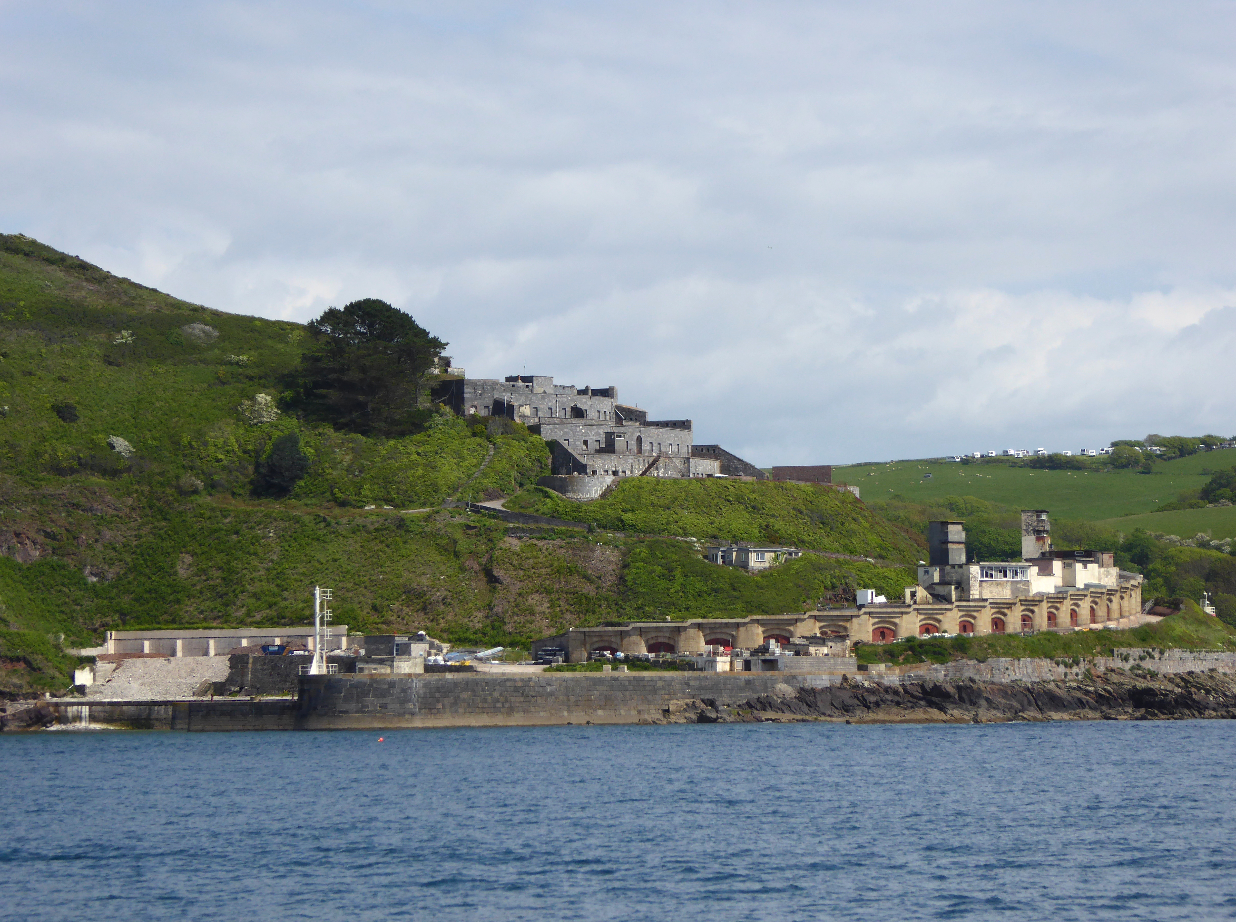
Fort Bovisand

Fort Bovisand is a fort in Devon, England near the beach of Bovisand. It was built as a result of the Royal Commission on the Defence of the United Kingdom...

Frobisher Battery

Frobisher Battery is a former gun battery at Staddon Heights, Plymouth, Devon. The original battery at the site, Twelve Acre Brake Battery, was completed...

HMS Cambridge (shore establishment)

HMS Cambridge was a Royal Navy shore establishment south of Plymouth UK, commissioned between 1956 and 2001. Formerly named HM Gunnery School, Devonport...

Brownhill Battery

Brownhill Battery is a former gun battery at Staddon Heights, Plymouth, Devon. It was one of a number of Plymouth fortifications to be recommended by the...

Nearby Amenities

Located within 500m of 50.328704,-4.1165058
Source: PGS
Lat/Long: 50.3312413/-4.1199524
Seamark Information: Auxiliary light Q.Y.Shown 24 hours.
Seamark Light 1 Character: Oc
Seamark Light 1 Colour: white
Seamark Light 1 Group: 2
Seamark Light 1 Height: 29
Seamark Light 1 Period: 10
Seamark Light 1 Range: 8
Seamark Light 1 Sector End: 139.5
Seamark Light 1 Sector Start: 137.5
Seamark Light 2 Character: Oc
Seamark Light 2 Colour: red
Seamark Light 2 Group: 2
Seamark Light 2 Height: 29
Seamark Light 2 Period: 10
Seamark Light 2 Range: 6
Seamark Light 2 Sector End: 159
Seamark Light 2 Sector Start: 139.5
Seamark Light 3 Character: Oc
Seamark Light 3 Colour: green
Seamark Light 3 Group: 2
Seamark Light 3 Height: 29
Seamark Light 3 Period: 10
Seamark Light 3 Range: 6
Seamark Light 3 Sector End: 137.5
Seamark Light 3 Sector Start: 0
Seamark Light Reference: A 0111.2
Seamark Type: light_minor
Source: US NGA Pub. 114. 2011-05-26.
Lat/Long: 50.3255667/-4.1211667
Source: PGS
Lat/Long: 50.3312091/-4.1197704
Toilets
Lat/Long: 50.3283695/-4.1199611
Bench
Backrest: yes
Mapillary: 848320009131676
Source Position: Mapillary 2021-06-12
Survey Date: 2021-06-12
Lat/Long: 50.3312917/-4.1184292
Bench
Mapillary: 214979310472807
Source Position: Mapillary 2021-06-12
Survey Date: 2021-06-12
Lat/Long: 50.32836/-4.120292
Bench
Mapillary: 226434409303972
Source Position: Mapillary 2021-06-12
Survey Date: 2021-06-12
Lat/Long: 50.3281412/-4.1214959
Direction: SSE
Generator Method: photovoltaic
Generator Output Electricity: yes
Generator Solar Modules: 7
Generator Source: solar
Generator Type: solar_photovoltaic_panel
Location: roof
Power: generator
Lat/Long: 50.3298708/-4.1166531
Direction: SSE
Generator Method: photovoltaic
Generator Output Electricity: yes
Generator Solar Modules: 10
Generator Source: solar
Generator Type: solar_photovoltaic_panel
Location: roof
Power: generator
Lat/Long: 50.3296391/-4.1165854
Direction: 175
Generator Method: photovoltaic
Generator Output Electricity: yes
Generator Solar Modules: 10
Generator Source: solar
Generator Type: solar_photovoltaic_panel
Location: roof
Power: generator
Lat/Long: 50.3309958/-4.116621
Direction: SSE
Generator Method: photovoltaic
Generator Output Electricity: yes
Generator Solar Modules: 7
Generator Source: solar
Generator Type: solar_photovoltaic_panel
Location: roof
Power: generator
Lat/Long: 50.3298459/-4.1166373
Direction: 175
Generator Method: photovoltaic
Generator Output Electricity: yes
Generator Solar Modules: 16
Generator Source: solar
Generator Type: solar_photovoltaic_panel
Location: roof
Power: generator
Lat/Long: 50.3305431/-4.1167705
Direction: 175
Generator Method: photovoltaic
Generator Output Electricity: yes
Generator Solar Modules: 4
Generator Source: solar
Generator Type: solar_photovoltaic_panel
Location: roof
Power: generator
Lat/Long: 50.3309018/-4.1169173
Direction: 175
Generator Method: photovoltaic
Generator Output Electricity: yes
Generator Solar Modules: 8
Generator Source: solar
Generator Type: solar_photovoltaic_panel
Location: roof
Power: generator
Lat/Long: 50.3309315/-4.1166137
Direction: 175
Generator Method: photovoltaic
Generator Output Electricity: yes
Generator Solar Modules: 8
Generator Source: solar
Generator Type: solar_photovoltaic_panel
Location: roof
Power: generator
Lat/Long: 50.3309856/-4.1169046
Direction: 175
Generator Method: photovoltaic
Generator Output Electricity: yes
Generator Solar Modules: 4
Generator Source: solar
Generator Type: solar_photovoltaic_panel
Location: roof
Power: generator
Lat/Long: 50.3309077/-4.1168042
Turning Circle
Lat/Long: 50.3282373/-4.1211053
Bench
Lat/Long: 50.328688/-4.1203765
Bench
Lat/Long: 50.3286671/-4.1205667
Bench
Mapillary: 971771516918528
Source Position: Mapillary 2021-06-12
Survey Date: 2021-06-12
Lat/Long: 50.3284879/-4.1209838
Bench
Backrest: yes
Mapillary: 964535584397903
Source Position: Mapillary 2021-06-12
Survey Date: 2021-12-11
Lat/Long: 50.3310483/-4.1183861
Bench
Backrest: yes
Mapillary: 515794176525519
Source Position: Mapillary 2021-06-12
Survey Date: 2021-12-11
Lat/Long: 50.3309003/-4.1183049
Bench
Backrest: yes
Survey Date: 2021-12-11
Lat/Long: 50.330684/-4.118197
Waste Basket
Survey Date: 2021-12-11
Waste: dog_excrement
Lat/Long: 50.331942/-4.1185263
Bench
Backrest: yes
Mapillary: 967938374005186
Source Position: Mapillary 2021-06-12
Survey Date: 2021-12-11
Lat/Long: 50.3307823/-4.1182681
Bench
Mapillary: 1641462849378487
Source Position: Mapillary 2021-06-12
Survey Date: 2021-12-11
Lat/Long: 50.328658/-4.1191533
Waste Basket
Survey Date: 2021-12-11
Waste: dog_excrement
Lat/Long: 50.3285255/-4.119867
Waste Basket
Survey Date: 2021-12-11
Waste: dog_excrement
Lat/Long: 50.3282284/-4.121317
Bench
Backrest: yes
Mapillary: 934555593787651
Source Position: Mapillary 2021-06-12
Survey Date: 2021-12-11
Lat/Long: 50.3305648/-4.1182187
Waste Basket
Survey Date: 2021-12-11
Waste: dog_excrement
Lat/Long: 50.3305501/-4.1183497
Waste Basket
Survey Date: 2021-12-11
Waste: dog_excrement
Lat/Long: 50.3290089/-4.1186734
Bench
Mapillary: 185288346860559
Source Position: Mapillary 2021-06-12
Survey Date: 2021-12-11
Lat/Long: 50.3283421/-4.1213059
Fire Hydrant
Emergency: fire_hydrant
Fire Hydrant Diameter: 75
Fire Hydrant Position: lane
Fire Hydrant Type: underground
Survey Date: 2022-04-20
Lat/Long: 50.3284145/-4.1142423
Post Box
Collection Times: Mo-Fr 09:00; Sa 07:00
Ref: PL9 756D
Royal Cypher: EIIR
Royal Cypher Wikidata: Q33102113
Survey Date: 2022-04-20
Lat/Long: 50.3284002/-4.1142844
Fire Hydrant
Emergency: fire_hydrant
Fire Hydrant Diameter: 3"
Fire Hydrant Type: underground
Survey Date: 2022-04-20
Lat/Long: 50.3298307/-4.1183426
Addr Housename: Blue Haze
Lat/Long: 50.3309455/-4.1166318
Addr Housename: Dockan
Lat/Long: 50.3308202/-4.1167701
Addr Housename: Amidships
Lat/Long: 50.3307276/-4.1168051
Addr Housename: Horizons
Lat/Long: 50.3306551/-4.1167701
Addr Housename: Bluewaters
Lat/Long: 50.3305631/-4.1167564
Addr Housename: Swiss Cottage
Lat/Long: 50.3303745/-4.1167974
Addr Housename: Seabreakers
Lat/Long: 50.3301871/-4.1167872
Addr Housename: Inveresk
Lat/Long: 50.3300662/-4.1167214
Addr Housename: Channel View
Lat/Long: 50.3299103/-4.1166856
Addr Housename: Crownhill Bay House
Lat/Long: 50.3296924/-4.1166028
Addr Housename: Sea Cot
Lat/Long: 50.3300804/-4.1174892
Addr Housename: Cliff Cot
Lat/Long: 50.3299763/-4.1174697
The data included in this document is from www.openstreetmap.org. The data is made available under ODbL.

Have you been to Bovisand Park?

Leave your review of Bovisand Park below (or comments, questions and feedback).