Bad Donn

Downs, Moorland in Perthshire

Scotland

Bad Donn

Glen Lyon Looking east across along Glen Lyon at Pubil, Aberfeldy near the head of Loch Lyon
Within walking distance of Pubil there are five Munros with an additional 20 or so that can be reached with a short drive or cycle.
Glen Lyon Credit: I Love Colour

Bad Donn, located in Perthshire, is a region characterized by its downs and moorland landscapes. Situated in the heart of Scotland, Bad Donn is known for its stunning natural beauty and rugged terrain.

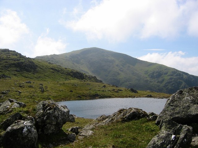
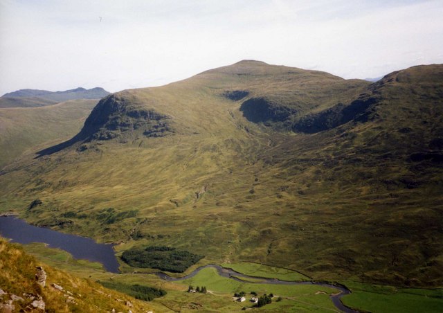
The downs of Bad Donn offer vast expanses of rolling hills and open grasslands, creating a picturesque setting. These downs are often covered in heather and other native vegetation, providing a vibrant and colorful scenery. Visitors to Bad Donn can enjoy long walks or hikes in this serene environment, surrounded by breathtaking views of the surrounding countryside.

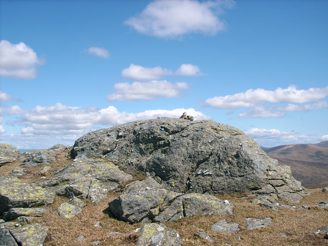
The moorland in Bad Donn is equally captivating, with its vast stretches of wild and untouched land. Moorland areas are typically characterized by their wet and boggy nature, offering a unique habitat for various plant and animal species. The moorland in Bad Donn is home to a diverse range of flora and fauna, including heather, mosses, and various bird species.

In addition to its natural beauty, Bad Donn offers numerous outdoor recreational activities. The vast downs and moorland provide ample opportunities for activities such as hiking, birdwatching, and nature photography. The region's remote and tranquil nature makes it an ideal destination for those seeking solitude and a chance to reconnect with nature.

Overall, Bad Donn in Perthshire is a remarkable region, offering breathtaking downs and moorland landscapes. Its untouched beauty and diverse wildlife make it a must-visit destination for nature lovers and outdoor enthusiasts.

If you have any feedback on the listing, please let us know in the comments section below.

Bad Donn Images

Images are sourced within 2km of 56.528286/-4.5081027 or Grid Reference NN4540. Thanks to Geograph Open Source API. All images are credited.

Glen Lyon Looking east across along Glen Lyon at Pubil, Aberfeldy near the head of Loch Lyon
Within walking distance of Pubil there are five Munros with an additional 20 or so that can be reached with a short drive or cycle.
Glen Lyon
Looking east across along Glen Lyon at Pubil, Aberfeldy near the head of Loch Lyon Within walking distance of Pubil there are five Munros with an additional 20 or so that can be reached with a short drive or cycle.
Pubil, Glen Lyon Looking east across along Glen Lyon at Pubil, Aberfeldy near the head of Loch Lyon
Within walking distance of Pubil there are five Munros with an additional 20 or so that can be reached with a short drive or cycle
Pubil, Glen Lyon
Looking east across along Glen Lyon at Pubil, Aberfeldy near the head of Loch Lyon Within walking distance of Pubil there are five Munros with an additional 20 or so that can be reached with a short drive or cycle
Glen Lyon, Pubil Hamlet Pubil hamlet at the western end of Glen Lyon, near the head of Loch Lyon
Glen Lyon, Pubil Hamlet
Pubil hamlet at the western end of Glen Lyon, near the head of Loch Lyon
Burn on hillside below Creag a' Chaorainn
Hillside of Meall nan Subh towards Allt Rioran
Peaty ridge, Meall nan Subh The ridge lies SE-NW with a number of cairns, small tops and lochans. The hill in view is the Munro Meall Ghaordaidh (1039m).
Peaty ridge, Meall nan Subh
The ridge lies SE-NW with a number of cairns, small tops and lochans. The hill in view is the Munro Meall Ghaordaidh (1039m).
Cairn on Meall nan Subh One of several cairns on this ridge, looking west towards Beinn Sheasgarnaich.
Cairn on Meall nan Subh
One of several cairns on this ridge, looking west towards Beinn Sheasgarnaich.
Concrete block cairn, Meall nan Subh Marked as 'concrete block' on the 1:25,000 map, the cairn is on one of the bumps on the ridge and is built from blocks with a metal tube embedded vertically. I can only conjecture that it was a survey point for the hydroelectric works here dating from 1961 or earlier.
Concrete block cairn, Meall nan Subh
Marked as 'concrete block' on the 1:25,000 map, the cairn is on one of the bumps on the ridge and is built from blocks with a metal tube embedded vertically. I can only conjecture that it was a survey point for the hydroelectric works here dating from 1961 or earlier.
Lochans on Meall nan Subh Beinn Sheasgarnaich is on the western skyline.
Lochans on Meall nan Subh
Beinn Sheasgarnaich is on the western skyline.
Summit ridge, Meall nan Subh The summit of the 'hill of the raspberries' (806m) lies at the high point R of centre.
Summit ridge, Meall nan Subh
The summit of the 'hill of the raspberries' (806m) lies at the high point R of centre.
Slopes rising to Meall nan Sùbh The approach to Meall nan Sùbh from the south-west.
The knoll at the centre of the image is not the mountain summit but is a slightly lower top at 795 m.; the actual summit lies beyond that, across a level area before the final rise to 806 m..
(From a copied, Fujichrome transparency.)
Slopes rising to Meall nan Sùbh
The approach to Meall nan Sùbh from the south-west. The knoll at the centre of the image is not the mountain summit but is a slightly lower top at 795 m.; the actual summit lies beyond that, across a level area before the final rise to 806 m.. (From a copied, Fujichrome transparency.)
Moorland in vicinity of Creag na h-Iolaire Creag na h-Iolaire is a minor feature of the western side of the Corbett, Meall nan Sùbh, which is behind the camera position.
Beinn Sheasgarnaich is the snowed peak, lying to the west.
Moorland in vicinity of Creag na h-Iolaire
Creag na h-Iolaire is a minor feature of the western side of the Corbett, Meall nan Sùbh, which is behind the camera position. Beinn Sheasgarnaich is the snowed peak, lying to the west.
Pile of stones on hillside below Creag na h-Iolaire One of many piles of stones along the regional boundary
Pile of stones on hillside below Creag na h-Iolaire
One of many piles of stones along the regional boundary
Hillside below Creag na h-Iolaire toward Allt Làirig nan Lunn
Hillocks on plateau near top of Meall nan Subh
Towards summit of Meall nan Subh
Southern end of Meall nan Subh plateau
Sheep fold on the banks of the Allt Lairig nan Lunn
Show me another place!

Bad Donn is located at Grid Ref: NN4540 (Lat: 56.528286, Lng: -4.5081027)

Unitary Authority: Perth and Kinross

Police Authority: Tayside

What 3 Words

///pizzas.blacken.catch. Near Pubil, Perth & Kinross

Nearby Locations

Bad Donn

Related Wikis

Loch Lyon

Loch Lyon (Scottish Gaelic, Loch Lìobhann) is a freshwater loch in Glen Lyon, located in Perthshire, Scotland, which feeds the River Lyon, a tributary...

Beinn Heasgarnich

Beinn Heasgarnich (Scottish Gaelic: Beinn Sheasgarnaich) is a mountain in the Breadalbane region of the Scottish Highlands. It lies about 2 km south of...

Stuchd an Lochain

Stuchd an Lochain (Scottish Gaelic: Stùc an Lochain, 'peak of the little lake') is a mountain in the Breadalbane region of the southern Scottish Highlands...

Meall Ghaordaidh

Meall Ghaordaidh is a mountain in the Southern Highlands of Scotland, approximately 10 km north-west of Killin. The mountain can be ascended via Glen Lochay...

Meall Buidhe (Corbett)

Meall Buidhe is a Corbett situated in the southern highlands of Scotland. It forms part of the ridge line separating Glen Daimh, an offshoot of Glen Lyon...

Beinn Mhanach

Beinn Mhanach (Scottish Gaelic for 'monks' mountain'), also anglicized Ben Vannoch, is a mountain in the Breadalbane region of the Scottish Highlands....

Creag Mhòr

Creag Mhòr is a mountain in the Breadalbane region of the Scottish Highlands. It is in the Forest of Mamlorn, ten kilometres northeast of Tyndrum, and...

Beinn nan Oighreag

Beinn nan Oighreag (910 m) is a mountain in the Grampian Mountains of Scotland. It lies between Glen Lyon and Glen Lochay, on the border of Perthshire...

Nearby Amenities

Located within 500m of 56.528286,-4.5081027
Meall nan Sùbh
Corbett: yes
Description: Hill of raspberries
Ele: 806
Graham: no
Marilyn: yes
Munro: no
Natural: peak
Prominence: 214
Wikidata: Q20598674
Lat/Long: 56.5244192/-4.5039723
The data included in this document is from www.openstreetmap.org. The data is made available under ODbL.

Have you been to Bad Donn?

Leave your review of Bad Donn below (or comments, questions and feedback).