South Down

Downs, Moorland in Cornwall

England

South Down

Eastbound A38 near Burraton Blue signs giving advance notice of toll charges on the Tamar Bridge ahead (although traffic will have to negotiate the Saltash Tunnel before reaching the bridge).
Eastbound A38 near Burraton Credit: David Dixon

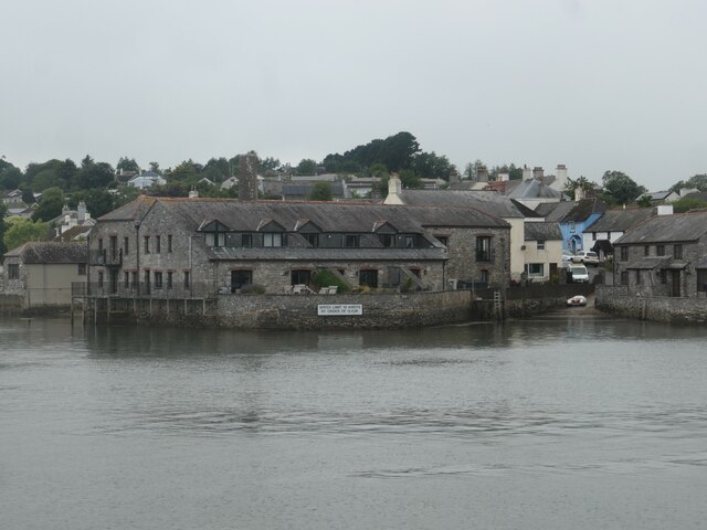
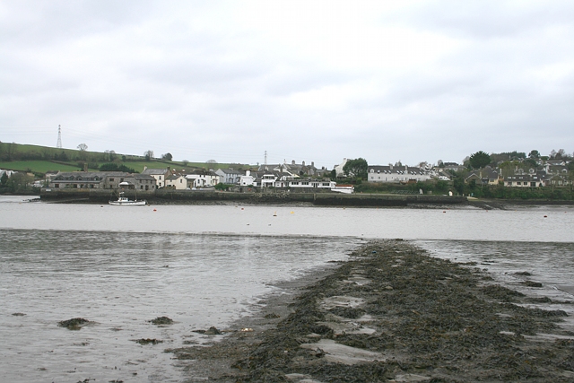
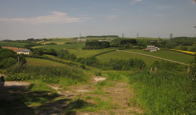
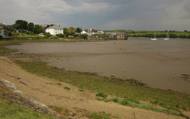
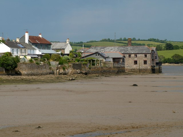
South Down is a picturesque region located in Cornwall, England. It is renowned for its stunning downs and moorland landscapes, which offer visitors a unique and breathtaking experience. The area is characterized by its rolling hills, heather-covered moors, and expansive grasslands, creating a diverse and rich natural environment.

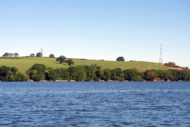
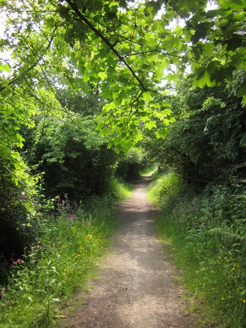
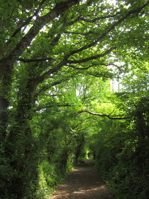
The downs of South Down are a prominent feature, offering visitors panoramic views of the surrounding countryside and the coastline. These hills are covered in lush green grass and are often dotted with grazing livestock, adding to the charm and tranquility of the area. The moorland, on the other hand, displays a rugged beauty with its wild and untamed terrain. Visitors can explore the moors, discovering hidden valleys, ancient stone circles, and remnants of historic settlements.

Wildlife enthusiasts will find South Down to be a haven for various species. The moorland is home to a variety of birds, including buzzards, skylarks, and peregrine falcons, while the downs provide a habitat for rabbits, hares, and even the occasional deer. The flora of South Down is equally diverse, with heather, gorse, and wildflowers adorning the landscape.

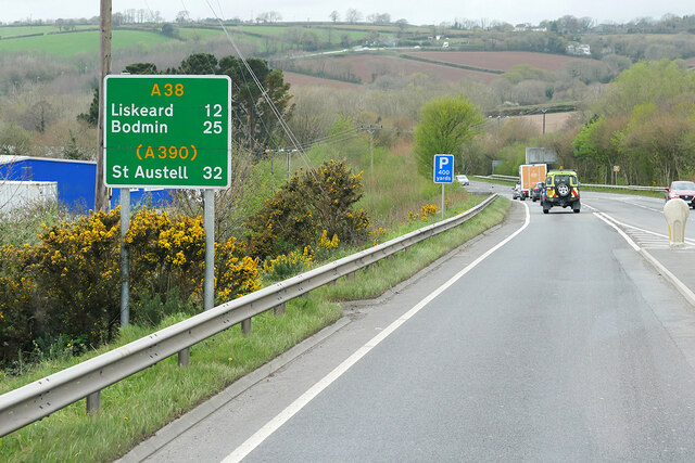
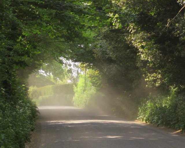
The region offers numerous recreational activities for outdoor enthusiasts. Hiking and walking trails crisscross the area, allowing visitors to explore the downs and moorland at their own pace. Additionally, South Down is a popular spot for birdwatching, photography, and picnicking.

South Down, Cornwall, is a true gem, offering visitors a tranquil escape into nature. With its stunning downs and moorland landscapes, diverse wildlife, and ample recreational opportunities, it is a must-visit destination for those seeking natural beauty and serenity.

If you have any feedback on the listing, please let us know in the comments section below.

South Down Images

Images are sourced within 2km of 50.430095/-4.2217175 or Grid Reference SX4261. Thanks to Geograph Open Source API. All images are credited.

Eastbound A38 near Burraton Blue signs giving advance notice of toll charges on the Tamar Bridge ahead (although traffic will have to negotiate the Saltash Tunnel before reaching the bridge).
Eastbound A38 near Burraton
Blue signs giving advance notice of toll charges on the Tamar Bridge ahead (although traffic will have to negotiate the Saltash Tunnel before reaching the bridge).
Westbound A38 at Carkeel The A38 is a major A-class trunk route. When first designated in 1922, it ran from Derby to Plymouth but it was later extended at both ends so that it now runs for 292 miles from Mansfield in Nottinghamshire to Bodmin in Cornwall.

Prior to the opening of the M5 motorway in the 1960s and 1970s, the A38 formed the main "holiday route" from the Midlands to Somerset, Devon and Cornwall and the south-western section was notorious at holiday times for the congestion. Nowadays, for most of the southern section, the A38 is a fairly quiet road shadowing the M5 extremely closely; often running alongside the motorway as a single carriageway road. The section between Exeter and Plymouth is, however, a busy dual carriageway which serves as the southern extension of the M5 and is known as “the Devon Expressway”.

More information at <span class="nowrap"><a title="http://en.wikipedia.org/wiki/A38_road" rel="nofollow ugc noopener" href="http://en.wikipedia.org/wiki/A38_road">Link</a><img style="margin-left:2px;" alt="External link" title="External link - shift click to open in new window" src="https://s1.geograph.org.uk/img/external.png" width="10" height="10"/></span>  (Wikipedia) and <span class="nowrap"><a title="http://www.sabre-roads.org.uk/wiki/index.php?title=A38" rel="nofollow ugc noopener" href="http://www.sabre-roads.org.uk/wiki/index.php?title=A38">Link</a><img style="margin-left:2px;" alt="External link" title="External link - shift click to open in new window" src="https://s1.geograph.org.uk/img/external.png" width="10" height="10"/></span>  (SABRE).
Westbound A38 at Carkeel
The A38 is a major A-class trunk route. When first designated in 1922, it ran from Derby to Plymouth but it was later extended at both ends so that it now runs for 292 miles from Mansfield in Nottinghamshire to Bodmin in Cornwall. Prior to the opening of the M5 motorway in the 1960s and 1970s, the A38 formed the main "holiday route" from the Midlands to Somerset, Devon and Cornwall and the south-western section was notorious at holiday times for the congestion. Nowadays, for most of the southern section, the A38 is a fairly quiet road shadowing the M5 extremely closely; often running alongside the motorway as a single carriageway road. The section between Exeter and Plymouth is, however, a busy dual carriageway which serves as the southern extension of the M5 and is known as “the Devon Expressway”. More information at LinkExternal link (Wikipedia) and LinkExternal link (SABRE).
'Firestorm' off Skinham Point The yacht plods gently downstream along the River Tamar north of Saltash.
'Firestorm' off Skinham Point
The yacht plods gently downstream along the River Tamar north of Saltash.
River Tamar, near Landulph Looking from the water to the bank on the Cornish side between Neal Point and Weir Point.
River Tamar, near Landulph
Looking from the water to the bank on the Cornish side between Neal Point and Weir Point.
St Mary's Church
St Mary's Church
Former Botus Fleming Wesleyan Chapel
Saltash Travelodge
Saltash Travelodge
Quay and slipway, off Fore Street, Cargreen On the Cornish side of the River Tamar.
Quay and slipway, off Fore Street, Cargreen
On the Cornish side of the River Tamar.
Thorn Point ferry hard Ferry hard extending to the river edge at low water, with Cargreen quay visible opposite.
Thorn Point ferry hard
Ferry hard extending to the river edge at low water, with Cargreen quay visible opposite.
Saltash: Waitrose Off the A388 and close to its junction with the A38 trunk road, north of Saltash town
Saltash: Waitrose
Off the A388 and close to its junction with the A38 trunk road, north of Saltash town
Meadow, Tamar Park A flower-filled field beside Pill Lane, south of <a href="https://www.geograph.org.uk/photo/66868">SX4260 : China Fleet Country Club, Saltash</a>.
Meadow, Tamar Park
A flower-filled field beside Pill Lane, south of SX4260 : China Fleet Country Club, Saltash.
Gravestones, Botusfleming In the churchyard of St Mary's church.
Gravestones, Botusfleming
In the churchyard of St Mary's church.
Countryside at Kingsmill Park The valley soon leads to Kingsmill Lake, a creek on the Tamar estuary. The house on the right is new.
Countryside at Kingsmill Park
The valley soon leads to Kingsmill Lake, a creek on the Tamar estuary. The house on the right is new.
Cargreen As <a href="https://www.geograph.org.uk/photo/2260056">SX4362 : Cargreen seen from footpath in 1992</a> shows, the village is on a promontory jutting out into the Tamar estuary.
Cargreen
As SX4362 : Cargreen seen from footpath in 1992 shows, the village is on a promontory jutting out into the Tamar estuary.
Cargreen A closer look at the buildings at the end of the promontory shown in <a href="https://www.geograph.org.uk/photo/3506051">SX4362 : Cargreen</a>.
Cargreen
A closer look at the buildings at the end of the promontory shown in SX4362 : Cargreen.
Road at Wayton Sunshine filters through the dust raised by the passage of cars on this quite busy road.
Road at Wayton
Sunshine filters through the dust raised by the passage of cars on this quite busy road.
Bridleway to Pill Lane A little further down bridleway 636/9/1 shown in <a href="https://www.geograph.org.uk/photo/817860">SX4160 : Bridleway from Carkeel</a>.
Bridleway to Pill Lane
A little further down bridleway 636/9/1 shown in SX4160 : Bridleway from Carkeel.
Pill Lane A reverse view of <a href="https://www.geograph.org.uk/photo/817784">SX4260 : Green Lane near Pill Farm</a>, with a route with public access following the green lane as a continuation of bridleway 636/9/1.
Pill Lane
A reverse view of SX4260 : Green Lane near Pill Farm, with a route with public access following the green lane as a continuation of bridleway 636/9/1.
Show me another place!

South Down is located at Grid Ref: SX4261 (Lat: 50.430095, Lng: -4.2217175)

Unitary Authority: Cornwall

Police Authority: Devon and Cornwall

What 3 Words

///reference.regretted.streak. Near Saltash, Cornwall

Related Wikis

Landulph

Landulph (Cornish: Lanndhylyk) is a hamlet and a rural civil parish in south-east Cornwall, England, United Kingdom. It is about 3 miles (5 km) north of...

Carkeel

Carkeel is a hamlet north of Saltash in southeast Cornwall, England. == References ==

Cargreen

Cargreen (Cornish: Karrekreun) is a small settlement in southeast Cornwall, England, United Kingdom. It is situated beside the River Tamar approximately...

South Pill

South Pill is a suburb of Saltash in the civil parish of Saltash, east Cornwall, England, the word "pill" deriving from a tidal pool related to the estuary...

Nearby Amenities

Located within 500m of 50.430095,-4.2217175
Source: PGS
Lat/Long: 50.4265074/-4.22408
Source: PGS
Lat/Long: 50.4270019/-4.2244429
Source: PGS
Lat/Long: 50.4272029/-4.2250378
Source: PGS
Lat/Long: 50.4276314/-4.2268655
Source: PGS
Lat/Long: 50.4277468/-4.2271876
Source: PGS
Lat/Long: 50.4278016/-4.2276092
Source: PGS
Lat/Long: 50.4279282/-4.2277318
Source: PGS
Lat/Long: 50.4261433/-4.2219248
Source: PGS
Lat/Long: 50.4260705/-4.2218377
Source: PGS
Lat/Long: 50.425954/-4.2211727
Source: PGS
Lat/Long: 50.4260488/-4.2200658
Source: PGS
Lat/Long: 50.4265433/-4.2191635
Source: PGS
Lat/Long: 50.4266843/-4.219204
Source: PGS
Lat/Long: 50.4266884/-4.2189309
Source: PGS
Lat/Long: 50.4269278/-4.2187504
Barrier: yes
Lat/Long: 50.432645/-4.2187153
The data included in this document is from www.openstreetmap.org. The data is made available under ODbL.

Have you been to South Down?

Leave your review of South Down below (or comments, questions and feedback).