Bad Liath

Downs, Moorland in Sutherland

Scotland

Bad Liath

Corrykinloch An isolated house at the head of Loch Shin. It is used for holiday lets.
Corrykinloch Credit: Richard Webb

Bad Liath is a prominent downs and moorland area located in Sutherland, Scotland. It is characterized by its rugged and wild landscape, offering a dramatic and picturesque setting. The name "Bad Liath" translates to "Grey Clump" in English, referring to the greyish appearance of the moorland.

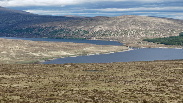
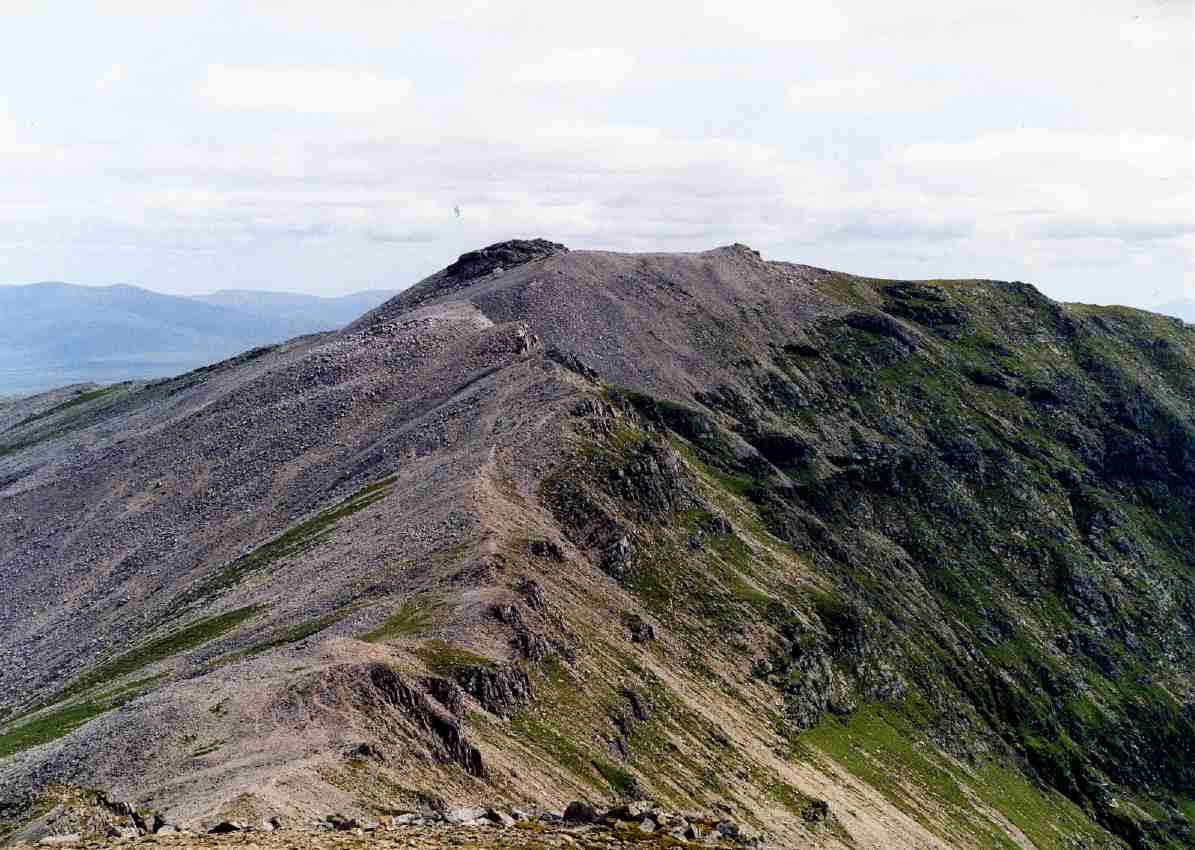
Covering a vast expanse, Bad Liath consists of undulating hills, heather-clad moors, and scattered rocky outcrops. The terrain is predominantly composed of peat bogs, which adds to the unique charm of the area. This terrain is often challenging to traverse, making it a popular destination for hikers and nature enthusiasts seeking a more adventurous experience.

The area is home to a variety of flora and fauna, including heather, cotton grass, and a diverse range of bird species such as golden plovers and red grouse. It provides a vital habitat for several species, including the threatened red deer and mountain hare.

The weather in Bad Liath can be unpredictable, with frequent mist and rainfall. This, coupled with the strong winds that sweep across the moorland, creates a harsh and atmospheric environment that adds to the allure of the area.

Bad Liath offers visitors an opportunity to immerse themselves in the untouched beauty of Scotland's natural landscape. The solitude and tranquility found here make it an ideal place for those seeking solitude or an escape from the hustle and bustle of everyday life.

If you have any feedback on the listing, please let us know in the comments section below.
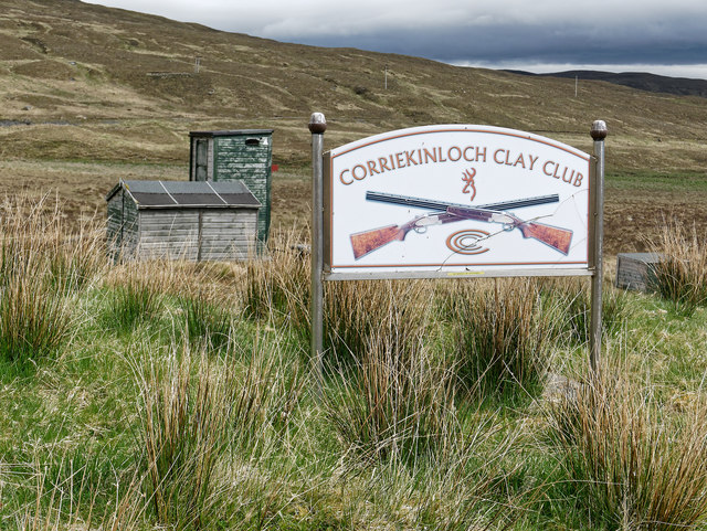
Bad Liath Images

Images are sourced within 2km of 58.183865/-4.7788872 or Grid Reference NC3625. Thanks to Geograph Open Source API. All images are credited.

Corrykinloch An isolated house at the head of Loch Shin. It is used for holiday lets.
Corrykinloch
An isolated house at the head of Loch Shin. It is used for holiday lets.
Crag and lone tree on the side of Sròn na Garbh Uidh A feature in a uniform slope.
Crag and lone tree on the side of Sròn na Garbh Uidh
A feature in a uniform slope.
Deer beside the hydro road at north end of Loch Shin This well maintained road serves the power stations fed by the Loch Shin catchment.
Deer beside the hydro road at north end of Loch Shin
This well maintained road serves the power stations fed by the Loch Shin catchment.
Track to Coire Ceann Loch near Corrykinloch A clear ATV track heads up the glen and the route is never in doubt.
Track to Coire Ceann Loch near Corrykinloch
A clear ATV track heads up the glen and the route is never in doubt.
Hillside above Abhainn a' Choire, Corrykinloch A steep hillside falls towards the river.
Hillside above Abhainn a' Choire, Corrykinloch
A steep hillside falls towards the river.
Abhainn a' Choire near Corrykinloch A burn that proved rather tricky to cross with the input of melting snow.
Abhainn a' Choire near Corrykinloch
A burn that proved rather tricky to cross with the input of melting snow.
On the path/ATV track beside Abhainn a' Choire A clear track that leads to "FB" on the map, but in reality a difficult ford when the river is high with snow melt
On the path/ATV track beside Abhainn a' Choire
A clear track that leads to "FB" on the map, but in reality a difficult ford when the river is high with snow melt
Prominent boulder below Coire Ceann Loch Loch Shin is visible at the end of the valley
Prominent boulder below Coire Ceann Loch
Loch Shin is visible at the end of the valley
Crossing point of Abhainn a' Choire We found no obvious place to cross the burn.  The footbridge marked by the OS has disappeared entirely.  The burn was higher than in the morning and we made a drier crossing here than down by the mythical footbridge.
Crossing point of Abhainn a' Choire
We found no obvious place to cross the burn. The footbridge marked by the OS has disappeared entirely. The burn was higher than in the morning and we made a drier crossing here than down by the mythical footbridge.
Walking to Corrykinloch An excellent road services the Scottish Hydro facilities beside Loch Shin from Corriekinloch on the A838.
Walking to Corrykinloch
An excellent road services the Scottish Hydro facilities beside Loch Shin from Corriekinloch on the A838.
Gauging station on the Abhainn a' Choire Our party did not investigate but concluded that the barrier and structure were for assessing water flow.
Gauging station on the Abhainn a' Choire
Our party did not investigate but concluded that the barrier and structure were for assessing water flow.
Facilities of the Corriekinloch Clay Club Although marked as Loch Shin on old maps, there is now a large area of ground (including these facilities) that are unlikely to be under water at maximum reservoir capacity.
Facilities of the Corriekinloch Clay Club
Although marked as Loch Shin on old maps, there is now a large area of ground (including these facilities) that are unlikely to be under water at maximum reservoir capacity.
Allt na Bà, Corriekinloch The main outflow for a large area of moorland.
Allt na Bà, Corriekinloch
The main outflow for a large area of moorland.
Regenerating deer-fence-proof moorland Natural woodland is being enhanced with a large enclosure surrounded by deer fence.  A gate provides access through the fence both at the loch side and upper level. The isolated house of Corrykinloch is visible in the middle of the view.
Regenerating deer-fence-proof moorland
Natural woodland is being enhanced with a large enclosure surrounded by deer fence. A gate provides access through the fence both at the loch side and upper level. The isolated house of Corrykinloch is visible in the middle of the view.
Gate in the deer fence A modern deer fence surrounds the area of regenerating hillside, and with gates at top and bottom, the area can be traversed.  The upper gate required a judicious use of a walking stick to prise apart a rusted catch on the gate, which would otherwise have needed applications of WD40, or a retreat and detour to resume the walk with our dog.
Gate in the deer fence
A modern deer fence surrounds the area of regenerating hillside, and with gates at top and bottom, the area can be traversed. The upper gate required a judicious use of a walking stick to prise apart a rusted catch on the gate, which would otherwise have needed applications of WD40, or a retreat and detour to resume the walk with our dog.
Allt Coire na Smugaidean A small burn draining the coire.  Below and in the distance Loch Shin and Loch a' Ghriama.
Allt Coire na Smugaidean
A small burn draining the coire. Below and in the distance Loch Shin and Loch a' Ghriama.
Moorland above Loch Shin Loch Shin and Loch a' Ghriama visible in the background. The terrain was very dry after a long period on no heavy rainfall.
Moorland above Loch Shin
Loch Shin and Loch a' Ghriama visible in the background. The terrain was very dry after a long period on no heavy rainfall.
Moorland terrain near Allt Coire na Smugaidean Very dry underfoot for the terrain thanks to an extended dry period. Typical hillside of peat, peat hags, and bog.
Moorland terrain near Allt Coire na Smugaidean
Very dry underfoot for the terrain thanks to an extended dry period. Typical hillside of peat, peat hags, and bog.
Show me another place!

Bad Liath is located at Grid Ref: NC3625 (Lat: 58.183865, Lng: -4.7788872)

Unitary Authority: Highland

Police Authority: Highlands and Islands

What 3 Words

///crystals.renting.positions. Near Inchnadamph, Highland

Nearby Locations

Bad Liath

Related Wikis

Beinn Leoid

Beinn Leoid (792 m) is a mountain in the Northwest Highlands of Scotland. It lies in Sutherland, east of the village of Kylesku. A very remote mountain...

Loch Merkland

Loch Merkland is a large long inland loch in Sutherland, Northern Scotland. It is located adjacent to the A838 main road which provides almost all access...

Ben More Assynt

Ben More Assynt (Scottish Gaelic: Beinn Mhòr Asaint) is a mountain in Assynt in the far northwest of Scotland, 30 kilometres (19 miles) north-northeast...
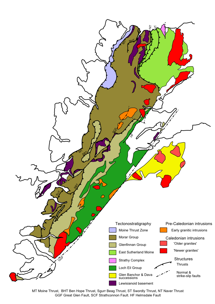
Moine Thrust Belt

The Moine Thrust Belt or Moine Thrust Zone is a linear tectonic feature in the Scottish Highlands which runs from Loch Eriboll on the north coast 190 kilometres...

Nearby Amenities

Located within 500m of 58.183865,-4.7788872
Power: pole
Lat/Long: 58.1855283/-4.7766461
Power: pole
Lat/Long: 58.1872546/-4.7771109
The data included in this document is from www.openstreetmap.org. The data is made available under ODbL.

Have you been to Bad Liath?

Leave your review of Bad Liath below (or comments, questions and feedback).