Doire Dubh

Downs, Moorland in Sutherland

Scotland

Doire Dubh

Timber Footbridge at Kinloch Brae, Sutherland By the Lairg to Laxford Bridge road.
Timber Footbridge at Kinloch Brae, Sutherland Credit: Andrew Tryon

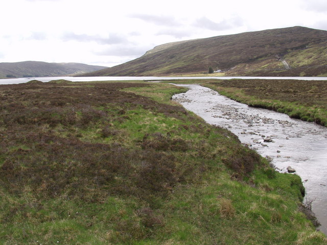
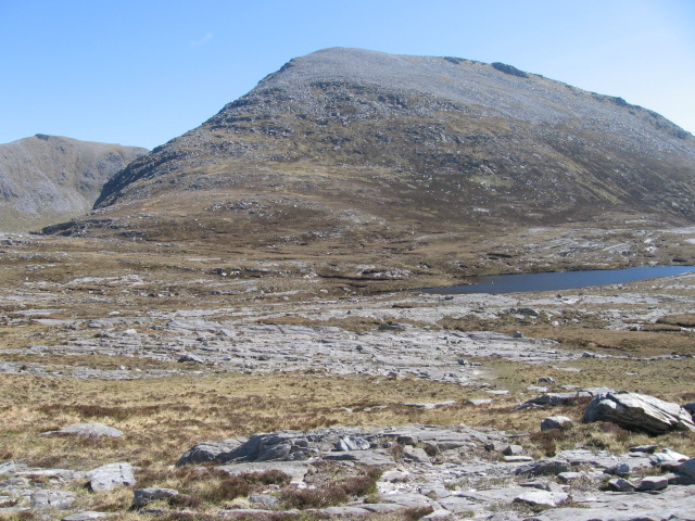
Doire Dubh is a vast expanse of downs and moorland located in Sutherland, a county in the Highlands of Scotland. It is nestled within the majestic and rugged landscapes of the North West Highlands Geopark. Covering an area of approximately 2,000 hectares, Doire Dubh is a captivating natural area that offers a glimpse into the untamed beauty of the Scottish wilderness.

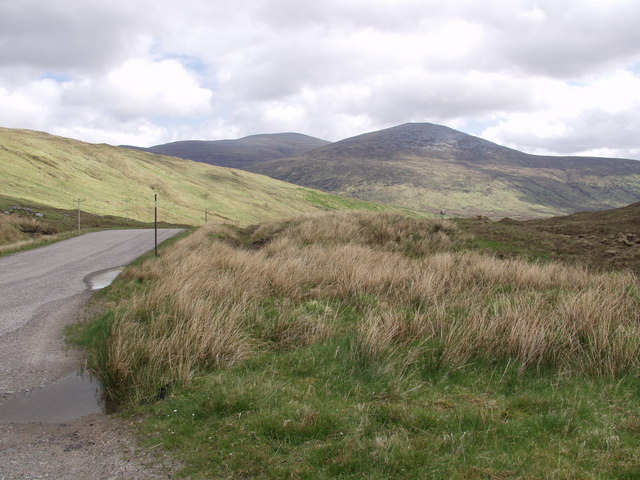
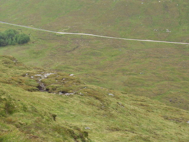
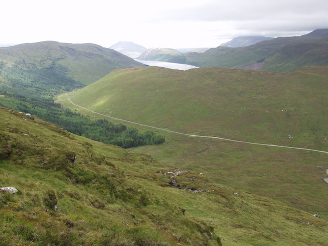
The terrain of Doire Dubh is characterized by rolling hills, heather-covered moorland, and scattered clusters of trees. Its name, which translates to "dark thicket" in Gaelic, reflects the dense vegetation that can be found in parts of the area. The downs provide stunning panoramic views of the surrounding mountains, lochs, and glens, making it a popular spot for hikers and nature enthusiasts.

The diverse ecosystem of Doire Dubh supports a variety of wildlife, including red deer, golden eagles, and ptarmigan. It is also home to several rare plant species, such as the Sutherland variety of orchids. The area is protected as a Site of Special Scientific Interest (SSSI) due to its ecological significance.

Exploring Doire Dubh offers visitors a chance to immerse themselves in the tranquility of the Scottish Highlands. The area boasts numerous walking trails that cater to different skill levels, allowing visitors to choose their own adventure. Whether it's a leisurely stroll or a challenging hike, Doire Dubh has something to offer everyone.

Visitors are advised to come prepared with appropriate clothing, as the weather in the Highlands can be unpredictable. Additionally, it is important to respect the fragile ecosystem by sticking to designated paths and refraining from littering. Doire Dubh truly is a hidden gem, providing an authentic Scottish experience amidst the untouched beauty of Sutherland's downs and moorland.

If you have any feedback on the listing, please let us know in the comments section below.

Doire Dubh Images

Images are sourced within 2km of 58.252695/-4.7906164 or Grid Reference NC3632. Thanks to Geograph Open Source API. All images are credited.

Timber Footbridge at Kinloch Brae, Sutherland By the Lairg to Laxford Bridge road.
Timber Footbridge at Kinloch Brae, Sutherland
By the Lairg to Laxford Bridge road.
Kinloch and Loch More, Sutherland
Moorland Pool near Meall na Leitreach, Sutherland
The watershed between Loch Merkland and Loch More The stream on the right drains north into Loch More, while the stream on the left drains south into Loch Merkland then Loch Shin. The centre of the slope markes the boundary between the botanical vice counties of East Sutherland on the left and West Sutherland on the right.
The watershed between Loch Merkland and Loch More
The stream on the right drains north into Loch More, while the stream on the left drains south into Loch Merkland then Loch Shin. The centre of the slope markes the boundary between the botanical vice counties of East Sutherland on the left and West Sutherland on the right.
Loch Merkland Creag nan Suibheag (466 m) on the horizon above the western shore of Loch Merkland. The construction of a new road on the far bank is part of a hydro electricity scheme for the local estate (rather than another wind farm).
Loch Merkland
Creag nan Suibheag (466 m) on the horizon above the western shore of Loch Merkland. The construction of a new road on the far bank is part of a hydro electricity scheme for the local estate (rather than another wind farm).
Watershed between Loch More and Loch Merkland Ben Hee (873 m) in the distance on the left and closer Meallan Liath Mor (683 m) on the right of the skyline, looking east from the highpoint on the pass.
Watershed between Loch More and Loch Merkland
Ben Hee (873 m) in the distance on the left and closer Meallan Liath Mor (683 m) on the right of the skyline, looking east from the highpoint on the pass.
A pair of stags by Kinloch Brae plantation Not a very impressive set of antlers in either case in this instance but still it's great to see these creatures in the wild.
A pair of stags by Kinloch Brae plantation
Not a very impressive set of antlers in either case in this instance but still it's great to see these creatures in the wild.
A bachelor party by Kinloch Brae plantation I've just been spotted and these guys are off.
A bachelor party by Kinloch Brae plantation
I've just been spotted and these guys are off.
Heads or Tails? On this occasion it was tails that won. In their velvets, these stags are known as "Knobbers" in the Highlands.
Heads or Tails?
On this occasion it was tails that won. In their velvets, these stags are known as "Knobbers" in the Highlands.
Cold bridge
Cold bridge
Stags in Velvet;  wannabe monarchs Note the "furry" velvet on the antlers which will be gone when the rut starts in October.
Stags in Velvet; wannabe monarchs
Note the "furry" velvet on the antlers which will be gone when the rut starts in October.
Watershed between Loch Merkland and Loch More The botanical vice-counties of West Sutherland (vc. 108, left hand side) and East Sutherland (vc. 107, right hand side) are separated by an ill-defined border that runs along the low ridge between the two streams draining Doire Dubh
Watershed between Loch Merkland and Loch More
The botanical vice-counties of West Sutherland (vc. 108, left hand side) and East Sutherland (vc. 107, right hand side) are separated by an ill-defined border that runs along the low ridge between the two streams draining Doire Dubh
Loch More from above Creag an Sgamhlainn Ben Stack (on the left) and Arkle (on the right) with their heads in the clouds. The road in the middle distance runs from Lairg on Loch Shin to Laxford Bridge on the west coast.
Loch More from above Creag an Sgamhlainn
Ben Stack (on the left) and Arkle (on the right) with their heads in the clouds. The road in the middle distance runs from Lairg on Loch Shin to Laxford Bridge on the west coast.
Loch Merkland from above Creag an Sgamhlainn Ben Hee with its summit in cloud above the track from West Merkland to Gobernuisgach (pronounced gober-noosh-ka with the emphasis on the noosh)
Loch Merkland from above Creag an Sgamhlainn
Ben Hee with its summit in cloud above the track from West Merkland to Gobernuisgach (pronounced gober-noosh-ka with the emphasis on the noosh)
Loch More and Ben Stack The road from Lairg to Laxford Bridge crosses the watershed here. To the right of the picture, the river drains into the Moray Firth, while Loch More drains into the Atlantic.
Loch More and Ben Stack
The road from Lairg to Laxford Bridge crosses the watershed here. To the right of the picture, the river drains into the Moray Firth, while Loch More drains into the Atlantic.
Summit heath of Meall an Fheur Loch The dramatic cliffs of Beinn Leòid on the skyline in the distance
Summit heath of Meall an Fheur Loch
The dramatic cliffs of Beinn Leòid on the skyline in the distance
Meall an Fheur Loch Unlike many of the neighbouring peaks, the summit ridge of this hill is grassy rather than ericaceous
Meall an Fheur Loch
Unlike many of the neighbouring peaks, the summit ridge of this hill is grassy rather than ericaceous
Species-rich crags on Meall an Fheur Loch These crags support a magnificent diversity of uncommon mountain plant species including Saussurea alpina and Asplenium viride.
Species-rich crags on Meall an Fheur Loch
These crags support a magnificent diversity of uncommon mountain plant species including Saussurea alpina and Asplenium viride.
Show me another place!

Doire Dubh is located at Grid Ref: NC3632 (Lat: 58.252695, Lng: -4.7906164)

Unitary Authority: Highland

Police Authority: Highlands and Islands

What 3 Words

///lottery.petrified.enchanted. Near Inchnadamph, Highland

Related Wikis

Loch Merkland

Loch Merkland is a large long inland loch in Sutherland, Northern Scotland. It is located adjacent to the A838 main road which provides almost all access...
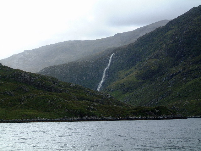
Eas Creag an Luchda

Eas Creag an Luchda is a waterfall of Scotland. == See also == Waterfalls of Scotland == References ==

Beinn Leoid

Beinn Leoid (792 m) is a mountain in the Northwest Highlands of Scotland. It lies in Sutherland, east of the village of Kylesku. A very remote mountain...

Ben Hee

Ben Hee is a mountain in Scotland that rises to the height of 865.7 metres (2,840 ft). == References == == External links == Foinaven-Ben Hee Wild Land...

Meallan Liath Coire Mhic Dhùghaill

Meallan Liath Coire Mhic Dhughaill (801 m) is a mountain in the Northwest Highlands, Scotland. It lies in the far north of Scotland between Lairg and Durness...

Eas a' Chual Aluinn

Eas a' Chual Aluinn (grid reference NC281278) in the parish of Assynt, Sutherland, Highland, Scotland, is the tallest waterfall in the United Kingdom with...

Achfary

Achfary (Scottish Gaelic: Achadh Taigh Phairidh) is a hamlet in the Scottish council area of Highland. To the east of the village lies Loch nan Ealachan...

Nearby Amenities

Located within 500m of 58.252695,-4.7906164
Power: pole
Lat/Long: 58.257085/-4.7898827
The data included in this document is from www.openstreetmap.org. The data is made available under ODbL.

Have you been to Doire Dubh?

Leave your review of Doire Dubh below (or comments, questions and feedback).