Bad an t-Seabhaig
Downs, Moorland in Argyllshire
Scotland
Bad an t-Seabhaig

Bad an t-Seabhaig, also known as The Downs, is an area located in Argyllshire, Scotland. Situated amidst the captivating moorland landscape, it is renowned for its natural beauty and diverse flora and fauna.
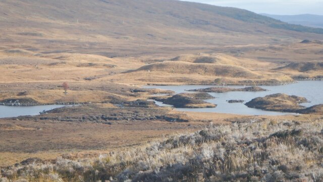
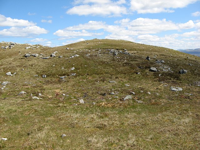
Covering a vast expanse, Bad an t-Seabhaig is characterized by rolling hills, heather-covered moors, and scattered lochs. The area boasts a rich variety of plant life, including wildflowers, mosses, and grasses. The moorland vegetation provides a habitat for numerous bird species, such as red grouse, golden plovers, and curlews, making it a haven for birdwatching enthusiasts.
The Downs is also home to several lochs, adding to its scenic appeal. These freshwater bodies support a range of aquatic life, including trout and salmon, making it a popular spot for fishing. Visitors can indulge in angling activities or simply relax by the tranquil waters, enjoying the serenity of the surroundings.
For those seeking outdoor adventures, Bad an t-Seabhaig offers ample opportunities for hiking and walking. The undulating terrain presents both challenging and leisurely trails, catering to varying fitness levels. Explorers can immerse themselves in the picturesque landscapes, breathing in the crisp, clean air and taking in the panoramic views of the moorland.
Overall, Bad an t-Seabhaig in Argyllshire is a captivating destination that showcases the natural wonders of Scotland. Its downs and moorland provide a peaceful retreat for nature lovers, offering a chance to connect with the wilderness and appreciate the raw beauty of the Scottish countryside.
If you have any feedback on the listing, please let us know in the comments section below.
Bad an t-Seabhaig Images
Images are sourced within 2km of 56.638187/-4.6752305 or Grid Reference NN3652. Thanks to Geograph Open Source API. All images are credited.


Bad an t-Seabhaig is located at Grid Ref: NN3652 (Lat: 56.638187, Lng: -4.6752305)
Unitary Authority: Highland
Police Authority: Highlands and Islands
What 3 Words
///dart.caravans.requiring. Near Pubil, Perth & Kinross
Nearby Locations
Related Wikis

Loch Laidon
Loch Laidon or Loch Lydoch or Loch Luydan is a long thin freshwater loch, on a southwest to northeast orientation, with outlets on the southwest side...
Stob na Cruaiche
Stob na Cruaiche (739 m) is a hill in the Grampian Mountains, Scotland. It lies on the border of Highland and Perthshire, on the northern edge of Rannoch...

Rannoch Moor
Rannoch Moor ( ; Scottish Gaelic: Mòinteach Rai(th)neach) is an expanse of around 50 square miles (130 km2) of boggy moorland to the west of Loch Rannoch...

Gorton railway station (Scotland)
Gorton railway station or Gortan railway station, named for the nearby Meall a Ghortain area of high ground, was a remote rural private railway station...
Nearby Amenities
Located within 500m of 56.638187,-4.6752305Have you been to Bad an t-Seabhaig?
Leave your review of Bad an t-Seabhaig below (or comments, questions and feedback).