Allt Fawr

Downs, Moorland in Anglesey

Wales

Allt Fawr

A4080 Merddyn-y-bit A small house at the junction of the A4080 and a minor road joining from the north.
A4080 Merddyn-y-bit Credit: David Dixon

Allt Fawr is a prominent hill located in Anglesey, Wales. It is situated on the southeastern side of the island, near the village of Llanfairpwllgwyngyll. With an elevation of approximately 204 meters (669 feet), it offers captivating views of the surrounding countryside and the nearby Menai Strait.

The hill is characterized by its diverse landscape, which includes both downs and moorland. The downs are grassy slopes that provide ample grazing opportunities for livestock, while the moorland consists of open, rugged terrain covered in heather and other low-lying vegetation. This mixture of habitats creates a unique and picturesque environment that attracts both nature enthusiasts and hikers.

Allt Fawr is home to a variety of wildlife, including several species of birds such as skylarks and meadow pipits. The presence of diverse flora and fauna adds to the charm of this natural area.

Visitors can explore the hill via a network of walking paths and trails that crisscross the landscape. These trails offer opportunities to discover the beauty of the downs and moorland up close while enjoying panoramic views of the surrounding countryside.

Allt Fawr is a popular destination for outdoor activities such as hiking, birdwatching, and picnicking. Its accessibility and stunning scenery make it a must-visit location for nature lovers and those seeking a peaceful retreat in the heart of Anglesey.

If you have any feedback on the listing, please let us know in the comments section below.
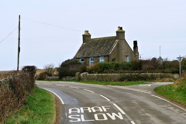
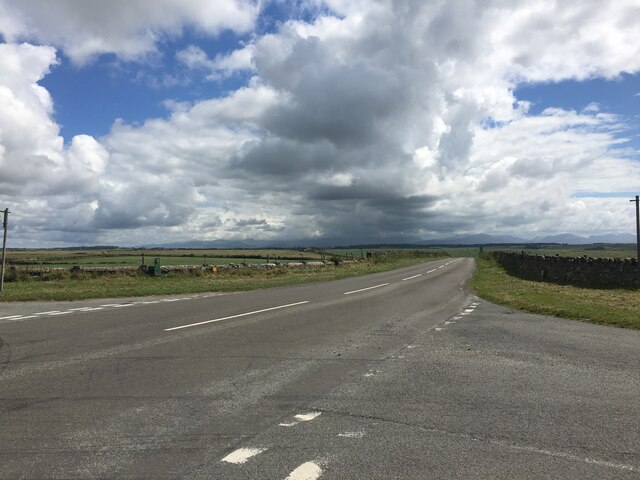
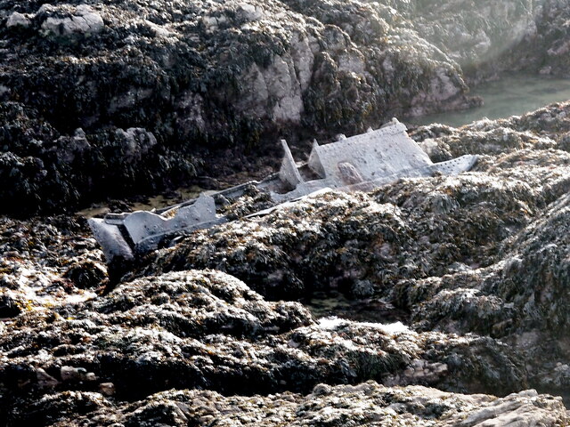
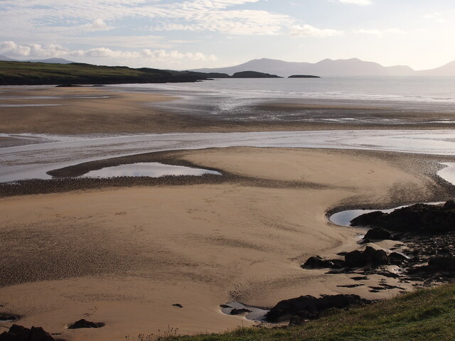
Allt Fawr Images

Images are sourced within 2km of 53.18791/-4.4748618 or Grid Reference SH3468. Thanks to Geograph Open Source API. All images are credited.

A4080 Merddyn-y-bit A small house at the junction of the A4080 and a minor road joining from the north.
A4080 Merddyn-y-bit
A small house at the junction of the A4080 and a minor road joining from the north.
Junction on the A4080 near Anglesey Circuit
Merddyn-y-bit
Merddyn-y-bit
Minor road near Aberffraw
St. Cwyfan’s Chapel, Anglesey St Cwyfan's Church is a Grade II listed medieval church in Anglesey, Wales. Located on the small tidal island. It is popularly known as the "Little Church in the Sea". The church dates from the 12th century, with some renovations made in the 19th century.

<span class="nowrap"><a title="https://en.wikipedia.org/wiki/St_Cwyfan%27s_Church,_Llangwyfan" rel="nofollow ugc noopener" href="https://en.wikipedia.org/wiki/St_Cwyfan%27s_Church,_Llangwyfan">Link</a><img style="margin-left:2px;" alt="External link" title="External link - shift click to open in new window" src="https://s1.geograph.org.uk/img/external.png" width="10" height="10"/></span>
St. Cwyfan’s Chapel, Anglesey
St Cwyfan's Church is a Grade II listed medieval church in Anglesey, Wales. Located on the small tidal island. It is popularly known as the "Little Church in the Sea". The church dates from the 12th century, with some renovations made in the 19th century. LinkExternal link
Ship Wreckage, Porth Aels Possibly part of the steamer 'Kyle Prince' that sank on the 8th of October 1938.
Ship Wreckage, Porth Aels
Possibly part of the steamer 'Kyle Prince' that sank on the 8th of October 1938.
Traeth Mawr
Traeth Mawr
Layby on the A4080 crossing Tywyn Aberffraw The A4080 road runs for 24½ miles along the southwestern side of Anglesey. It starts on the A5 at Llanfair Pwllgwyngyll and passes through several villages before terminating on the A5 between Bryngwran and Gwalchmai.
Layby on the A4080 crossing Tywyn Aberffraw
The A4080 road runs for 24½ miles along the southwestern side of Anglesey. It starts on the A5 at Llanfair Pwllgwyngyll and passes through several villages before terminating on the A5 between Bryngwran and Gwalchmai.
Approaching Aberffraw on the A4080 The A4080 road runs for 24½ miles along the southwestern side of Anglesey. It starts on the A5 at Llanfair Pwllgwyngyll and passes through several villages before terminating on the A5 between Bryngwran and Gwalchmai.
Approaching Aberffraw on the A4080
The A4080 road runs for 24½ miles along the southwestern side of Anglesey. It starts on the A5 at Llanfair Pwllgwyngyll and passes through several villages before terminating on the A5 between Bryngwran and Gwalchmai.
Aberffraw Aberffraw is a small village on the southwest coast of the Isle of Anglesey by the west bank of the Afon Ffraw. Access by road is by way of the A4080.
Aberffraw
Aberffraw is a small village on the southwest coast of the Isle of Anglesey by the west bank of the Afon Ffraw. Access by road is by way of the A4080.
Pont Aberffraw A single-span, hump-backed bridge of rubble masonry built in 1731 across Afon Ffraw. The bridge is now in use as a footbridge over the river having been closed to vehicular traffic when the new road bridge spanning the Afon Ffraw was built.

It is grade II-listed (Cadw reference 5258 <span class="nowrap"><a title="http://cadwpublic-api.azurewebsites.net/reports/listedbuilding/FullReport?lang=en&id=5259" rel="nofollow ugc noopener" href="http://cadwpublic-api.azurewebsites.net/reports/listedbuilding/FullReport?lang=en&id=5259">Link</a><img style="margin-left:2px;" alt="External link" title="External link - shift click to open in new window" src="https://s1.geograph.org.uk/img/external.png" width="10" height="10"/></span> ).
Pont Aberffraw
A single-span, hump-backed bridge of rubble masonry built in 1731 across Afon Ffraw. The bridge is now in use as a footbridge over the river having been closed to vehicular traffic when the new road bridge spanning the Afon Ffraw was built. It is grade II-listed (Cadw reference 5258 LinkExternal link ).
Pont Aberffraw A single-span, hump-backed bridge of rubble masonry constructed in 1731 across Afon Ffraw. The bridge is now in use as a footbridge over the river having been closed to vehicular traffic when the new road bridge spanning the Afon Ffraw was built.

It is grade II-listed (Cadw reference 5258 <span class="nowrap"><a title="http://cadwpublic-api.azurewebsites.net/reports/listedbuilding/FullReport?lang=en&id=5259" rel="nofollow ugc noopener" href="http://cadwpublic-api.azurewebsites.net/reports/listedbuilding/FullReport?lang=en&id=5259">Link</a><img style="margin-left:2px;" alt="External link" title="External link - shift click to open in new window" src="https://s1.geograph.org.uk/img/external.png" width="10" height="10"/></span> ).
Pont Aberffraw
A single-span, hump-backed bridge of rubble masonry constructed in 1731 across Afon Ffraw. The bridge is now in use as a footbridge over the river having been closed to vehicular traffic when the new road bridge spanning the Afon Ffraw was built. It is grade II-listed (Cadw reference 5258 LinkExternal link ).
Afon Ffraw at Aberffraw
Seion Methodist Chapel, Abberffraw Nineteenth century Methodist chapel. a slate plaque to the right of the entrance reads "Eglwys Fethodistaidd Seion 1887". Grade II listed building (Cadw reference 20964 <span class="nowrap"><a title="https://cadwpublic-api.azurewebsites.net/reports/listedbuilding/FullReport?lang=en&id=20964" rel="nofollow ugc noopener" href="https://cadwpublic-api.azurewebsites.net/reports/listedbuilding/FullReport?lang=en&id=20964">Link</a><img style="margin-left:2px;" alt="External link" title="External link - shift click to open in new window" src="https://s1.geograph.org.uk/img/external.png" width="10" height="10"/></span> ).
Seion Methodist Chapel, Abberffraw
Nineteenth century Methodist chapel. a slate plaque to the right of the entrance reads "Eglwys Fethodistaidd Seion 1887". Grade II listed building (Cadw reference 20964 LinkExternal link ).
Hairpin bend, Anglesey Circuit
Track and run-off, Anglesey Circuit
Paddock area, Anglesey Circuit
Gate and field near Anglesey Circuit
Show me another place!

Allt Fawr is located at Grid Ref: SH3468 (Lat: 53.18791, Lng: -4.4748618)

Unitary Authority: Isle of Anglesey

Police Authority: North Wales

What 3 Words

///credit.youths.typical. Near Rhosneigr, Isle of Anglesey

Nearby Locations

Allt Fawr

Related Wikis

St Beuno's Church, Aberffraw

St Beuno's Church, Aberffraw is a 12th-century parish church in Anglesey, north Wales. A church was established in Aberffraw in the 7th century by St Beuno...
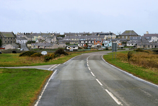
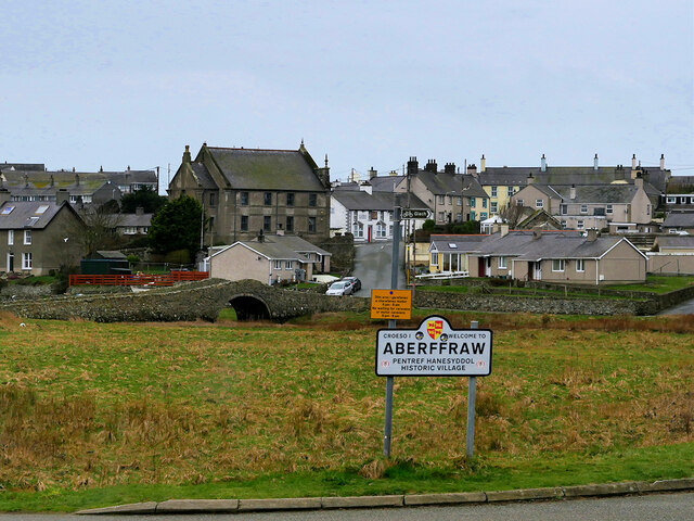
Aberffraw

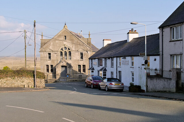
Aberffraw is a village and community on the south west coast of the Isle of Anglesey in Wales. The village is 9 miles from the island's capital, Llangefni...
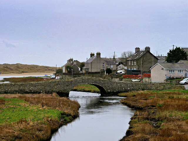
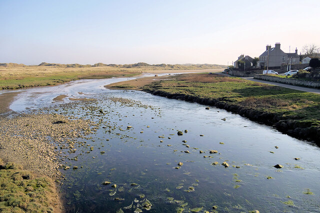
Afon Ffraw

The Afon Ffraw is a short river on the Isle of Anglesey, Wales. It arises at Llyn Coron and flows southwest for two miles along the northwestern margin...
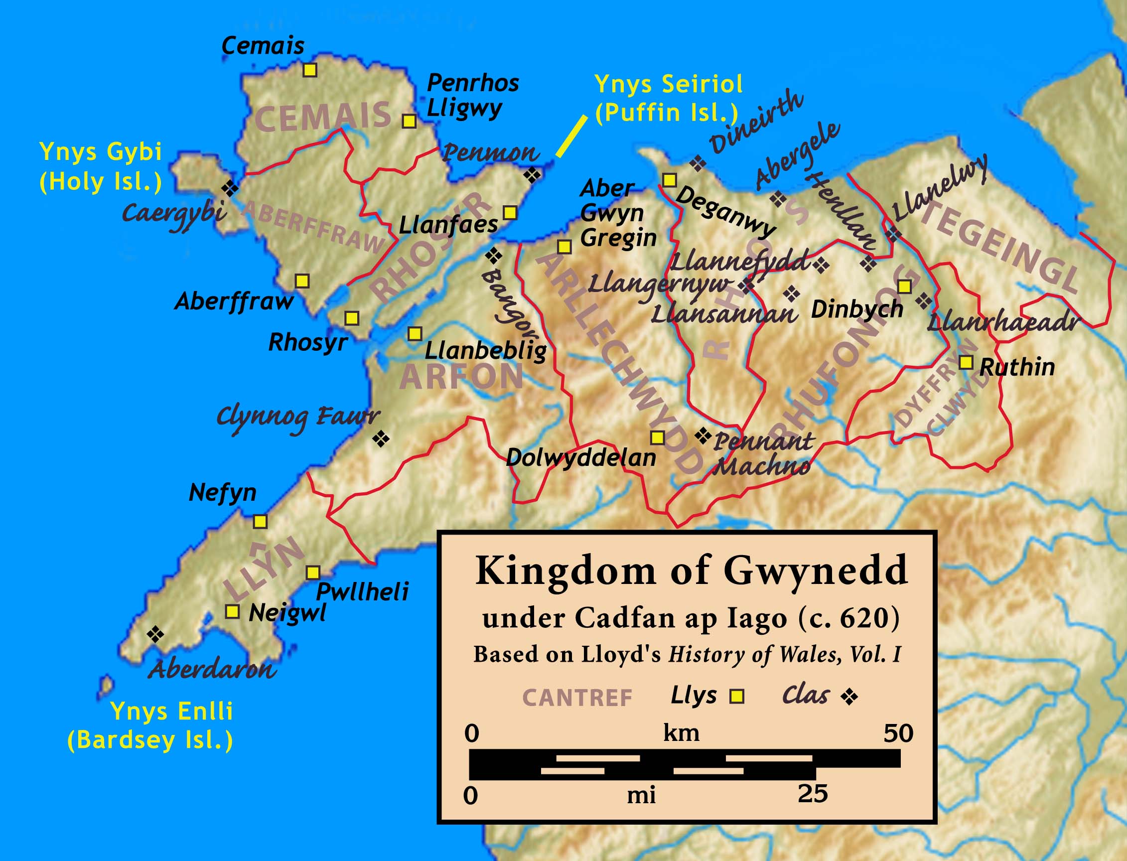
Aberffraw (cantref)

Aberffraw was one of the three medieval cantrefs on the island of Anglesey, north Wales, in the Kingdom of Gwynedd as a cadet branch, named the House of...

St Cwyfan's Church, Llangwyfan

Eglwys Cwyfan (St Cwyfan's Church) is a Grade II*-listed medieval church in Llangadwaladr, Anglesey, Wales. Located on the small tidal island of Cribinau...

Llangwyfan, Anglesey

Llangwyfan named after St. Cwyfan is a hamlet in the community of Aberffraw, Anglesey, Wales, which is 130.8 miles (210.6 km) from Cardiff and 218 miles...
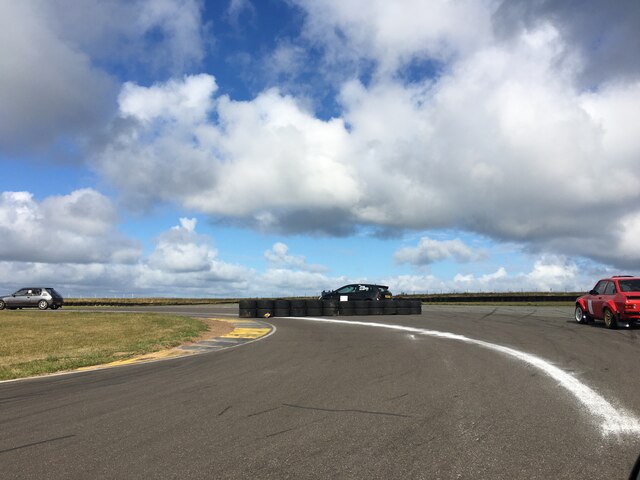
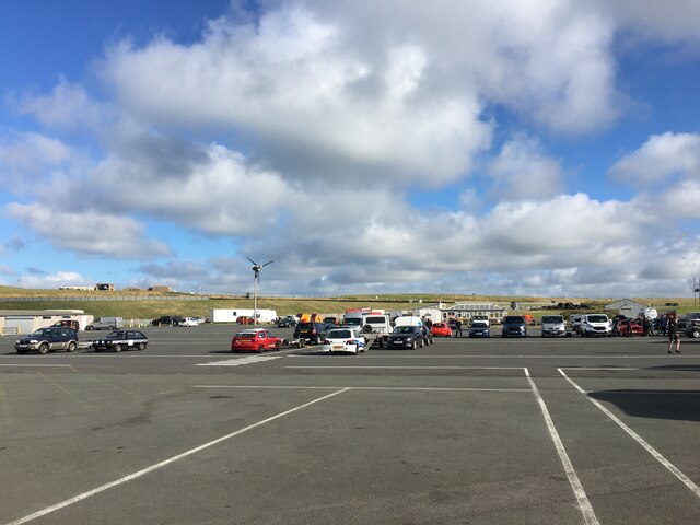
Anglesey Circuit

The Anglesey Circuit (Welsh: Trac Môn) is a motor racing circuit located in Ty Croes, Anglesey, Wales. It plays host to a variety of motorsport events...

Trecastell

Trecastell is a farm and historical site in the community of Aberffraw, Anglesey, Wales. == History == Llywelyn the Great, Prince of the Kingdom of Gwynedd...

Nearby Amenities

Located within 500m of 53.18791,-4.4748618
Direction: 195
Generator Method: photovoltaic
Generator Output Electricity: yes
Generator Solar Modules: 4
Generator Source: solar
Generator Type: solar_photovoltaic_panel
Location: roof
Power: generator
Lat/Long: 53.1858799/-4.47019
The data included in this document is from www.openstreetmap.org. The data is made available under ODbL.

Have you been to Allt Fawr?

Leave your review of Allt Fawr below (or comments, questions and feedback).