Huddisford Moor

Downs, Moorland in Devon Torridge

England

Huddisford Moor

Higher Huddisford
Higher Huddisford Credit: Roger A Smith

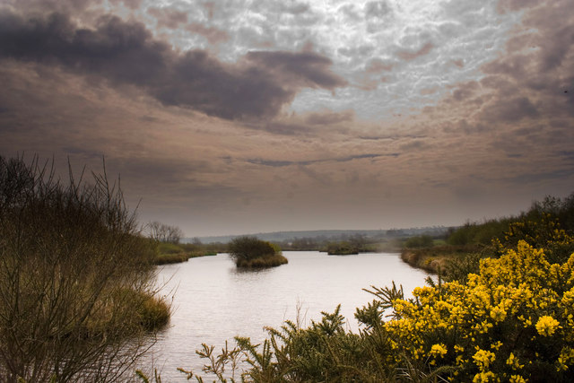
Huddisford Moor, located in Devon, England, is a picturesque area known for its stunning natural beauty and diverse wildlife. Covering approximately 500 acres, the moorland is situated in the heart of the county and is a popular destination for nature enthusiasts and hikers alike.

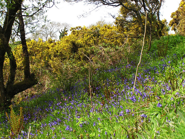
The moorland is composed of rolling hills, heathland, and open grasslands, providing a unique habitat for a wide range of plant and animal species. Visitors can expect to encounter a variety of bird species, including skylarks, curlews, and meadow pipits, as well as small mammals such as rabbits, foxes, and badgers.

Huddisford Moor is also home to several rare and protected species, including the high brown fritillary butterfly and the southern damselfly. These species thrive in the moorland's diverse ecosystems, which consist of wetlands, heather-covered areas, and scattered woodlands.

In addition to its rich biodiversity, Huddisford Moor offers breathtaking panoramic views of the surrounding countryside. From the elevated vantage points, visitors can take in the stunning vistas of Dartmoor National Park and the rolling hills of Devon.

For those seeking outdoor activities, the moorland offers numerous hiking trails that weave through its varied landscapes. These paths cater to all levels of ability and provide an opportunity to explore the area's natural wonders up close.

Overall, Huddisford Moor is a remarkable and captivating destination that showcases the beauty and diversity of Devon's landscape. Whether you are a nature lover, a keen hiker, or simply looking for a peaceful retreat, this moorland is sure to leave a lasting impression.

If you have any feedback on the listing, please let us know in the comments section below.

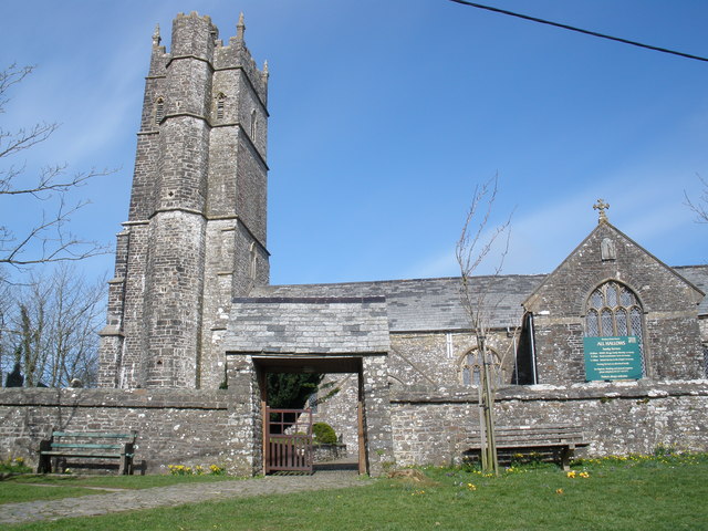
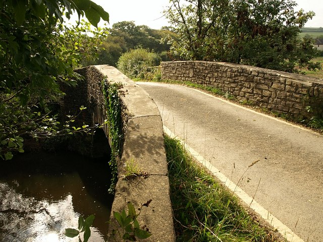
Huddisford Moor Images

Images are sourced within 2km of 50.94699/-4.3986153 or Grid Reference SS3119. Thanks to Geograph Open Source API. All images are credited.

Higher Huddisford
Higher Huddisford
Farmland near Higher Venn Farmland near Higher Venn to the south of Woolfardisworthy.
Farmland near Higher Venn
Farmland near Higher Venn to the south of Woolfardisworthy.
Haycroft trout lake, Hole Farm A private syndicate lake in a peaceful part of Devon.
Haycroft trout lake, Hole Farm
A private syndicate lake in a peaceful part of Devon.
Bluebells and Gorse, Fordmill Farm Photo taken when gardens were open to raise funds for North Devon Hospice.
Bluebells and Gorse, Fordmill Farm
Photo taken when gardens were open to raise funds for North Devon Hospice.
Farm Cottages at Claw Cross Traditional farm cottages in rural North Devon
Farm Cottages at Claw Cross
Traditional farm cottages in rural North Devon
Gazebo at Fordmill Farm This quaint stone structure was built by the owner Andrew Milman in his gardens which he opens to the public to raise funds for charity.
Gazebo at Fordmill Farm
This quaint stone structure was built by the owner Andrew Milman in his gardens which he opens to the public to raise funds for charity.
Wet fields south of Biteford A stubble field left until drier weather for cultivation.
Wet fields south of Biteford
A stubble field left until drier weather for cultivation.
Ditch in woodland near Huddisford This is access woodland. My advice would be not to bother. A dense young conifer plantation, thick with brambles and deer tracks, it is crossed by ditches such as this, running roughly northwest-southeast, of which this is one.
Ditch in woodland near Huddisford
This is access woodland. My advice would be not to bother. A dense young conifer plantation, thick with brambles and deer tracks, it is crossed by ditches such as this, running roughly northwest-southeast, of which this is one.
Wood, Huddisford From the straight lane between Biteford Bridge and Duerdon, which brushes across the edge of this square, a view from a deer-crossing point on the laneside bank of a rectangular plantation, seen end on, to the east of the three farms at Huddisford. The land slopes to the left, towards Clifford Water.
Wood, Huddisford
From the straight lane between Biteford Bridge and Duerdon, which brushes across the edge of this square, a view from a deer-crossing point on the laneside bank of a rectangular plantation, seen end on, to the east of the three farms at Huddisford. The land slopes to the left, towards Clifford Water.
Logpiles, Huddisford Plantation This track, seen from the point where it leaves the lane between Biteford Bridge and Duerdon, runs through the heart of the plantation, which is access land. The entire eastern half of the wood has been felled; logging operations mean that access is currently forbidden.
Logpiles, Huddisford Plantation
This track, seen from the point where it leaves the lane between Biteford Bridge and Duerdon, runs through the heart of the plantation, which is access land. The entire eastern half of the wood has been felled; logging operations mean that access is currently forbidden.
Stream and lane, Duerdon The lane from Biteford Bridge is joined by a small stream as it passes the southeast corner of Huddisford Plantation.
Stream and lane, Duerdon
The lane from Biteford Bridge is joined by a small stream as it passes the southeast corner of Huddisford Plantation.
Birches near Marshall Farm Spindly birches frame a view along a narrow field by the lane between Biteford Bridge and Duerdon (on the left), from a track by the side of the access woodland shown in <a href="https://www.geograph.org.uk/photo/741202">SS3118 : Ditch in woodland near Huddisford</a>.
Birches near Marshall Farm
Spindly birches frame a view along a narrow field by the lane between Biteford Bridge and Duerdon (on the left), from a track by the side of the access woodland shown in SS3118 : Ditch in woodland near Huddisford.
Field near Marshall Farm A detail of the scene in <a href="https://www.geograph.org.uk/photo/743784">SS3119 : Birches near Marshall Farm</a>. The long rectangular field between the lane on the left, and the trees following a drain on the right, and which ends at the cottage, has a track crossing it half-way along.
Field near Marshall Farm
A detail of the scene in SS3119 : Birches near Marshall Farm. The long rectangular field between the lane on the left, and the trees following a drain on the right, and which ends at the cottage, has a track crossing it half-way along.
Horton Bridge
Horton Bridge
Horton Bridge
Horton Bridge
Horton Bridge as seen from downstream
Horton Bridge as seen from Upstream
The view upstream from Horton Bridge
Show me another place!

Huddisford Moor is located at Grid Ref: SS3119 (Lat: 50.94699, Lng: -4.3986153)

Administrative County: Devon

District: Torridge

Police Authority: Devon and Cornwall

What 3 Words

///stability.coolest.collected. Near Holsworthy, Devon

Related Wikis

Woolfardisworthy, Torridge

Woolfardisworthy is a village and civil parish in the Torridge district of Devon, England. The village is accessible via the A39 road, 2 miles (3 km) from...

Alminstone Cross

Alminstone Cross is a village in Devon, England. == References == Media related to Alminstone Cross at Wikimedia Commons

Ashmansworthy

Ashmansworthy is a village in Devon, England. Recorded in the Domesday Book, it was in the hundred of Hartland. == References == == External links... ==

Lynbarn Railway

The 1 ft 11+1⁄2 in (597 mm) narrow gauge Lynbarn Railway opened in 1995 as a park ride at the Milky Way Adventure Park, a family-based theme park attraction...

Nearby Amenities

Located within 500m of 50.94699,-4.3986153
Power: pole
Lat/Long: 50.9447315/-4.4032672
Power: pole
Lat/Long: 50.945737/-4.4028595
Power: pole
Lat/Long: 50.9467949/-4.4023472
Power: pole
Lat/Long: 50.9478832/-4.4019127
Power: pole
Lat/Long: 50.9489072/-4.4014353
Power: pole
Lat/Long: 50.949965/-4.4013709
Power: pole
Lat/Long: 50.9508555/-4.4013789
Power: pole
Source: bing
Lat/Long: 50.9467129/-4.4017531
Power: pole
Source: bing
Lat/Long: 50.9463707/-4.401623
Power: pole
Source: bing
Lat/Long: 50.9469571/-4.3981214
Power: pole
Source: bing
Transformer: distribution
Lat/Long: 50.9473449/-4.3984808
Power: pole
Source: bing
Lat/Long: 50.9472452/-4.3996717
Power: pole
Source: bing
Lat/Long: 50.9471531/-4.4007151
Power: pole
Source: bing
Lat/Long: 50.9470543/-4.4018832
Power: pole
Source: bing
Lat/Long: 50.9469301/-4.4034375
Power: pole
Source: bing
Lat/Long: 50.9468194/-4.4046955
Barrier: cattle_grid
Lat/Long: 50.9461235/-4.4012465
The data included in this document is from www.openstreetmap.org. The data is made available under ODbL.

Have you been to Huddisford Moor?

Leave your review of Huddisford Moor below (or comments, questions and feedback).