Bogside Flats

Downs, Moorland in Ayrshire

Scotland

Bogside Flats

McGowan Bridge This bridge crosses the River Garnock, providing access to and from Ardeer. It sees little, if any, use now.
McGowan Bridge Credit: SGM

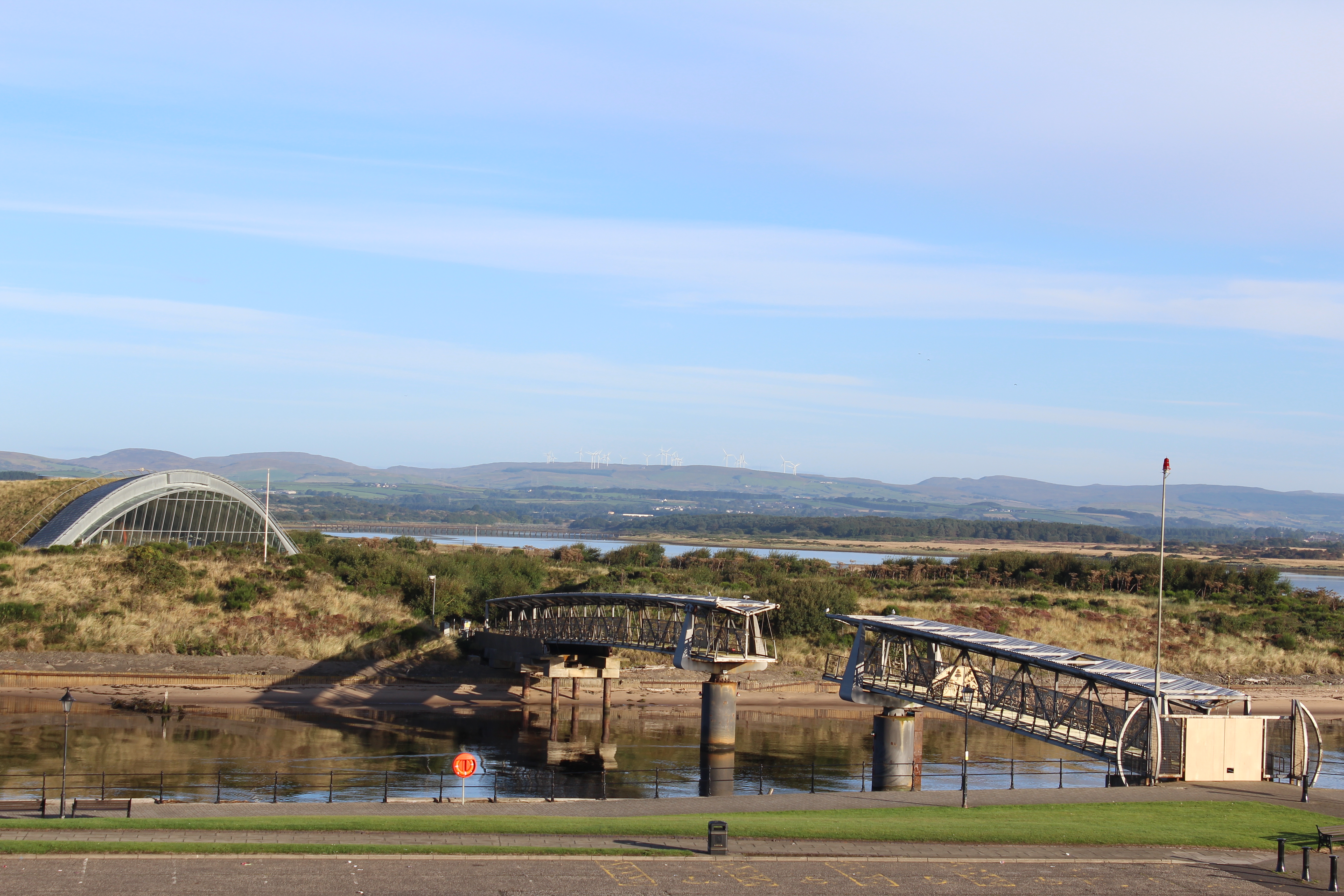
Bogside Flats, located in Ayrshire, Scotland, is a picturesque area known for its serene natural beauty and diverse landscape. Situated amidst downs and moorland, this region offers a unique combination of rolling hills, open fields, and heather-covered moors.

The downs in Bogside Flats are characterized by gently sloping terrain, with wide expanses of grasslands offering breathtaking views of the surrounding countryside. These downs provide ample space for recreational activities such as hiking, picnicking, and nature walks. The lush greenery and the tranquil atmosphere make it an ideal spot for relaxation and unwinding.

On the other hand, the moorland in Bogside Flats adds a touch of ruggedness to the landscape. Covered in vibrant purple heather, these moors create a stunning contrast against the green backdrop. They are home to a variety of flora and fauna, including rare bird species such as curlews and golden plovers. The moorland also serves as a habitat for various wild animals, including red deer and mountain hares, making it a popular destination for wildlife enthusiasts.

Apart from its natural wonders, Bogside Flats is also known for its rich historical and cultural heritage. The area has several archaeological sites, including ancient standing stones and burial mounds, which provide insights into its past. Additionally, the local community takes pride in preserving their traditional arts and crafts, with local artisans showcasing their work in galleries and craft shops.

In summary, Bogside Flats in Ayrshire offers a captivating blend of downs and moorland, providing a haven for nature lovers, outdoor enthusiasts, and history buffs alike.

If you have any feedback on the listing, please let us know in the comments section below.

Bogside Flats Images

Images are sourced within 2km of 55.613712/-4.6854713 or Grid Reference NS3038. Thanks to Geograph Open Source API. All images are credited.

McGowan Bridge This bridge crosses the River Garnock, providing access to and from Ardeer. It sees little, if any, use now.
McGowan Bridge
This bridge crosses the River Garnock, providing access to and from Ardeer. It sees little, if any, use now.
Irvine Bay Shore Looking towards Irvine Bar. This is a sand bar jutting into the sea.
Irvine Bay Shore
Looking towards Irvine Bar. This is a sand bar jutting into the sea.
Washed Up Irvine Shore Debris on the shore.
Washed Up Irvine Shore
Debris on the shore.
Irvine Bay Shore Showing the erosion to the sea defence below Ardeer.
Irvine Bay Shore
Showing the erosion to the sea defence below Ardeer.
Irvine Bar (south) Tide was coming in.
Irvine Bar (south)
Tide was coming in.
River Garnock  and bridge This is a disused bridge that is part of the Ardeer complex.
River Garnock and bridge
This is a disused bridge that is part of the Ardeer complex.
Irvine Bar (south) A low tide allowed me into the square.
Irvine Bar (south)
A low tide allowed me into the square.
Irvine Bar (north) Taken from the south bar. The posts mark the channel into Irvine harbour.
Irvine Bar (north)
Taken from the south bar. The posts mark the channel into Irvine harbour.
McGowan bridge Crossing the River Garnock this bridge is no longer used.
McGowan bridge
Crossing the River Garnock this bridge is no longer used.
Rose bush by McGowan bridge A rather desolate spot brightened up by this rose bush.
Rose bush by McGowan bridge
A rather desolate spot brightened up by this rose bush.
Shore at Ardeer Pictured looking North West towards Saltcoats. 9th August 2009 1.00pm
Shore at Ardeer
Pictured looking North West towards Saltcoats. 9th August 2009 1.00pm
Sand hills, Ardeer Steep sandy slopes above the beach on the Ardeer Peninsula.
Sand hills, Ardeer
Steep sandy slopes above the beach on the Ardeer Peninsula.
Fence, sand and slag The shoreline at the ICI Nobel explosive works site. Waste material from earlier industry, iron smelting, has been used to protect the sand hills from the sea.
Fence, sand and slag
The shoreline at the ICI Nobel explosive works site. Waste material from earlier industry, iron smelting, has been used to protect the sand hills from the sea.
Falling tide, Ardeer Beach Taken on returning from the end.
Falling tide, Ardeer Beach
Taken on returning from the end.
Irvine Bay and the Clyde coast Looking east, across the estuaries of the Rivers Garnock and Irvine.
Irvine Bay and the Clyde coast
Looking east, across the estuaries of the Rivers Garnock and Irvine.
Ardeer Beach Ardeer Beach
Ardeer Beach
Ardeer Beach
Ardeer Beach Looking towards Ailsa Craig (far left) and Arran from Ardeer Beach.
Ardeer Beach
Looking towards Ailsa Craig (far left) and Arran from Ardeer Beach.
The River Garnock The River Garnock is the smallest of Ayrshire's six principal rivers. Its source is on the southerly side of the Hill of Stake in the heart of the Clyde Muirshiel Regional Park. About a mile and a half south of this starting point the untested stream tumbles over the Spout of Garnock, the highest waterfall in Ayrshire. The river then continues, for a total length of 20 miles or so, through the towns of Kilbirnie, Glengarnock, Dalry and Kilwinning to its confluence with the River Irvine at Irvine Harbour.
The River Garnock
The River Garnock is the smallest of Ayrshire's six principal rivers. Its source is on the southerly side of the Hill of Stake in the heart of the Clyde Muirshiel Regional Park. About a mile and a half south of this starting point the untested stream tumbles over the Spout of Garnock, the highest waterfall in Ayrshire. The river then continues, for a total length of 20 miles or so, through the towns of Kilbirnie, Glengarnock, Dalry and Kilwinning to its confluence with the River Irvine at Irvine Harbour.
Show me another place!

Bogside Flats is located at Grid Ref: NS3038 (Lat: 55.613712, Lng: -4.6854713)

Unitary Authority: North Ayrshire

Police Authority: Ayrshire

What 3 Words

///double.smug.wants. Near Irvine, North Ayrshire

Related Wikis

Irvine Victoria F.C.

Irvine Victoria Football Club is a Scottish football club, based in the town of Irvine, North Ayrshire. Nicknamed The Vics and "Westenders", it was formed...

Irvine railway station

Irvine railway station is a railway station serving the town of Irvine, North Ayrshire, Scotland. The station is managed by ScotRail and is on the Ayrshire...

The Big Idea (museum)

The Big Idea was a science centre located in the town of Irvine, North Ayrshire, Scotland. Located on the former Nobel Explosives manufacturing site on...

Irvine Beat FM

Irvine Beat FM is a community radio station based in the North Ayrshire town of Irvine serving the Fullarton, Harbourside, Redburn, Vineburgh and Castlepark...

Have you been to Bogside Flats?

Leave your review of Bogside Flats below (or comments, questions and feedback).