Ashleigh Meadow

Downs, Moorland in Cornwall

England

Ashleigh Meadow

St Lalluwy
St Lalluwy Credit: Paul Barnett

Ashleigh Meadow is a picturesque area located in Cornwall, England. Situated amidst the stunning natural beauty of the region, it is known for its diverse landscapes, including downs, moorland, and meadows. Spanning approximately several acres, Ashleigh Meadow offers a tranquil escape for those seeking a peaceful retreat in the heart of nature.

The downs in Ashleigh Meadow are characterized by rolling hills and grassy slopes, providing breathtaking panoramic views of the surrounding area. This landscape is home to a rich variety of flora and fauna, making it an ideal spot for nature enthusiasts and bird watchers. The moorland, on the other hand, showcases a rugged terrain with heather and gorse, creating a unique and wild atmosphere.

The meadows in Ashleigh Meadow add to its charm, with lush green grasses and colorful wildflowers. These open spaces are perfect for leisurely walks, picnics, and outdoor activities. Visitors can also find several walking trails that wind through the area, allowing them to fully immerse themselves in the natural beauty of the landscape.

Ashleigh Meadow is not only a haven for nature lovers but also a place of cultural significance. The area is steeped in history, with ancient archaeological sites and remnants of old settlements dotting the landscape. It is believed that these sites date back hundreds, if not thousands, of years, providing a glimpse into the region's fascinating past.

Overall, Ashleigh Meadow offers a blend of stunning natural beauty, diverse landscapes, and a rich cultural heritage. It is a destination that promises an unforgettable experience for those seeking to explore and appreciate the wonders of Cornwall's countryside.

If you have any feedback on the listing, please let us know in the comments section below.

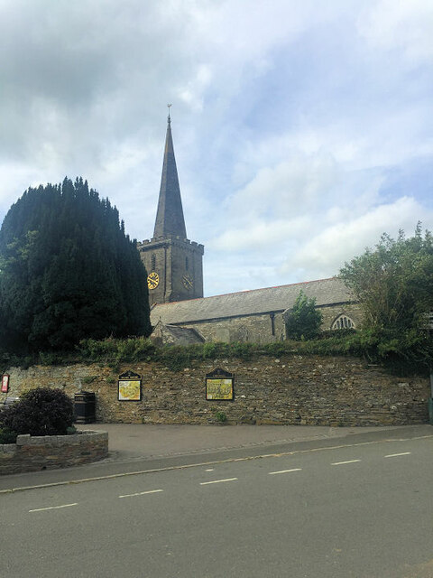
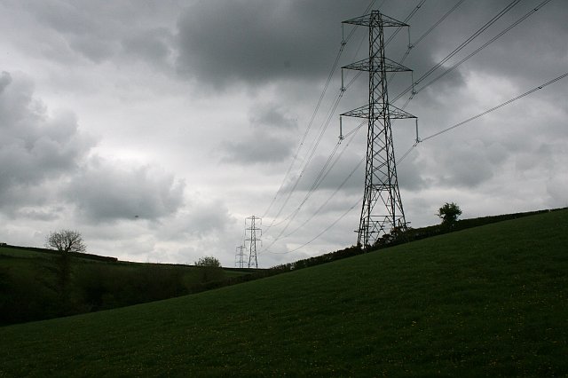
Ashleigh Meadow Images

Images are sourced within 2km of 50.452432/-4.407286 or Grid Reference SX2964. Thanks to Geograph Open Source API. All images are credited.

St Lalluwy
St Lalluwy
St Lalluwy
St Lalluwy
St Lalluwy
St Lalluwy
Menheniott Methodist Church
East Road
East Road
Valley at Trenodden The trees hide a farm.  The black blotches on the photograph are some sort of large flies which were hanging around the hedgerows in abundance.
Valley at Trenodden
The trees hide a farm. The black blotches on the photograph are some sort of large flies which were hanging around the hedgerows in abundance.
House at Treweese Cross
Large Pasture/Silage Field This is typical of the fields in this area but not easily seen unless you take to the footpaths.  The high hedges on the roadside hide everything.
Large Pasture/Silage Field
This is typical of the fields in this area but not easily seen unless you take to the footpaths. The high hedges on the roadside hide everything.
Free-range beef On steep pasture above the Tregondale valley near Lambest farm.
Free-range beef
On steep pasture above the Tregondale valley near Lambest farm.
Lane looking towards Menheniot Almost at the valley bottom the road will cross a small stream then start to climb up the valley
Lane looking towards Menheniot
Almost at the valley bottom the road will cross a small stream then start to climb up the valley
Rural East Cornwall  As seen from along the Menheniot to Quethiock road plenty of pasture land. The valley is hidden but there is quite a drop.
Rural East Cornwall
As seen from along the Menheniot to Quethiock road plenty of pasture land. The valley is hidden but there is quite a drop.
Narrow Lane On the Menheniot to Quethiock road
Narrow Lane
On the Menheniot to Quethiock road
Cattle Feeding Station
South Trewint Farm
South Trewint Farm
Sheep Grazing and Houses This is on the eastern outskirts of the village of Menheniot
Sheep Grazing and Houses
This is on the eastern outskirts of the village of Menheniot
Menheniot Menheniot is in many respects a typical 'parish village' with a church at its centre.  It suffered great changes in the mid 19th century when for a short time lead was mined in the vicinity.  A number of new houses have been built in the latter half of the 20th century which has kept the village population high enough to support a pub and a shop.
Menheniot
Menheniot is in many respects a typical 'parish village' with a church at its centre. It suffered great changes in the mid 19th century when for a short time lead was mined in the vicinity. A number of new houses have been built in the latter half of the 20th century which has kept the village population high enough to support a pub and a shop.
Exposed for Cloud It is not uncommon to have grey cloudy days in Cornwall, or in England for that matter.  On such days the cloud cover and the details within it are a part of the landscape.  Unfortunately, the limitations of photography mean that if we are to show the landscape, the cloudscape is usually overexposed and becomes a field of white in the photograph.  Here I have done just the opposite, exposed the photograph for the cloudscape and let the landscape disappear into black.  This is a colour photograph, it has not been converted to black and white!
Exposed for Cloud
It is not uncommon to have grey cloudy days in Cornwall, or in England for that matter. On such days the cloud cover and the details within it are a part of the landscape. Unfortunately, the limitations of photography mean that if we are to show the landscape, the cloudscape is usually overexposed and becomes a field of white in the photograph. Here I have done just the opposite, exposed the photograph for the cloudscape and let the landscape disappear into black. This is a colour photograph, it has not been converted to black and white!
Old Lead Mine This is now a contractors site or depot.  The red triangle warning sign on the gate warns of the danger of falling down old mine shafts.
Old Lead Mine
This is now a contractors site or depot. The red triangle warning sign on the gate warns of the danger of falling down old mine shafts.
Show me another place!

Ashleigh Meadow is located at Grid Ref: SX2964 (Lat: 50.452432, Lng: -4.407286)

Unitary Authority: Cornwall

Police Authority: Devon and Cornwall

What 3 Words

///result.blacken.dwarf. Near Liskeard, Cornwall

Related Wikis

Menheniot

Menheniot (pronounced Men-en-yut; Cornish: Mahynyet) is a civil parish and village in Cornwall, England, United Kingdom. The village is 2+1⁄2 miles (4...

Pengover Green

Pengover Green is a hamlet east of Liskeard in east Cornwall, England. == Local Industry == Local abattoir, Peake (GB) Limited is situated 900m southwest...

Merrymeet

Merrymeet is a village in north of the parish of Menheniot in east Cornwall, England. Merrymeet is on the A390 main road.During the Blitz in World War...

Bodway

Bodway is a hamlet in Cornwall, England, UK. It is situated 0.8 km (0.5 mi) southeast of the village of Menheniot, within the civil parish of the same...

Quethiock

Quethiock (Cornish: Koosek, meaning forested place) is a village and civil parish in Cornwall, England, United Kingdom, roughly five miles east of Liskeard...

Doddycross

Doddycross is a small hamlet at a crossroads in the former Caradon district of southeast Cornwall, England, with a population of <50. There are 14 houses...

Wivelshire

East Wivelshire and West Wivelshire (usually known merely as East and West) are two of the ancient Hundreds of Cornwall. East and West (Wivelshire) must...

Menheniot railway station

Menheniot railway station (Cornish: Manhynyes) serves the village of Menheniot in Cornwall, England. It is 261 miles 61 chains (421.3 km) from London Paddington...

Nearby Amenities

Located within 500m of 50.452432,-4.407286
Design: three-level
Power: tower
Lat/Long: 50.4480972/-4.4058818
Ashleigh Meadow
Lat/Long: 50.4527618/-4.4065013
The data included in this document is from www.openstreetmap.org. The data is made available under ODbL.

Have you been to Ashleigh Meadow?

Leave your review of Ashleigh Meadow below (or comments, questions and feedback).