Fasnakyle Forest
Downs, Moorland in Inverness-shire
Scotland
Fasnakyle Forest

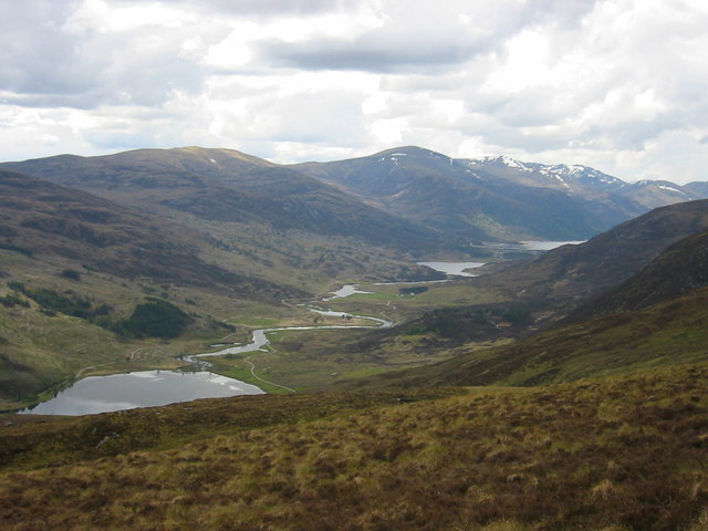
Fasnakyle Forest is located in Inverness-shire, Scotland, and is characterized by its diverse landscape of downs and moorland. The forest covers a vast area of approximately 15,000 hectares, making it one of the largest forests in the region. It is nestled within the picturesque surroundings of the Scottish Highlands, offering visitors breathtaking views of the surrounding mountains and valleys.
The forest is home to an abundance of wildlife, making it a popular destination for nature enthusiasts and wildlife photographers. The diverse ecosystem supports a variety of species, including red deer, Scottish wildcats, golden eagles, and pine martens. Birdwatchers can also spot a wide range of avian species, such as ospreys and capercaillies.
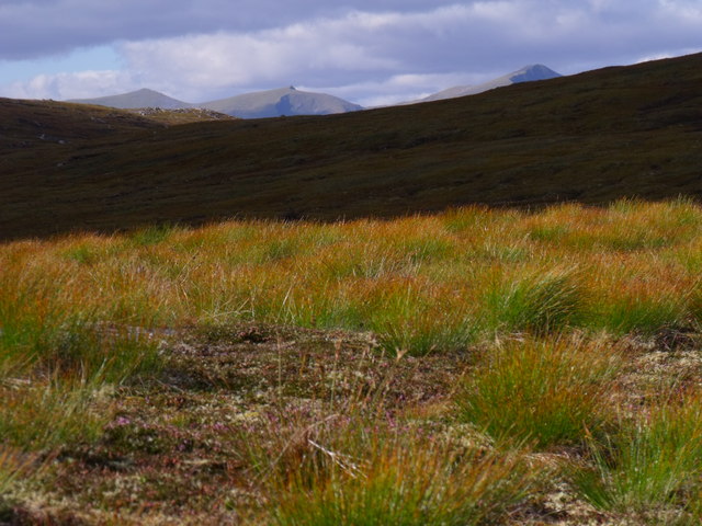
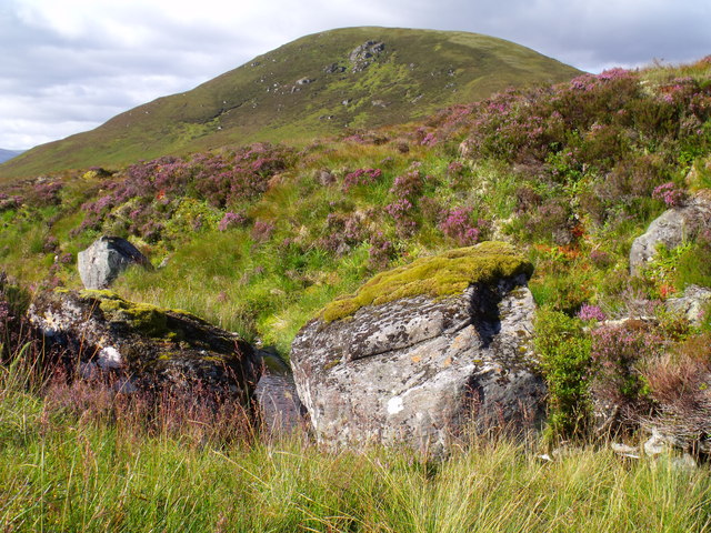
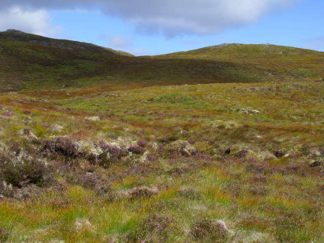
The terrain within Fasnakyle Forest varies, offering visitors a unique experience. The downs, characterized by rolling hills and open grasslands, provide opportunities for hiking, picnicking, and enjoying the panoramic views. The moorland, on the other hand, is covered with heather and scattered with lochs, creating a serene and tranquil atmosphere. The moorland is ideal for nature walks and birdwatching, with several well-marked trails leading visitors through its varied landscapes.
Fasnakyle Forest is managed by the Forestry Commission Scotland, which ensures the preservation and conservation of the natural environment. The commission also maintains a network of footpaths and viewpoints, allowing visitors to explore the forest while minimizing their impact on the delicate ecosystem.
Overall, Fasnakyle Forest offers a unique blend of downs and moorland, providing visitors with stunning landscapes and a chance to immerse themselves in Scotland's natural beauty.
If you have any feedback on the listing, please let us know in the comments section below.
Fasnakyle Forest Images
Images are sourced within 2km of 57.329062/-4.8774832 or Grid Reference NH2630. Thanks to Geograph Open Source API. All images are credited.


Fasnakyle Forest is located at Grid Ref: NH2630 (Lat: 57.329062, Lng: -4.8774832)
Unitary Authority: Highland
Police Authority: Highlands and Islands
What 3 Words
///waiters.logbook.scrubbing. Near Cannich, Highland
Nearby Locations
Related Wikis
Dog Falls, Glen Affric
Dog Falls (Gaelic: Eas a' Choin) is a series of waterfalls on the River Affric, in Glen Affric in the Highlands of Scotland. The falls are within the Glen...
Glen Cannich
Glen Cannich (Scottish Gaelic: Gleann Chanaich) is a long glen in the Northwest Highlands of Scotland and through which runs the River Cannich. Emerging...
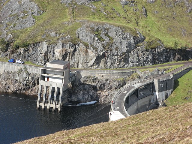
Affric-Beauly hydro-electric power scheme
The Affric-Beauly hydro-electric power scheme for the generation of hydro-electric power is located in the western Highlands of Scotland. It is based around...

Eas Maol Mhairi
Eas Maol Mhairi is a waterfall of Scotland. Just east of this waterfall is the River Cannich. == See also == Waterfalls of Scotland == References ==

Tomich (village)
Tomich (Scottish Gaelic: Tomaich) is a Victorian model conservation village situated in the Scottish Highlands at the western end of Strathglass, approximately...

Guisachan Fall
Guisachan Fall is a waterfall of Scotland. Known locally as Home Falls, they are located near to the ruins of Guisachan House, and can be accessed by a...

Sgorr na Dìollaid
Sgorr na Dìollaid is a mountain in the Northwest Highlands of Scotland. It is situated between Glen Strathfarrar and Glen Cannich, 7 km north-west of the...

Plodda Falls
Plodda Falls (Gaelic: Eas Ploda) is a waterfall, situated 5 km south-west of the village of Tomich, near Glen Affric, in the Highlands of Scotland. The...
Have you been to Fasnakyle Forest?
Leave your review of Fasnakyle Forest below (or comments, questions and feedback).