Tremarcoombe Common

Downs, Moorland in Cornwall

England

Tremarcoombe Common

Trethevy Quoit A Neolithic burial chamber <span class="nowrap"><a title="https://www.megalithic.co.uk/article.php?sid=167" rel="nofollow ugc noopener" href="https://www.megalithic.co.uk/article.php?sid=167">Link</a><img style="margin-left:2px;" alt="External link" title="External link - shift click to open in new window" src="https://s1.geograph.org.uk/img/external.png" width="10" height="10"/></span>
Trethevy Quoit Credit: Sandy Gerrard

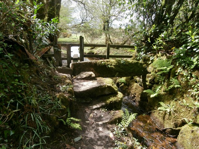
Tremarcoombe Common is a stunning area of natural beauty located in Cornwall, England. Covering a vast expanse of downs and moorland, this common is a haven for outdoor enthusiasts and nature lovers alike.

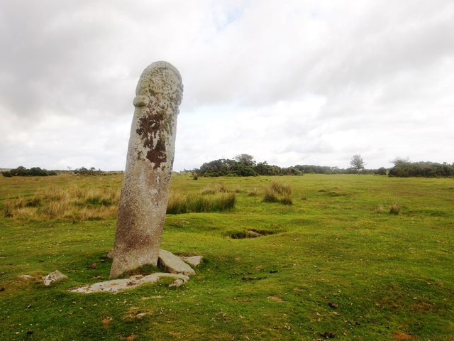
Situated near the village of Tremarcoombe, the common is characterized by its rolling hills, lush green meadows, and rugged moorland. The area is home to a diverse range of flora and fauna, with heather, gorse, and wildflowers dotting the landscape, and various species of birds, butterflies, and small mammals thriving in the rich ecosystem.

Tremarcoombe Common offers a multitude of recreational activities for visitors to enjoy. Hiking trails crisscross the area, providing panoramic views of the surrounding countryside and the nearby coastline. These trails cater to all levels of fitness and offer a chance to explore the unique flora and fauna up close. Additionally, the common is a popular spot for birdwatching, with various species including skylarks, kestrels, and buzzards frequently spotted.

The tranquility and natural beauty of Tremarcoombe Common make it an ideal location for picnicking and relaxation. The peaceful atmosphere and wide-open spaces provide the perfect setting for unwinding and enjoying the surrounding countryside.

Access to Tremarcoombe Common is straightforward, with ample parking available nearby. The common is well-maintained, and visitors are encouraged to respect the natural environment by following the designated paths and taking their litter with them.

In conclusion, Tremarcoombe Common is a picturesque and diverse landscape, offering a range of outdoor activities and a chance to immerse oneself in the beauty of Cornwall's natural surroundings.

If you have any feedback on the listing, please let us know in the comments section below.

Tremarcoombe Common Images

Images are sourced within 2km of 50.494848/-4.4632928 or Grid Reference SX2569. Thanks to Geograph Open Source API. All images are credited.

Trethevy Quoit A Neolithic burial chamber <span class="nowrap"><a title="https://www.megalithic.co.uk/article.php?sid=167" rel="nofollow ugc noopener" href="https://www.megalithic.co.uk/article.php?sid=167">Link</a><img style="margin-left:2px;" alt="External link" title="External link - shift click to open in new window" src="https://s1.geograph.org.uk/img/external.png" width="10" height="10"/></span>
Trethevy Quoit
A Neolithic burial chamber LinkExternal link
Gated track onto St Cleer Downs
Bus shelter by entrance to St Cleer Sports Ground
Holy Well in 1983 St Cleer's Well is a Grade I listing
Holy Well in 1983
St Cleer's Well is a Grade I listing
Trethevy Quoit Neolithic dolmen with a 200 tonne capstone near Tremar, known locally as 'The Giant's House' or 'Chi an Kowr' in Cornish
Trethevy Quoit
Neolithic dolmen with a 200 tonne capstone near Tremar, known locally as 'The Giant's House' or 'Chi an Kowr' in Cornish
Trethevy Quoit Neolithic dolmen with a 200 tonne capstone near Tremar, known locally as 'The Giant's House' or 'Chi an Kowr' in Cornish
Trethevy Quoit
Neolithic dolmen with a 200 tonne capstone near Tremar, known locally as 'The Giant's House' or 'Chi an Kowr' in Cornish
Trethevy Quoit Neolithic dolmen with a 200 tonne capstone near Tremar, known locally as 'The Giant's House' or 'Chi an Kowr' in Cornish
Trethevy Quoit
Neolithic dolmen with a 200 tonne capstone near Tremar, known locally as 'The Giant's House' or 'Chi an Kowr' in Cornish
Stone Stile SX2368a On the B3360 60m W of King Doniert’s Stone.
Sheep stile with protruding stone steps and galvanised steel handrail across a high field boundary wall accessing a public footpath across a field heading SE.
Public footpath 624/14/1 gold from B3360 towards St Cleer.
Stone Stile SX2368a
On the B3360 60m W of King Doniert’s Stone. Sheep stile with protruding stone steps and galvanised steel handrail across a high field boundary wall accessing a public footpath across a field heading SE. Public footpath 624/14/1 gold from B3360 towards St Cleer.
Stone Stile SX2369a South Trekeive. The small stile is in combination with and follows on from a wooden stile, immediately beside a stream.
One tread on each side, granite blocks.
Height on W side 35cm. Height on E side 35cm. Width 100cm.
In reasonable state of repair. 
Public footpath 624/27/2 Gold from Draynes Bridge to South Trekeive.
Stone Stile SX2369a
South Trekeive. The small stile is in combination with and follows on from a wooden stile, immediately beside a stream. One tread on each side, granite blocks. Height on W side 35cm. Height on E side 35cm. Width 100cm. In reasonable state of repair. Public footpath 624/27/2 Gold from Draynes Bridge to South Trekeive.
Stone Stile SX2369b South Trekeive. Approximately 25m east of stile SX2369a. Immediately beside the stream, the stile leads from the footpath onto a road.
On the west side, two treads and a third one on the ground. 
Two treads on the eastern side.  
Height on W side 100cm. Height on E side 80cm. Width 76cm.
In good state of repair.
Public footpath 624/27/2 Gold from: Draynes Bridge to: South Trekieve.
Stone Stile SX2369b
South Trekeive. Approximately 25m east of stile SX2369a. Immediately beside the stream, the stile leads from the footpath onto a road. On the west side, two treads and a third one on the ground. Two treads on the eastern side. Height on W side 100cm. Height on E side 80cm. Width 76cm. In good state of repair. Public footpath 624/27/2 Gold from: Draynes Bridge to: South Trekieve.
Stone Stile SX2468a 275m NW of St Cleer Recreation Ground at the start of a track heading W towards King Doniert’s Stone and the B3360.
Sheep stile with four protruding stone steps on the east side and five protruding stone steps on the west side, across a high boundary wall giving access to a farm track. 
Public footpath 624/14/1 gold from St Cleer towards B3360.
Stone Stile SX2468a
275m NW of St Cleer Recreation Ground at the start of a track heading W towards King Doniert’s Stone and the B3360. Sheep stile with four protruding stone steps on the east side and five protruding stone steps on the west side, across a high boundary wall giving access to a farm track. Public footpath 624/14/1 gold from St Cleer towards B3360.
Former Bible Christian Chapel
St Cleer's Church
St Cleer's Church
St Cleer Cemetery
St Cleer Cemetery
The Old School House
View from No 3
View from No 3
The Longstone, Minions Also known as Long Tom.
The Longstone, Minions
Also known as Long Tom.
Mine Chimney on Craddock Moor Part of the Craddock Moor Mine which is marked hereabouts and close to the West Caradon Mine; both of which jumped on the boom created by the nearby South Caradon Mine which hit a very productive lode of copper in the mid 19thC. 
"In 1846 we have a report on the Craddock Moor Mine in the grandly entitled 'The Railway Register and Record of Public Enterprise for Railways, Mines, Patents and Inventions' by Hyde Clarke Esquire stating: 'Craddock Moor, to the north-east of Caradon Consols, and west of West Caradon, is a splendid sett; but the workings are on a miserably small scale, and such as will never, we should think, prove it a mine. The engine is a small 22-inch cylinder, and the shaft, which is now only 18 fathoms deep, is on an inclined plane, and sinking on the course of the lode, at an expense of £30 per fathom. When we were there, two men were drawing up the stuff by means of the horse whim'."
Mine Chimney on Craddock Moor
Part of the Craddock Moor Mine which is marked hereabouts and close to the West Caradon Mine; both of which jumped on the boom created by the nearby South Caradon Mine which hit a very productive lode of copper in the mid 19thC. "In 1846 we have a report on the Craddock Moor Mine in the grandly entitled 'The Railway Register and Record of Public Enterprise for Railways, Mines, Patents and Inventions' by Hyde Clarke Esquire stating: 'Craddock Moor, to the north-east of Caradon Consols, and west of West Caradon, is a splendid sett; but the workings are on a miserably small scale, and such as will never, we should think, prove it a mine. The engine is a small 22-inch cylinder, and the shaft, which is now only 18 fathoms deep, is on an inclined plane, and sinking on the course of the lode, at an expense of £30 per fathom. When we were there, two men were drawing up the stuff by means of the horse whim'."
Show me another place!

Tremarcoombe Common is located at Grid Ref: SX2569 (Lat: 50.494848, Lng: -4.4632928)

Unitary Authority: Cornwall

Police Authority: Devon and Cornwall

What 3 Words

///vaccines.lifelong.quits. Near Pensilva, Cornwall

Related Wikis

Tremar Coombe

Tremar Coombe is a small hamlet situated in the former Caradon District north of Liskeard in Cornwall. "Tremar" ("Trevargh") means "Mark's farm" or "Horse...

Higher Tremarcoombe

Higher Tremarcoombe is a hamlet in the parish of St Cleer, Cornwall, England. == References ==

Trethevy Quoit

Trethevy Quoit (Cornish: Koyt Tredhewi) is a well-preserved megalithic structure between St Cleer and Darite in Cornwall, England, United Kingdom. It is...

Darite

Darite is a village in the civil parish of St Cleer (where the 2011 census population was included), Cornwall, England, United Kingdom. It is three miles...

Nearby Amenities

Located within 500m of 50.494848,-4.4632928
Bus Stop
Trecarne Gate
Bus: yes
Naptan AtcoCode: 0800COA10332
Naptan Bearing: SW
Naptan CommonName: Trecarne Gate
Naptan NaptanCode: cordtawa
Naptan PlusbusZoneRef: LISKARD
Naptan Street: Chapel Row
Naptan Verified: no
Public Transport: platform
Source: naptan_import
Lat/Long: 50.4919913/-4.4625188
Bus Stop
South View
Bus: yes
Naptan AtcoCode: 0800COA10344
Naptan Bearing: SW
Naptan CommonName: South View
Naptan NaptanCode: cordtdwd
Naptan PlusbusZoneRef: LISKARD
Naptan Street: Unclassified
Naptan Verified: no
Public Transport: platform
Shelter: yes
Source: naptan_import
Lat/Long: 50.4976801/-4.4584995
Bus Stop
Telephone Box
Bus: yes
Naptan AtcoCode: 0800COA10345
Naptan Bearing: SW
Naptan CommonName: Telephone Box
Naptan NaptanCode: cordtdtm
Naptan PlusbusZoneRef: LISKARD
Naptan Street: Unclassified
Naptan Verified: no
Public Transport: platform
Source: naptan_import
Lat/Long: 50.4976567/-4.4587522
Barrier: cattle_grid
Lat/Long: 50.4946861/-4.4622305
Tremar Coombe
Place: hamlet
Source: OS-OpenData_StreetView
Wikidata: Q7838040
Lat/Long: 50.492259/-4.4618862
Ford: yes
Lat/Long: 50.4981841/-4.4622715
Generator Method: photovoltaic
Generator Output Electricity: yes
Generator Source: solar
Generator Type: solar_photovoltaic_panel
Location: roof
Power: generator
Lat/Long: 50.4985905/-4.46623
Generator Method: photovoltaic
Generator Output Electricity: yes
Generator Source: solar
Generator Type: solar_photovoltaic_panel
Location: roof
Power: generator
Lat/Long: 50.4979388/-4.4666619
Generator Method: photovoltaic
Generator Output Electricity: yes
Generator Source: solar
Generator Type: solar_photovoltaic_panel
Location: roof
Power: generator
Lat/Long: 50.4978057/-4.4659511
Generator Method: photovoltaic
Generator Output Electricity: yes
Generator Source: solar
Generator Type: solar_photovoltaic_panel
Location: roof
Power: generator
Lat/Long: 50.497862/-4.4659082
Generator Method: photovoltaic
Generator Output Electricity: yes
Generator Source: solar
Generator Type: solar_photovoltaic_panel
Location: roof
Power: generator
Lat/Long: 50.4975813/-4.4647454
Generator Method: photovoltaic
Generator Output Electricity: yes
Generator Source: solar
Generator Type: solar_photovoltaic_panel
Location: roof
Power: generator
Lat/Long: 50.4978211/-4.4657365
Generator Method: photovoltaic
Generator Output Electricity: yes
Generator Source: solar
Generator Type: solar_photovoltaic_panel
Location: roof
Power: generator
Lat/Long: 50.4973996/-4.458913
Bench
Lat/Long: 50.4975993/-4.458332
Defibrillator
Booth: K6
Covered: booth
Defibrillator Location: inside old red phone box in Darite
Disused Amenity: telephone
Emergency: defibrillator
Man Made: telephone_box
Lat/Long: 50.497638/-4.4588166
Give Way
Direction: forward
Lat/Long: 50.4977204/-4.4585789
Noexit: yes
Lat/Long: 50.4968915/-4.4583164
The data included in this document is from www.openstreetmap.org. The data is made available under ODbL.

Have you been to Tremarcoombe Common?

Leave your review of Tremarcoombe Common below (or comments, questions and feedback).