Lux Park

Downs, Moorland in Cornwall

England

Lux Park

North side of A38 cutting east of Dobwalls
North side of A38 cutting east of Dobwalls Credit: David Smith

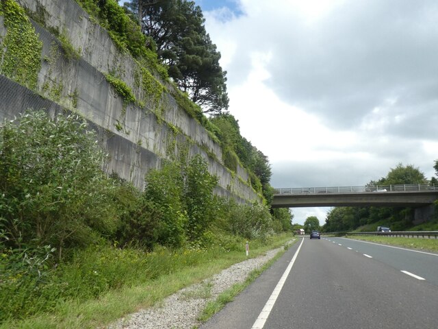
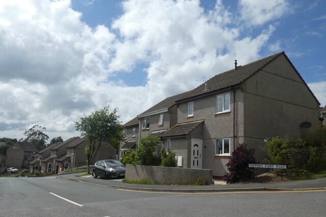
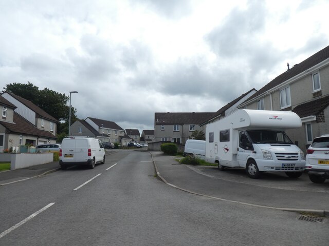
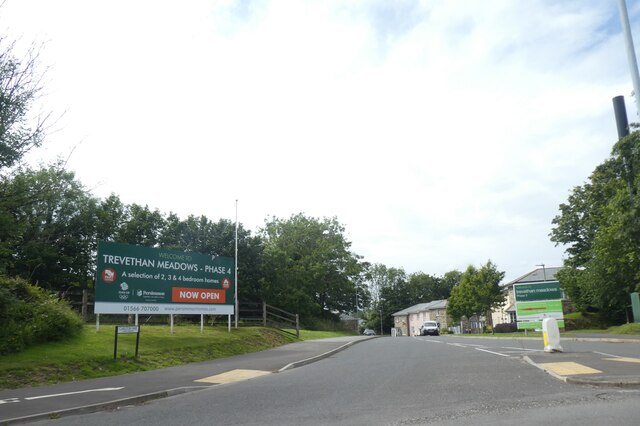
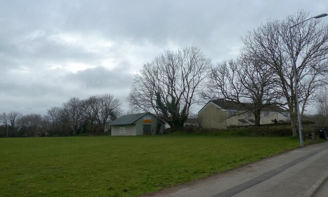
Lux Park is a recreational park located in Liskeard, Cornwall, known for its stunning natural beauty and diverse range of activities. Spread over 25 acres, Lux Park offers a perfect blend of downs and moorland landscapes, making it a popular destination for both locals and tourists.

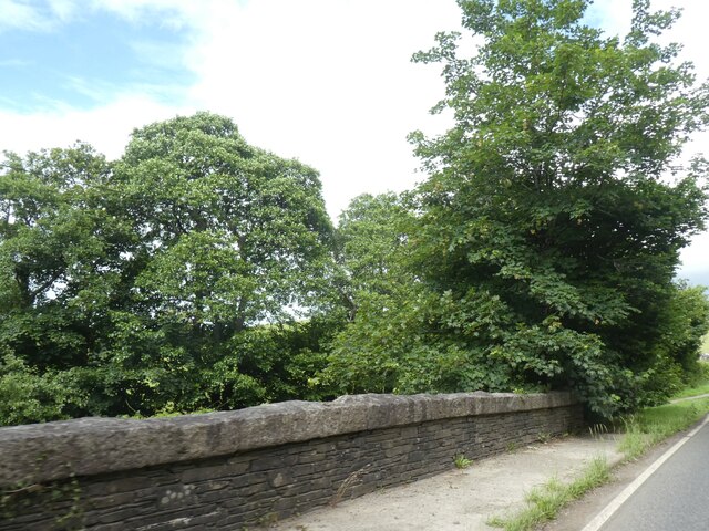
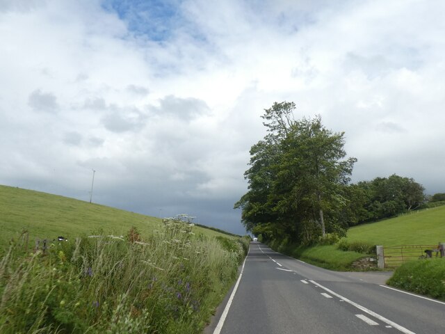
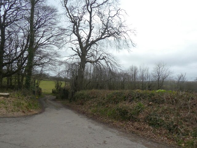
The park boasts well-maintained walking trails that wind through its picturesque surroundings, allowing visitors to immerse themselves in the tranquility of nature. The downs are characterized by gently rolling hills covered in lush green grass, while the moorland offers a wilder, more rugged terrain with heather and gorse bushes dotting the landscape.

Lux Park is also home to various sports facilities, including a state-of-the-art leisure center. The center features a large swimming pool, fully equipped gymnasium, and multiple indoor sports halls, catering to a wide range of fitness enthusiasts. Additionally, there are outdoor tennis courts and a football pitch, providing ample opportunities for team sports and individual workouts.

For families, Lux Park offers a fantastic children's play area with modern equipment and ample space for kids to run around and have fun. The park also hosts regular events and activities, such as outdoor concerts, sports tournaments, and community gatherings, making it a vibrant hub of social interaction.

With its stunning natural landscapes and diverse range of activities, Lux Park in Cornwall truly offers something for everyone, making it a must-visit destination for nature lovers and sports enthusiasts alike.

If you have any feedback on the listing, please let us know in the comments section below.

Lux Park Images

Images are sourced within 2km of 50.461276/-4.4630551 or Grid Reference SX2565. Thanks to Geograph Open Source API. All images are credited.

North side of A38 cutting east of Dobwalls
Bridge support with graffiti by A38
A390 east of Liskeard
Housing estate west of A390 bypassing Liskeard
Peppers Park Road, Liskeard A link road from A390 into housing estates on the east side of Liskeard
Peppers Park Road, Liskeard
A link road from A390 into housing estates on the east side of Liskeard
Aldi supermarket, Liskeard
Bus shelter, Clemo Road, Liskeard
Oak Tree Surgery, Clemo Road, Liskeard
Stephens Road, Liskeard Part of a housing estate on the north-east side of Liskeard
Stephens Road, Liskeard
Part of a housing estate on the north-east side of Liskeard
Carlton Way, Liskeard Access road from the bypass to a growing (in 2021) housing estate
Carlton Way, Liskeard
Access road from the bypass to a growing (in 2021) housing estate
Bridge parapet, Hendra Bridge, on A390
A390 passing entrance road to Hendra One of several places in Cornwall with the name Hendra, probably meaning "Home Farm"
A390 passing entrance road to Hendra
One of several places in Cornwall with the name Hendra, probably meaning "Home Farm"
Sports ground by B3254 north of Liskeard
Access road to Trevecca Farm
Two lone trees by B3254
Road to Old Treworgey
Barras Street B3254 Main thoroughfare in Liskeard old town
Barras Street
B3254 Main thoroughfare in Liskeard old town
Stuart House Grade II* listed Stuart House on Barras Street. Largely 17th century with late medieval origins. King Charles I reputedly slept here for several nights in 1644
Stuart House
Grade II* listed Stuart House on Barras Street. Largely 17th century with late medieval origins. King Charles I reputedly slept here for several nights in 1644
Show me another place!

Lux Park is located at Grid Ref: SX2565 (Lat: 50.461276, Lng: -4.4630551)

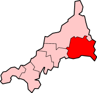
Unitary Authority: Cornwall

Police Authority: Devon and Cornwall

What 3 Words

///ambitions.pushing.camcorder. Near Liskeard, Cornwall

Related Wikis

Liskeard Athletic F.C.

Liskeard Athletic Football Club is a football club based in Liskeard, Cornwall, England. They are currently members of the South West Peninsula League...

Addington, Cornwall

Addington is a residential area of northeast Liskeard, in Cornwall, England, United Kingdom. It is located at grid reference SX 259 651. According to the...
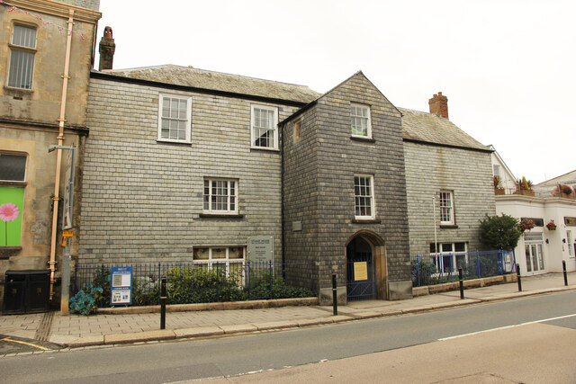
Liskeard Guildhall

Liskeard Guildhall is a municipal building in Pike Street, Liskeard, Cornwall, England. The structure, which was the meeting place of Liskeard Borough...
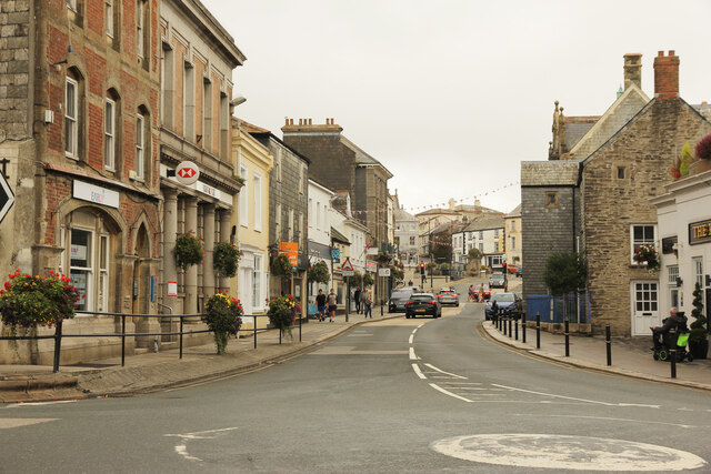
Liskeard

Liskeard ( lih-SKARD; Cornish: Lyskerrys) is an ancient stannary and market town in south-east Cornwall, England, United Kingdom. It is situated approximately...

St Martin's Church, Liskeard

St Martin's Church, Liskeard is a Church of England parish church in Liskeard, Cornwall, the second-largest parish church in Cornwall after St Petroc's...

Caradon

Caradon was a local government district in Cornwall, England, United Kingdom. It contained five towns: Callington, Liskeard, Looe, Saltash and Torpoint...

Liskeard School and Community College

Liskeard School and Community College is a coeducational secondary school and sixth form with former engineering specialist status, located in Liskeard...

Old Park, Cornwall

Old Park is a hamlet in the parish of Liskeard, Cornwall, England, UK. == References ==

Nearby Amenities

Located within 500m of 50.461276,-4.4630551
Mini Roundabout
Direction: clockwise
Lat/Long: 50.4586618/-4.4598504
Mini Roundabout
Direction: clockwise
Lat/Long: 50.4584715/-4.460244
Bus Stop
Culverland
Bus: yes
Naptan AtcoCode: 0800COD41281
Naptan Bearing: W
Naptan CommonName: Culverland
Naptan Crossing: Hooper Court
Naptan NaptanCode: cordtajt
Naptan PlusbusZoneRef: LISKARD
Naptan Street: Culverwood Road
Naptan Verified: no
Public Transport: platform
Source: naptan_import
Lat/Long: 50.4637318/-4.4624029
Bus Stop
Culverland
Bus: yes
Naptan AtcoCode: 0800COD41282
Naptan Bearing: E
Naptan CommonName: Culverland
Naptan Crossing: Culverland Park
Naptan Indicator: Opp
Naptan NaptanCode: cordtajg
Naptan PlusbusZoneRef: LISKARD
Naptan Street: Culverwood Road
Naptan Verified: no
Public Transport: platform
Source: naptan_import
Lat/Long: 50.4638832/-4.4633268
Bus Stop
Addington
Bus: yes
Naptan AtcoCode: 0800COD41288
Naptan Bearing: W
Naptan CommonName: Addington
Naptan Crossing: Greenbank Road
Naptan NaptanCode: cordtdgw
Naptan PlusbusZoneRef: LISKARD
Naptan Street: Callington Road
Naptan Verified: no
Public Transport: platform
Source: naptan_import
Lat/Long: 50.4585181/-4.4596945
Bus Stop
Addington
Bus: yes
Naptan AtcoCode: 0800COY38645
Naptan Bearing: E
Naptan CommonName: Addington
Naptan Crossing: Higher Lux Street
Naptan Indicator: Opp
Naptan NaptanCode: cordtawm
Naptan PlusbusZoneRef: LISKARD
Naptan Street: Greenbank Road
Naptan Verified: no
Public Transport: platform
Source: naptan_import
Lat/Long: 50.4584808/-4.4606084
Bus Stop
St Cleer Rd Jct
Bus: yes
Naptan AtcoCode: 0800FWX38770
Naptan Bearing: N
Naptan CommonName: St Cleer Rd Jct
Naptan NaptanCode: cordtdga
Naptan PlusbusZoneRef: LISKARD
Naptan Street: St Cleer Road
Naptan Verified: no
Public Transport: platform
Source: naptan_import
Lat/Long: 50.4589126/-4.4601799
Source: gps survey
Lat/Long: 50.4568714/-4.4629747
Post Box
Post Box Type: pillar
Lat/Long: 50.4581918/-4.4598392
Telephone
Booth: KX100
Covered: booth
Lat/Long: 50.4583256/-4.4596446
Man Made: tower
Tower Type: communication
Lat/Long: 50.4579181/-4.4639633
Crossing
Crossing: unmarked
Crossing Island: yes
Crossing Markings: no
Lat/Long: 50.4583489/-4.4601576
Crossing
Crossing: unmarked
Crossing Island: yes
Crossing Markings: no
Lat/Long: 50.4586671/-4.4596902
Fuel
Addington Service Station
Brand: BP
Brand Wikidata: Q152057
Fuel Biodiesel: yes
Website: https://map.bp.com/en-GB/GB/petrol-station/liskeard/addington-filling-station/3580
Lat/Long: 50.4595255/-4.4577891
Barrier: cycle_barrier
Bicycle: no
Foot: yes
Lat/Long: 50.4599515/-4.457667
Barrier: cycle_barrier
Bicycle: no
Foot: yes
Lat/Long: 50.4602619/-4.4574145
Bicycle: no
Foot: no
Lat/Long: 50.460455/-4.4571047
Post Box
Brand: Royal Mail
Brand Wikidata: Q638098
Operator: Royal Mail
Operator Wikidata: Q638098
Lat/Long: 50.4578861/-4.4658514
Barrier: bollard
Bicycle: yes
Foot: yes
Lat/Long: 50.4573311/-4.4609848
Barrier: bollard
Bicycle: yes
Foot: yes
Lat/Long: 50.4574389/-4.4612433
Crossing
Crossing: traffic_signals
Crossing Island: no
Crossing Ref: pelican
Tactile Paving: yes
Lat/Long: 50.458346/-4.4607914
Crossing
Crossing: unmarked
Crossing Island: no
Crossing Markings: no
Tactile Paving: yes
Lat/Long: 50.459582/-4.4656483
Charging Station
Access: permit
Authentication Membership Card: yes
Fee: yes
Note: Two charging points at one location: "permits only".
Operator: www.geniepoint.co.uk
Lat/Long: 50.4575149/-4.4614784
Fast Food
Ian's Plaice
Addr Postcode: PL14 3JX
Cuisine: fish_and_chips
Fhrs Id: 722553
Opening Hours: Mo-Sa 12:00-13:45,16:45-20:30
Source: gps_survey;local_knowledge
Lat/Long: 50.4581147/-4.459635
Bus Stop
Miners Meadow
Bus: yes
Naptan AtcoCode: 0800COA16233
Naptan Bearing: SW
Naptan CommonName: Miners Meadow
Naptan Indicator: SW-bound
Naptan NaptanCode: corgpdad
Naptan Verified: no
Public Transport: platform
Route Ref: 541;592
Source: naptan;bing;naptan_compare_tool
Lat/Long: 50.459369/-4.4577583
Defibrillator
Defibrillator Location: On wall outside door of shop.
Emergency: defibrillator
Indoor: no
Operator: Electrical Solutions Ltd;SW Ambulance Service
Source: survey
Lat/Long: 50.4581341/-4.459843
Addington Stores: Off licence
Shop: convenience
Source: gps_survey;local_knowledge
Lat/Long: 50.4581495/-4.4597572
Liskeard Clutch Centre
Shop: car_repair
Source: gps survey
Lat/Long: 50.4639868/-4.4638059
Noexit: yes
Lat/Long: 50.4642862/-4.4645047
Bus Stop
Miners Meadow
Bus: yes
Naptan AtcoCode: 0800COA16234
Naptan Bearing: NE
Naptan CommonName: Miners Meadow
Naptan Indicator: opp
Naptan NaptanCode: corgpdag
Naptan Verified: no
Public Transport: platform
Lat/Long: 50.4594987/-4.457631
Addr Housenumber: 7
Addr Street: Pyrite Gardens
Source: gps_survey;photographic_survey
Lat/Long: 50.4643127/-4.4594452
Generator Method: photovoltaic
Generator Output Electricity: yes
Generator Source: solar
Generator Type: solar_photovoltaic_panel
Location: roof
Power: generator
Lat/Long: 50.4597858/-4.4573882
Generator Method: photovoltaic
Generator Output Electricity: yes
Generator Source: solar
Generator Type: solar_photovoltaic_panel
Location: roof
Power: generator
Lat/Long: 50.4588876/-4.4576055
Generator Method: photovoltaic
Generator Output Electricity: yes
Generator Source: solar
Generator Type: solar_photovoltaic_panel
Location: roof
Power: generator
Lat/Long: 50.4596748/-4.459475
Generator Method: photovoltaic
Generator Output Electricity: yes
Generator Source: solar
Generator Type: solar_photovoltaic_panel
Location: roof
Power: generator
Lat/Long: 50.4581512/-4.4633734
Generator Method: photovoltaic
Generator Output Electricity: yes
Generator Source: solar
Generator Type: solar_photovoltaic_panel
Location: roof
Power: generator
Lat/Long: 50.4581393/-4.4637382
Generator Method: photovoltaic
Generator Output Electricity: yes
Generator Source: solar
Generator Type: solar_photovoltaic_panel
Location: roof
Power: generator
Lat/Long: 50.4581307/-4.4639152
Generator Method: photovoltaic
Generator Output Electricity: yes
Generator Source: solar
Generator Type: solar_photovoltaic_panel
Location: roof
Power: generator
Lat/Long: 50.4580027/-4.4673404
Generator Method: photovoltaic
Generator Output Electricity: yes
Generator Source: solar
Generator Type: solar_photovoltaic_panel
Location: roof
Power: generator
Lat/Long: 50.4579412/-4.4673109
Generator Method: photovoltaic
Generator Output Electricity: yes
Generator Source: solar
Generator Type: solar_photovoltaic_panel
Location: roof
Power: generator
Lat/Long: 50.4578917/-4.467276
Generator Method: photovoltaic
Generator Output Electricity: yes
Generator Source: solar
Generator Type: solar_photovoltaic_panel
Location: roof
Power: generator
Lat/Long: 50.4578558/-4.4672438
Generator Method: photovoltaic
Generator Output Electricity: yes
Generator Source: solar
Generator Type: solar_photovoltaic_panel
Location: roof
Power: generator
Lat/Long: 50.4577909/-4.4672036
Generator Method: photovoltaic
Generator Output Electricity: yes
Generator Source: solar
Generator Type: solar_photovoltaic_panel
Location: roof
Power: generator
Lat/Long: 50.4578968/-4.4676703
Generator Method: photovoltaic
Generator Output Electricity: yes
Generator Source: solar
Generator Type: solar_photovoltaic_panel
Location: roof
Power: generator
Lat/Long: 50.4579156/-4.4675912
Generator Method: photovoltaic
Generator Output Electricity: yes
Generator Source: solar
Generator Type: solar_photovoltaic_panel
Location: roof
Power: generator
Lat/Long: 50.4579275/-4.4675174
Generator Method: photovoltaic
Generator Output Electricity: yes
Generator Source: solar
Generator Type: solar_photovoltaic_panel
Location: roof
Power: generator
Lat/Long: 50.4577461/-4.4671607
Bench
Seats: 3
Source: gps_survey
Lat/Long: 50.458252/-4.4604841
Library
liskeard Library
Note: Liskeard Library is in Luxstowe House at least for now
Lat/Long: 50.4575962/-4.461785
The Council Chamber
Office: government
Lat/Long: 50.4573418/-4.4616482
Defibrillator
Access: customers
Defibrillator Location: Council Offices/Liskeard Job Centre
Emergency: defibrillator
Indoor: yes
Lat/Long: 50.457274/-4.4619414
Historic: wayside_cross
Material: stone
Lat/Long: 50.4636267/-4.4617619
Traffic Signals
Direction: backward
Lat/Long: 50.4583533/-4.4607653
Traffic Signals
Direction: forward
Lat/Long: 50.4583303/-4.4608414
Traffic Calming: island
Lat/Long: 50.458443/-4.4604036
Crossing
Crossing: unmarked
Crossing Island: yes
Crossing Markings: no
Lat/Long: 50.4587732/-4.459894
The data included in this document is from www.openstreetmap.org. The data is made available under ODbL.

Have you been to Lux Park?

Leave your review of Lux Park below (or comments, questions and feedback).