Bad na h-Achlaise

Downs, Moorland in Sutherland

Scotland

Bad na h-Achlaise

The Banks of Loch Urigill You can see Cul Mor in the distance and the deer fence around the Ledmoore Estate
The Banks of Loch Urigill Credit: rob

Bad na h-Achlaise is a remote and desolate area located in Sutherland, a county in the northernmost part of the Scottish Highlands. The name "Bad na h-Achlaise" translates to "Place of the Field" in English, reflecting the barrenness and lack of vegetation in the area.

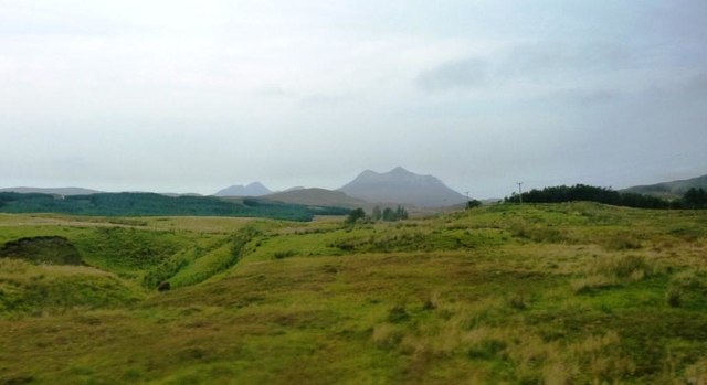
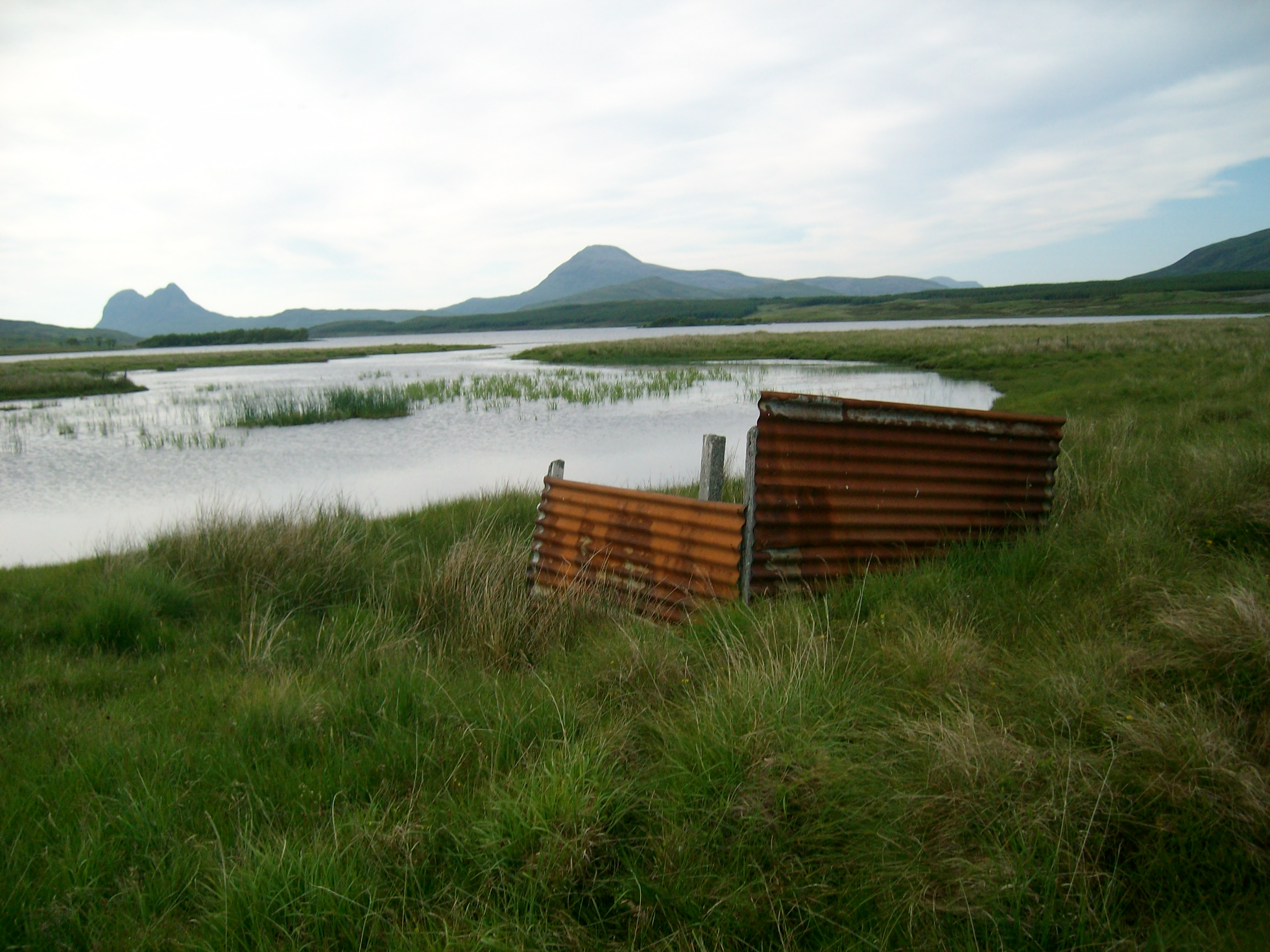
Characterized by its rugged landscape, Bad na h-Achlaise mainly consists of downs and moorland, with vast open spaces and rolling hills stretching as far as the eye can see. The terrain is predominantly composed of peat, which gives the ground a dark and spongy appearance. There are very few trees or shrubs in the vicinity, contributing to the overall starkness of the environment.

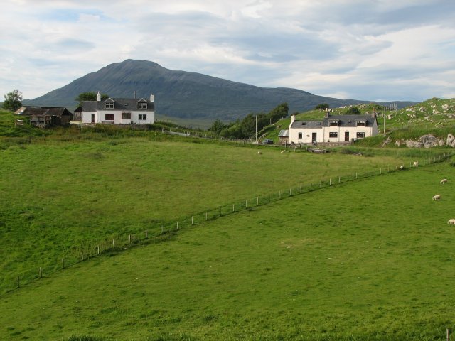
The area is known for its challenging weather conditions, often experiencing strong winds, heavy rainfall, and low temperatures. As a result, the land is often wet and marshy, making it difficult to traverse on foot. The isolation and harsh climate of Bad na h-Achlaise have ensured that it remains sparsely populated, with only a handful of scattered crofting communities in the surrounding areas.

Despite its inhospitable nature, Bad na h-Achlaise offers breathtaking panoramic views of the surrounding mountains and lochs. The barrenness of the landscape, devoid of human development, contributes to a sense of untouched wilderness and natural beauty. Visitors to the area can witness the vastness of the Scottish Highlands and immerse themselves in the solitude and tranquility of this remote location.

If you have any feedback on the listing, please let us know in the comments section below.

Bad na h-Achlaise Images

Images are sourced within 2km of 58.054498/-4.974495 or Grid Reference NC2411. Thanks to Geograph Open Source API. All images are credited.

The Banks of Loch Urigill You can see Cul Mor in the distance and the deer fence around the Ledmoore Estate
The Banks of Loch Urigill
You can see Cul Mor in the distance and the deer fence around the Ledmoore Estate
Farm development at Ledmore
Ice-covered Loch Borralan Cùl Mòr beyond.
Ice-covered Loch Borralan
Cùl Mòr beyond.
Slopes of Cnoc na Stroine
Loch Borralan From the A837.
Loch Borralan
From the A837.
Ledmore River Looking towards Ledmore from the A837.
Ledmore River
Looking towards Ledmore from the A837.
Ledmore River By the A837.
Ledmore River
By the A837.
Loch Borralan and shoreline Taken from A837 approaching Altnacealgach Motel. Col Mor visible in mist in distance.
Loch Borralan and shoreline
Taken from A837 approaching Altnacealgach Motel. Col Mor visible in mist in distance.
Ledmore River Bend in Ledmore River viewed from the A837. Cul Mor visible in distance in middle of image.
Ledmore River
Bend in Ledmore River viewed from the A837. Cul Mor visible in distance in middle of image.
Sheep Pen at Ledmore Taken from A837. Cul Mor prominent in distance.
Sheep Pen at Ledmore
Taken from A837. Cul Mor prominent in distance.
Snowy landscape from Ledmore A view from the A837 past Ledmore Junction - Cul Mor (R), the smaller snowy top of An Laogh left of centre and the two tops of Cul Beag in cloud beyond the rocky spur of Creag Dhubh.
Snowy landscape from Ledmore
A view from the A837 past Ledmore Junction - Cul Mor (R), the smaller snowy top of An Laogh left of centre and the two tops of Cul Beag in cloud beyond the rocky spur of Creag Dhubh.
Loch Borralan Loch Borralan looking towards Suilven and Cul Mor.
Loch Borralan
Loch Borralan looking towards Suilven and Cul Mor.
Loch Borralan
Loch Borralan
Approaching the Altnacealgach Hotel on the A837 Loch Borrolan on the right, with what looks like a yellow torpedo on the shore.
Approaching the Altnacealgach Hotel on the A837
Loch Borrolan on the right, with what looks like a yellow torpedo on the shore.
Old Milestone by the A837, Lairg parish Milestone by the A837, in parish of Lairg (Highland District), South East of Ledmore junction with the A836, on verge below farm, Borralan.

Surveyed

Milestone Society National ID: HI_LDIS00
Old Milestone by the A837, Lairg parish
Milestone by the A837, in parish of Lairg (Highland District), South East of Ledmore junction with the A836, on verge below farm, Borralan. Surveyed Milestone Society National ID: HI_LDIS00
Loch Borralan and Suilven
OSBM Bolt on Ledbeg Bridge OSBM Bolt: Ledbeg Bridge
OSBM Bolt on Ledbeg Bridge
OSBM Bolt: Ledbeg Bridge
North Coast 500 roadsign At the A837 at its junction with the A835
North Coast 500 roadsign
At the A837 at its junction with the A835
Show me another place!

Bad na h-Achlaise is located at Grid Ref: NC2411 (Lat: 58.054498, Lng: -4.974495)

Unitary Authority: Highland

Police Authority: Highlands and Islands

What 3 Words

///fled.curly.gave. Near Inchnadamph, Highland

Related Wikis

Loch Urigill

Loch Urigill is a freshwater loch near Elphin at the southern tip of the Assynt District in north-west Sutherland, Scotland.It's 2 miles from Elphin and...

Loch Borralan

Loch Borralan is a freshwater loch in the Assynt District of Sutherland in the Highland Council Area, northern Scotland.It is located adjacent to the A837...

Elphin, Highland

Elphin (Scottish Gaelic: Ailbhinn, which possibly derives from a combination of Norse and Gaelic fjell, "cliff" or "rock", and fionn, "bright") is a crofting...

Cam Loch, Sutherland

Cam Loch (the crooked loch) is an irregularly-shaped freshwater loch, about 5 km long, on a north-west to south-east orientation, located slightly north...

Have you been to Bad na h-Achlaise?

Leave your review of Bad na h-Achlaise below (or comments, questions and feedback).