Banc-y-Warren
Downs, Moorland in Cardiganshire
Wales
Banc-y-Warren
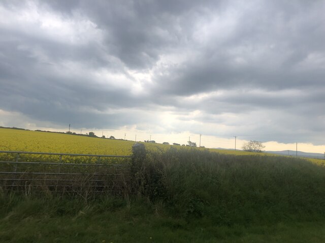
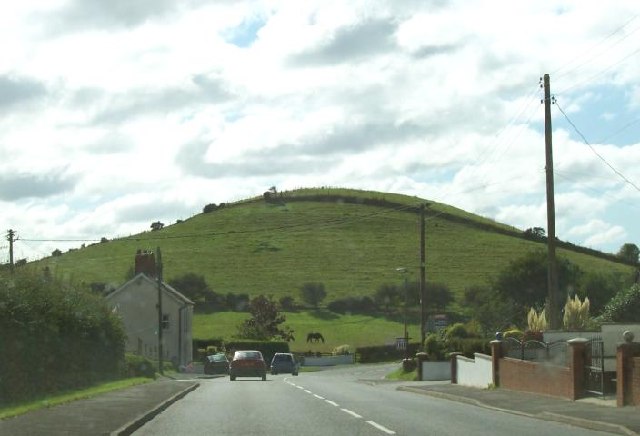
![Banc-y-Warren Parked in the village then walked up the main road to use track to the NW to access two gates to summit field with two horses.
Name: Banc y Warren
Hill number: 15488
Height:146m / 479ft
Parent (Ma/M): 2221 Rhos Ymryson
Section:31C: South-West Wales
County/UA: Cardiganshire [Ceredigion] (CoU)
Class: Tump (100-199m)
Grid ref:SN204475 (est)
Drop: 38m
Col:108m SN206476](https://s1.geograph.org.uk/geophotos/04/66/69/4666969_084ce3ba.jpg)
Banc-y-Warren is a picturesque area located in Cardiganshire, Wales. Nestled amidst rolling downs and expansive moorland, this region offers a serene and idyllic setting for nature enthusiasts and those seeking tranquility.
The area is characterized by its undulating landscape, adorned with lush greenery and dotted with scattered trees and flowering plants. The downs, with their gentle slopes and grassy expanses, provide a perfect backdrop for leisurely walks and picnics amidst nature. The moorland, on the other hand, offers a more rugged terrain, with heather-covered hills and rocky outcrops.
Banc-y-Warren is home to a rich variety of wildlife, with numerous bird species, including skylarks and peregrine falcons, gracing the skies above. The moorland is also known for its diverse flora, including rare orchids and vibrant wildflowers, adding a splash of color to the landscape.
Visitors to Banc-y-Warren can partake in a range of outdoor activities. Hiking and trekking are popular pursuits, with several trails crisscrossing the area, providing opportunities to explore the downs and moorland. The region is also renowned for its excellent birdwatching spots, attracting enthusiasts from far and wide.
For those seeking a peaceful retreat, Banc-y-Warren offers a selection of accommodation options, including cozy cottages and bed and breakfast establishments. Local amenities, such as quaint tea rooms and traditional pubs, provide opportunities to indulge in delicious Welsh cuisine and immerse oneself in the local culture.
Overall, Banc-y-Warren in Cardiganshire is a haven of natural beauty, offering a tranquil escape from the hustle and bustle of modern life.
If you have any feedback on the listing, please let us know in the comments section below.
Banc-y-Warren Images
Images are sourced within 2km of 52.096418/-4.6235939 or Grid Reference SN2047. Thanks to Geograph Open Source API. All images are credited.


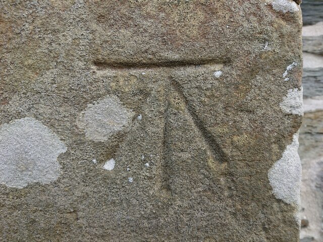
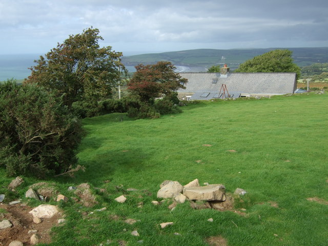
![OS Fundamental Benchmark - Llangoedmor, Cardigan FBM Ordnance Survey Fundamental Benchmark (FBM) used for levelling height above Ordnance Datum (OD).
Height (1954): 89.4719m OD (Newlyn). Mark verified by the Ordnance Survey in 1972. Description: CARDIGAN FBM 4.3M S SIDE TK 43M SW CORNER GARAGE. 0.3m above ground. 1st Order BM.
The FBM was used on the Haverford West to Cardigan (G077) and Cardigan to Aberystwyth (G082) lines of the Third Geodetic Levelling of England &amp; Wales in 1954 and 1956 respectively. It was levelled with a height of 293.543&#039; above OD (Newlyn). Abstract G 65: <span class="nowrap"><a title="http://discovery.nationalarchives.gov.uk/SearchUI/details?Uri=C11264473" rel="nofollow ugc noopener" href="http://discovery.nationalarchives.gov.uk/SearchUI/details?Uri=C11264473">Link</a><img style="margin-left:2px;" alt="External link" title="External link - shift click to open in new window" src="https://s1.geograph.org.uk/img/external.png" width="10" height="10"/></span> [OS 54/754]
Context: <a href="https://www.geograph.org.uk/photo/7443469">SN2046 : OS Fundamental Benchmark - Llangoedmor, Cardigan FBM</a>](https://s2.geograph.org.uk/geophotos/07/44/34/7443462_fac186da.jpg)
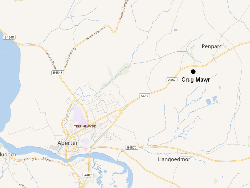
Banc-y-Warren is located at Grid Ref: SN2047 (Lat: 52.096418, Lng: -4.6235939)
Unitary Authority: Ceredigion
Police Authority: Dyfed Powys
What 3 Words
///limelight.mixers.patio. Near Cardigan, Ceredigion
Nearby Locations
Related Wikis
Banc-y-Warren
Banc-y-Warren is hill in Ceredigion with a height of 146 m. It is also classed as a Site of Special Scientific Interest. == See also == List of Sites of...
Battle of Crug Mawr
The Battle of Crug Mawr (Welsh: Brwydr Crug Mawr), sometimes referred to as the Battle of Cardigan, took place in September or October 1136, as part of...
Penparc
Penparc (also known as Penyparc) is a village in Ceredigion, Wales, on the A487 road 3 miles (4.8 km) northeast of Cardigan. The surrounding land is principally...

Banc y Mwldan
Banc y Mwldan is a Site of Special Scientific Interest in Ceredigion, west Wales. == References == == See also == List of Sites of Special Scientific...
Nearby Amenities
Located within 500m of 52.096418,-4.6235939Have you been to Banc-y-Warren?
Leave your review of Banc-y-Warren below (or comments, questions and feedback).