Bad a' Chìgean

Downs, Moorland in Sutherland

Scotland

Bad a' Chìgean

Culag Community Woodland Trust shelter, Loch an t-Sabhail Appropriate for the "loch of the barn", the Trust have built this wooden framed shelter beside the loch. Quinag is the background hill.
Culag Community Woodland Trust shelter, Loch an t-Sabhail Credit: AlastairG

Bad a' Chìgean is a stunning area located in Sutherland, Scotland, known for its breathtaking downs and moorland landscapes. Spanning over a vast expanse of approximately 200 square kilometers, this region offers visitors a unique and captivating experience.

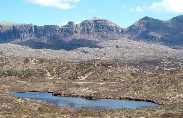
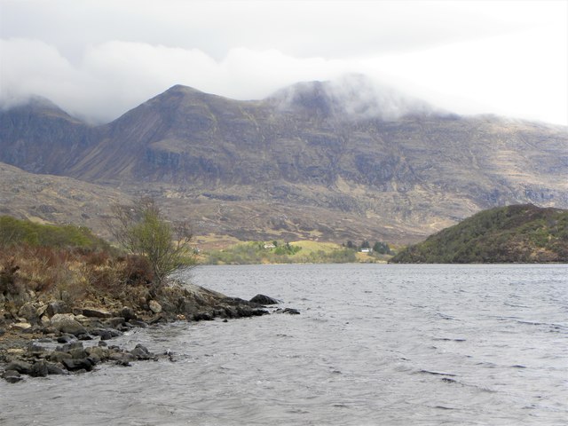
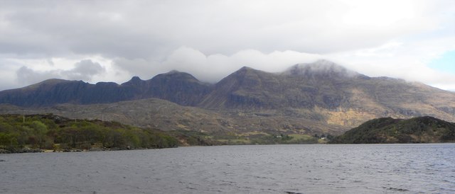
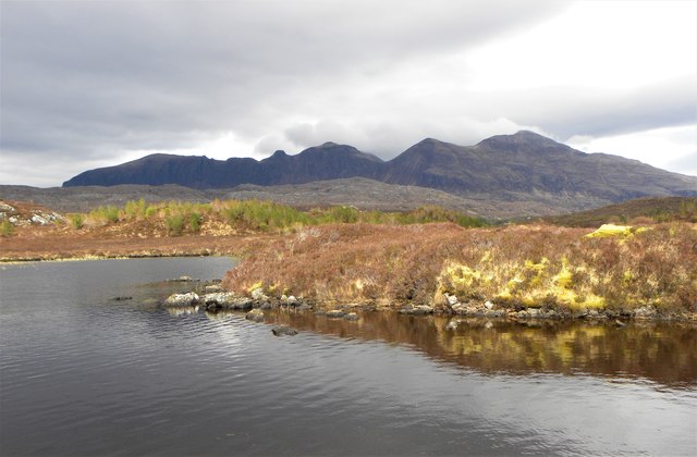
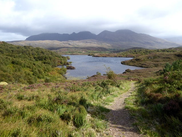
The downs of Bad a' Chìgean feature rolling hills and gently sloping valleys covered in lush green grasses. These downs provide a picturesque backdrop against the dramatic Scottish sky, creating a truly enchanting sight. The area is also home to a variety of wildlife, with red deer, hares, and various bird species frequently spotted among the downs.

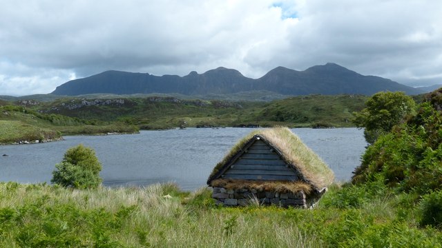
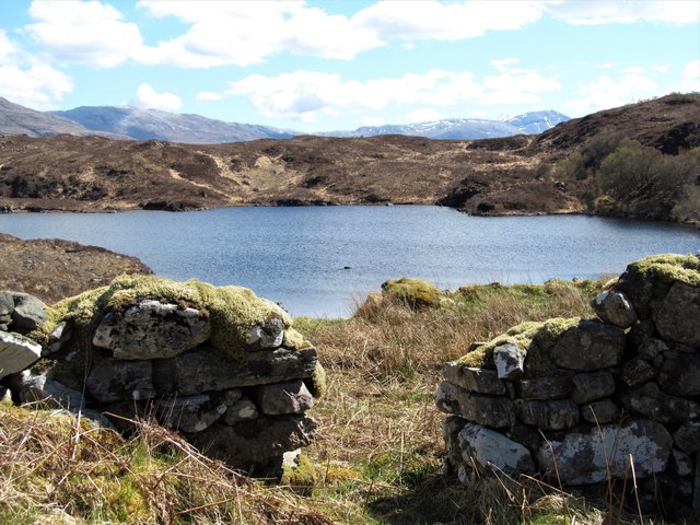
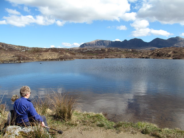
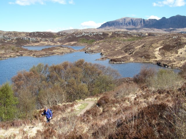
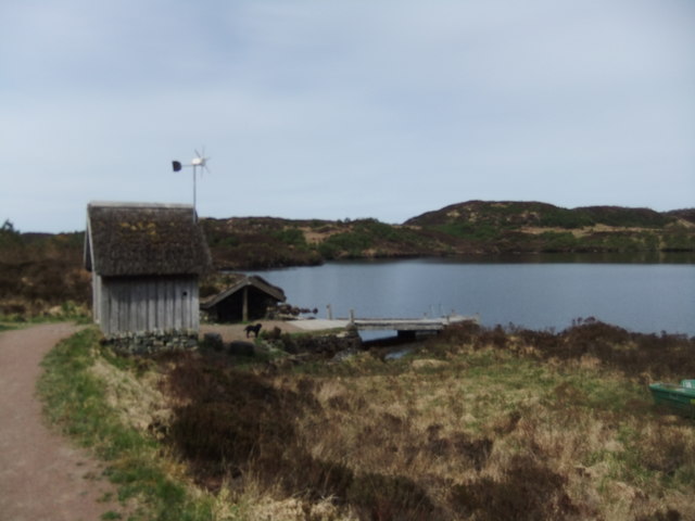
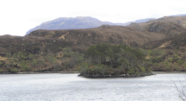
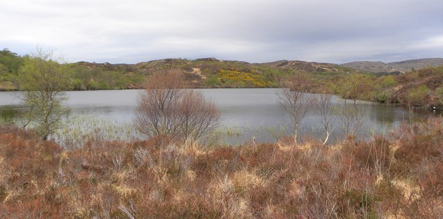
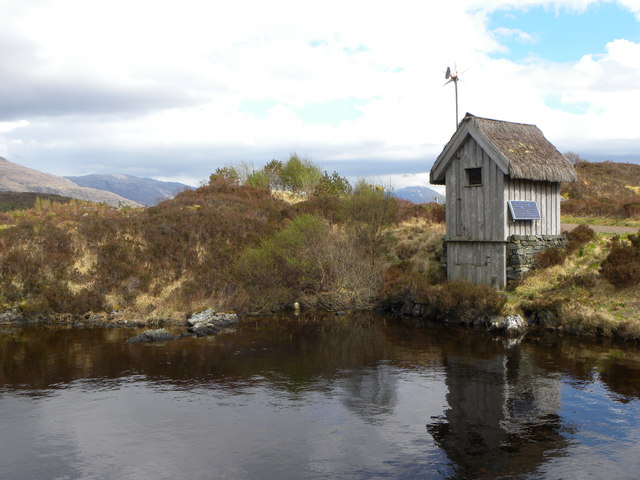
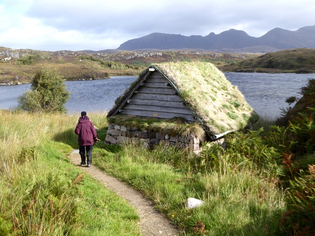
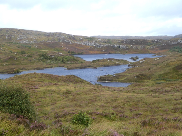
The moorland of Bad a' Chìgean is equally stunning, characterized by vast stretches of open, treeless terrain. The moorland is covered in heather, creating a stunning purple hue during the summer months. This unique landscape is punctuated by scattered lochs and peat bogs, adding to the allure and diversity of the area.

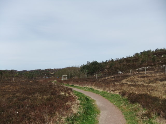
Visitors to Bad a' Chìgean can enjoy a range of outdoor activities, including hiking, birdwatching, and photography. The downs and moorland offer countless walking trails, allowing visitors to explore the area and soak in its natural beauty. The untouched and rugged nature of Bad a' Chìgean makes it a prime location for nature enthusiasts and those seeking tranquility and solitude.

Overall, Bad a' Chìgean in Sutherland is a truly remarkable area, with its downs and moorland offering a captivating blend of natural beauty and tranquility. Whether it's the rolling hills of the downs or the vast expanse of the moorland, this region provides a unique and unforgettable experience for all who visit.

If you have any feedback on the listing, please let us know in the comments section below.

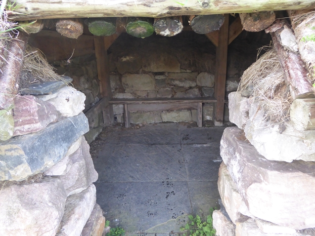
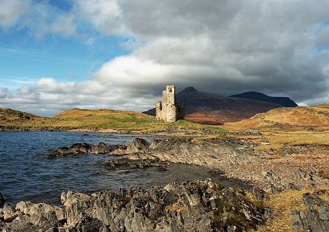
Bad a' Chìgean Images

Images are sourced within 2km of 58.197236/-5.1205055 or Grid Reference NC1627. Thanks to Geograph Open Source API. All images are credited.

Culag Community Woodland Trust shelter, Loch an t-Sabhail Appropriate for the "loch of the barn", the Trust have built this wooden framed shelter beside the loch. Quinag is the background hill.
Culag Community Woodland Trust shelter, Loch an t-Sabhail
Appropriate for the "loch of the barn", the Trust have built this wooden framed shelter beside the loch. Quinag is the background hill.
Old sheiling above Loch an t-Sabhail On the drier slopes above this loch are the remains of several sheilings. The question is, were they just summer pasture shelters or something more permanent?
Old sheiling above Loch an t-Sabhail
On the drier slopes above this loch are the remains of several sheilings. The question is, were they just summer pasture shelters or something more permanent?
Loch an t-Sabhail Small loch set amongst the knobbly terrain below Quinag.
Loch an t-Sabhail
Small loch set amongst the knobbly terrain below Quinag.
Path ascending from the lochside On one of the Little Assynt estate paths as it climbs a small rocky hill above Loch an t-Sabhail. Beyond the loch is its slightly larger neighbour, Loch an Ruighein, and beyond that again a line of small crags denote the edge of the promised land of a 'virgin' grid square.  This contributor did attempt to reach the square via the moor on the west side of the lochs, but after floundering in thick vegetation and bog for some time decided that the prize wasn't worth the effort.
Path ascending from the lochside
On one of the Little Assynt estate paths as it climbs a small rocky hill above Loch an t-Sabhail. Beyond the loch is its slightly larger neighbour, Loch an Ruighein, and beyond that again a line of small crags denote the edge of the promised land of a 'virgin' grid square. This contributor did attempt to reach the square via the moor on the west side of the lochs, but after floundering in thick vegetation and bog for some time decided that the prize wasn't worth the effort.
Unnamed lochan on the moor It would be a very hard task to count all the lochs and lochans on OS Explorer sheet 442, and it is not surprising that many are not named. However this lochan does provide some foreground interest in a fine view of Quinag's western flanks. This area which is part of the Little Assynt estate is surrounded by deer fences and there are efforts being made to encourage tree growth through natural seeding and through planting. However there are a few deer within the fenced area as we came across deer slots in mud.
Unnamed lochan on the moor
It would be a very hard task to count all the lochs and lochans on OS Explorer sheet 442, and it is not surprising that many are not named. However this lochan does provide some foreground interest in a fine view of Quinag's western flanks. This area which is part of the Little Assynt estate is surrounded by deer fences and there are efforts being made to encourage tree growth through natural seeding and through planting. However there are a few deer within the fenced area as we came across deer slots in mud.
Path into Assynt Estate
Jetty by Loch Leitir Easaidh
Assynt sheiling
Assynt sheiling
Eilean an Sgudain A small tree covered island in Loch Assynt. The OS map shows extensive tree cover on the hilly land on the far shore, but that doesn't exist apart from the usual stunted birch and willow.
Eilean an Sgudain
A small tree covered island in Loch Assynt. The OS map shows extensive tree cover on the hilly land on the far shore, but that doesn't exist apart from the usual stunted birch and willow.
Along Loch Assynt Looking north east along the loch towards Quinag.
Along Loch Assynt
Looking north east along the loch towards Quinag.
Loch Assynt A gravelly spit of land on the west side of Loch Assynt gives the chance for views along the loch towards the cloud capped peaks of Quinag.
Loch Assynt
A gravelly spit of land on the west side of Loch Assynt gives the chance for views along the loch towards the cloud capped peaks of Quinag.
Loch na h-Innse Fraoich Seen from the excellent path that circles the area. Apart from the obvious silver birch trees scattered about, the most numerous tree is the dwarf willow that rarely gets much above knee height. Plenty of cuckoos in this area, but the best 'spot' was a black throated diver on the loch.
Loch na h-Innse Fraoich
Seen from the excellent path that circles the area. Apart from the obvious silver birch trees scattered about, the most numerous tree is the dwarf willow that rarely gets much above knee height. Plenty of cuckoos in this area, but the best 'spot' was a black throated diver on the loch.
Still waters, dark mountain Taken across a little bay of Loch na h-Innse Fraoich with the brroding bulk of Quinag in the distance.
Still waters, dark mountain
Taken across a little bay of Loch na h-Innse Fraoich with the brroding bulk of Quinag in the distance.
Loo with a view One of two such structures close by the path on the Little Assynt estate. The loo might have a view, but one might not want to linger for too long as the little hut also contains rather a lot of flies.
Loo with a view
One of two such structures close by the path on the Little Assynt estate. The loo might have a view, but one might not want to linger for too long as the little hut also contains rather a lot of flies.
Path on the Little Assynt estate In 2000, the local community bought the Little Assynt estate at the western end of Loch Assynt. Since then, they have constructed both a circular path from Little Assynt Field and a wheelchair-accessible path further east to let the public access this remote and beautiful countryside. The path in the foreground links the two.

In the middle distance is Loch na h-Innse Fraoich <a href="https://www.geograph.org.uk/gridref/NC1626">NC1626</a> whilst the skyline is dominated by the Quinag ridge <a href="https://www.geograph.org.uk/gridref/NC2027">NC2027</a>.
Path on the Little Assynt estate
In 2000, the local community bought the Little Assynt estate at the western end of Loch Assynt. Since then, they have constructed both a circular path from Little Assynt Field and a wheelchair-accessible path further east to let the public access this remote and beautiful countryside. The path in the foreground links the two. In the middle distance is Loch na h-Innse Fraoich NC1626 whilst the skyline is dominated by the Quinag ridge NC2027.
Shelter on the shore of Loch an t-Sabhail In 2000, the local community bought the Little Assynt estate at the western end of Loch Assynt. Since then, they have constructed a circular path from Little Assynt Field to let the public access this remote and beautiful countryside, together with this shelter half-way round on the shore of Loch an t-Sabhail. The skyline is dominated by the Quinag ridge <a href="https://www.geograph.org.uk/gridref/NC2027">NC2027</a>.
Shelter on the shore of Loch an t-Sabhail
In 2000, the local community bought the Little Assynt estate at the western end of Loch Assynt. Since then, they have constructed a circular path from Little Assynt Field to let the public access this remote and beautiful countryside, together with this shelter half-way round on the shore of Loch an t-Sabhail. The skyline is dominated by the Quinag ridge NC2027.
Inside the shelter on Loch an t-Sabhail Interior of the shelter seen in <a href="https://www.geograph.org.uk/photo/5909809">NC1526 : Shelter on the shore of Loch an t-Sabhail</a>.
Inside the shelter on Loch an t-Sabhail
Interior of the shelter seen in NC1526 : Shelter on the shore of Loch an t-Sabhail.
Loch an t-Sabhail and Loch an Ruighein Two lochs on the Little Assynt estate separated by a very narrow neck of land.
Loch an t-Sabhail and Loch an Ruighein
Two lochs on the Little Assynt estate separated by a very narrow neck of land.
Show me another place!

Bad a' Chìgean is located at Grid Ref: NC1627 (Lat: 58.197236, Lng: -5.1205055)

Unitary Authority: Highland

Police Authority: Highlands and Islands

What 3 Words

///envelope.harshest.talent. Near Inchnadamph, Highland

Related Wikis

Loch Leitir Easaidh

Loch Leitir Easaidh is a small shallow irregular shaped freshwater lochan that flows directly into the northwestern end of Loch Assynt in Assynt, Sutherland...

Loch Beannach, Assynt

Loch Beannach is a small v-shaped loch, located 2 miles to the west of Loch Assynt and 3 miles northeast of Lochinver within the Assynt area of Sutherland...

Assynt Castle

Assynt Castle was a castle, located on Eilean Assynt located in Loch Assynt, Highland in Scotland. == History == The Murray of Culbin family held lands...

Assynt

Assynt (Scottish Gaelic: Asainn [ˈas̪ɪɲ] or Asainte [ˈas̪ɪɲtʲə]) is a sparsely populated area in the south-west of Sutherland, lying north of Ullapool...

Have you been to Bad a' Chìgean?

Leave your review of Bad a' Chìgean below (or comments, questions and feedback).