Holtroad Downs

Downs, Moorland in Cornwall

England

Holtroad Downs

Lay-by on A38 west of Clinnicks Farm The A38 is also known as the Devon Expressway. It runs 292 miles from Bodmin to Mansfield, across the South West and Midlands. Primary places visited include Liskeard, Plymouth, Exeter, Taunton, Bridgwater, Bristol, Gloucester, Worcester, Bromsgrove, Birmingham, Lichfield, Burton upon Trent and Derby.
Wikipedia: <span class="nowrap"><a title="http://en.wikipedia.org/wiki/A38_road" rel="nofollow ugc noopener" href="http://en.wikipedia.org/wiki/A38_road">Link</a><img style="margin-left:2px;" alt="External link" title="External link - shift click to open in new window" src="https://s1.geograph.org.uk/img/external.png" width="10" height="10"/></span>
Lay-by on A38 west of Clinnicks Farm Credit: David Smith

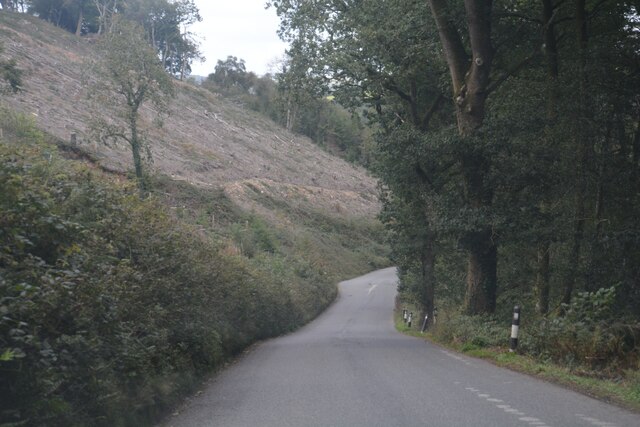
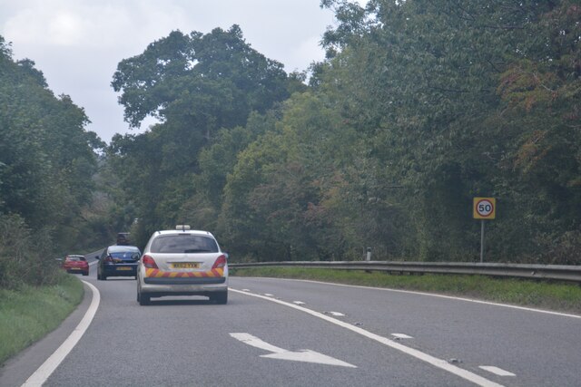
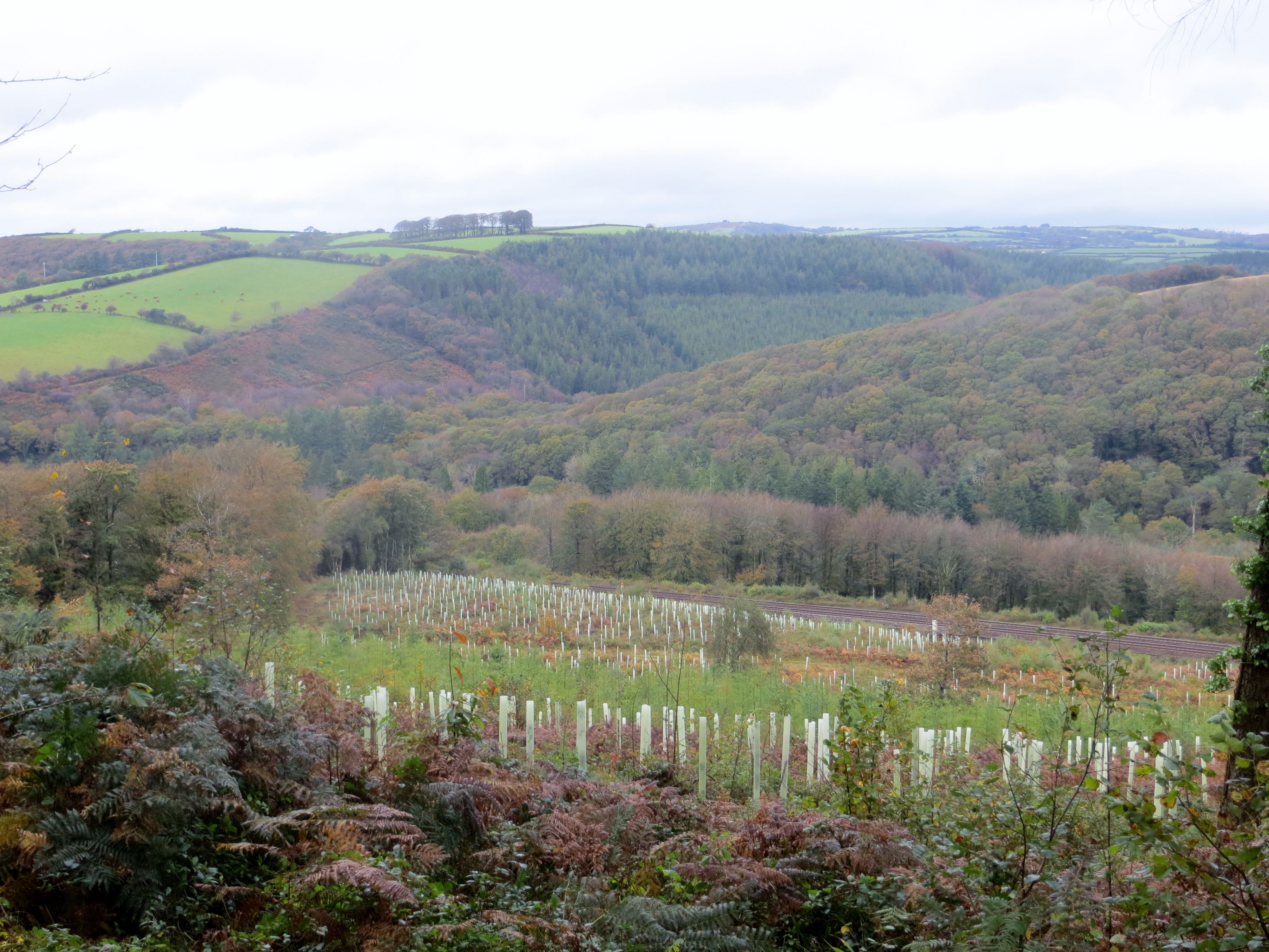
Holtroad Downs is a picturesque area located in Cornwall, England. It is characterized by its vast open spaces, rolling hills, and rugged moorland terrain. The Downs offer stunning panoramic views of the surrounding countryside and are a popular destination for hikers, nature enthusiasts, and outdoor adventurers.

The landscape of Holtroad Downs is dotted with patches of heather, gorse, and grasses, creating a vibrant and diverse ecosystem. The area is also home to a variety of wildlife, including birds of prey, deer, and other small mammals.

Visitors to Holtroad Downs can explore a network of walking trails that wind through the countryside, offering opportunities to discover hidden valleys, ancient archaeological sites, and peaceful meadows. The Downs are also a great spot for picnicking, birdwatching, and stargazing on clear nights.

Overall, Holtroad Downs is a tranquil and unspoiled natural environment that provides a welcome escape from the hustle and bustle of city life. Whether you're looking for a leisurely stroll or a challenging hike, this beautiful area has something to offer for everyone.

If you have any feedback on the listing, please let us know in the comments section below.

Holtroad Downs Images

Images are sourced within 2km of 50.461279/-4.606923 or Grid Reference SX1565. Thanks to Geograph Open Source API. All images are credited.

Lay-by on A38 west of Clinnicks Farm The A38 is also known as the Devon Expressway. It runs 292 miles from Bodmin to Mansfield, across the South West and Midlands. Primary places visited include Liskeard, Plymouth, Exeter, Taunton, Bridgwater, Bristol, Gloucester, Worcester, Bromsgrove, Birmingham, Lichfield, Burton upon Trent and Derby.
Wikipedia: <span class="nowrap"><a title="http://en.wikipedia.org/wiki/A38_road" rel="nofollow ugc noopener" href="http://en.wikipedia.org/wiki/A38_road">Link</a><img style="margin-left:2px;" alt="External link" title="External link - shift click to open in new window" src="https://s1.geograph.org.uk/img/external.png" width="10" height="10"/></span>
Lay-by on A38 west of Clinnicks Farm
The A38 is also known as the Devon Expressway. It runs 292 miles from Bodmin to Mansfield, across the South West and Midlands. Primary places visited include Liskeard, Plymouth, Exeter, Taunton, Bridgwater, Bristol, Gloucester, Worcester, Bromsgrove, Birmingham, Lichfield, Burton upon Trent and Derby. Wikipedia: LinkExternal link
Field access at Clinnicks Farm
Road into the valley at Wainsford
Approach to lay-by off A38 in Hollowmarsh Wood The lay-by appears to be the result of road realignment; it is at a lower level than the road, which possibly explains this long approach road
Approach to lay-by off A38 in Hollowmarsh Wood
The lay-by appears to be the result of road realignment; it is at a lower level than the road, which possibly explains this long approach road
Road to Tredinnick from A38
A38 in Lewarne Great Wood The A38 is also known as the Devon Expressway. It runs 292 miles from Bodmin to Mansfield, across the South West and Midlands. Primary places visited include Liskeard, Plymouth, Exeter, Taunton, Bridgwater, Bristol, Gloucester, Worcester, Bromsgrove, Birmingham, Lichfield, Burton upon Trent and Derby.
Wikipedia: <span class="nowrap"><a title="http://en.wikipedia.org/wiki/A38_road" rel="nofollow ugc noopener" href="http://en.wikipedia.org/wiki/A38_road">Link</a><img style="margin-left:2px;" alt="External link" title="External link - shift click to open in new window" src="https://s1.geograph.org.uk/img/external.png" width="10" height="10"/></span>
A38 in Lewarne Great Wood
The A38 is also known as the Devon Expressway. It runs 292 miles from Bodmin to Mansfield, across the South West and Midlands. Primary places visited include Liskeard, Plymouth, Exeter, Taunton, Bridgwater, Bristol, Gloucester, Worcester, Bromsgrove, Birmingham, Lichfield, Burton upon Trent and Derby. Wikipedia: LinkExternal link
Braddock : North Lane A lane heads through the countryside.
Braddock : North Lane
A lane heads through the countryside.
Wooded valley by Derricombe
Lower Drift From Pendalake Viaduct
Lower Drift
From Pendalake Viaduct
Braddock : North Lane Looking along North Lane.
Braddock : North Lane
Looking along North Lane.
Braddock : North Lane Looking along North Lane.
Braddock : North Lane
Looking along North Lane.
Braddock : North Lane Looking along North Lane.
Braddock : North Lane
Looking along North Lane.
Braddock : A38 Looking along the A38.
Braddock : A38
Looking along the A38.
Braddock : A38 Looking along the A38.
Braddock : A38
Looking along the A38.
Braddock : A38 Looking along the A38.
Braddock : A38
Looking along the A38.
Braddock : A38 Looking along the A38.
Braddock : A38
Looking along the A38.
Fowey Trout Pond This private trout fishing pond is close to the River Fowey.
Fowey Trout Pond
This private trout fishing pond is close to the River Fowey.
The Glynn Valley at Derricombe The main road is the A38 which runs along the floor of the valley.  This photo was taken from a train, the line runs along the southern side of the valley.
The Glynn Valley at Derricombe
The main road is the A38 which runs along the floor of the valley. This photo was taken from a train, the line runs along the southern side of the valley.
Show me another place!

Holtroad Downs is located at Grid Ref: SX1565 (Lat: 50.461279, Lng: -4.606923)

Unitary Authority: Cornwall

Police Authority: Devon and Cornwall

What 3 Words

///veto.scope.portfolio. Near Dobwalls, Cornwall

Related Wikis

Drawbridge, Cornwall

Drawbridge is a hamlet in the parish of St Neot (where the 2011 census was included), Cornwall, England, UK. == References ==

Cabilla and Redrice Woods

Cabilla and Redrice Woods is a nature reserve of the Cornwall Wildlife Trust, about 3 miles (4.8 km) east of Bodmin, in Cornwall, England. It is an extensive...

Largin Castle

Largin Castle is a contour hillfort and scheduled monument in Cornwall, England, presumed to date from the Iron Age. Largin Castle is situated approximately...

West Taphouse

West Taphouse is a hamlet in Cornwall, England. It is on the A390 road west of Middle Taphouse and East Taphouse. == References ==

Nearby Amenities

Located within 500m of 50.461279,-4.606923
Wainsford
Place: hamlet
Lat/Long: 50.4582365/-4.6065809
The data included in this document is from www.openstreetmap.org. The data is made available under ODbL.

Have you been to Holtroad Downs?

Leave your review of Holtroad Downs below (or comments, questions and feedback).