Tresparrett Down

Downs, Moorland in Cornwall

England

Tresparrett Down

The River Valency Below the Ford It's difficult to visualise this little river rising to the extent that it could cause a devastating flood downstream in Boscastle.
The River Valency Below the Ford Credit: Tony Atkin

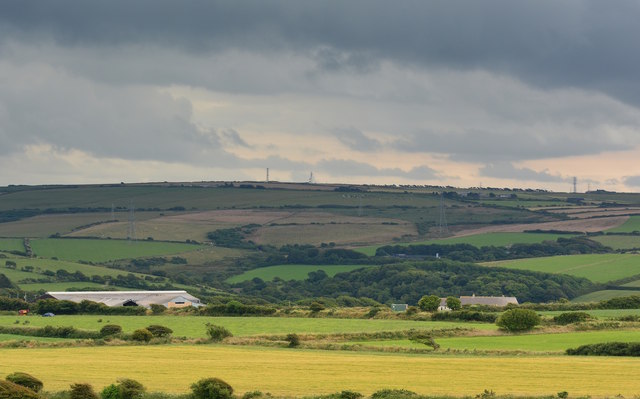
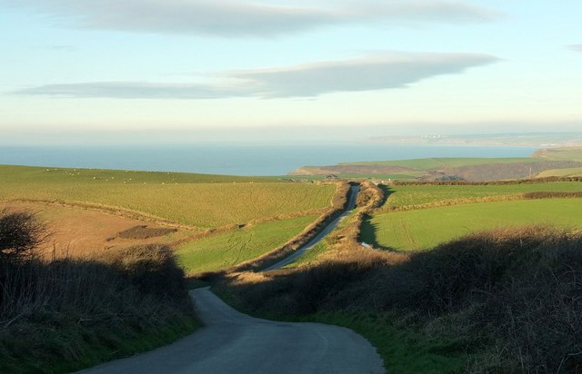
Tresparrett Down is a small village located in the moorland region of Cornwall, England. Situated just a few miles from the coast, the village is surrounded by vast expanses of open countryside, making it an ideal location for those seeking a peaceful and rural setting.

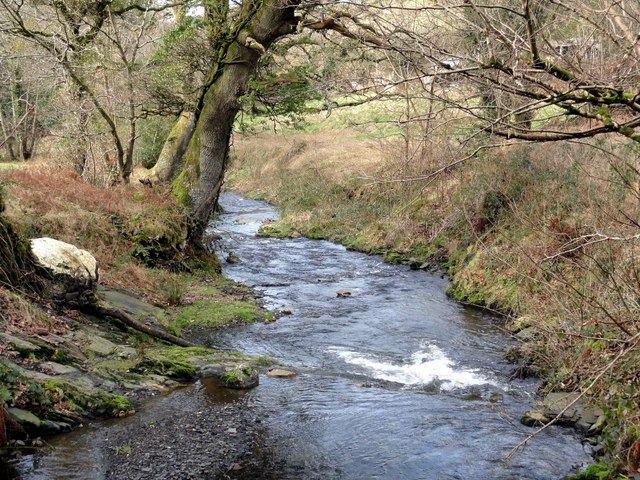
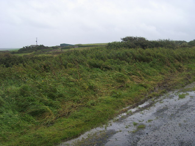
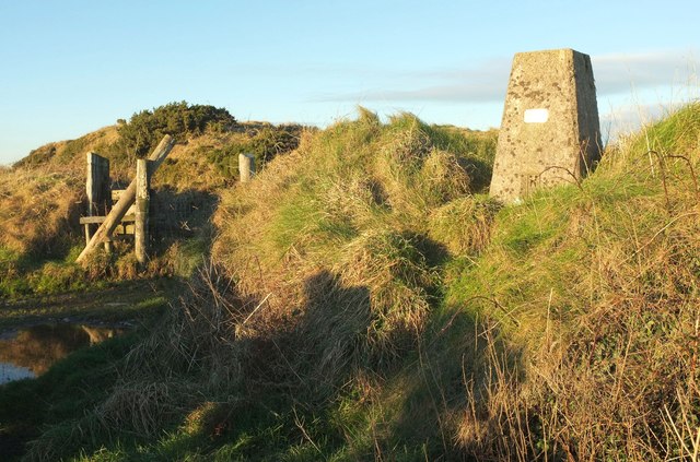
The landscape of Tresparrett Down is characterized by rolling hills, heathlands, and meadows, with scattered clusters of trees and shrubs. The area is known for its unique flora and fauna, with a variety of plant species that thrive in the moorland environment.

The village itself is small, with a handful of houses and a local pub providing the main amenities for residents and visitors. The community is tight-knit and friendly, with a strong sense of local pride and tradition.

Tresparrett Down is a popular destination for hikers and nature enthusiasts, who come to explore the rugged beauty of the moorland and take in the stunning views of the surrounding countryside. The area also offers plenty of opportunities for outdoor activities such as birdwatching, cycling, and picnicking.

If you have any feedback on the listing, please let us know in the comments section below.

Tresparrett Down Images

Images are sourced within 2km of 50.705614/-4.6291835 or Grid Reference SX1492. Thanks to Geograph Open Source API. All images are credited.

The River Valency Below the Ford It's difficult to visualise this little river rising to the extent that it could cause a devastating flood downstream in Boscastle.
The River Valency Below the Ford
It's difficult to visualise this little river rising to the extent that it could cause a devastating flood downstream in Boscastle.
North Cornwall : The A39 The road heads downhill and around the corner.
North Cornwall : The A39
The road heads downhill and around the corner.
Looking to Newton From the parking by Newton Farm looking to Newton
Looking to Newton
From the parking by Newton Farm looking to Newton
Fields, turbines and pylons, Marshgate, Cornwall These turbines were not here in 2011. They have been springing up all over the hills to the north of the county.
Fields, turbines and pylons, Marshgate, Cornwall
These turbines were not here in 2011. They have been springing up all over the hills to the north of the county.
Farmland, turbines and a pylon, near Tresparrett, Cornwall These turbines have sprung up within the last five years.

When the big ones are installed, there is sometimes also a small one installed near a farm.
Farmland, turbines and a pylon, near Tresparrett, Cornwall
These turbines have sprung up within the last five years. When the big ones are installed, there is sometimes also a small one installed near a farm.
Gloomy weather at Tresparrett, Cornwall
Dark skies over Tresparrett, Cornwall
Tresparrett Ford This ford on the River Valency is found at Tresparrett. A YouTube video of the ford can be seen at:
<span class="nowrap"><a title="https://youtu.be/HumpOAS61TY" rel="nofollow ugc noopener" href="https://youtu.be/HumpOAS61TY">Link</a><img style="margin-left:2px;" alt="External link" title="External link - shift click to open in new window" src="https://s1.geograph.org.uk/img/external.png" width="10" height="10"/></span>
Tresparrett Ford
This ford on the River Valency is found at Tresparrett. A YouTube video of the ford can be seen at: LinkExternal link
Lane near Newton Farm Falling and rising across a col between the head of a tributary valley of the Crackington Stream (right) and a steep drop down Rusey Cliff to the left. Larger sizes will reveal Morwenstow Satellite Station - see<a href="https://www.geograph.org.uk/photo/412255">SS2012 : Cattle by GCHQ radio station</a> - in the distance right of centre.
Lane near Newton Farm
Falling and rising across a col between the head of a tributary valley of the Crackington Stream (right) and a steep drop down Rusey Cliff to the left. Larger sizes will reveal Morwenstow Satellite Station - seeSS2012 : Cattle by GCHQ radio station - in the distance right of centre.
Fields near Hill From the same point as <a href="https://www.geograph.org.uk/photo/5393761">SX1395 : Towards Trehole Farm</a>, looking right with some overlap, and a striking array of narrow rectangular fields.
Fields near Hill
From the same point as SX1395 : Towards Trehole Farm, looking right with some overlap, and a striking array of narrow rectangular fields.
Tumulus and trig point, Tresparrett Down See also <a title="https://www.geograph.org.uk/search.php?i=71897884" href="https://www.geograph.org.uk/search.php?i=71897884">Link</a> . The trig point has been regularly visited <span class="nowrap"><a title="http://trigpointing.uk/trig/334" rel="nofollow ugc noopener" href="http://trigpointing.uk/trig/334">Link</a><img style="margin-left:2px;" alt="External link" title="External link - shift click to open in new window" src="https://s1.geograph.org.uk/img/external.png" width="10" height="10"/></span> .
Tumulus and trig point, Tresparrett Down
See also Link . The trig point has been regularly visited LinkExternal link .
Towards Ringford Farm From the same place as <a href="https://www.geograph.org.uk/photo/5393860">SX1393 : Tumulus and trig point, Tresparrett Down</a>, looking the other way.
Towards Ringford Farm
From the same place as SX1393 : Tumulus and trig point, Tresparrett Down, looking the other way.
Field near trig point, Tresparrett Down The view from a gate between the trig point and tumulus shown in <a href="https://www.geograph.org.uk/photo/5393860">SX1393 : Tumulus and trig point, Tresparrett Down</a>.
Field near trig point, Tresparrett Down
The view from a gate between the trig point and tumulus shown in SX1393 : Tumulus and trig point, Tresparrett Down.
Junction on Tresparrett Down A coastal road from Crackington Haven meets the B3263 at a staggered crossroads; the road ahead (to Marshgate, visible in the distance left of centre) is 40 metres off to the left.
Junction on Tresparrett Down
A coastal road from Crackington Haven meets the B3263 at a staggered crossroads; the road ahead (to Marshgate, visible in the distance left of centre) is 40 metres off to the left.
B3263 at Little Ringford From the junction with the side lane to Pennycrocker and Beeny.
B3263 at Little Ringford
From the junction with the side lane to Pennycrocker and Beeny.
Gate by the lane to Pennycrocker A fairly recently-installed gate.
Gate by the lane to Pennycrocker
A fairly recently-installed gate.
Lane to Pennycrocker From where <a href="https://www.geograph.org.uk/photo/5722714">SX1392 : Gate by the lane to Pennycrocker</a> was taken, looking left, with a further steel gate.
Lane to Pennycrocker
From where SX1392 : Gate by the lane to Pennycrocker was taken, looking left, with a further steel gate.
Lane to Little Ringford Looking in the opposite direction from where <a href="https://www.geograph.org.uk/photo/5722714">SX1392 : Gate by the lane to Pennycrocker</a> and <a href="https://www.geograph.org.uk/photo/5722716">SX1392 : Lane to Pennycrocker</a> were taken.
Lane to Little Ringford
Looking in the opposite direction from where SX1392 : Gate by the lane to Pennycrocker and SX1392 : Lane to Pennycrocker were taken.
Show me another place!

Tresparrett Down is located at Grid Ref: SX1492 (Lat: 50.705614, Lng: -4.6291835)

Unitary Authority: Cornwall

Police Authority: Devon and Cornwall

What 3 Words

///either.socialite.abacus. Near Jacobstow, Cornwall

Related Wikis

Tresparrett Posts

Tresparrett Posts is a hamlet in the civil parish of St Gennys in north Cornwall, England, United Kingdom. == References ==

St Juliot

St Juliot is a civil parish in north-east Cornwall, England, United Kingdom. The parish is entirely rural and the settlements within it are the hamlets...

Tresparrett

Tresparrett is a hamlet in north Cornwall, England, United Kingdom at Grid ref SX 14 19. Tresparrett was noted in the Domesday Book (1086), under the...

Marshgate

Marshgate is a hamlet partly in the parish of Otterham, Cornwall, England, UK. The population at the 2011 census was included in the civil parish of St...

Nearby Amenities

Located within 500m of 50.705614,-4.6291835
tumulus
Archaeological Site: tumulus
Historic: archaeological_site
Source: Bing;NPE
Lat/Long: 50.7076495/-4.6318748
tumulus
Archaeological Site: tumulus
Historic: archaeological_site
Lat/Long: 50.7080391/-4.6331805
camp
Historic: archaeological_site
Lat/Long: 50.7086615/-4.6298331
tumulus
Archaeological Site: tumulus
Historic: archaeological_site
Lat/Long: 50.7078761/-4.6325368
Pensilva Farm
Place: isolated_dwelling
Lat/Long: 50.7063651/-4.6237475
The data included in this document is from www.openstreetmap.org. The data is made available under ODbL.

Have you been to Tresparrett Down?

Leave your review of Tresparrett Down below (or comments, questions and feedback).