Casehill Downs

Downs, Moorland in Cornwall

England

Casehill Downs

Stannon stone circle
Stannon stone circle Credit: Hansjoerg Lipp

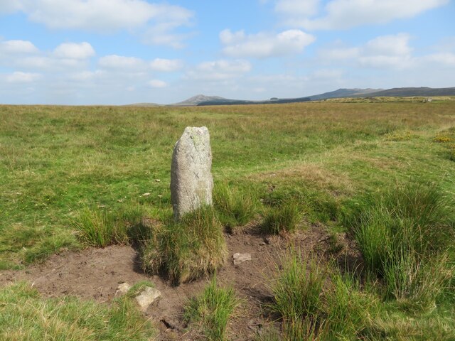
Casehill Downs, Cornwall is a picturesque expanse of land located in the southern region of England. Situated near the town of Bodmin, it is a popular destination for nature enthusiasts and outdoor adventurers. With an area spanning over 1000 acres, the Downs offer breathtaking views of rolling hills, expansive moorlands, and rugged cliffs.

The landscape of Casehill Downs is characterized by its diverse flora and fauna. The area boasts an array of wildflowers, including heather, gorse, and bluebells, which create a vibrant and colorful display during the spring and summer months. The Downs are also home to a variety of wildlife, such as ponies, deer, and numerous bird species, making it an ideal spot for birdwatching and wildlife spotting.

Visitors to Casehill Downs can enjoy a range of outdoor activities. The area offers ample opportunities for hiking, with numerous trails winding through the moorland and hills. These trails cater to different difficulty levels, making it suitable for both seasoned hikers and beginners. Additionally, the Downs provide an excellent setting for picnics, allowing visitors to relax and soak in the natural beauty surrounding them.

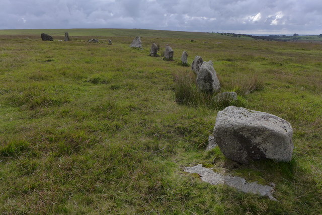
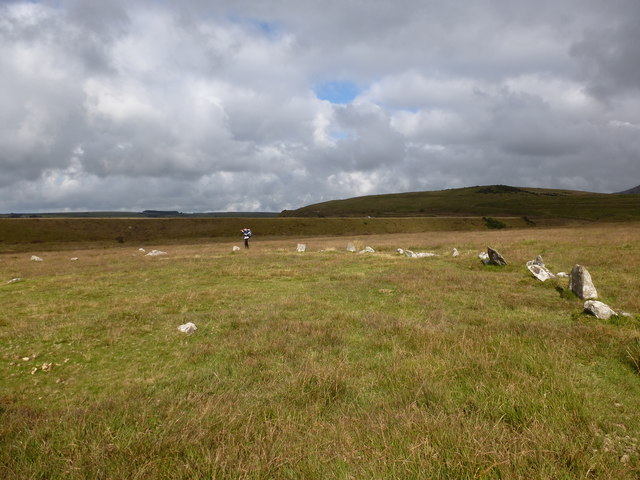
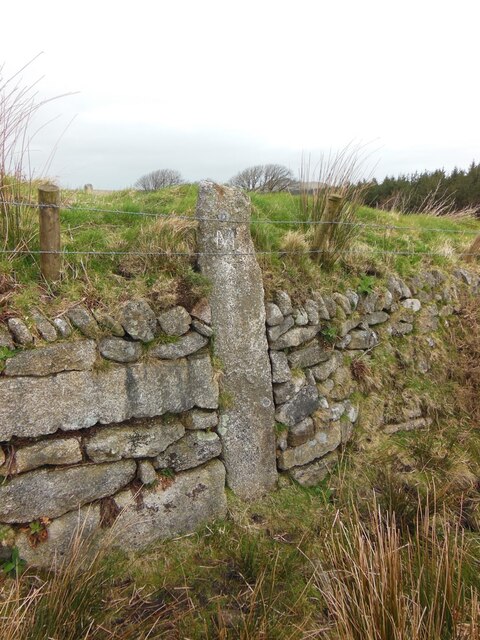
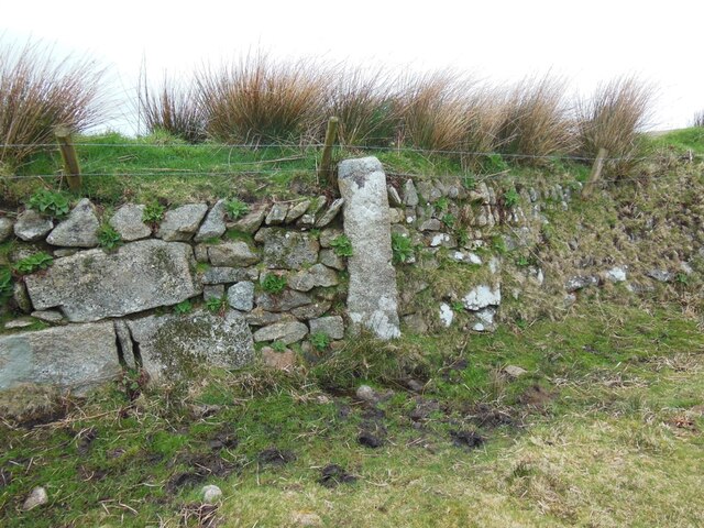
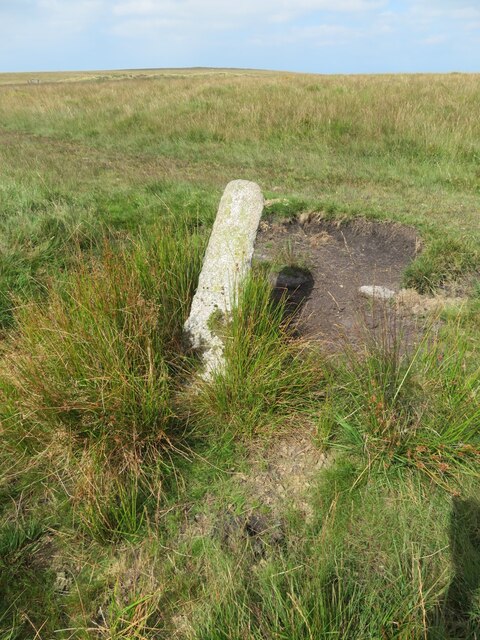
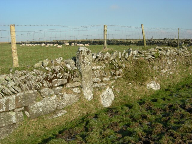
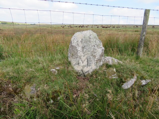
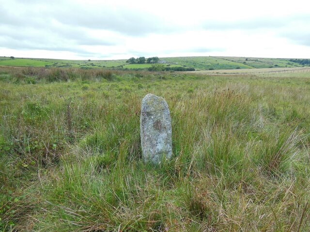
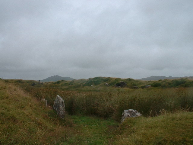
For those interested in history and archaeology, Casehill Downs has much to offer. The area is scattered with remnants of ancient settlements, including stone circles and burial mounds, providing insight into the region's rich cultural heritage.

Overall, Casehill Downs, Cornwall is a captivating destination for anyone seeking an escape into nature. Its stunning landscapes, diverse wildlife, and recreational opportunities make it a must-visit location for both locals and tourists alike.

If you have any feedback on the listing, please let us know in the comments section below.

Casehill Downs Images

Images are sourced within 2km of 50.574264/-4.6490638 or Grid Reference SX1278. Thanks to Geograph Open Source API. All images are credited.

Stannon stone circle
Stannon stone circle and china clay works This image shows a similar perspective as the older image <a href="https://www.geograph.org.uk/photo/418770">SX1280 : Stone Circle with modern china clay works.</a>. There was no activity at the china clay works any more.

See also <span class="nowrap"><a title="http://news.bbc.co.uk/2/hi/uk_news/england/cornwall/8555757.stm" rel="nofollow ugc noopener" href="http://news.bbc.co.uk/2/hi/uk_news/england/cornwall/8555757.stm">Link</a><img style="margin-left:2px;" alt="External link" title="External link - shift click to open in new window" src="https://s1.geograph.org.uk/img/external.png" width="10" height="10"/></span> and <span class="nowrap"><a title="https://www.southwestwater.co.uk/index.cfm?articleid=7478" rel="nofollow ugc noopener" href="https://www.southwestwater.co.uk/index.cfm?articleid=7478">Link</a><img style="margin-left:2px;" alt="External link" title="External link - shift click to open in new window" src="https://s1.geograph.org.uk/img/external.png" width="10" height="10"/></span>
Stannon stone circle and china clay works
This image shows a similar perspective as the older image SX1280 : Stone Circle with modern china clay works.. There was no activity at the china clay works any more. See also LinkExternal link and LinkExternal link
Approaching Stannon Stannon is a former china clay quarry and ahead is one of the spoil heaps. The public road ends just this side of it; the stone circle is off to the right of the parked vehicles.
Approaching Stannon
Stannon is a former china clay quarry and ahead is one of the spoil heaps. The public road ends just this side of it; the stone circle is off to the right of the parked vehicles.
Lane near Stannon Looking in the opposite direction to <a href="https://www.geograph.org.uk/photo/5436405">SX1280 : Approaching Stannon</a>, past an amazed cow with the sun on its ears.
Lane near Stannon
Looking in the opposite direction to SX1280 : Approaching Stannon, past an amazed cow with the sun on its ears.
Entrance to Stannon The road into the former china clay quarry; the notice on the gate says "Stannon House", now a private dwelling. Above on the right is a spoil heap.
Entrance to Stannon
The road into the former china clay quarry; the notice on the gate says "Stannon House", now a private dwelling. Above on the right is a spoil heap.
Ponies at Stannon The scene on the other side of the road from <a href="https://www.geograph.org.uk/photo/5436546">SX1280 : Entrance to Stannon</a>. Stannon stone circle is not far up the hill.
Ponies at Stannon
The scene on the other side of the road from SX1280 : Entrance to Stannon. Stannon stone circle is not far up the hill.
Stannon Stone Circle Apparently there are eighty-one visible stones, with thirty-nine still standing.
Stannon Stone Circle
Apparently there are eighty-one visible stones, with thirty-nine still standing.
Access to Stannon House The mounds on the right are related to china clay workings at Stannon Works.
Access to Stannon House
The mounds on the right are related to china clay workings at Stannon Works.
Stannon prehistoric stone row A probable combination single and double prehistoric stone row measuring at least 144m long, including at least 11 widely spaced small and medium-sized stones. The row is orientated SSE to NNW and has noteworthy visual links with Brown Willy, Rough Tor, Alex Tor and three separate sea views. <span class="nowrap"><a title="https://stonerows.wordpress.com/gazetteer/region/bodmin-moor/stannon/" rel="nofollow ugc noopener" href="https://stonerows.wordpress.com/gazetteer/region/bodmin-moor/stannon/">Link</a><img style="margin-left:2px;" alt="External link" title="External link - shift click to open in new window" src="https://s1.geograph.org.uk/img/external.png" width="10" height="10"/></span>
Stannon prehistoric stone row
A probable combination single and double prehistoric stone row measuring at least 144m long, including at least 11 widely spaced small and medium-sized stones. The row is orientated SSE to NNW and has noteworthy visual links with Brown Willy, Rough Tor, Alex Tor and three separate sea views. LinkExternal link
Old Boundary Marker on Emblance Downs, St Breward parish Boundary Marker on the open moorland of Emblance Downs clearly visible to the south of the minor road to Ivey and the De Lank water works. St Beward parish. Inscribed NEWMANS / CORNER. The function of this stone is not known, but it is shown on Ordnance Survey maps of 1880.

Milestone Society National ID: CW_BREWAR01bm
Old Boundary Marker on Emblance Downs, St Breward parish
Boundary Marker on the open moorland of Emblance Downs clearly visible to the south of the minor road to Ivey and the De Lank water works. St Beward parish. Inscribed NEWMANS / CORNER. The function of this stone is not known, but it is shown on Ordnance Survey maps of 1880. Milestone Society National ID: CW_BREWAR01bm
Old Boundary Marker on the boundary of King Arthur’s Downs and Emblance Downs, St Breward parish Estate Boundary Marker against the boundary wall of the enclosed land of Mount Pleasant Farm close to the valley adjoining Garrow Tor and Emblance Downs. St Beward parish. Inscribed M X.

One of a series of stones that mark the boundary of King Arthur’s Downs and Emblance Downs. King Arthur’s Downs was owned by the Manor of Hametethy, and Emblance Downs by the manor of Blisland. The Molesworth family owned the manor of Blisland and their mark MX can be found on the southern face of this stone. The letter X is smaller than the M and it is thought that it was a later addition to the stone.

Milestone Society National ID: CW_BREWAR02em
Old Boundary Marker on the boundary of King Arthur’s Downs and Emblance Downs, St Breward parish
Estate Boundary Marker against the boundary wall of the enclosed land of Mount Pleasant Farm close to the valley adjoining Garrow Tor and Emblance Downs. St Beward parish. Inscribed M X. One of a series of stones that mark the boundary of King Arthur’s Downs and Emblance Downs. King Arthur’s Downs was owned by the Manor of Hametethy, and Emblance Downs by the manor of Blisland. The Molesworth family owned the manor of Blisland and their mark MX can be found on the southern face of this stone. The letter X is smaller than the M and it is thought that it was a later addition to the stone. Milestone Society National ID: CW_BREWAR02em
Old Boundary Marker on the boundary of King Arthur’s Downs and Emblance Downs, St Breward parish Estate Boundary Marker against the boundary wall of the enclosed land of Mount Pleasant Farm 12 metres west of the gate to the farm. St Beward parish. Inscribed M X.

One of a series of stones that mark the boundary of King Arthur’s Downs and Emblance Downs. King Arthur’s Downs was owned by the manor of Hametethy, and Emblance Downs by the manor of Blisland. The Molesworth family owned the manor of Blisland and their mark M X can be found on the southern face of this stone. The letter X is smaller than the M and it is thought that it was a later addition to the stone.

Milestone Society National ID: CW_BREWAR03em
Old Boundary Marker on the boundary of King Arthur’s Downs and Emblance Downs, St Breward parish
Estate Boundary Marker against the boundary wall of the enclosed land of Mount Pleasant Farm 12 metres west of the gate to the farm. St Beward parish. Inscribed M X. One of a series of stones that mark the boundary of King Arthur’s Downs and Emblance Downs. King Arthur’s Downs was owned by the manor of Hametethy, and Emblance Downs by the manor of Blisland. The Molesworth family owned the manor of Blisland and their mark M X can be found on the southern face of this stone. The letter X is smaller than the M and it is thought that it was a later addition to the stone. Milestone Society National ID: CW_BREWAR03em
Old Boundary Marker on the boundary of King Arthur’s Downs and Emblance Downs, St Breward parish Estate Boundary Marker against the boundary wall of the enclosed land of Mount Pleasant Farm close to the western corner of the field. St Beward parish. Inscribed M X.

One of a series of stones that mark the boundary of King Arthur’s Downs and Emblance Downs. King Arthur’s Downs was owned by the manor of Hametethy, and Emblance Downs by the manor of Blisland. The Molesworth family owned the manor of Blisland and their mark M X can be found on the southern face of this stone. The letter X is smaller than the M and it is thought that it was a later addition to the stone
.

Milestone Society National ID: CW_BREWAR04em
Old Boundary Marker on the boundary of King Arthur’s Downs and Emblance Downs, St Breward parish
Estate Boundary Marker against the boundary wall of the enclosed land of Mount Pleasant Farm close to the western corner of the field. St Beward parish. Inscribed M X. One of a series of stones that mark the boundary of King Arthur’s Downs and Emblance Downs. King Arthur’s Downs was owned by the manor of Hametethy, and Emblance Downs by the manor of Blisland. The Molesworth family owned the manor of Blisland and their mark M X can be found on the southern face of this stone. The letter X is smaller than the M and it is thought that it was a later addition to the stone . Milestone Society National ID: CW_BREWAR04em
Old Boundary Marker on the boundary of King Arthur’s Downs and Emblance Downs, St Breward parish Estate Boundary Marker close to the remains of the medieval boundary bank that marked the boundary between the manors of Blisland and Hametethy on the open moorland of Emblance Downs 100 metres southeast of King Arthur’s Hall. St Beward parish. Inscribed M.

One of a series of stones that mark the boundary of King Arthur’s Downs and Emblance Downs. King Arthur’s Downs was owned by the manor of Hametethy, and Emblance Downs by the manor of Blisland. The Molesworth family owned the manor of Blisland and their mark M can be found on the southern face of this stone.

Milestone Society National ID: CW_BREWAR05em
Old Boundary Marker on the boundary of King Arthur’s Downs and Emblance Downs, St Breward parish
Estate Boundary Marker close to the remains of the medieval boundary bank that marked the boundary between the manors of Blisland and Hametethy on the open moorland of Emblance Downs 100 metres southeast of King Arthur’s Hall. St Beward parish. Inscribed M. One of a series of stones that mark the boundary of King Arthur’s Downs and Emblance Downs. King Arthur’s Downs was owned by the manor of Hametethy, and Emblance Downs by the manor of Blisland. The Molesworth family owned the manor of Blisland and their mark M can be found on the southern face of this stone. Milestone Society National ID: CW_BREWAR05em
Old Boundary Marker on the boundary of King Arthur’s Downs and Emblance Downs, St Breward parish Estate Boundary Marker on the remains of the medieval boundary bank that marked the boundary between the manors of Blisland and Hametethy on the open moorland of Emblance Downs 140 metres southwest of King Arthur’s Hall. St Beward parish. Inscribed M.

One of a series of stones that mark the boundary of King Arthur’s Downs and Emblance Downs. King Arthur’s Downs was owned by the manor of Hametethy, and Emblance Downs by the manor of Blisland. The Molesworth family owned the manor of Blisland and their mark M can be found on the southern face of this stone.

Milestone Society National ID: CW_BREWAR06em
Old Boundary Marker on the boundary of King Arthur’s Downs and Emblance Downs, St Breward parish
Estate Boundary Marker on the remains of the medieval boundary bank that marked the boundary between the manors of Blisland and Hametethy on the open moorland of Emblance Downs 140 metres southwest of King Arthur’s Hall. St Beward parish. Inscribed M. One of a series of stones that mark the boundary of King Arthur’s Downs and Emblance Downs. King Arthur’s Downs was owned by the manor of Hametethy, and Emblance Downs by the manor of Blisland. The Molesworth family owned the manor of Blisland and their mark M can be found on the southern face of this stone. Milestone Society National ID: CW_BREWAR06em
Old Boundary Marker on the boundary of King Arthur’s Downs and Emblance Downs, St Breward parish Estate Boundary Marker adjacent to the wall enclosing fields on the western edge of Emblance Downs 330 metres southwest of King Arthurs Hall. The wall appears to have been built on the continuation of the medieval boundary bank that marked the boundary between the manors of Blisland and Hametethy. St Beward parish. Inscribed M X.

One of a series of stones that mark the boundary of King Arthur’s Downs and Emblance Downs. King Arthur’s Downs was owned by the manor of Hametethy, and Emblance Downs by the manor of Blisland. The Molesworth family owned the manor of Blisland and their mark M X can be found on the southern face of this stone. The letter X is smaller than the M and it is thought that it was a later addition to the stone.

Milestone Society National ID: CW_BREWAR07em
Old Boundary Marker on the boundary of King Arthur’s Downs and Emblance Downs, St Breward parish
Estate Boundary Marker adjacent to the wall enclosing fields on the western edge of Emblance Downs 330 metres southwest of King Arthurs Hall. The wall appears to have been built on the continuation of the medieval boundary bank that marked the boundary between the manors of Blisland and Hametethy. St Beward parish. Inscribed M X. One of a series of stones that mark the boundary of King Arthur’s Downs and Emblance Downs. King Arthur’s Downs was owned by the manor of Hametethy, and Emblance Downs by the manor of Blisland. The Molesworth family owned the manor of Blisland and their mark M X can be found on the southern face of this stone. The letter X is smaller than the M and it is thought that it was a later addition to the stone. Milestone Society National ID: CW_BREWAR07em
Old Boundary Marker on the boundary of King Arthur’s Downs and Emblance Downs, St Breward parish Estate Boundary Marker protruding from the top of the wall enclosing fields on the western edge of Emblance Downs 550 metres southwest of King Arthurs Hall. The wall appears to have been built on the continuation of the medieval boundary bank that marked the boundary between the manors of Blisland and Hametethy. St Beward parish. Inscribed M X.

One of a series of stones that mark the boundary of King Arthur’s Downs and Emblance Downs. King Arthur’s Downs was owned by the manor of Hametethy, and Emblance Downs by the manor of Blisland. The Molesworth family owned the manor of Blisland and their mark M X can be found on the southern face of this stone.

Milestone Society National ID: CW_BREWAR08em
Old Boundary Marker on the boundary of King Arthur’s Downs and Emblance Downs, St Breward parish
Estate Boundary Marker protruding from the top of the wall enclosing fields on the western edge of Emblance Downs 550 metres southwest of King Arthurs Hall. The wall appears to have been built on the continuation of the medieval boundary bank that marked the boundary between the manors of Blisland and Hametethy. St Beward parish. Inscribed M X. One of a series of stones that mark the boundary of King Arthur’s Downs and Emblance Downs. King Arthur’s Downs was owned by the manor of Hametethy, and Emblance Downs by the manor of Blisland. The Molesworth family owned the manor of Blisland and their mark M X can be found on the southern face of this stone. Milestone Society National ID: CW_BREWAR08em
Old Boundary Marker on the boundary of King Arthur’s Downs and Emblance Downs, St Breward parish Estate Boundary Marker on marshy ground within the enclosed farmland on the continuation of the medieval boundary bank that marked the boundary between the manors of Blisland and Hametethy. St Beward parish. Inscribed M.

One of a series of stones that mark the boundary of King Arthur’s Downs and Emblance Downs. King Arthur’s Downs was owned by the manor of Hametethy, and Emblance Downs by the manor of Blisland. The Molesworth family owned the manor of Blisland and their mark M can be found on the southern face of this stone.

Milestone Society National ID: CW_BREWAR09em
Old Boundary Marker on the boundary of King Arthur’s Downs and Emblance Downs, St Breward parish
Estate Boundary Marker on marshy ground within the enclosed farmland on the continuation of the medieval boundary bank that marked the boundary between the manors of Blisland and Hametethy. St Beward parish. Inscribed M. One of a series of stones that mark the boundary of King Arthur’s Downs and Emblance Downs. King Arthur’s Downs was owned by the manor of Hametethy, and Emblance Downs by the manor of Blisland. The Molesworth family owned the manor of Blisland and their mark M can be found on the southern face of this stone. Milestone Society National ID: CW_BREWAR09em
Show me another place!

Casehill Downs is located at Grid Ref: SX1278 (Lat: 50.574264, Lng: -4.6490638)

Unitary Authority: Cornwall

Police Authority: Devon and Cornwall

What 3 Words

///pressing.bends.chew. Near Camelford, Cornwall

Nearby Locations

St. Breward Casehill Downs

Related Wikis

King Arthur's Hall

King Arthur's Hall is a megalithic enclosure on Bodmin Moor in Cornwall, England. It is thought to be a late Neolithic or early Bronze Age ceremonial site...

Emblance Downs stone circles

Emblance Downs stone circles are a pair of stone circles located in the parish of St. Breward on Bodmin Moor in Cornwall, England. == Description == The...

Leaze stone circle

Leaze stone circle is a stone circle located in the parish of St. Breward on Bodmin Moor in Cornwall, UK (grid reference SX13667728). == Description... ==

Alex Tor

Alex Tor is a conical hill, 291 metres (955 ft) high, located in the west of Bodmin Moor in the county of Cornwall, England.At the summit of Alex Tor are...

Nearby Amenities

Located within 500m of 50.574264,-4.6490638
Casehill
Place: isolated_dwelling
Lat/Long: 50.5715768/-4.6547013
tumulus
Historic: archaeological_site
Source: NPE
Lat/Long: 50.5712446/-4.6471341
Power: pole
Lat/Long: 50.5778445/-4.6522971
Power: pole
Lat/Long: 50.5770028/-4.6522468
Power: pole
Lat/Long: 50.5764292/-4.6526325
Power: pole
Lat/Long: 50.5758098/-4.6530548
Power: pole
Lat/Long: 50.5751991/-4.6534704
Power: pole
Lat/Long: 50.5745044/-4.6540385
Power: pole
Lat/Long: 50.573787/-4.6546101
Power: pole
Lat/Long: 50.5730276/-4.6552275
The data included in this document is from www.openstreetmap.org. The data is made available under ODbL.

Have you been to Casehill Downs?

Leave your review of Casehill Downs below (or comments, questions and feedback).