Doirean Domhnuill
Downs, Moorland in Sutherland
Scotland
Doirean Domhnuill

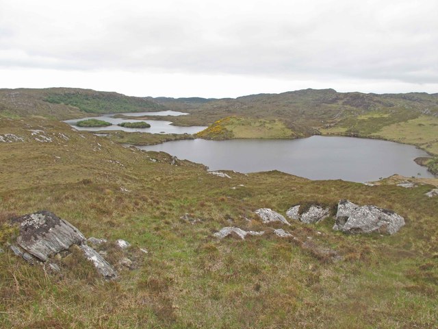
Doirean Domhnuill, also known as Donald's Oakwood, is a picturesque region located in Sutherland, Scotland. Situated amidst the stunning landscape of the Highlands, this area is renowned for its diverse natural beauty, characterized by downs and moorland.
The downs of Doirean Domhnuill feature vast stretches of undulating hills covered in lush green grasses, dotted with small patches of heather and wildflowers, creating a vibrant and colorful panorama. These downs provide ample grazing grounds for livestock, particularly sheep, which are a common sight in the area.
In contrast, the moorland of Doirean Domhnuill offers a more rugged and wild terrain. Here, heather dominates the landscape, transforming the moors into a sea of purple hues during the blooming season. The moorland is interspersed with peat bogs, providing a unique habitat for various species of plants and wildlife.
Visitors to Doirean Domhnuill can enjoy leisurely walks or hikes through the downs and moorland, immersing themselves in the tranquility of the surrounding nature. The area is also popular among birdwatchers, as it supports a diverse avian population, including golden plovers, merlins, and short-eared owls.
Doirean Domhnuill truly offers a captivating experience for those seeking to explore the untouched beauty of the Scottish Highlands. With its breathtaking downs and moorland, this region is a haven for nature lovers and outdoor enthusiasts, providing a unique and unforgettable glimpse into the raw and pristine landscapes of Sutherland.
If you have any feedback on the listing, please let us know in the comments section below.
Doirean Domhnuill Images
Images are sourced within 2km of 58.183852/-5.201451 or Grid Reference NC1126. Thanks to Geograph Open Source API. All images are credited.


Doirean Domhnuill is located at Grid Ref: NC1126 (Lat: 58.183852, Lng: -5.201451)
Unitary Authority: Highland
Police Authority: Highlands and Islands
What 3 Words
///shut.stood.national. Near Clachtoll, Highland
Nearby Locations
Related Wikis

Loch an Tuirc
Loch an Tuirc is a large irregular shaped, shallow loch, located about two miles north-by-north-east of Lochinver in the Assynt district of Sutherland...

Loch Cròcach, Lochinver
Loch Cròcach is a large irregular shaped, shallow loch, located about three miles north of Lochinver in the Assynt district of Sutherland, Highland, Scotland...

Loch Beannach, Assynt
Loch Beannach is a small v-shaped loch, located 2 miles to the west of Loch Assynt and 3 miles northeast of Lochinver within the Assynt area of Sutherland...

Loch Culag
Loch Culag also known as Loch na Doire Daraich is a small freshwater shallow loch, located south of Lochinver in the Assynt district of Sutherland, Highland...
Have you been to Doirean Domhnuill?
Leave your review of Doirean Domhnuill below (or comments, questions and feedback).