Bad na Labhairt
Downs, Moorland in Sutherland
Scotland
Bad na Labhairt

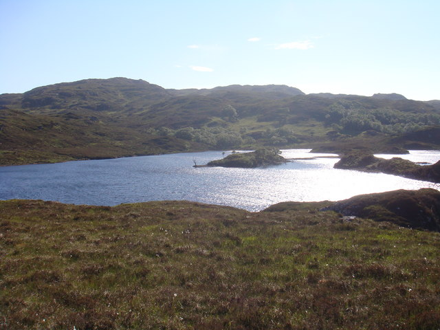
Bad na Labhairt, located in Sutherland, Scotland, is an area known for its remarkable downs and moorland. Spanning over a vast expanse, it is characterized by its rugged terrain and breathtaking natural beauty.
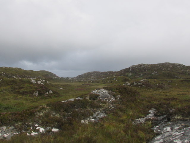
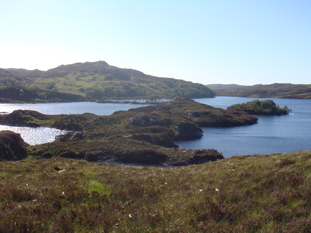
The downs in Bad na Labhairt are characterized by their rolling hills, covered in lush green grasses and scattered with wildflowers. The landscape offers panoramic views of the surrounding countryside, with occasional rocky outcrops adding to its charm. The area is a haven for wildlife, with numerous species of birds, such as grouse and plovers, making their homes in the downs.
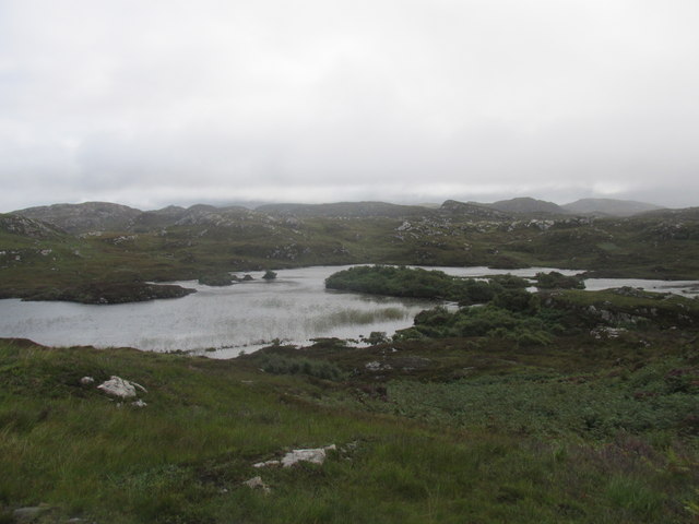
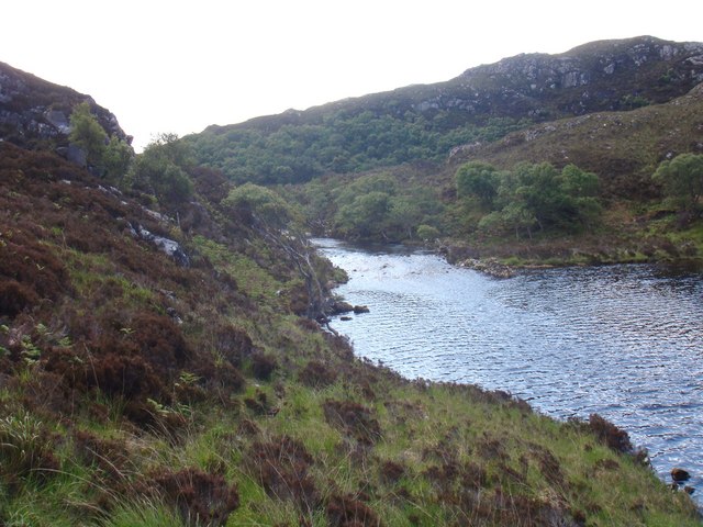
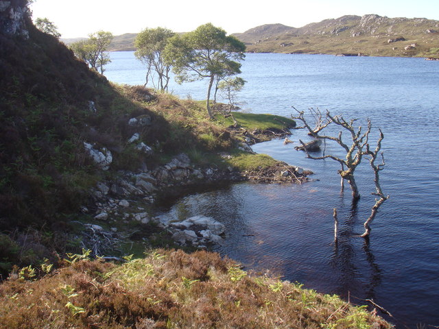
The moorland, on the other hand, is characterized by its vast stretches of open land, covered in heather and gorse. The vibrant purple hues of the heather create a stunning contrast against the greenery of the downs. Moorland streams and small lochs dot the landscape, providing habitats for various aquatic species.
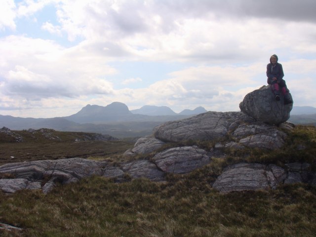
Bad na Labhairt is a paradise for outdoor enthusiasts. It offers ample opportunities for hiking, birdwatching, and photography. The terrain is challenging yet rewarding, with numerous walking trails crisscrossing the area. It is advisable to come prepared with appropriate footwear and clothing, as the weather can be unpredictable in this region.
Visitors to Bad na Labhairt can experience a sense of tranquility and solitude, as the area is sparsely populated. The absence of major tourist attractions adds to its untouched and unspoiled appeal. It is a place where nature reigns supreme, offering a peaceful retreat from the hustle and bustle of everyday life.
If you have any feedback on the listing, please let us know in the comments section below.
Bad na Labhairt Images
Images are sourced within 2km of 58.219499/-5.206741 or Grid Reference NC1130. Thanks to Geograph Open Source API. All images are credited.


Bad na Labhairt is located at Grid Ref: NC1130 (Lat: 58.219499, Lng: -5.206741)
Unitary Authority: Highland
Police Authority: Highlands and Islands
What 3 Words
///tastier.sizzled.buggy. Near Clachtoll, Highland
Nearby Locations
Related Wikis

Drumbeg, Sutherland
Drumbeg (Scottish Gaelic: An Druim Beag) is a remote crofting village on the north west coast of Scotland in Assynt, Sutherland, Scottish Highlands and...

Nedd
Nedd (Scottish Gaelic: An Nead) is a small village, which lies on the western head of Loch Nedd in Lairg, western Sutherland, Scottish Highlands and is...

Loch Cròcach, Lochinver
Loch Cròcach is a large irregular shaped, shallow loch, located about three miles north of Lochinver in the Assynt district of Sutherland, Highland, Scotland...

MV Bermuda
MV Bermuda was a passenger motor ship that Furness, Withy's Furness Bermuda Line operated between New York and Bermuda from 1928 until 1931. She was damaged...

Culkein Drumbeg
Culkein Drumbeg (Scottish Gaelic: Cùl-cinn an Droma Bhig) is a remote village on the north west coast of Scotland. It is located 0.93 miles (1.50 km) north...

Loch an Tuirc
Loch an Tuirc is a large irregular shaped, shallow loch, located about two miles north-by-north-east of Lochinver in the Assynt district of Sutherland...

Loch Beannach, Assynt
Loch Beannach is a small v-shaped loch, located 2 miles to the west of Loch Assynt and 3 miles northeast of Lochinver within the Assynt area of Sutherland...
Oldany Island
Oldany Island (formerly Oldney Island) is an uninhabited island in Assynt, Sutherland, north-west Scotland. The name is Norse in origin and possibly means...
Nearby Amenities
Located within 500m of 58.219499,-5.206741Have you been to Bad na Labhairt?
Leave your review of Bad na Labhairt below (or comments, questions and feedback).