Harpur's Downs

Downs, Moorland in Cornwall

England

Harpur's Downs

The Bridge at Watergate
The Bridge at Watergate Credit: Tony Atkin

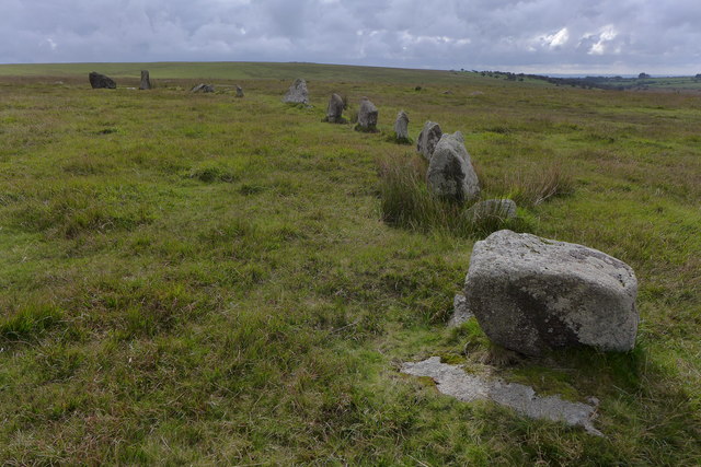
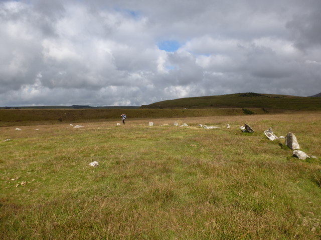
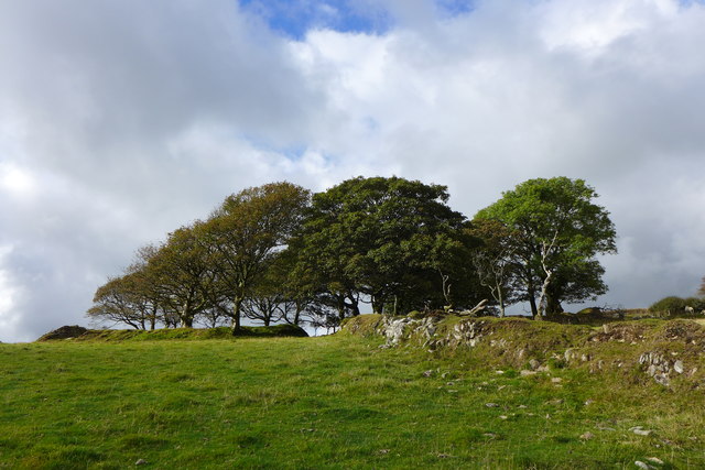
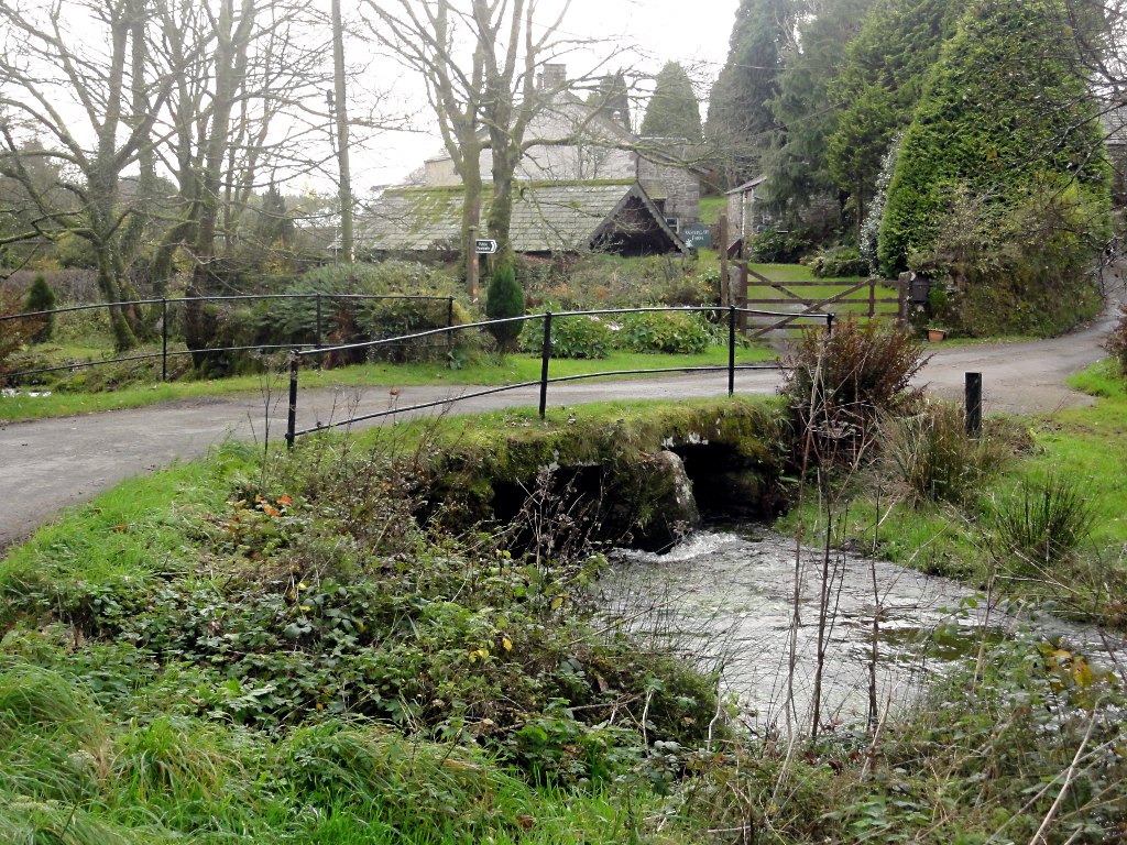
Harpur's Downs is a picturesque area located in Cornwall, England. It is a region characterized by its stunning landscapes, which consist of rolling hills, expansive moorland, and breathtaking views. The Downs are a popular destination for outdoor enthusiasts, offering an array of activities such as hiking, cycling, and wildlife spotting.

Covering a vast area, Harpur's Downs is home to a diverse range of flora and fauna. The moorland is adorned with heather, gorse, and wildflowers, creating a vibrant and colorful environment. The region is also a haven for various bird species, including buzzards, kestrels, and skylarks, making it a paradise for birdwatchers.

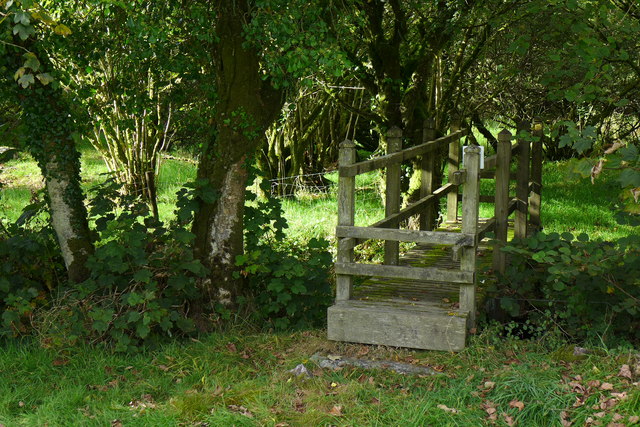
One of the highlights of Harpur's Downs is its network of walking trails, which cater to all levels of difficulty. From leisurely strolls to challenging hikes, visitors can explore the area's natural beauty at their own pace. The South West Coast Path, which passes through the Downs, offers breathtaking views of the coastline, adding to the allure of the region.

For those seeking a peaceful retreat, Harpur's Downs provides a tranquil atmosphere away from the hustle and bustle of city life. Visitors can immerse themselves in the beauty of the moorland, enjoying the serene ambiance and stunning sunsets.

In conclusion, Harpur's Downs in Cornwall is a must-visit destination for nature lovers and outdoor enthusiasts. With its captivating landscapes, diverse wildlife, and abundance of recreational activities, it offers a truly unforgettable experience for visitors of all ages.

If you have any feedback on the listing, please let us know in the comments section below.

Harpur's Downs Images

Images are sourced within 2km of 50.587699/-4.6645546 or Grid Reference SX1179. Thanks to Geograph Open Source API. All images are credited.

The Bridge at Watergate
Stannon stone circle
Stannon stone circle and china clay works This image shows a similar perspective as the older image <a href="https://www.geograph.org.uk/photo/418770">SX1280 : Stone Circle with modern china clay works.</a>. There was no activity at the china clay works any more.

See also <span class="nowrap"><a title="http://news.bbc.co.uk/2/hi/uk_news/england/cornwall/8555757.stm" rel="nofollow ugc noopener" href="http://news.bbc.co.uk/2/hi/uk_news/england/cornwall/8555757.stm">Link</a><img style="margin-left:2px;" alt="External link" title="External link - shift click to open in new window" src="https://s1.geograph.org.uk/img/external.png" width="10" height="10"/></span> and <span class="nowrap"><a title="https://www.southwestwater.co.uk/index.cfm?articleid=7478" rel="nofollow ugc noopener" href="https://www.southwestwater.co.uk/index.cfm?articleid=7478">Link</a><img style="margin-left:2px;" alt="External link" title="External link - shift click to open in new window" src="https://s1.geograph.org.uk/img/external.png" width="10" height="10"/></span>
Stannon stone circle and china clay works
This image shows a similar perspective as the older image SX1280 : Stone Circle with modern china clay works.. There was no activity at the china clay works any more. See also LinkExternal link and LinkExternal link
Field near Heneward
Field near Heneward
Footbridge near Tresinney
Footbridge near Heneward
Flooded china clay pit at Stannon Works near Watergate
Lane leading N towards Wategate near Camelford
Ford at Watergate This ford is found beside the road bridge in Watergate.
Ford at Watergate
This ford is found beside the road bridge in Watergate.
Bible Christian Chapel, Highertown The chapel is also shown in <a href="https://www.geograph.org.uk/photo/689752">SX1281 : Chapel and telephone box</a>; how those trees have grown in nine years! The lane is followed by NCN3 and the Moorland Walk.
Bible Christian Chapel, Highertown
The chapel is also shown in SX1281 : Chapel and telephone box; how those trees have grown in nine years! The lane is followed by NCN3 and the Moorland Walk.
Farm at Trewint A lovely collection of farm buildings on a tiny lane above the Camel valley. The "possibly late C16" farmhouse (right) is listed and described at <span class="nowrap"><a title="https://www.historicengland.org.uk/listing/the-list/list-entry/1142721" rel="nofollow ugc noopener" href="https://www.historicengland.org.uk/listing/the-list/list-entry/1142721">Link</a><img style="margin-left:2px;" alt="External link" title="External link - shift click to open in new window" src="https://s1.geograph.org.uk/img/external.png" width="10" height="10"/></span> . Several other farm buildings from the early C19 are listed and described at <span class="nowrap"><a title="https://www.historicengland.org.uk/listing/the-list/list-entry/1137699" rel="nofollow ugc noopener" href="https://www.historicengland.org.uk/listing/the-list/list-entry/1137699">Link</a><img style="margin-left:2px;" alt="External link" title="External link - shift click to open in new window" src="https://s1.geograph.org.uk/img/external.png" width="10" height="10"/></span> ; just left of centre is the hipped roofed granary.
Farm at Trewint
A lovely collection of farm buildings on a tiny lane above the Camel valley. The "possibly late C16" farmhouse (right) is listed and described at LinkExternal link . Several other farm buildings from the early C19 are listed and described at LinkExternal link ; just left of centre is the hipped roofed granary.
Buildings at Trewint There is overlap on the right with <a href="https://www.geograph.org.uk/photo/5263955">SX1080 : Farm at Trewint</a>. I'm not sure whether this attractive building across the lane is included in the listed building description at <span class="nowrap"><a title="https://www.historicengland.org.uk/listing/the-list/list-entry/1137699" rel="nofollow ugc noopener" href="https://www.historicengland.org.uk/listing/the-list/list-entry/1137699">Link</a><img style="margin-left:2px;" alt="External link" title="External link - shift click to open in new window" src="https://s1.geograph.org.uk/img/external.png" width="10" height="10"/></span> ; it doesn't seem to be.
Buildings at Trewint
There is overlap on the right with SX1080 : Farm at Trewint. I'm not sure whether this attractive building across the lane is included in the listed building description at LinkExternal link ; it doesn't seem to be.
Lane at Trewint The lane is heading up towards Harpur's Downs.
Lane at Trewint
The lane is heading up towards Harpur's Downs.
Footpath at Trewint Footpath 501 3/4 leaves the lane shown in <a href="https://www.geograph.org.uk/photo/5267187">SX1080 : Buildings at Trewint</a> and <a href="https://www.geograph.org.uk/photo/5267203">SX1080 : Lane at Trewint</a>.
Footpath at Trewint
Footpath 501 3/4 leaves the lane shown in SX1080 : Buildings at Trewint and SX1080 : Lane at Trewint.
Approaching Stannon Stannon is a former china clay quarry and ahead is one of the spoil heaps. The public road ends just this side of it; the stone circle is off to the right of the parked vehicles.
Approaching Stannon
Stannon is a former china clay quarry and ahead is one of the spoil heaps. The public road ends just this side of it; the stone circle is off to the right of the parked vehicles.
Lane near Stannon Looking in the opposite direction to <a href="https://www.geograph.org.uk/photo/5436405">SX1280 : Approaching Stannon</a>, past an amazed cow with the sun on its ears.
Lane near Stannon
Looking in the opposite direction to SX1280 : Approaching Stannon, past an amazed cow with the sun on its ears.
Entrance to Stannon The road into the former china clay quarry; the notice on the gate says "Stannon House", now a private dwelling. Above on the right is a spoil heap.
Entrance to Stannon
The road into the former china clay quarry; the notice on the gate says "Stannon House", now a private dwelling. Above on the right is a spoil heap.
Ponies at Stannon The scene on the other side of the road from <a href="https://www.geograph.org.uk/photo/5436546">SX1280 : Entrance to Stannon</a>. Stannon stone circle is not far up the hill.
Ponies at Stannon
The scene on the other side of the road from SX1280 : Entrance to Stannon. Stannon stone circle is not far up the hill.
Show me another place!

Harpur's Downs is located at Grid Ref: SX1179 (Lat: 50.587699, Lng: -4.6645546)

Unitary Authority: Cornwall

Police Authority: Devon and Cornwall

What 3 Words

///plantings.hurtles.takeovers. Near Camelford, Cornwall

Nearby Locations

Harpur's Downs

Related Wikis

Alex Tor

Alex Tor is a conical hill, 291 metres (955 ft) high, located in the west of Bodmin Moor in the county of Cornwall, England.At the summit of Alex Tor are...

Stannon stone circle

Stannon stone circle (also known as Stannon circle or simply Stannon) is a stone circle located near St. Breward on Bodmin Moor in Cornwall, England....

Highertown

Highertown is a hamlet in Cornwall, England. It is on the western edge of Bodmin Moor in the parish of Advent. == References ==

Watergate, Cornwall

Watergate is a hamlet in the civil parish of Advent in Cornwall, England, United Kingdom. There is also a hamlet called Watergate in the civil parish of...

Nearby Amenities

Located within 500m of 50.587699,-4.6645546
Ford: yes
Lat/Long: 50.5889088/-4.6710217
Barrier: cattle_grid
Lat/Long: 50.5900077/-4.6683201
Barrier: cattle_grid
Lat/Long: 50.5888885/-4.6704354
Barrier: stile
Lat/Long: 50.5882098/-4.664811
Man Made: chimney
Lat/Long: 50.5900088/-4.666953
Ford: yes
Lat/Long: 50.5913127/-4.6639261
Barrier: cattle_grid
Lat/Long: 50.5893388/-4.6706795
Barrier: stile
Lat/Long: 50.5881352/-4.6648385
Power: pole
Lat/Long: 50.5848613/-4.6658018
Power: pole
Lat/Long: 50.5839349/-4.6668586
Power: pole
Lat/Long: 50.5857997/-4.6646807
Power: pole
Lat/Long: 50.5866818/-4.6636587
Power: pole
Lat/Long: 50.5875146/-4.6626878
Power: pole
Lat/Long: 50.5883218/-4.6617651
Power: pole
Lat/Long: 50.5892873/-4.6614996
Power: pole
Lat/Long: 50.5905678/-4.661167
Power: pole
Lat/Long: 50.5911042/-4.660888
Power: pole
Lat/Long: 50.5909181/-4.6688575
Power: pole
Lat/Long: 50.5918262/-4.6640155
Power: pole
Lat/Long: 50.5909527/-4.6662846
Power: pole
Lat/Long: 50.5909203/-4.6637204
Power: pole
Lat/Long: 50.5901966/-4.6635541
Power: pole
Lat/Long: 50.590941/-4.6678256
Heneward
Place: isolated_dwelling
Wikidata: Q26597907
Lat/Long: 50.5898524/-4.6630915
Barrier: cattle_grid
Lat/Long: 50.5882643/-4.6618452
The data included in this document is from www.openstreetmap.org. The data is made available under ODbL.

Have you been to Harpur's Downs?

Leave your review of Harpur's Downs below (or comments, questions and feedback).