Balker Moor
Downs, Moorland in Wigtownshire
Scotland
Balker Moor

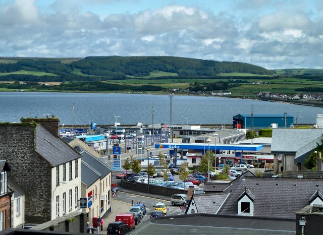
Balker Moor is a scenic area located in Wigtownshire, Scotland. Situated on the outskirts of the small rural village of Balker, it is known for its breathtaking downs and picturesque moorland landscapes. Spanning over several square miles, this serene location offers visitors a glimpse into the untouched beauty of the Scottish countryside.
The downs of Balker Moor are characterized by rolling hills and open grasslands, providing a perfect setting for leisurely walks and hikes. The unspoiled nature of the downs allows visitors to immerse themselves in the tranquility of the surrounding environment. From the top of the downs, one can enjoy panoramic views of the surrounding countryside, with glimpses of nearby lochs and distant mountains.
The moorland of Balker Moor is a haven for wildlife enthusiasts and bird watchers. This diverse ecosystem is home to a variety of animal species, including red deer, brown hares, and various birds of prey. The moorland's rich vegetation, consisting of heather, mosses, and grasses, provides a habitat for numerous small mammals and insects as well.
In addition to its natural beauty, Balker Moor is also steeped in history. The area is dotted with ancient standing stones and archaeological remains, offering a glimpse into the region's past. These historical sites provide an opportunity for visitors to learn about the area's cultural heritage and engage in archaeological exploration.
Overall, Balker Moor in Wigtownshire is a stunning destination, offering visitors a chance to escape the hustle and bustle of everyday life and immerse themselves in the peace and serenity of the Scottish countryside.
If you have any feedback on the listing, please let us know in the comments section below.
Balker Moor Images
Images are sourced within 2km of 54.93971/-4.9453585 or Grid Reference NX1164. Thanks to Geograph Open Source API. All images are credited.


Balker Moor is located at Grid Ref: NX1164 (Lat: 54.93971, Lng: -4.9453585)
Unitary Authority: Dumfries and Galloway
Police Authority: Dumfries and Galloway
What 3 Words
///ascendant.harmless.lyricist. Near Cairnryan, Dumfries & Galloway
Nearby Locations
Related Wikis
Inch, Dumfries and Galloway
Inch is a civil parish in Dumfries and Galloway, southwest Scotland. It lies on the shore of Loch Ryan, in the traditional county of Wigtownshire.The...

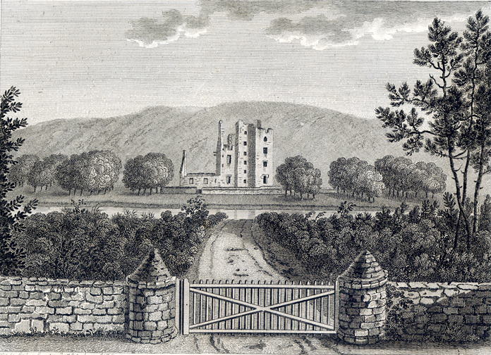
Castle Kennedy (castle)
Castle Kennedy is a ruined 17th-century tower house, about 3 miles (4.8 km) east of Stranraer, Dumfries and Galloway, Scotland, around 0.5 miles (0.80...

RAF Castle Kennedy
Royal Air Force Castle Kennedy, or more simply RAF Castle Kennedy, is a former Royal Air Force satellite station located in Castle Kennedy, Dumfries and...
Castle Kennedy
Castle Kennedy is a small village 3 miles (4.8 km) east of Stranraer in Dumfries and Galloway, south-west Scotland. It is on the A75 road, and is within...
Aird, Dumfries and Galloway
Aird (Gaelic:An Àird) is a village in Dumfries and Galloway, in the southwest of Scotland. It is 2.5 miles (4.0 km) east of Stranraer and 1 mile (1.6 km...

Castle Kennedy railway station
Castle Kennedy railway station served the village of Castle Kennedy, Dumfries and Galloway, Scotland from 1861 to 1965 on the Portpatrick and Wigtownshire...

Penwhirn Reservoir
Penwhirn Reservoir, is a reservoir in Dumfries and Galloway, Scotland, approximately 3.5 miles (6 km) east of Cairnryan. The reservoir was built in the...

New Luce railway station
New Luce railway station served the village of New Luce, Dumfries and Galloway, Scotland from 1887 to 1965 on the Girvan and Portpatrick Junction Railway...
Nearby Amenities
Located within 500m of 54.93971,-4.9453585Have you been to Balker Moor?
Leave your review of Balker Moor below (or comments, questions and feedback).