Brocklan Braes

Downs, Moorland in Wigtownshire

Scotland

Brocklan Braes

Fields above Knockencule Farm On the west coast of the Rhins.
Fields above Knockencule Farm Credit: David Purchase

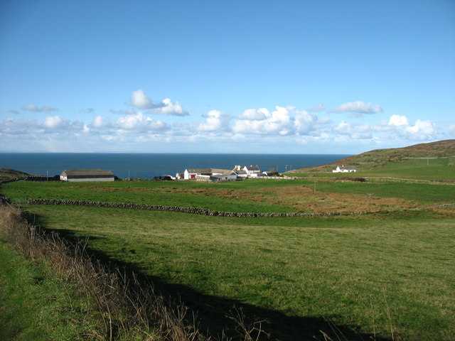
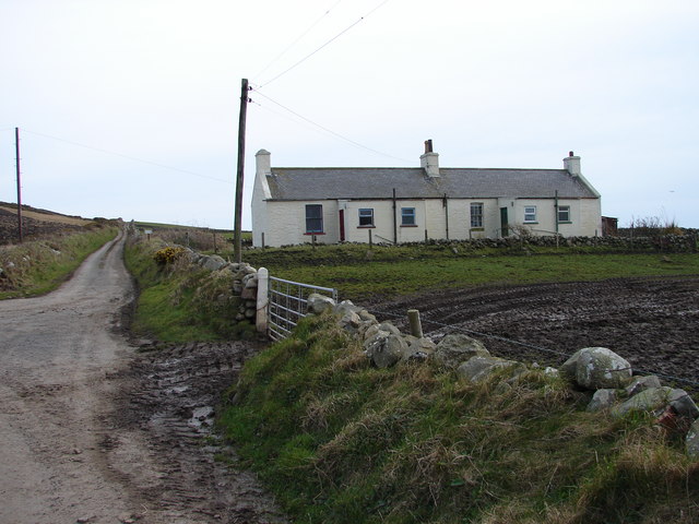
Brocklan Braes is a picturesque region located in Wigtownshire, a historical county in southwestern Scotland. It is characterized by its stunning downs and moorland landscapes, offering visitors a unique and diverse experience.

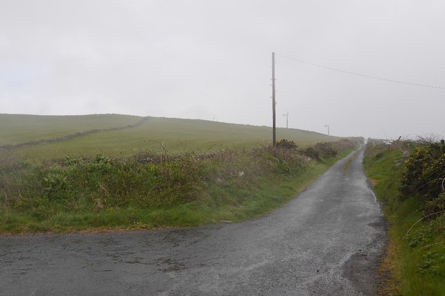
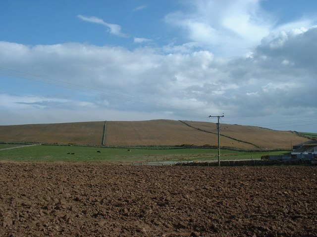
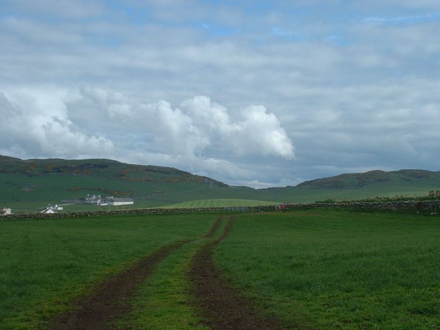
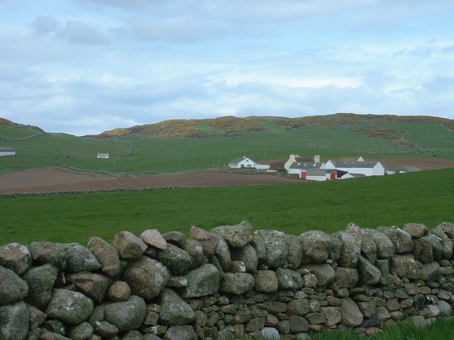
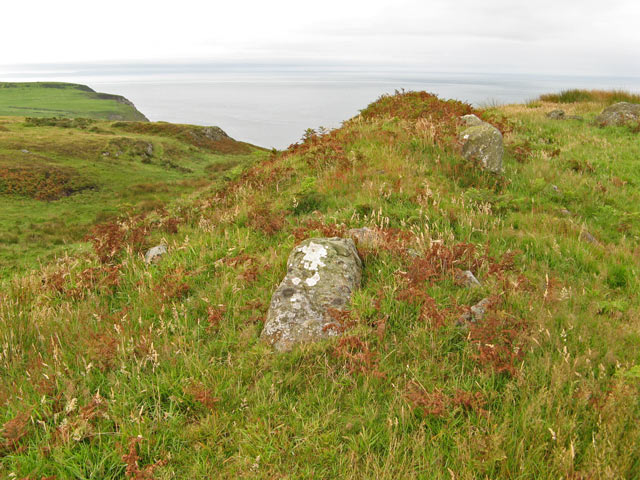
The downs of Brocklan Braes are characterized by rolling hills and vast open spaces, adorned with vibrant greenery during the summer months. These downs provide breathtaking panoramic views of the surrounding countryside, making it an ideal destination for nature enthusiasts and hikers. The area is also home to various wildlife species, including birds, rabbits, and occasional deer, adding to its natural beauty.

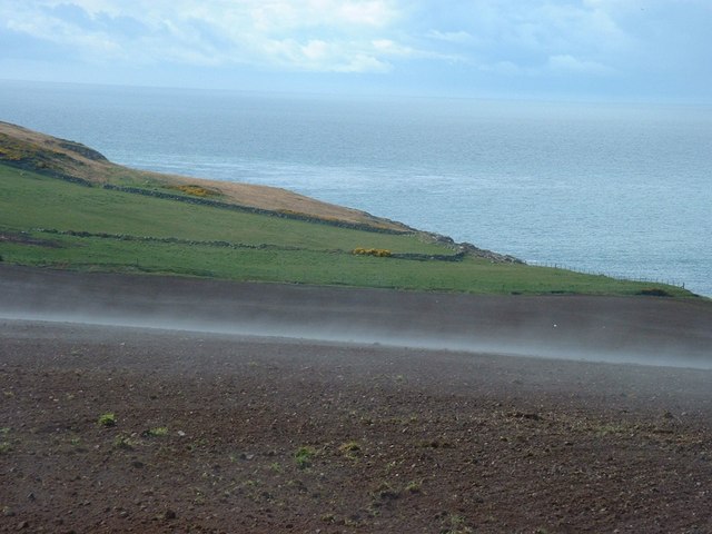
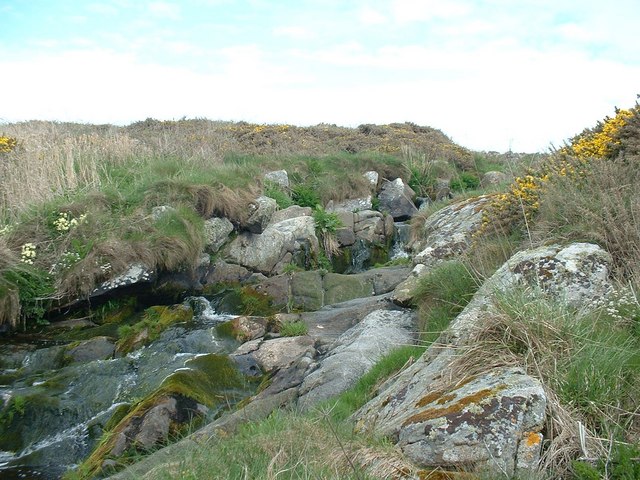
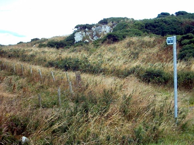
In contrast, the moorland of Brocklan Braes is a rugged terrain covered in heather and grasses. This wild and untamed landscape offers a sense of solitude and tranquility, attracting those seeking a peaceful getaway. The moorland is also known for its unique flora and fauna, including rare orchids and birds of prey.

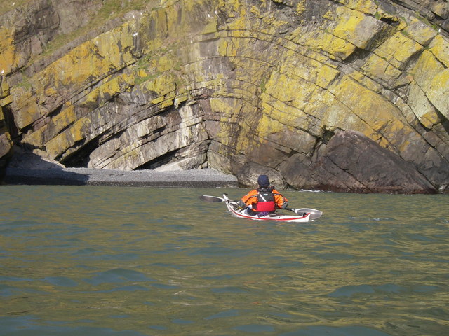
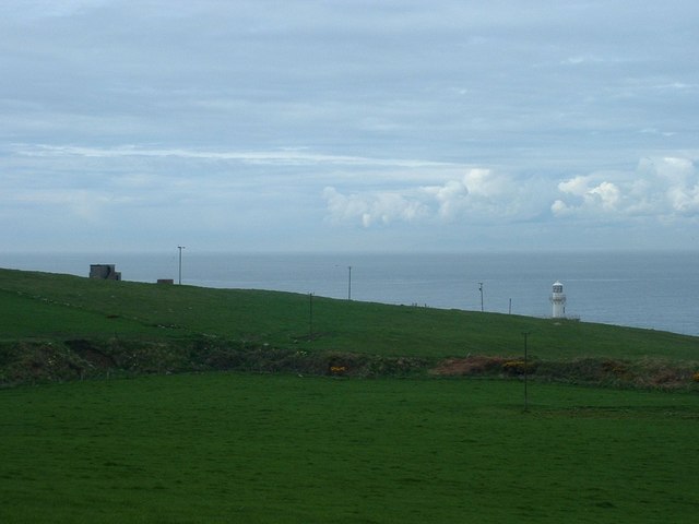
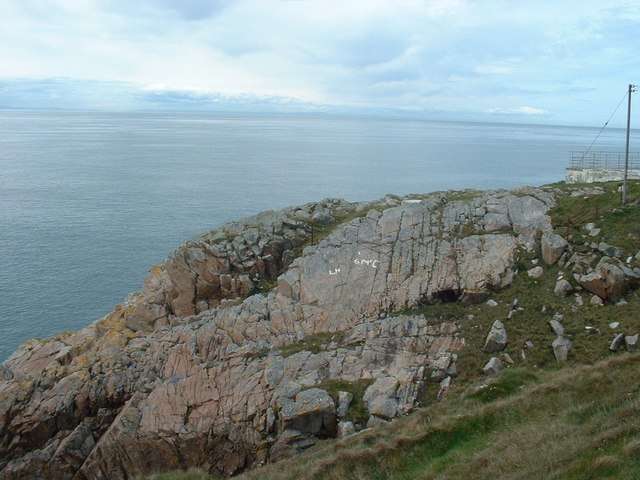
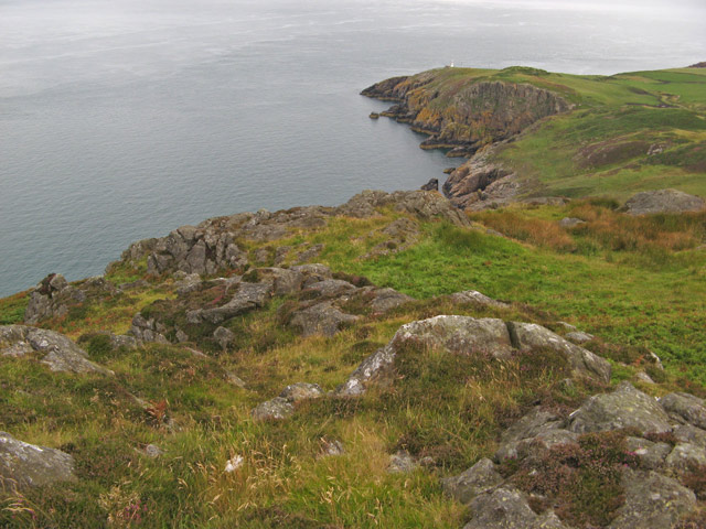
Visitors to Brocklan Braes can enjoy a range of outdoor activities, such as hiking, birdwatching, and photography. The region is intersected by several walking trails, providing ample opportunities to explore the downs and moorland. Additionally, the nearby coastal areas offer stunning beaches and cliffs, further enhancing the region's appeal.

The charm of Brocklan Braes lies in its unspoiled natural beauty and peaceful atmosphere. It serves as an oasis for those seeking a break from the hustle and bustle of city life, allowing them to immerse themselves in the splendor of Scotland's countryside.

If you have any feedback on the listing, please let us know in the comments section below.

Brocklan Braes Images

Images are sourced within 2km of 54.663395/-4.9373508 or Grid Reference NX1033. Thanks to Geograph Open Source API. All images are credited.

Fields above Knockencule Farm On the west coast of the Rhins.
Fields above Knockencule Farm
On the west coast of the Rhins.
Road to Slockmill Serving scattered dwellings on the exposed west coast of the Rhins of Galloway.
Road to Slockmill
Serving scattered dwellings on the exposed west coast of the Rhins of Galloway.
Arched Rock bed at Portdown bay
Knockencule Cottages Farm cottages at Knockencule in the remote south-west corner of South Rhins.
Knockencule Cottages
Farm cottages at Knockencule in the remote south-west corner of South Rhins.
Fields by Knockencule With outbuildings of Knockencule Farm to right.
Fields by Knockencule
With outbuildings of Knockencule Farm to right.
Buildings on Crammag Head To left, abandoned coastguard lookout.  To right, newly erected glass fibre lighthouse.
Buildings on Crammag Head
To left, abandoned coastguard lookout. To right, newly erected glass fibre lighthouse.
New lighthouse at Crammag Head Erected over the winter of 2009/2010 by specialist builders from the Orkney's, this glass fibre lighthouse replaced previous structure whose square base is visible to left. Coast of Northern Ireland near Belfast just visible on far horizon.
New lighthouse at Crammag Head
Erected over the winter of 2009/2010 by specialist builders from the Orkney's, this glass fibre lighthouse replaced previous structure whose square base is visible to left. Coast of Northern Ireland near Belfast just visible on far horizon.
Towards Mull of Galloway From south side of newly erected lighthouse at Crammag Head along western coast line of South Rhinns with Isle of Mann visible on far horizon.
Towards Mull of Galloway
From south side of newly erected lighthouse at Crammag Head along western coast line of South Rhinns with Isle of Mann visible on far horizon.
Old coastguard lookout Derelict but still identifiable.
Old coastguard lookout
Derelict but still identifiable.
Lighthouse constructors graffiti South side of newly erected lighthouse at Crammag Head, platform to right, where the very fresh and white coloured initials were probably left by the constructors in February 2010.
Lighthouse constructors graffiti
South side of newly erected lighthouse at Crammag Head, platform to right, where the very fresh and white coloured initials were probably left by the constructors in February 2010.
Har forming at Knockencule Har mist forming over freshly planted barley field.
Har forming at Knockencule
Har mist forming over freshly planted barley field.
Stone wall with field gate Dry stone wall with field gate in middle distance, Barncorkrie Farm to left with Barncorkrie Moor in left background, Cairn fell right background and valley between.
Stone wall with field gate
Dry stone wall with field gate in middle distance, Barncorkrie Farm to left with Barncorkrie Moor in left background, Cairn fell right background and valley between.
Moss on dry stone wall Different types of moss and lichen on drystone field wall by Multea Burn towards Inshanks Farm with Inshanks Fell behind.
Moss on dry stone wall
Different types of moss and lichen on drystone field wall by Multea Burn towards Inshanks Farm with Inshanks Fell behind.
Multea Burn Multea Burn below Stockmill, with primrose in bloom on far bank.
Multea Burn
Multea Burn below Stockmill, with primrose in bloom on far bank.
Coast view from Dunman The headland of Dunman makes a high viwepoint with spectacular cliffs. This is the view to the northwest, towards Little Dunman and the dramatic inlet of Sloucheen Slunk. In the next square can be seen the lighthouse on Crammag Head <a href="https://www.geograph.org.uk/photo/1867781">NX0834 : New lighthouse at Crammag Head</a>.
Coast view from Dunman
The headland of Dunman makes a high viwepoint with spectacular cliffs. This is the view to the northwest, towards Little Dunman and the dramatic inlet of Sloucheen Slunk. In the next square can be seen the lighthouse on Crammag Head NX0834 : New lighthouse at Crammag Head.
Dunman fort It proved impossible to find a viewpoint that does justice to this fine piece of fortification on the aptly named hill of Dunman, since it is the highest point around. Quite a lot of rock protrudes from the southern rampart which follows a distinct cleft in the hill. The fort commands a fine view of the North Channel as it is situated above formidable cliffs.
Dunman fort
It proved impossible to find a viewpoint that does justice to this fine piece of fortification on the aptly named hill of Dunman, since it is the highest point around. Quite a lot of rock protrudes from the southern rampart which follows a distinct cleft in the hill. The fort commands a fine view of the North Channel as it is situated above formidable cliffs.
Portdown Bay A vertiginous drop down a gully from the sheep path at the edge of the cliffs leads to the optimistically-named Portdown Bay.
Portdown Bay
A vertiginous drop down a gully from the sheep path at the edge of the cliffs leads to the optimistically-named Portdown Bay.
Path to Castle Clanyard
Show me another place!

Brocklan Braes is located at Grid Ref: NX1033 (Lat: 54.663395, Lng: -4.9373508)

Unitary Authority: Dumfries and Galloway

Police Authority: Dumfries and Galloway

What 3 Words

///boxing.streak.shins. Near Drummore, Dumfries & Galloway

Related Wikis

Cairngaan

Cairngaan, Wigtownshire, is the southmost settlement in Scotland. The hamlet of Cairngaan lies just north of the Mull of Galloway (which contains Scotland...

Kirkmaiden (village)

Kirkmaiden (sometimes Maidenkirk; Scottish Gaelic: Cill M'Eudan) is a small settlement in Galloway, Scotland, located approximately 17 miles (27 km) south...

Kirkmaiden

Kirkmaiden is a parish in the Rhins of Galloway, the most southerly in Scotland; the present Church of Scotland parish has the same name as and is approximately...

Drummore

Drummore (drum-ORE; (from Gaelic An Druim Mòr meaning "the great ridge") is the southernmost village in Scotland, located at the southern end of the Rhins...

Mull of Galloway

The Mull of Galloway (Scottish Gaelic: Maol nan Gall, pronounced [mɯːlˠ̪ nəŋ ˈkaulˠ̪]; grid reference NX158303) is the southernmost point of Scotland....

Port Logan

Port Logan, formerly Port Nessock, is a small village in the parish of Kirkmaiden in the Rhins of Galloway in Wigtownshire. The Gaelic name is Port Neasaig...

Pasages (steam trawler)

ST Pasages (FD 119) was originally a Canadian "Castle" – TR series minesweeping trawler built by the Dominion Shipbuilding Company, Toronto, in 1917 for...

Logan Botanic Garden

Logan Botanic Garden is a botanical garden near Port Logan on the Rhins of Galloway, at the south-western tip of Scotland. The Botanic Garden was established...

Nearby Amenities

Located within 500m of 54.663395,-4.9373508
Sliddery Stane
Name En: Sliddery Stone
Name Sco: Sliddery Stane
Natural: rock
Lat/Long: 54.6616131/-4.941059
Auchneight
Place: farm
Lat/Long: 54.6610457/-4.9314213
The data included in this document is from www.openstreetmap.org. The data is made available under ODbL.

Have you been to Brocklan Braes?

Leave your review of Brocklan Braes below (or comments, questions and feedback).