Ledgowan Forest

Downs, Moorland in Ross-shire

Scotland

Ledgowan Forest

The summit of Carn Beag, Ledgowan Forest Looking north-west to Torridon (left), Loch Maree (centre), and Slioch and the Fisherfield Forest (right).
The summit of Carn Beag, Ledgowan Forest Credit: Michael Earnshaw

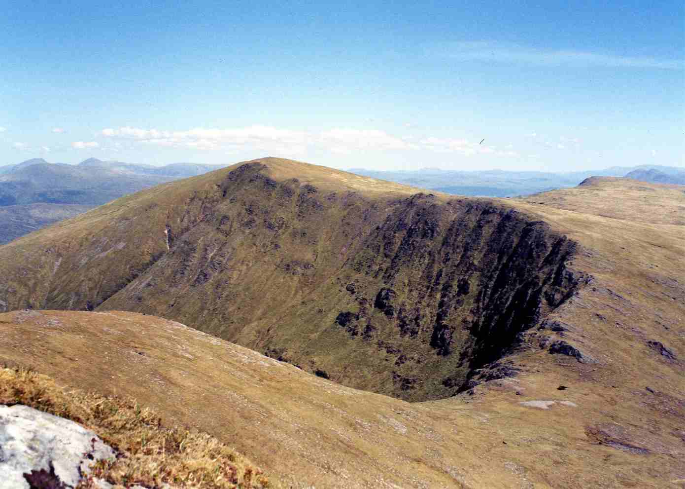
Ledgowan Forest is a picturesque natural area located in Ross-shire, Scotland. Situated amidst the stunning Highlands landscape, it covers a vast expanse of downs and moorland, offering visitors a unique and immersive experience in the heart of nature.

The forest is known for its diverse range of flora and fauna, showcasing the rich biodiversity of the region. The downs feature rolling hills covered in lush green grass, providing a serene and tranquil environment for visitors to explore. These open spaces are ideal for walking, picnicking, or simply enjoying the breathtaking panoramic views.

The moorland within Ledgowan Forest is characterized by its expansive heather-covered landscapes, creating a vibrant purple hue during the summer months. This habitat is home to a variety of bird species, including golden eagles, peregrine falcons, and red grouse, making it an excellent destination for birdwatching enthusiasts.

Outdoor enthusiasts will find an abundance of activities to enjoy in Ledgowan Forest. The area boasts several well-maintained walking trails, ranging in difficulty and length, allowing visitors of all fitness levels to explore the forest at their own pace. From gentle strolls to more challenging hikes, these trails provide an opportunity to immerse oneself in the natural beauty of the surroundings.

Ledgowan Forest, Ross-shire offers a captivating and idyllic escape from the hustle and bustle of everyday life. Its downs and moorland present a unique blend of natural wonders, making it a must-visit destination for nature lovers and those seeking a tranquil retreat amidst the majestic Scottish Highlands.

If you have any feedback on the listing, please let us know in the comments section below.

Ledgowan Forest Images

Images are sourced within 2km of 57.552009/-5.1697326 or Grid Reference NH1055. Thanks to Geograph Open Source API. All images are credited.

The summit of Carn Beag, Ledgowan Forest Looking north-west to Torridon (left), Loch Maree (centre), and Slioch and the Fisherfield Forest (right).
The summit of Carn Beag, Ledgowan Forest
Looking north-west to Torridon (left), Loch Maree (centre), and Slioch and the Fisherfield Forest (right).
Footbridge Footbridge over the river between Loch a' Chroisg and Loch Crann, west of Achnasheen - Indian Summer weather.
Footbridge
Footbridge over the river between Loch a' Chroisg and Loch Crann, west of Achnasheen - Indian Summer weather.
Heather Covered Gully Lovely autumnal colours in gully on the Allt Glac an Sguitheir near Achnasheen.
Heather Covered Gully
Lovely autumnal colours in gully on the Allt Glac an Sguitheir near Achnasheen.
Mountain Stream On moorland south of Loch a' Chroisg near Achnasheen.
Mountain Stream
On moorland south of Loch a' Chroisg near Achnasheen.
High Peatland Looking across the un-named 508m top above Loch a' Chroisg on a glorious September day.
High Peatland
Looking across the un-named 508m top above Loch a' Chroisg on a glorious September day.
Tropical Trig Point A day on the hills doesn't get much better than this! (except maybe with a wee Talisker to toast the hills) - about 9 Munros and 3 Corbetts plus the full length of Loch Maree can be seen.
Tropical Trig Point
A day on the hills doesn't get much better than this! (except maybe with a wee Talisker to toast the hills) - about 9 Munros and 3 Corbetts plus the full length of Loch Maree can be seen.
Coire Mhic Fhearchair Looking down into Coire Mhic Fhearchair.
Coire Mhic Fhearchair
Looking down into Coire Mhic Fhearchair.
Old Fence Remains of old fence on the summit of Graham, Beinn na Feusaige - Ledgowan Forest.
Old Fence
Remains of old fence on the summit of Graham, Beinn na Feusaige - Ledgowan Forest.
Torridon View A stunning day on the hills on a lowly Graham and one of the best viewpoints in the British Isles.
Torridon View
A stunning day on the hills on a lowly Graham and one of the best viewpoints in the British Isles.
High Lochain Lochan Sgeireach, north of the Graham Beinn na Feusaige.
High Lochain
Lochan Sgeireach, north of the Graham Beinn na Feusaige.
Indian Summer Heading off the hill in a September heatwave, and a convert to the attractions of wee hills.
Indian Summer
Heading off the hill in a September heatwave, and a convert to the attractions of wee hills.
Mile Dubh Looking across the moorland of square towards Beinn na Feusaige beyond.
Mile Dubh
Looking across the moorland of square towards Beinn na Feusaige beyond.
Beinn na Feusaige The summit plateau seen from across the glen on Moruisg.  The published location of the summit has moved to the west after access to large scale mapping through geograph.org.uk
Beinn na Feusaige
The summit plateau seen from across the glen on Moruisg. The published location of the summit has moved to the west after access to large scale mapping through geograph.org.uk
South end of Lochan Sgeireach Taken from the mayor intake to the Lochan (on a wet day).
South end of Lochan Sgeireach
Taken from the mayor intake to the Lochan (on a wet day).
Lochan Sgeireach from the north A new track comes to the north end of the Lochan suggesting it is fished on a regular basis.   Arctic Char, perhaps.
Lochan Sgeireach from the north
A new track comes to the north end of the Lochan suggesting it is fished on a regular basis. Arctic Char, perhaps.
Wet moorland north of Carn Beag The west end of Loch a' Chroisg can be seen in the distance, through the rain.
Wet moorland north of Carn Beag
The west end of Loch a' Chroisg can be seen in the distance, through the rain.
Allt a' Phiobaire A steeply falling moorland stream.
Allt a' Phiobaire
A steeply falling moorland stream.
New track, Coire a' Ghormachain Ledgowan Estate has constructed a number of new tracks in the hills south of Loch a' Chroisg.  They have made access into this area much easier, but have left prominent scars on the landscape.
New track, Coire a' Ghormachain
Ledgowan Estate has constructed a number of new tracks in the hills south of Loch a' Chroisg. They have made access into this area much easier, but have left prominent scars on the landscape.
Show me another place!

Ledgowan Forest is located at Grid Ref: NH1055 (Lat: 57.552009, Lng: -5.1697326)

Unitary Authority: Highland

Police Authority: Highlands and Islands

What 3 Words

///crackles.meatballs.squish. Near Achnasheen, Highland

Nearby Locations

Carn Beag Ledgowan Forest

Related Wikis

Ledgowan Forest

Ledgowan Forest is a deer forest in the Northwest Highlands of Scotland. It stands in Wester Ross to the southwest of Achnasheen. Ledgowan Forest is the...

Loch Scaven

Loch Scaven (Gaelic: Loch Sgamhain) is a small freshwater loch at the head of Glen Carron near the source of the River Carron, Wester Ross, Scotland. It...

Mòruisg

Mòruisg is a Scottish mountain situated in the Glencarron and Glenuig Forest, 10 kilometres south west of the village of Achnasheen in the Highland council...

Glencarron Estate

The Glencarron Estate is a 12,000 acre highland estate in Wester Ross. It provides sports facilities for fishing (river and loch) and grouse shooting....

Glencarron Platform railway station

Glencarron Platform was an intermediate halt on the Dingwall and Skye Railway between Achnashellach and Achnasheen. It was 36 miles 19 chains (58.3 km...

Achnasheen railway station

Achnasheen railway station is a remote railway station on the Kyle of Lochalsh Line, serving the village of Achnasheen in the north of Scotland. The station...
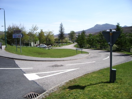
Achnasheen

Achnasheen (Gaelic Achadh na Sìne) is a small village in Ross-shire in the Highland council area of Scotland. The village is situated on the River Bran...
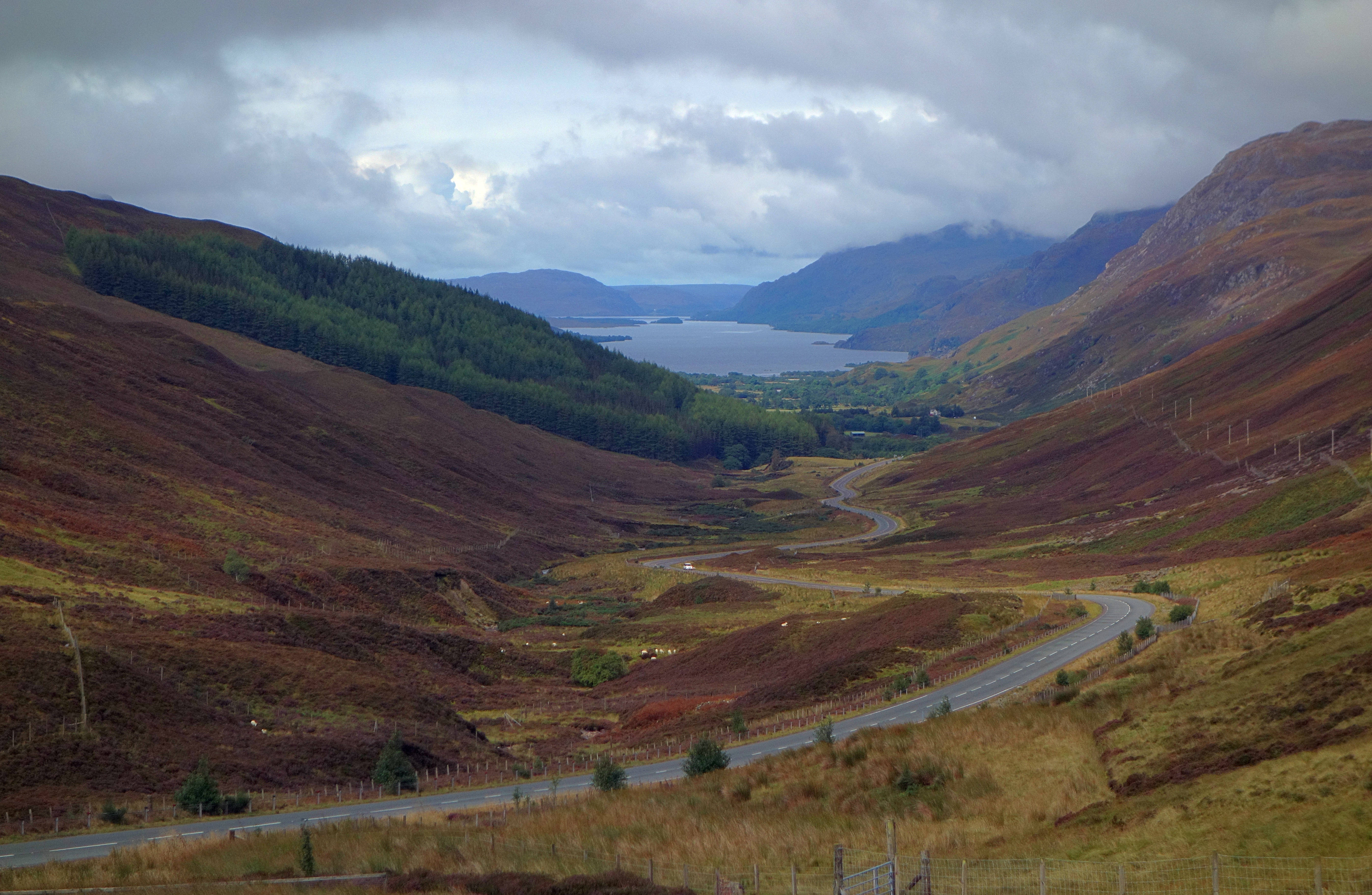
Glen Docherty

Glen Docherty (Scottish Gaelic: Gleann Dochartaich) is a glen in Wester Ross in Scotland, between Loch Maree and Kinlochewe to the west and Loch a'Chroisg...

Nearby Amenities

Located within 500m of 57.552009,-5.1697326
Carn Beag
Ele: 540
Natural: peak
Lat/Long: 57.5502435/-5.1633198
Man Made: survey_point
Lat/Long: 57.5502636/-5.1632532
The data included in this document is from www.openstreetmap.org. The data is made available under ODbL.

Have you been to Ledgowan Forest?

Leave your review of Ledgowan Forest below (or comments, questions and feedback).