Chiverton Croft

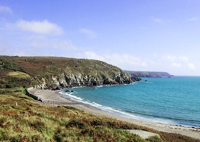
Downs, Moorland in Cornwall

England

Chiverton Croft

Old Serpentine Works, Poltesco The ruins of the serpentine factory - with the pilchard tower on the end, taken from the pebbly beach at Carleon Cove.
Old Serpentine Works, Poltesco Credit: Trevor Harris

Chiverton Croft is a picturesque and idyllic area located in Cornwall, England. Situated on the Downs and surrounded by stunning moorland, it offers a unique and breathtaking landscape for visitors to explore.

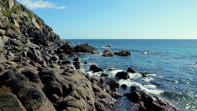
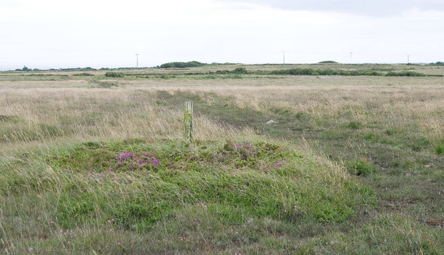
The area is characterized by rolling green hills, dotted with vibrant wildflowers and heather. The moorland, in particular, is a sight to behold, with its vast expanses of open space and rocky outcrops. It is a haven for wildlife, with numerous species of birds, small mammals, and reptiles making their homes here.

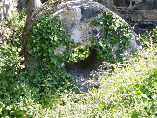
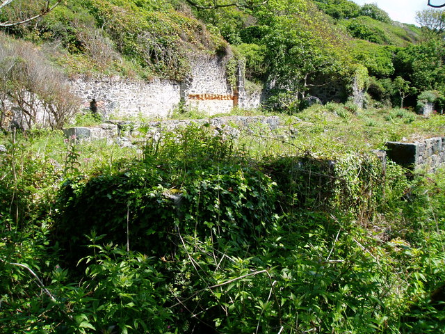
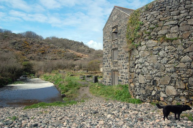
Chiverton Croft is also known for its rich history and heritage. There are several ancient burial sites, stone circles, and remnants of prehistoric settlements scattered throughout the area. These archaeological sites provide a fascinating glimpse into the lives of the people who once inhabited this land.

For outdoor enthusiasts, Chiverton Croft offers a plethora of activities to enjoy. Hiking and walking trails crisscross the region, allowing visitors to immerse themselves in the stunning natural beauty. The moorland is also a popular spot for birdwatching and nature photography, with its diverse range of avian species and breathtaking vistas.

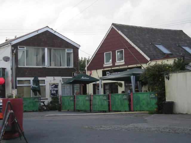
In terms of amenities, Chiverton Croft has limited facilities. There are a few small villages nearby that offer basic services such as accommodations and dining options. However, the area is primarily a place to escape the hustle and bustle of city life and connect with nature.

Overall, Chiverton Croft is a hidden gem in Cornwall, where visitors can experience the tranquility of the moorland and enjoy the beauty of the Downs. It is a perfect destination for nature lovers, history enthusiasts, and those seeking a peaceful retreat away from the crowds.

If you have any feedback on the listing, please let us know in the comments section below.

Chiverton Croft Images

Images are sourced within 2km of 50.01467/-5.1728766 or Grid Reference SW7217. Thanks to Geograph Open Source API. All images are credited.

Old Serpentine Works, Poltesco The ruins of the serpentine factory - with the pilchard tower on the end, taken from the pebbly beach at Carleon Cove.
Old Serpentine Works, Poltesco
The ruins of the serpentine factory - with the pilchard tower on the end, taken from the pebbly beach at Carleon Cove.
Public Footpath sign, Trerice near Ruan Major
Chimney Stack ..  all that remains The Poltesco Serpentine Works was initially powered by a water wheel feed by a leat from the Poltesco Valley stream. Then as technology moved on the machinery in the works was powered by a steam engine. The tall chimney shown in the old photos of the Lizard Serpentine Company's works is no longer standing and all that remains is one small section which is shown in this photograph. <a href="https://www.geograph.org.uk/photo/2430524">SW7215 : Derelict Serpentine Works at Carleon Cove</a>
Chimney Stack .. all that remains
The Poltesco Serpentine Works was initially powered by a water wheel feed by a leat from the Poltesco Valley stream. Then as technology moved on the machinery in the works was powered by a steam engine. The tall chimney shown in the old photos of the Lizard Serpentine Company's works is no longer standing and all that remains is one small section which is shown in this photograph. SW7215 : Derelict Serpentine Works at Carleon Cove
Water-wheel pit (remains) In the early days of the serpentine rock processing works on this site the power for the machinery came from a water-wheel. The water came from the nearby stream containing rain water which came as run-off from the high lands of Goonhilly Downs. The water was fed from the stream along in a leat and then finally delivered to the overshot water-wheel by means of an overhead wooden channel known as a launder.  

The iron framed wheel was 25 feet in diameter. It had wooden buckets and was made locally in Helston. The wheel was located on a substantial wooden framework over a deep pit.  The pit in which it ran is now the only element of the water-wheel which remains and that is overgrown with vegetation including trees as shown in this photograph.

The used water was then channelled to return to the Poltesco valley stream which flowed out to sea. The stream is to the right of photograph. <a href="https://www.geograph.org.uk/photo/2430419">SW7215 : Poltesco Valley stream reaches the beach</a>
Water-wheel pit (remains)
In the early days of the serpentine rock processing works on this site the power for the machinery came from a water-wheel. The water came from the nearby stream containing rain water which came as run-off from the high lands of Goonhilly Downs. The water was fed from the stream along in a leat and then finally delivered to the overshot water-wheel by means of an overhead wooden channel known as a launder. The iron framed wheel was 25 feet in diameter. It had wooden buckets and was made locally in Helston. The wheel was located on a substantial wooden framework over a deep pit. The pit in which it ran is now the only element of the water-wheel which remains and that is overgrown with vegetation including trees as shown in this photograph. The used water was then channelled to return to the Poltesco valley stream which flowed out to sea. The stream is to the right of photograph. SW7215 : Poltesco Valley stream reaches the beach
Poltesco Valley stream reaches the beach This photograph shows a number of features of this quiet and delightful cove. Quiet now, but not in the period around 1860s when this would have been a noisy and busy industrial site creating wonderful features pieces for the grand homes and London shopfronts of the Victorian era.

Just visible right of centre and hidden by vegetation is the site of the 25 foot diameter water-wheel. <a href="https://www.geograph.org.uk/photo/2430402">SW7215 : Water-wheel pit (remains)</a>

On the right on the edge of the stream can just be seen the stone quay for barges to dock alongside the serpentine works to collect the stone items produced by the works and transport them out to waiting sailing ships.

Finally, the effects of the powerful  easterly winter storms can be seen in the foreground. Masses of large and small stones have been washed into Carleon Cove to create a bank blocking the mouth of the river as it flows out of the Poltesco valley onto the seashore and on out to sea. <a href="https://www.geograph.org.uk/photo/2430431">SW7215 : View from the quay at Carleon Cove</a>
Poltesco Valley stream reaches the beach
This photograph shows a number of features of this quiet and delightful cove. Quiet now, but not in the period around 1860s when this would have been a noisy and busy industrial site creating wonderful features pieces for the grand homes and London shopfronts of the Victorian era. Just visible right of centre and hidden by vegetation is the site of the 25 foot diameter water-wheel. SW7215 : Water-wheel pit (remains) On the right on the edge of the stream can just be seen the stone quay for barges to dock alongside the serpentine works to collect the stone items produced by the works and transport them out to waiting sailing ships. Finally, the effects of the powerful easterly winter storms can be seen in the foreground. Masses of large and small stones have been washed into Carleon Cove to create a bank blocking the mouth of the river as it flows out of the Poltesco valley onto the seashore and on out to sea. SW7215 : View from the quay at Carleon Cove
View from the quay at Carleon Cove The small stone quay in the foreground is where the delicate serpentine products from the Lizard Serpentine Company's works were loaded onto barges for delivery to ships anchored off shore. <a href="https://www.geograph.org.uk/photo/2430419">SW7215 : Poltesco Valley stream reaches the beach</a>

The photos shows the stream from the Poltesco valley looking more like a lake. The reason is that it is held back from flowing directly out to sea by the build-up of storm driven pebbles on the seashore.
View from the quay at Carleon Cove
The small stone quay in the foreground is where the delicate serpentine products from the Lizard Serpentine Company's works were loaded onto barges for delivery to ships anchored off shore. SW7215 : Poltesco Valley stream reaches the beach The photos shows the stream from the Poltesco valley looking more like a lake. The reason is that it is held back from flowing directly out to sea by the build-up of storm driven pebbles on the seashore.
Wall - Local Serpentine Stone used for building This photo shows the great variety of serpentine rocks used in the building of what was the home of the manager of the Lizard Serpentine Company's stone works at Carleon Cove, Poltesco. <a href="https://www.geograph.org.uk/photo/2431176">SW7215 : Owner's House for Serpentine Quarries and Factory</a>

The many of the rocks in the Lizard area are special, but not unique. They have come from the mantle deep below the earth's surface. Some 350 million years ago a mass of molten rock burst up from within the earth's mantle and picked up all sorts of different rock types on its passage to the surface of the earth. Then later, due to movement of the tectonic plates, this same rock was subjected to even more heat and pressure resulting in a rock we see today which varies in colour, texture and patterning. This rock, called 'serpentine' can now be seen in outcrops all around the Lizard. Some of the rock is suitable for turning on a lathe or for being sculptured into delicate ornaments the best know being a lighthouse shaped ornament. Such ornaments sold mostly as tourist souvenirs are made locally by a handful of craftsmen. There are only few craftsmen left from what years ago was a flourishing serpentine industry of the Victorian period. 

The stone not suitable for decorative work was used in ordinary buildings as shown in this photo.  <a href="https://www.geograph.org.uk/photo/2430473">SW7216 : Lighthouse ornament created from serpentine rock</a> <a href="https://www.geograph.org.uk/photo/2430402">SW7215 : Water-wheel pit (remains)</a>
Wall - Local Serpentine Stone used for building
This photo shows the great variety of serpentine rocks used in the building of what was the home of the manager of the Lizard Serpentine Company's stone works at Carleon Cove, Poltesco. SW7215 : Owner's House for Serpentine Quarries and Factory The many of the rocks in the Lizard area are special, but not unique. They have come from the mantle deep below the earth's surface. Some 350 million years ago a mass of molten rock burst up from within the earth's mantle and picked up all sorts of different rock types on its passage to the surface of the earth. Then later, due to movement of the tectonic plates, this same rock was subjected to even more heat and pressure resulting in a rock we see today which varies in colour, texture and patterning. This rock, called 'serpentine' can now be seen in outcrops all around the Lizard. Some of the rock is suitable for turning on a lathe or for being sculptured into delicate ornaments the best know being a lighthouse shaped ornament. Such ornaments sold mostly as tourist souvenirs are made locally by a handful of craftsmen. There are only few craftsmen left from what years ago was a flourishing serpentine industry of the Victorian period. The stone not suitable for decorative work was used in ordinary buildings as shown in this photo. SW7216 : Lighthouse ornament created from serpentine rock SW7215 : Water-wheel pit (remains)
Lighthouse ornament created from serpentine rock An example of the traditional lighthouse ornament created from the local rock known as serpentine. There are currently (2011) only five craftsmen and one young apprentice creating such ornaments.
Lighthouse ornament created from serpentine rock
An example of the traditional lighthouse ornament created from the local rock known as serpentine. There are currently (2011) only five craftsmen and one young apprentice creating such ornaments.
Derelict Serpentine Works at Carleon Cove On the ground it is not difficult to trace out the walls of the old industrial buildings, but from this photograph it looks very much overgrown.

By comparing this photo with an old postcard of the site, it is possible to identify the part of the works where the steam engine was housed and which would have had a tall stone chimney. In this photo the site of the steam engine house is at the back in the very shadowy area and there you can just detect all that remains of the fallen chimney. For a closer look at all that remains of that tall chimney go to the following link. <a href="https://www.geograph.org.uk/photo/2430392">SW7215 : Chimney Stack ..  all that remains</a>
Derelict Serpentine Works at Carleon Cove
On the ground it is not difficult to trace out the walls of the old industrial buildings, but from this photograph it looks very much overgrown. By comparing this photo with an old postcard of the site, it is possible to identify the part of the works where the steam engine was housed and which would have had a tall stone chimney. In this photo the site of the steam engine house is at the back in the very shadowy area and there you can just detect all that remains of the fallen chimney. For a closer look at all that remains of that tall chimney go to the following link. SW7215 : Chimney Stack .. all that remains
Capstan Room - Old Pilchard Fishing Industry site It is within this now roofless building that the workers would have walked round and round winding the rope around a vertical capstan to gradually wind in the fishing nets or, probably was used to pull the small boats up from the sea onto the beach. <a href="https://www.geograph.org.uk/photo/2378147">SW7215 : Old Serpentine Works, Poltesco</a> <a href="https://www.geograph.org.uk/photo/1263630">SW7215 : Poltesco Serpentine Works 1</a>

The path shown leads down to Carleon Cove along a sloping rocky incline.
Capstan Room - Old Pilchard Fishing Industry site
It is within this now roofless building that the workers would have walked round and round winding the rope around a vertical capstan to gradually wind in the fishing nets or, probably was used to pull the small boats up from the sea onto the beach. SW7215 : Old Serpentine Works, Poltesco SW7215 : Poltesco Serpentine Works 1 The path shown leads down to Carleon Cove along a sloping rocky incline.
Owner's House for Serpentine Quarries and Factory The site owner's or manager's house. In 1879, Mr Jabez Druitt came from London and bought the local quarries and the serpentine works. He lived in this house which overlooked the factory and the cove, probably more easily than it would be today as considerable vegetation has grown up in recent years.

The walls of the house used the local serpentine stone in its construction and would have been taken from the quarries close-by. 

The property is now in the ownership of the National Trust and is used by them for estate staff accommodation and offices.
<a href="https://www.geograph.org.uk/photo/2430463">SW7215 : Wall - Local Serpentine Stone used for building</a> <a href="https://www.geograph.org.uk/photo/2430524">SW7215 : Derelict Serpentine Works at Carleon Cove</a>
Owner's House for Serpentine Quarries and Factory
The site owner's or manager's house. In 1879, Mr Jabez Druitt came from London and bought the local quarries and the serpentine works. He lived in this house which overlooked the factory and the cove, probably more easily than it would be today as considerable vegetation has grown up in recent years. The walls of the house used the local serpentine stone in its construction and would have been taken from the quarries close-by. The property is now in the ownership of the National Trust and is used by them for estate staff accommodation and offices. SW7215 : Wall - Local Serpentine Stone used for building SW7215 : Derelict Serpentine Works at Carleon Cove
The lane leading to Erisey Barton
Cattle in a field at Erisey Barton The wind turbines are the new giant ones which replaced the original ones at Bonython wind farm some 3km distant - see <a href="https://www.geograph.org.uk/photo/2173569">SW7021 : New wind turbines at Bonython</a>.
Cattle in a field at Erisey Barton
The wind turbines are the new giant ones which replaced the original ones at Bonython wind farm some 3km distant - see SW7021 : New wind turbines at Bonython.
Field gate at Erisey Barton Leading into this field: <a href="https://www.geograph.org.uk/photo/2527886">SW7118 : Cattle in a field at Erisey Barton</a>.
Field gate at Erisey Barton
Waymarking post near Erisey Barton At the junction of a footpath and a bridleway.
Waymarking post near Erisey Barton
At the junction of a footpath and a bridleway.
Minor road junction near Tresaddern
Eastern Cliff West of Kennack Sands at approaching high tide (didn't want to go any further into the square!)
Eastern Cliff
West of Kennack Sands at approaching high tide (didn't want to go any further into the square!)
The Caerverracks This rocky section splits the two sections of Kennack Sands.
View south-west towards Lizard Point.
The Caerverracks
This rocky section splits the two sections of Kennack Sands. View south-west towards Lizard Point.
Show me another place!

Chiverton Croft is located at Grid Ref: SW7217 (Lat: 50.01467, Lng: -5.1728766)

Unitary Authority: Cornwall

Police Authority: Devon and Cornwall

What 3 Words

///romance.combines.magnitude. Near Mullion, Cornwall

Nearby Locations

Chiverton Croft

Related Wikis

Gwenter

Gwenter (Cornish: Gwynstir) is a hamlet in the parish of St Keverne (where the 2011 census population was included), Cornwall, England.Gwenter lies within...

Kennack Sands

Kennack Sands is a beach and sand-dune system on the east coast of the Lizard Peninsula, Cornwall, England, UK. == Geography == The beach is approximately...

Kuggar

Kuggar (Cornish: Koger) is a hamlet in the parish of Grade-Ruan in Cornwall, England. Kuggar, within the Cornwall Area of Outstanding Natural Beauty (AONB...

Poltesco

Poltesco is a hamlet and valley in the parish of Grade-Ruan, on the Lizard Peninsula, Cornwall, UK. The lower part of the valley is owned by the National...

Nearby Amenities

Located within 500m of 50.01467,-5.1728766
Ford: yes
Lat/Long: 50.0170586/-5.1706066
Power: pole
Lat/Long: 50.0184056/-5.169396
Power: pole
Lat/Long: 50.0176077/-5.1703669
Power: pole
Lat/Long: 50.0167046/-5.1714653
Power: pole
Lat/Long: 50.0163125/-5.1728869
Power: pole
Lat/Long: 50.0159575/-5.174126
Power: pole
Lat/Long: 50.015449/-5.1760036
Power: pole
Lat/Long: 50.0151379/-5.1771408
Power: pole
Lat/Long: 50.0148113/-5.1782808
Power: pole
Lat/Long: 50.0150302/-5.1797479
Power: pole
Lat/Long: 50.0114089/-5.1706633
Power: pole
Lat/Long: 50.0108125/-5.1700786
Power: pole
Lat/Long: 50.0158652/-5.1670504
Power: pole
Lat/Long: 50.0151172/-5.1679918
Power: pole
Lat/Long: 50.0145769/-5.1686543
Power: pole
Lat/Long: 50.0139168/-5.1694939
Power: pole
Lat/Long: 50.0130429/-5.1705681
Power: pole
Lat/Long: 50.0122306/-5.1714827
Power: pole
Lat/Long: 50.0117122/-5.1722834
Power: pole
Lat/Long: 50.011283/-5.1728064
Power: pole
Lat/Long: 50.0109176/-5.1732516
The data included in this document is from www.openstreetmap.org. The data is made available under ODbL.

Have you been to Chiverton Croft?

Leave your review of Chiverton Croft below (or comments, questions and feedback).