Merthen Downs

Downs, Moorland in Cornwall

England

Merthen Downs

Farmland, Constantine A crop of spring barley just coming into flower to the south of Treviades.
Farmland, Constantine Credit: Andrew Smith

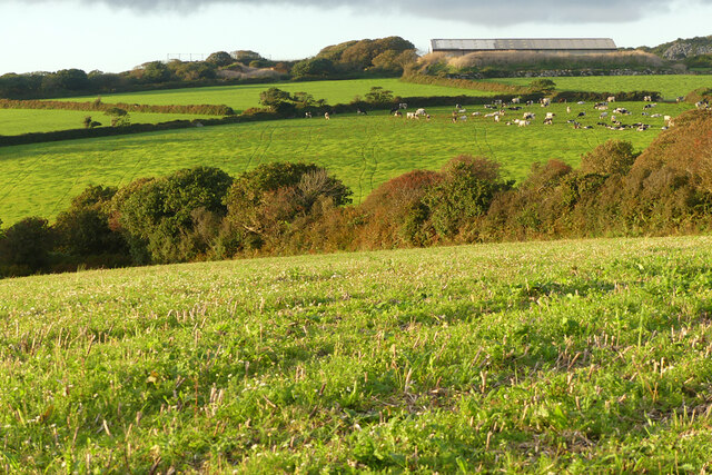
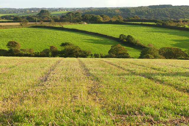
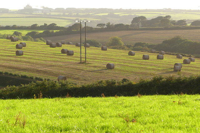
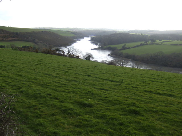
Merthen Downs is a beautiful area of moorland located in Cornwall, England. It covers a vast expanse of rolling hills and open grassland, offering stunning views of the surrounding countryside. The downs are known for their diverse wildlife, including a variety of bird species and small mammals.

The landscape of Merthen Downs is characterized by its rugged terrain and scattered rocky outcrops, which add to the area's natural charm. The downs are also home to several ancient archaeological sites, such as burial mounds and stone circles, which provide a glimpse into the area's rich history.

Visitors to Merthen Downs can enjoy a range of outdoor activities, including hiking, birdwatching, and picnicking. The area is a popular destination for nature lovers and outdoor enthusiasts seeking a peaceful retreat away from the hustle and bustle of city life.

Overall, Merthen Downs is a picturesque and serene destination in Cornwall, offering visitors a chance to immerse themselves in the beauty of the natural world.

If you have any feedback on the listing, please let us know in the comments section below.

Merthen Downs Images

Images are sourced within 2km of 50.105599/-5.1802428 or Grid Reference SW7227. Thanks to Geograph Open Source API. All images are credited.

Farmland, Constantine A crop of spring barley just coming into flower to the south of Treviades.
Farmland, Constantine
A crop of spring barley just coming into flower to the south of Treviades.
Farmland, Constantine A cut silage field descends to Polwheveral Creek with Scott's Wood in the background.
Farmland, Constantine
A cut silage field descends to Polwheveral Creek with Scott's Wood in the background.
Farmland, Constantine Officially the bridleway descending to Goongillings; stone stiles, in effect, limit it to being a footpath.
Farmland, Constantine
Officially the bridleway descending to Goongillings; stone stiles, in effect, limit it to being a footpath.
Grassland and wood, Constantine Scott's Wood is seen from the footpath descending to Scott's Quay.
Grassland and wood, Constantine
Scott's Wood is seen from the footpath descending to Scott's Quay.
St Constantine's Church
The Tolmen Centre
The Tolmen Centre
Old Guide Stone in Constantine Fingerstone by the UC road, in parish of Constantine (Kerrier District), opposite Old Vicarage and Church, junction of Bowling Green Road and Vicarage Terrace, by metal rails at junction.

Grade II listed.
List Entry Number: 1310987 <span class="nowrap"><a title="https://historicengland.org.uk/listing/the-list/list-entry/1310987" rel="nofollow ugc noopener" href="https://historicengland.org.uk/listing/the-list/list-entry/1310987">Link</a><img style="margin-left:2px;" alt="External link" title="External link - shift click to open in new window" src="https://s1.geograph.org.uk/img/external.png" width="10" height="10"/></span>

Surveyed

Milestone Society National ID: CW_GWLZ
Old Guide Stone in Constantine
Fingerstone by the UC road, in parish of Constantine (Kerrier District), opposite Old Vicarage and Church, junction of Bowling Green Road and Vicarage Terrace, by metal rails at junction. Grade II listed. List Entry Number: 1310987 LinkExternal link Surveyed Milestone Society National ID: CW_GWLZ
Farmland, Gweek Napheane Farm is to the right.
Farmland, Gweek
Napheane Farm is to the right.
Farmland, Gweek Looking south from the bridleway on Naphene Downs.
Farmland, Gweek
Looking south from the bridleway on Naphene Downs.
Farmland, Constantine With baled straw in a field to the south-west of Mount View.
Farmland, Constantine
With baled straw in a field to the south-west of Mount View.
Pasture, Constantine A footpath passes to the west of Trengilly Farm.
Pasture, Constantine
A footpath passes to the west of Trengilly Farm.
Fore Street, Constantine
Unnamed lane enters Polwheveral
Unnamed stream feeds into Polwheveral Creek This lively stream originates to the north near Lestraynes.
Unnamed stream feeds into Polwheveral Creek
This lively stream originates to the north near Lestraynes.
Lower Goongillings This is a Grade II listed house built in the early 17th C with additions in the 18th C. It has English Heritage Building ID: 66021 For a full description see:
<span class="nowrap"><a title="http://www.britishlistedbuildings.co.uk/en-66021-lower-goongillings-constantine-" rel="nofollow ugc noopener" href="http://www.britishlistedbuildings.co.uk/en-66021-lower-goongillings-constantine-">Link</a><img style="margin-left:2px;" alt="External link" title="External link - shift click to open in new window" src="https://s1.geograph.org.uk/img/external.png" width="10" height="10"/></span>
Lower Goongillings
This is a Grade II listed house built in the early 17th C with additions in the 18th C. It has English Heritage Building ID: 66021 For a full description see: LinkExternal link
The Trengilly Wartha Inn
Unnamed lane junction between Gweek and Constantine Perhaps the finger signpost was erected by workers who have just visited the nearby Trengilly Wartha Inn?
Unnamed lane junction between Gweek and Constantine
Perhaps the finger signpost was erected by workers who have just visited the nearby Trengilly Wartha Inn?
Unnamed road junction south of Carwythenack Farm
Show me another place!

Merthen Downs is located at Grid Ref: SW7227 (Lat: 50.105599, Lng: -5.1802428)

Unitary Authority: Cornwall

Police Authority: Devon and Cornwall

What 3 Words

///tolerable.stump.yards. Near Wendron, Cornwall

Nearby Locations

Merthen Downs

Related Wikis

Nancenoy

Nancenoy (Cornish: Nans Noy, meaning Noah's valley) is a hamlet near Constantine in west Cornwall, England, UK.The Trengilly Wartha Inn is a pub and restaurant...

Polpenwith

Polpenwith (Cornish: Poll Pennrudh, meaning creek of the red headland) is a hamlet south of Constantine in west Cornwall, England. It is at the head of...

Polwheveral

Polwheveral (Cornish: Poll Hwevrer, meaning lively creek) is a hamlet near Constantine in Cornwall, England. Polwheveral is at the head of a creek of the...
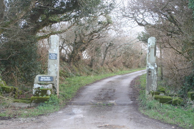
Merthen Manor

Merthen Manor (Cornish: Merdhin, meaning sea fort) is a 16th-century manor house in west Cornwall, England, UK. For most of its history it has been in...

Nearby Amenities

Located within 500m of 50.105599,-5.1802428
Place: farm
Lat/Long: 50.1071398/-5.1831909
Power: pole
Lat/Long: 50.1085985/-5.1839831
Power: pole
Lat/Long: 50.1076386/-5.1841602
Power: pole
Lat/Long: 50.1068903/-5.1842487
Power: pole
Lat/Long: 50.1061248/-5.1847154
Power: pole
Lat/Long: 50.1050874/-5.185445
Power: pole
Lat/Long: 50.1019479/-5.1841905
Power: pole
Lat/Long: 50.1024486/-5.1838257
Power: pole
Lat/Long: 50.1026021/-5.1819643
Power: pole
Lat/Long: 50.1026314/-5.1809195
Power: pole
Lat/Long: 50.1026959/-5.1809128
Power: pole
Lat/Long: 50.1031991/-5.1798936
Power: pole
Lat/Long: 50.1040395/-5.1781984
Power: pole
Lat/Long: 50.1042313/-5.1771551
Power: pole
Lat/Long: 50.104393/-5.1762901
Power: pole
Lat/Long: 50.104535/-5.1751313
Power: pole
Lat/Long: 50.1046924/-5.1739498
Power: pole
Lat/Long: 50.1019001/-5.1806259
Power: pole
Lat/Long: 50.1025274/-5.1828723
Power: pole
Lat/Long: 50.1036382/-5.1790051
Power: pole
Lat/Long: 50.1078492/-5.1830575
Power: pole
Lat/Long: 50.1086439/-5.1834075
Power: pole
Lat/Long: 50.1094554/-5.1837784
Power: pole
Lat/Long: 50.1076707/-5.1829791
The data included in this document is from www.openstreetmap.org. The data is made available under ODbL.

Have you been to Merthen Downs?

Leave your review of Merthen Downs below (or comments, questions and feedback).