Porkellis Moor

Downs, Moorland in Cornwall

England

Porkellis Moor

Track and pasture, Wendron The footpath approaching Pollangreen Farm from the west.
Track and pasture, Wendron Credit: Andrew Smith

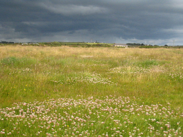
Porkellis Moor, located in the southwestern county of Cornwall, England, is a picturesque and ecologically diverse area known for its downs and moorland. This expansive landscape covers approximately 1,200 acres and is situated near the village of Porkellis.

The moor is characterized by its undulating terrain, featuring rolling hills, open grasslands, and heathland vegetation. It is home to a variety of plant species including heather, gorse, and bracken, which create a vibrant and colorful display during the summer months. The moorland also contains several small ponds and streams, adding to its natural beauty.

Porkellis Moor is a haven for wildlife enthusiasts, as it provides habitat for a diverse range of animals. Visitors may spot a variety of bird species, including skylarks, stonechats, and kestrels, soaring over the open grasslands. The moor is also home to small mammals such as voles and shrews, as well as reptiles like adders and common lizards.

This area is popular among hikers, nature lovers, and birdwatchers due to its tranquil surroundings and breathtaking views. There are several walking trails that meander through the moor, offering visitors the chance to explore its natural wonders at their own pace. Additionally, the moor is situated near the larger Cornwall Area of Outstanding Natural Beauty, providing ample opportunities for outdoor recreation and exploration.

Porkellis Moor, with its diverse landscape, abundant wildlife, and scenic vistas, is a true gem of Cornwall, attracting visitors from near and far to experience its natural splendor.

If you have any feedback on the listing, please let us know in the comments section below.

Porkellis Moor Images

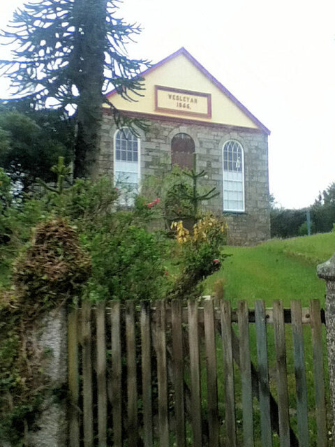
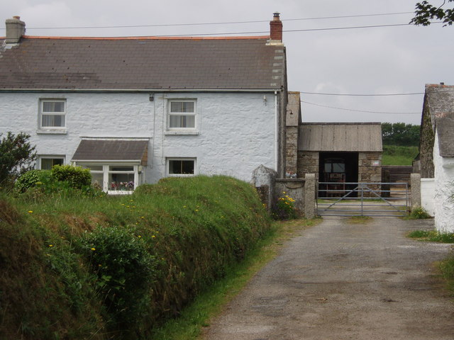
Images are sourced within 2km of 50.146007/-5.2350019 or Grid Reference SW6832. Thanks to Geograph Open Source API. All images are credited.

Track and pasture, Wendron The footpath approaching Pollangreen Farm from the west.
Track and pasture, Wendron
The footpath approaching Pollangreen Farm from the west.
Pasture at Garlidna The chimney on the horizon is this one: <a href="https://www.geograph.org.uk/photo/886987">SW7132 : Isolated ruined chimney in a field next to Retanna House Farm</a>.
Pasture at Garlidna
Cattle at Pollangreen Farm
Camping field at 'Out in the Open' A 'gay friendly' camp site near Porkellis, seen on a dreary wet day <span class="nowrap"><a title="http://www.outintheopen.co.uk/Out%20in%20the%20Open.html" rel="nofollow ugc noopener" href="http://www.outintheopen.co.uk/Out%20in%20the%20Open.html">Link</a><img style="margin-left:2px;" alt="External link" title="External link - shift click to open in new window" src="https://s1.geograph.org.uk/img/external.png" width="10" height="10"/></span>
Camping field at 'Out in the Open'
A 'gay friendly' camp site near Porkellis, seen on a dreary wet day LinkExternal link
Sign at the entrance to the camping field at 'Out in the Open' The decoration on top of the fence post is two rather bedraggled Barbie dolls on a surfboard.  See also <a href="https://www.geograph.org.uk/photo/2460631">SW7033 : Camping field at 'Out in the Open'</a>.
Sign at the entrance to the camping field at 'Out in the Open'
The decoration on top of the fence post is two rather bedraggled Barbie dolls on a surfboard. See also SW7033 : Camping field at 'Out in the Open'.
Shepherds' huts at Lower Dacum Farm Part of the 'Out in the Open' campsite, these traditional shepherds' huts offer a novel form of accommodation <span class="nowrap"><a title="http://www.outintheopen.co.uk/Shepherd%27s%20Huts.html" rel="nofollow ugc noopener" href="http://www.outintheopen.co.uk/Shepherd%27s%20Huts.html">Link</a><img style="margin-left:2px;" alt="External link" title="External link - shift click to open in new window" src="https://s1.geograph.org.uk/img/external.png" width="10" height="10"/></span>.
Shepherds' huts at Lower Dacum Farm
Part of the 'Out in the Open' campsite, these traditional shepherds' huts offer a novel form of accommodation LinkExternal link.
A394 north of Carnbone Farm
A394 at turning for Viscar
Cornwall : The A394 Heading along the A394 as it heads through Cornwall.
Cornwall : The A394
Heading along the A394 as it heads through Cornwall.
Cornwall : The A394 Heading along the A394 and following a lorry as it heads through Cornwall.
Cornwall : The A394
Heading along the A394 and following a lorry as it heads through Cornwall.
Heathland, Wendron A mixture of damp grass and woodland on Porkellis Moor is viewed from the road at New England Farm.
Heathland, Wendron
A mixture of damp grass and woodland on Porkellis Moor is viewed from the road at New England Farm.
Pasture, Wendron Looking down on Hendra Farm, it appears, with hindsight, I was the wrong side of the hedge as I tried to follow the footpath south of Trewavas.
Pasture, Wendron
Looking down on Hendra Farm, it appears, with hindsight, I was the wrong side of the hedge as I tried to follow the footpath south of Trewavas.
Pasture, Wendron The small chimney associated with Beacon Hill or Baljerrick Mine is seen in beneath a rainbow seen as rain approached.
Pasture, Wendron
The small chimney associated with Beacon Hill or Baljerrick Mine is seen in beneath a rainbow seen as rain approached.
Pasture, Wendron A footpath crosses small fields on the approach to Higher Manhay Farm.
Pasture, Wendron
A footpath crosses small fields on the approach to Higher Manhay Farm.
Pasture. Wendron The relatively short chimney of Beacon Hill Mine is seen in the background.
Pasture. Wendron
The relatively short chimney of Beacon Hill Mine is seen in the background.
Former St Christopher's Church
Former Wesleyan Chapel
Former Chapel
Former Chapel
Show me another place!

Porkellis Moor is located at Grid Ref: SW6832 (Lat: 50.146007, Lng: -5.2350019)

Unitary Authority: Cornwall

Police Authority: Devon and Cornwall

What 3 Words

///remarking.defender.piglets. Near Wendron, Cornwall

Related Wikis

Poldark Mine

Poldark Mine is a tourist attraction near the town of Helston in Cornwall, England, UK. It lies within the Wendron Mining District of the Cornwall and...

Porkellis

Porkellis (Cornish: Porthkellys) is a village in Cornwall, England, United Kingdom. It is approximately three and a half miles north-east of Helston, and...

Lezerea

Lezerea (Cornish: Lysgre, meaning herd's ruin) is a farmstead near Wendron in Cornwall, England, UK. Lezerea is in the civil parish of Wendron, situated...

Crelly

Crelly is a moorland in the parish of Wendron in Cornwall, England. On the edges of the moor are Crelly Farm, Crelly Barton and Higher Crelly Farm. �...

Nearby Amenities

Located within 500m of 50.146007,-5.2350019
Place: farm
Lat/Long: 50.1460662/-5.229153
Man Made: chimney
Lat/Long: 50.1498358/-5.2355309
Ford: yes
Lat/Long: 50.1496732/-5.2361734
Ford: yes
Lat/Long: 50.1485663/-5.2365283
Ford: yes
Lat/Long: 50.148312/-5.236554
The data included in this document is from www.openstreetmap.org. The data is made available under ODbL.

Have you been to Porkellis Moor?

Leave your review of Porkellis Moor below (or comments, questions and feedback).