Monadh Morsaig

Downs, Moorland in Inverness-shire

Scotland

Monadh Morsaig

Moorland and lochan The moorland here would be very boggy in wet weather. Fortunately, there has been no significant rainfall for several weeks, so today, the going was relatively easy.
Moorland and lochan Credit: Richard Dorrell

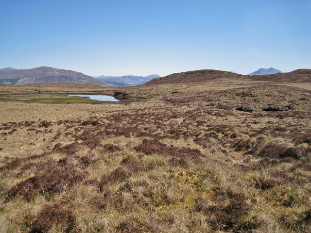
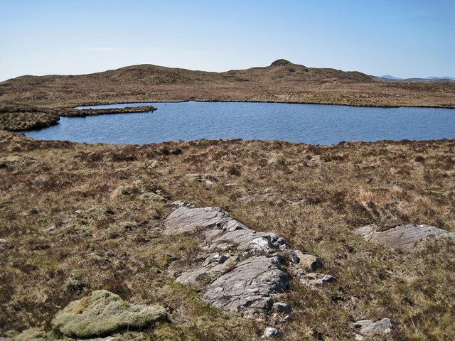
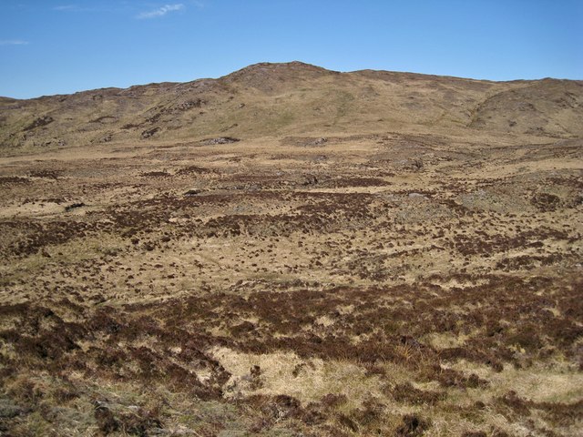
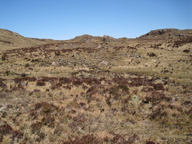
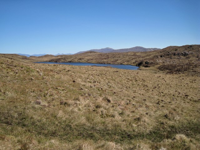
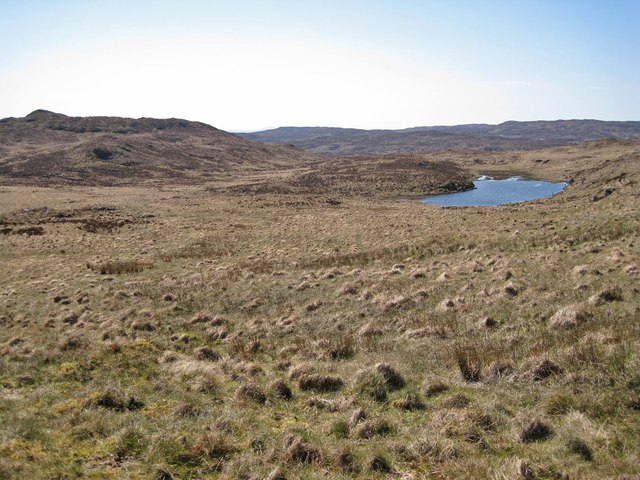
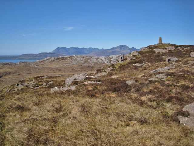
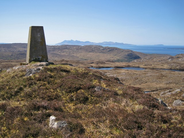
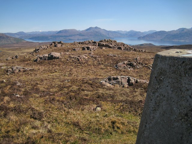
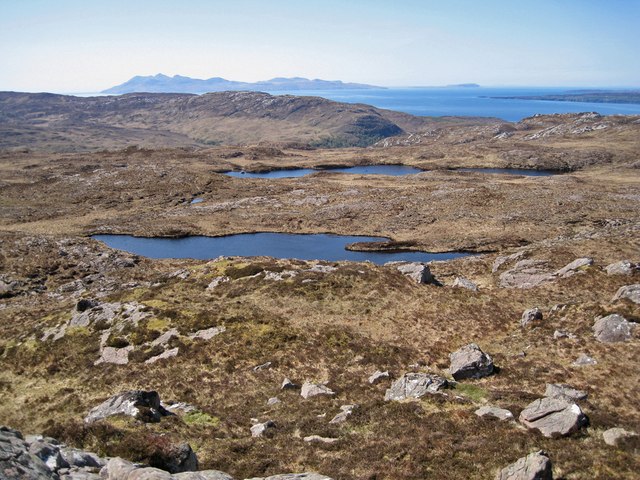
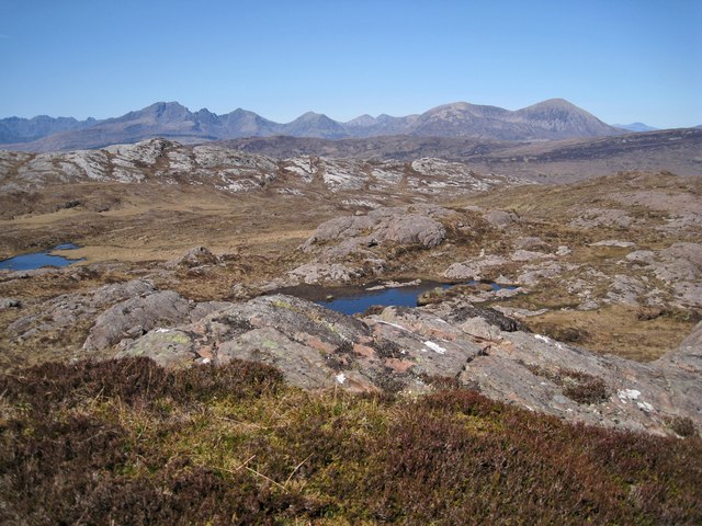
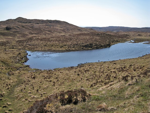
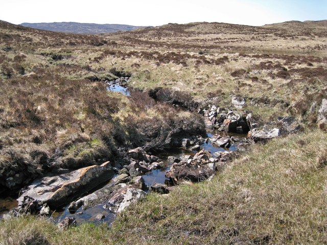
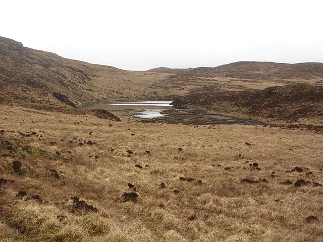
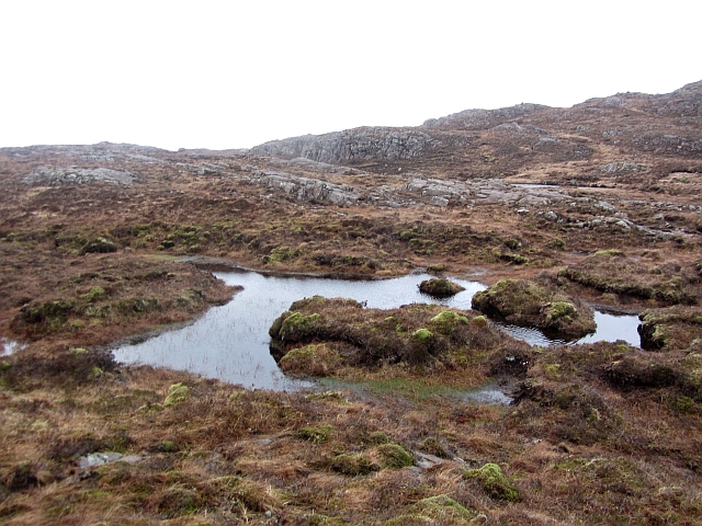
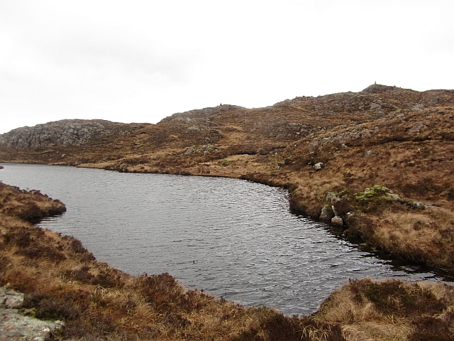
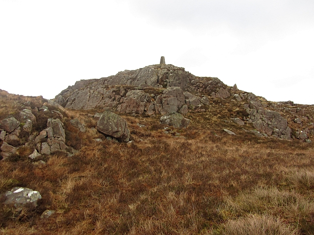
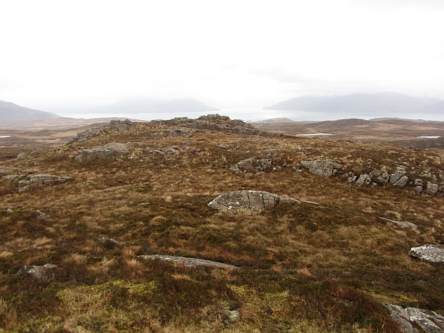
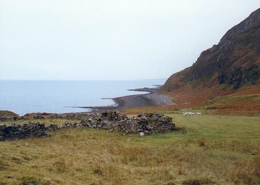
Monadh Morsaig is a remote and rugged area located in Inverness-shire, Scotland. The landscape of Monadh Morsaig is characterized by rolling hills, expansive moorland, and dramatic cliffs overlooking the Atlantic Ocean. The area is sparsely populated, with only a few scattered settlements and farms.

Monadh Morsaig is known for its wild and untamed beauty, with heather-covered hillsides and rocky outcrops creating a stunning backdrop for outdoor activities such as hiking, birdwatching, and photography. The area is home to a variety of wildlife, including red deer, eagles, and other bird species.

Access to Monadh Morsaig is limited, with no major roads passing through the area. Visitors can reach the region by taking a ferry from the nearby town of Mallaig or by hiking in from the surrounding countryside. The remoteness of Monadh Morsaig adds to its appeal for those seeking a peaceful and unspoiled natural environment to explore.

Overall, Monadh Morsaig offers a unique and tranquil escape for nature lovers and outdoor enthusiasts looking to immerse themselves in the beauty of the Scottish Highlands.

If you have any feedback on the listing, please let us know in the comments section below.

Monadh Morsaig Images

Images are sourced within 2km of 57.159099/-5.8750006 or Grid Reference NG6514. Thanks to Geograph Open Source API. All images are credited.

Moorland and lochan The moorland here would be very boggy in wet weather. Fortunately, there has been no significant rainfall for several weeks, so today, the going was relatively easy.
Moorland and lochan
The moorland here would be very boggy in wet weather. Fortunately, there has been no significant rainfall for several weeks, so today, the going was relatively easy.
Lochan Dubh? One of the lochans on the moor here is named on the OS map as Lochan Dubh, though it is not clear which lochan has the name. 'Dubh' is Gaelic for 'black', and in weather like today, the lochans look anything but black, though I can imagine on a gloomy wet winters day the deep, still water could look very black indeed.
The domed hill in the background is An Cruachan.
Lochan Dubh?
One of the lochans on the moor here is named on the OS map as Lochan Dubh, though it is not clear which lochan has the name. 'Dubh' is Gaelic for 'black', and in weather like today, the lochans look anything but black, though I can imagine on a gloomy wet winters day the deep, still water could look very black indeed. The domed hill in the background is An Cruachan.
Moorland below Sgòrach Breac The heather moorland here would become very boggy in wet weather. Fortunately for me, Skye has been largely dry for the past several weeks, so the going was relatively easy. In a few weeks time, the browns of the moor will turn green as this years grasses grow tall. The hill ahead is Sgòrach Breac, in <a href="https://www.geograph.org.uk/gridref/NG6513">NG6513</a> - the summit being the highest point in the Sleat peninsula.
Moorland below Sgòrach Breac
The heather moorland here would become very boggy in wet weather. Fortunately for me, Skye has been largely dry for the past several weeks, so the going was relatively easy. In a few weeks time, the browns of the moor will turn green as this years grasses grow tall. The hill ahead is Sgòrach Breac, in NG6513 - the summit being the highest point in the Sleat peninsula.
Rock outcrops on the moor Most of the moorland here is deep grass and heather, though a few rocky outcrops poke through.
Rock outcrops on the moor
Most of the moorland here is deep grass and heather, though a few rocky outcrops poke through.
Lochan Fada This is probably the largest of a group of lochans here which share the collective name of Lochan Fada.
Lochan Fada
This is probably the largest of a group of lochans here which share the collective name of Lochan Fada.
Lochan Fada A flattish and, in wetter weather, very boggy area of moorland here is dotted with lochans which share the collective name of Lochan Fada. The hill on the far left is An Cruachan.
Lochan Fada
A flattish and, in wetter weather, very boggy area of moorland here is dotted with lochans which share the collective name of Lochan Fada. The hill on the far left is An Cruachan.
A 'wow' moment Approaching the summit of Sgòrach Breac from this direction, one has trudged over what feels like miles of rather dull moorland, so suddenly coming upon a view over the rocky Sgiath-bheinn an Uird to the distant Cuillin is quite a treat. At just 299 metres, the summit trig is the highest point on the Sleat peninsula.
A 'wow' moment
Approaching the summit of Sgòrach Breac from this direction, one has trudged over what feels like miles of rather dull moorland, so suddenly coming upon a view over the rocky Sgiath-bheinn an Uird to the distant Cuillin is quite a treat. At just 299 metres, the summit trig is the highest point on the Sleat peninsula.
Summit of Sgòrach Breac At 299 metres, the summit is the highest point in the Sleat peninsula. The view is to the south west, with the island of Rum on the horizon.
Summit of Sgòrach Breac
At 299 metres, the summit is the highest point in the Sleat peninsula. The view is to the south west, with the island of Rum on the horizon.
Summit of Sgòrach Breac Looking east past the summit trig point towards the Sound of Sleat and distant mainland mountains.
Summit of Sgòrach Breac
Looking east past the summit trig point towards the Sound of Sleat and distant mainland mountains.
Lochans on Sgòrach Breac Looking south west from just below the summit of the hill. The area is dotted with many lochans. The island on the horizon is Rum.
Lochans on Sgòrach Breac
Looking south west from just below the summit of the hill. The area is dotted with many lochans. The island on the horizon is Rum.
North west from Sgòrach Breac Sleat is often referred to as 'The Garden of Skye' for its woodland and gentle shoreline landscapes. Here, on top of the peninsula, must be the rock garden, with much exposed limestone bedrock amid acres of barren moorland.
North west from Sgòrach Breac
Sleat is often referred to as 'The Garden of Skye' for its woodland and gentle shoreline landscapes. Here, on top of the peninsula, must be the rock garden, with much exposed limestone bedrock amid acres of barren moorland.
Lochan Fada This is one of several lochans in the area which share the name of Lochan Fada. The hill beyond is An Cruachan.
Lochan Fada
This is one of several lochans in the area which share the name of Lochan Fada. The hill beyond is An Cruachan.
Allt a Ghasgain There are not many burns amid the boggy moorland in this area, but here is one exception. This burn is a tributary of the Ord River which flows into the sea at Ord in <a href="https://www.geograph.org.uk/gridref/NG6113">NG6113</a>.
Allt a Ghasgain
There are not many burns amid the boggy moorland in this area, but here is one exception. This burn is a tributary of the Ord River which flows into the sea at Ord in NG6113.
Lochan, Sgòrach Breac A long lochan beneath the summit of Sgòrach Breac.
Lochan, Sgòrach Breac
A long lochan beneath the summit of Sgòrach Breac.
Bog, Sgòrach Breac The Torridonian sandstone traps peat and water forming a very wet landscape.
Bog, Sgòrach Breac
The Torridonian sandstone traps peat and water forming a very wet landscape.
Sgòrach Breac A lochan trapped by the bedding planes of the Torridonian Sandstone beneath the summit.
Sgòrach Breac
A lochan trapped by the bedding planes of the Torridonian Sandstone beneath the summit.
Sgòrach Breac The summit with Torridonian sandstone crags.
Sgòrach Breac
The summit with Torridonian sandstone crags.
Moorland, Sgòrach Breac Torridonian sandstone moorland near the summit of Sgòrach Breac.
Moorland, Sgòrach Breac
Torridonian sandstone moorland near the summit of Sgòrach Breac.
Show me another place!

Monadh Morsaig is located at Grid Ref: NG6514 (Lat: 57.159099, Lng: -5.8750006)

Unitary Authority: Highland

Police Authority: Highlands and Islands

What 3 Words

///lifeguard.scrap.cascade. Near Broadford, Highland

Nearby Locations

Monadh Morsaig

Related Wikis

Drumfearn

Drumfearn (Scottish Gaelic: An Druim Fheàrna) is a small crofting township, lying at the head of the Sleat peninsula, at the head of Loch Eishort, on...

Heaste

Heasta, Heast, or the anglicised form Heaste, pron. /heɪst/, is a small settlement on the island of Skye, Scotland. It is located on the west coast of...

Isleornsay

Isleornsay (Scottish Gaelic: Eilean Iarmain) is a village lying off the main Armadale to Sleat road (the A851) on the Isle of Skye in Scotland. It overlooks...

Boreraig

Boreraig (Scottish Gaelic: Boraraig) is a deserted township in Strath Swordale (Srath Shuardail) on the north shore of Loch Eishort (Loch Eiseort) in the...

Have you been to Monadh Morsaig?

Leave your review of Monadh Morsaig below (or comments, questions and feedback).